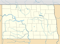
- McLeod, North Dakota
-
McLeod — Census-designated place — Location within the state of North Dakota Coordinates: 46°23′19″N 97°17′55″W / 46.38861°N 97.29861°WCoordinates: 46°23′19″N 97°17′55″W / 46.38861°N 97.29861°W Country United States State North Dakota County Ransom Elevation 1,076 ft (328 m) Time zone Central (CST) (UTC-6) - Summer (DST) CDT (UTC-5) ZIP codes 58057 FIPS code 38-49540[1] GNIS feature ID 2584351[1] McLeod (also Sandoun) is an census-designated place in eastern Ransom County, North Dakota, United States. An unincorporated community, it was designated as part of the U.S. Census Bureau's Participant Statistical Areas Program on March 31, 2010.[2] It was not counted separately during the 2000 Census,[3] but is scheduled for inclusion in the 2010 Census.[4]
Ransom lies along North Dakota Highway 27 east of the city of Lisbon, the county seat of Ransom County.[2] Originally named Sandoun for the many sand dunes in the area, it was renamed McLeod for local realtor J. J. McLeod.[5] Although it is unincorporated, it has a post office, with the ZIP code of 58057.[6]
References
- ^ a b "US Board on Geographic Names". United States Geological Survey. 2007-10-25. http://geonames.usgs.gov. Retrieved 2008-01-31.
- ^ a b "McLeod Census Designated Place". Geographic Names Information System, U.S. Geological Survey. http://geonames.usgs.gov/pls/gnispublic/f?p=gnispq:3:::NO::P3_FID:2584351. Retrieved 2010-07-13.
- ^ U.S. Census Bureau (2003). "Population and Housing Unit Counts, North Dakota" (PDF). 2000 Census of Population and Housing. Government Printing Office. http://www.census.gov/prod/cen2000/phc-3-36.pdf. Retrieved 2008-07-20.
- ^ U.S. Census Bureau (February 13, 2008). "Census Designated Place (CDP) Program for the 2010 Census—Final Criteria" (PDF). Federal Register. http://www.census.gov/geo/www/psap2010/cdp_criteria.pdf. Retrieved 2010-07-13.
- ^ Wick, Douglas A. (1988). North Dakota Place Names. Bismarck, North Dakota: Hedemarken Collectibles. ISBN 0-9620968-0-6. OCLC 191277027.
- ^ Zip Code Lookup
Municipalities and communities of Ransom County, North Dakota County seat: Lisbon Cities Elliott | Enderlin‡ | Fort Ransom | Lisbon | Sheldon
Townships Aliceton | Alleghany | Bale | Big Bend | Casey | Coburn | Elliott | Fort Ransom | Greene | Hanson | Island Park | Isley | Liberty | Moore | Northland | Owego | Preston | Rosemeade | Sandoun | Scoville | Shenford | Springer | Sydna | Tuller
CDPs Englevale | McLeod
Unincorporated
communityAnselm | Buttzville | Coburn | Venlo
Footnotes ‡This populated place also has portions in an adjacent county or counties
Categories:- North Dakota geography stubs
- Populated places in Ransom County, North Dakota
- Unincorporated communities in North Dakota
- Census-designated places in North Dakota
Wikimedia Foundation. 2010.


