- National Register of Historic Places listings in Warren County, Mississippi
-
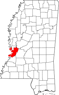 Location of Warren County in Mississippi
This is a list of the National Register of Historic Places listings in Warren County, Mississippi.
This is intended to be a complete list of the properties and districts on the National Register of Historic Places in Warren County, Mississippi, United States. Latitude and longitude coordinates are provided for many National Register properties and districts; these locations may be seen together in a Google map.[1]
There are 68 properties and districts listed on the National Register in the county, including 3 National Historic Landmarks.
-
- This National Park Service list is complete through NPS recent listings posted November 10, 2011.[2]
Current listings
[3] Landmark name [4] Image Date listed Location City or town Summary 1 1300 Grove Street House November 29, 1983 1300 Grove St.
32°21′03″N 90°52′28″W / 32.350833°N 90.874444°WVicksburg 2 Anchuca 
March 22, 1982 1010 1st E. St.
32°21′16″N 90°52′38″W / 32.354444°N 90.877222°WVicksburg 3 Balfour House 
October 26, 1971 1002 Crawford St.
32°20′51″N 90°52′43″W / 32.3475°N 90.878611°WVicksburg 4 Beck House March 29, 1979 1101 South St.
32°20′52″N 90°52′38″W / 32.347778°N 90.877222°WVicksburg 5 Belle Fleur May 7, 1992 1123 South St.
32°20′52″N 90°53′17″W / 32.347778°N 90.888056°WVicksburg 6 Bethel African Methodist Episcopal Church July 30, 1992 805 Monroe St.
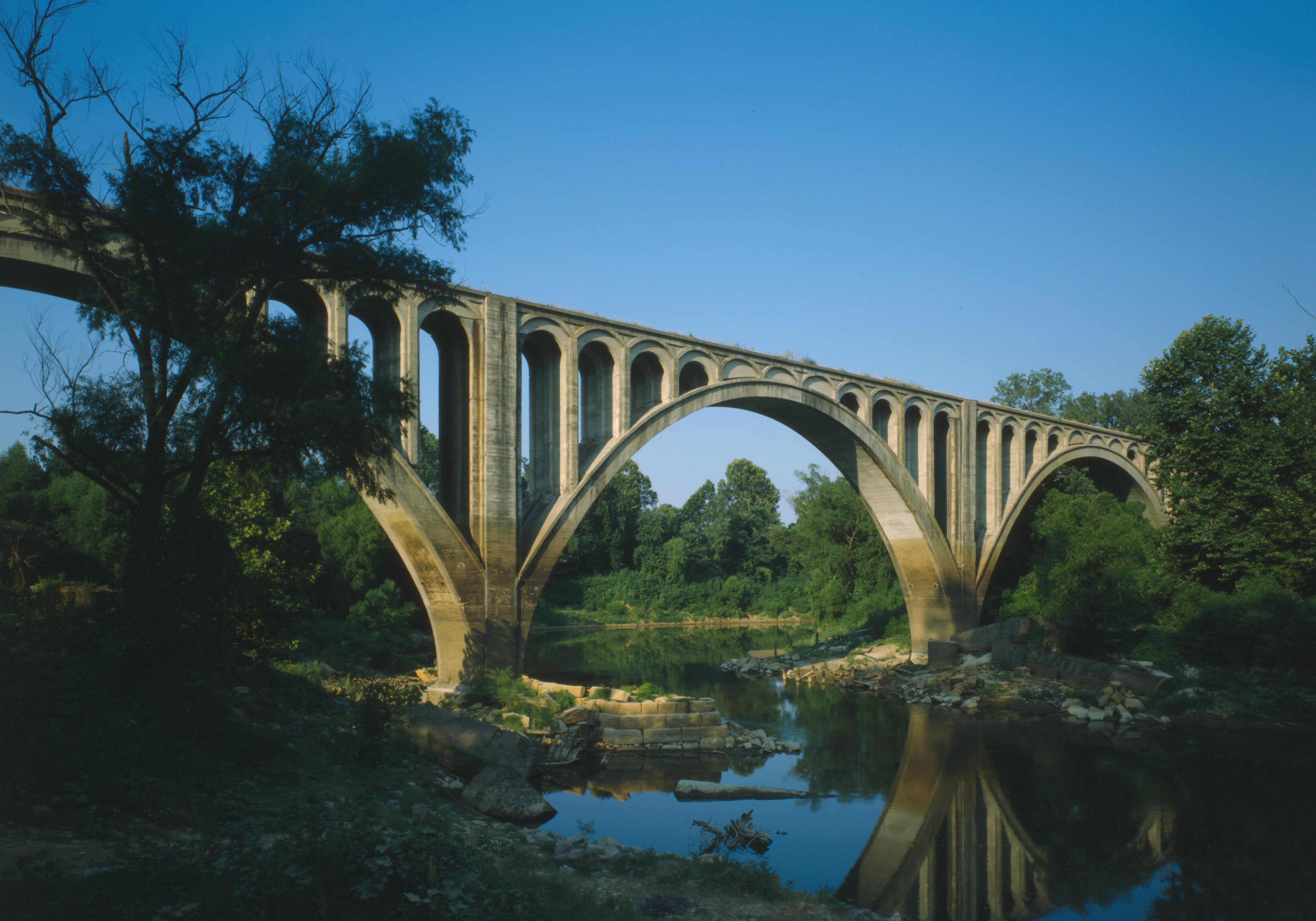
32°21′16″N 90°52′44″W / 32.354444°N 90.878889°WVicksburg 7 Beulah Cemetery October 23, 1992 Junction of Openwood St. and Old Jackson Rd.
32°21′26″N 90°50′59″W / 32.357222°N 90.849722°WVicksburg 8 Biedenharn Candy Company Building December 2, 1977 1107-1109 Washington St.
32°21′05″N 90°52′53″W / 32.351389°N 90.881389°WVicksburg 9 Big Black River Battlefield November 23, 1971 On both banks of the Big Black River between Smith's Station and Bovina
32°21′36″N 90°43′35″W / 32.36°N 90.726389°WBovina Extends into Hinds County 10 Big Black River Railroad Bridge 
November 16, 1988 Spans the Big Black River east of Bovina
32°20′49″N 90°42′17″W / 32.346944°N 90.704722°WBovina Extends into Hinds County 11 Blum House July 30, 1992 1420 Cherry St.
31°37′36″N 90°53′45″W / 31.626667°N 90.895833°WVicksburg 12 Bobb House January 8, 1979 1503 Harrison St.
32°20′45″N 90°52′21″W / 32.345833°N 90.8725°WVicksburg 13 Isaac Bonham House May 26, 1977 601 Klein St.
32°20′29″N 90°53′06″W / 32.341389°N 90.885°WVicksburg 14 Carr Junior High School April 5, 2002 1805 Cherry St.
32°20′41″N 90°52′42″W / 32.344722°N 90.878333°WVicksburg 15 Cedar Grove July 19, 1976 2200 Oak St.
32°20′25″N 90°53′08″W / 32.340278°N 90.885556°WVicksburg 16 Chickasaw Bayou Battlefield April 24, 1973 North of Vicksburg on U.S. Route 61
32°24′45″N 90°51′24″W / 32.4125°N 90.856667°WVicksburg Site of the Battle of Chickasaw Bayou 17 Church of the Holy Trinity May 22, 1978 South and Monroe Sts.
32°20′50″N 90°52′47″W / 32.347222°N 90.879722°WVicksburg 18 Confederate Avenue Brick Arch Bridge November 16, 1988 Confederate Ave.
32°19′44″N 90°52′31″W / 32.328889°N 90.875278°WVicksburg 19 Craig-Flowers House August 2, 1984 2011 Cherry St.
32°20′29″N 90°52′43″W / 32.341389°N 90.878611°WVicksburg 20 Davis-Mitchell House June 1, 1982 901 Crawford St.
32°20′57″N 90°52′46″W / 32.349167°N 90.879444°WVicksburg 21 Fairground Street Bridge 
November 16, 1988 Spans the Illinois Central railroad yard on Fairground St.
32°20′16″N 90°53′25″W / 32.337778°N 90.890278°WVicksburg 22 Federal Fortifications Along Bear Creek August 30, 1974 Southwest of Youngton
32°25′40″N 90°38′06″W / 32.427778°N 90.635°WYoungton 23 Feld House August 2, 1982 2108 Cherry St.
32°20′26″N 90°52′46″W / 32.340556°N 90.879444°WVicksburg 24 Fitz-Hugh Hall November 6, 1986 1322 Chambers St.
32°20′18″N 90°52′41″W / 32.338333°N 90.878056°WVicksburg 25 Col. Charles C. Flowerree House 
May 29, 1975 2309 Pearl St.
32°20′25″N 90°53′14″W / 32.340278°N 90.887222°WVicksburg 26 Fonsylvania September 7, 1984 Fisher Ferry Rd., south of Vicksburg
32°11′33″N 90°49′14″W / 32.1925°N 90.820556°WVicksburg 27 Fort St. Pierre Site February 16, 2000 Off U.S. Route 61 north of Vicksburg
32°29′44″N 90°47′55″W / 32.49556°N 90.79861°W[5]Vicksburg 28 The Galleries April 17, 1980 2421 Marshall St.
32°20′14″N 90°53′04″W / 32.337222°N 90.884444°WVicksburg 29 Glenwood-Vicklan Historic District November 3, 2009 Including Vicklan St., Glenwood Cir., Edna Dr., and Chambers St. east of the bayou
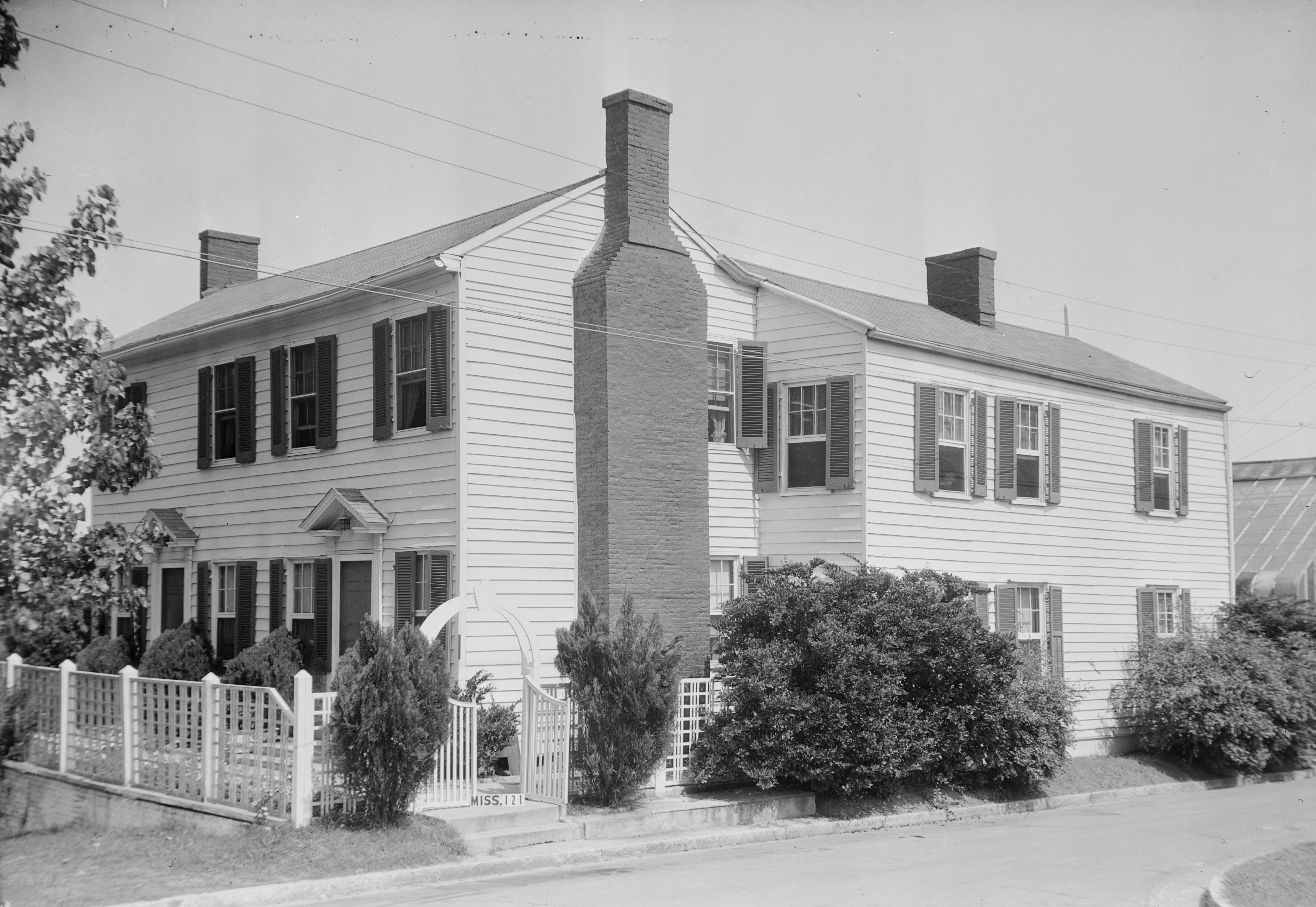
32°20′20″N 90°52′14″W / 32.338778°N 90.87065°WVicksburg 30 Duff Green House 
January 11, 1979 806 Locust St.
32°21′15″N 90°52′32″W / 32.354167°N 90.875556°WVicksburg 31 Grove Street Houses May 8, 1980 1117 and 1121 Grove St.
32°21′06″N 90°52′34″W / 32.351667°N 90.876111°WVicksburg 32 Grove Street-Jackson Historic District 
November 21, 2007 Along Grove and Jackson Sts. between Cherry St. and 1st N. St.
32°21′07″N 90°52′33″W / 32.351856°N 90.875906°WVicksburg 33 Guider House May 8, 1980 1115 Grove St.
32°21′05″N 90°52′35″W / 32.351389°N 90.876389°WVicksburg 34 P.M. Harding House July 17, 1986 1402 Chambers St.
32°20′18″N 90°52′35″W / 32.338333°N 90.876389°WVicksburg 35 Hotel Vicksburg 
June 4, 1979 801 Clay St.
32°21′00″N 90°52′50″W / 32.35°N 90.880556°WVicksburg 36 Joel and Margaret Hullum House July 5, 1984 749 Mallet Rd.
32°12′47″N 90°52′27″W / 32.213056°N 90.874167°WVicksburg 37 Hyland Mound Archeological Site August 30, 2001 Address Restricted Vicksburg 38 Fannie Willis Johnson House April 8, 1988 2430 Drummond St.
32°20′09″N 90°52′54″W / 32.335833°N 90.881667°WVicksburg 39 Dr. Isaac Cecil Knox House September 18, 1990 2823 Confederate Ave.
32°19′14″N 90°53′02″W / 32.320556°N 90.883889°WVicksburg 40 John Lane House 
May 6, 1982 905 Crawford St.
32°20′56″N 90°52′45″W / 32.348889°N 90.879167°WVicksburg 41 W.W. Lassiter Wholesale Grocery Warehouse March 7, 1994 1308 Levee St.
32°21′01″N 90°53′03″W / 32.350278°N 90.884167°WVicksburg 42 Loosa Yokena Archeological Site May 8, 2001 Address Restricted Kimberly 43 Luckett Compound 
July 28, 1983 1116-1122 Crawford St
32°20′53″N 90°52′36″W / 32.348056°N 90.876667°WVicksburg 44 The Magnolias February 26, 1987 1617 Monroe St.
32°20′43″N 90°52′49″W / 32.345278°N 90.880278°WVicksburg 45 Magruder-Morrissey House May 24, 1984 1117 Cherry St.
32°21′03″N 90°52′40″W / 32.350833°N 90.877778°WVicksburg 46 Main Street Historic District April 16, 1979 1st East, Adams, Main, and Openwoods Sts.; also roughly bounded by Adams St., Main St., Cherry St., and 1st East St.
32°21′12″N 90°52′32″W / 32.353333°N 90.875556°WVicksburg Second set of boundaries represents a boundary increase of January 5, 1989 47 McDermott House July 12, 1984 1100 South St.
32°20′50″N 90°52′40″W / 32.347222°N 90.877778°WVicksburg 48 McNutt House 
May 29, 1975 Northwestern corner of Monroe and E. 1st Sts.
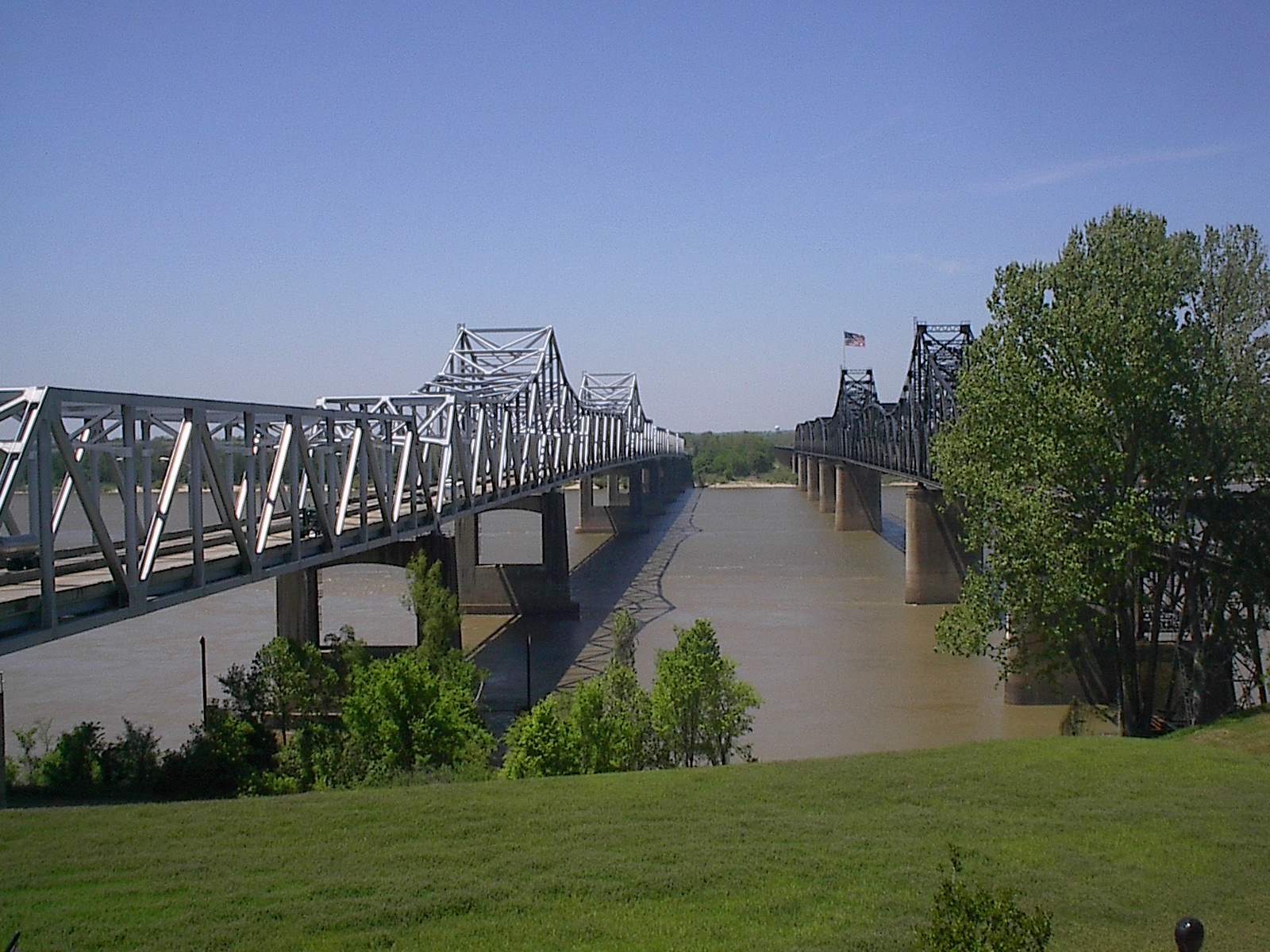
32°21′17″N 90°52′45″W / 32.354722°N 90.879167°WVicksburg 49 Mississippi River Bridge 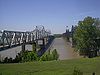
February 14, 1989 Spans the Mississippi River on Old U.S. Route 80
32°18′54″N 90°54′20″W / 32.315°N 90.905556°WVicksburg Extends into Madison Parish, Louisiana 50 Old Courthouse, Warren County 
May 23, 1968 Court Sq.
32°21′07″N 90°52′43″W / 32.351944°N 90.878611°WVicksburg 51 Pemberton's Headquarters 
July 23, 1970 1018 Crawford St.
32°20′54″N 90°52′40″W / 32.348333°N 90.877778°WVicksburg 52 Planters Hall June 21, 1971 822 Main St.
32°21′14″N 90°52′46″W / 32.353889°N 90.879444°WVicksburg 53 Adolph Rose Building November 12, 1992 717 Clay St.
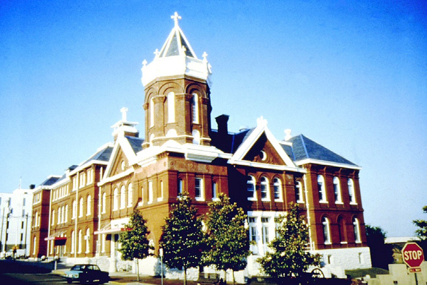
32°21′01″N 90°52′55″W / 32.350278°N 90.881944°WVicksburg 54 St. Francis Xavier Convent 
April 18, 1977 1021 Crawford St.
32°20′55″N 90°52′39″W / 32.348611°N 90.8775°WVicksburg 55 Shlenker House November 17, 1983 2212 Cherry St.
32°20′19″N 90°52′45″W / 32.338611°N 90.879167°WVicksburg 56 Snyder's Bluff February 6, 1973 Along the Yazoo River north of Redwood
32°29′51″N 90°47′53″W / 32.4975°N 90.79806°W[6]Redwood 57 South Cherry Street Historic District 
November 14, 2003 Along Cherry and Drummond Sts. from Harrison St. to Bowmar St. and including Chambers and Baum Sts.
32°20′25″N 90°52′42″W / 32.340278°N 90.878333°WVicksburg 58 South Vicksburg Public School No. 200 March 20, 1986 900 Speed St.
32°20′18″N 90°53′06″W / 32.338333°N 90.885°WVicksburg 59 Uptown Vicksburg Historic District 
August 19, 1993 Roughly bounded by Locust, South, Washington, and Clay Sts.; also mostly on Washington St. between Grove and Veto Sts.
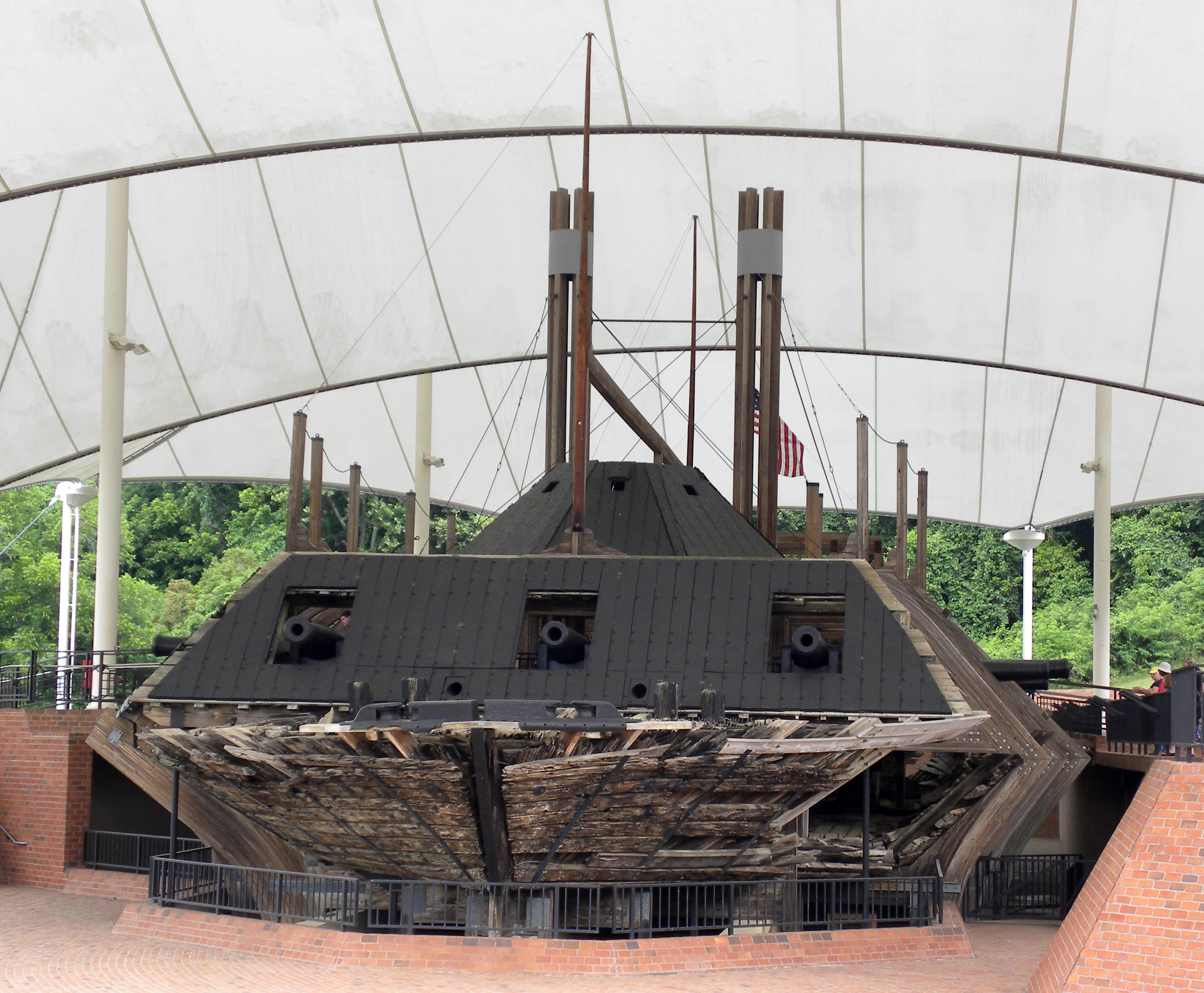
32°20′55″N 90°52′45″W / 32.348611°N 90.879167°WVicksburg Second set of boundaries represents a boundary increase of September 10, 2004 60 U.S.S. CAIRO 
September 3, 1971 U.S.S. Cairo Museum
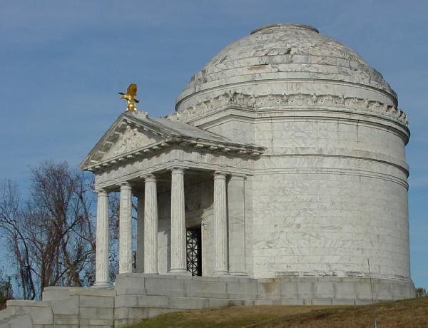
32°22′33″N 90°52′00″W / 32.375833°N 90.866667°WVicksburg 61 Vicksburg National Military Park 
October 15, 1966 North and east of Vicksburg
32°20′28″N 90°51′44″W / 32.341111°N 90.862222°WVicksburg 62 Old Vicksburg Public Library 
July 30, 1992 819 South St.
32°20′53″N 90°52′51″W / 32.348056°N 90.880833°WVicksburg 63 Vicksburg Siege Cave March 14, 1973 Near the Vicksburg City Cemetery
32°21′59″N 90°51′41″W / 32.366389°N 90.861389°WVicksburg 64 Walnut Hills March 19, 1982 1214 Adams St.
32°20′59″N 90°52′39″W / 32.349722°N 90.8775°WVicksburg 65 Waterways Experiment Station December 13, 2000 Roughly bounded by Spillway, Durden Creek, Tennessee Rd., and Dam Spillway
32°17′50″N 90°52′10″W / 32.297222°N 90.869444°WVicksburg 66 Yazoo And Mississippi Valley Depot 
November 13, 1979 500 Grove St.
32°21′09″N 90°52′59″W / 32.352553°N 90.882924°WVicksburg 67 Yokena Presbyterian Church September 7, 1984 South of Vicksburg on U.S. Route 61
32°10′24″N 90°56′31″W / 32.173333°N 90.941944°WVicksburg 68 Young-Bradfield House May 6, 1982 913 Crawford St.
32°20′56″N 90°52′44″W / 32.348889°N 90.878889°WVicksburg See also
- List of National Historic Landmarks in Mississippi
- National Register of Historic Places listings in Mississippi
References
- ^ The latitude and longitude information provided in this table was derived originally from the National Register Information System, which has been found to be fairly accurate for about 99% of listings. For about 1% of NRIS original coordinates, experience has shown that one or both coordinates are typos or otherwise extremely far off; some corrections may have been made. A more subtle problem causes many locations to be off by up to 150 yards, depending on location in the country: most NRIS coordinates were derived from tracing out latitude and longitudes off of USGS topographical quadrant maps created under the North American Datum of 1927, which differs from the current, highly accurate WGS84 GPS system used by Google maps. Chicago is about right, but NRIS longitudes in Washington are higher by about 4.5 seconds, and are lower by about 2.0 seconds in Maine. Latitudes differ by about 1.0 second in Florida. Some locations in this table may have been corrected to current GPS standards.
- ^ "National Register of Historic Places: Weekly List Actions". National Park Service, United States Department of the Interior. Retrieved on November 10, 2011.
- ^ Numbers represent an ordering by significant words. Various colorings, defined here, differentiate National Historic Landmark sites and National Register of Historic Places Districts from other NRHP buildings, structures, sites or objects.
- ^ "National Register Information System". National Register of Historic Places. National Park Service. . http://nrhp.focus.nps.gov/natreg/docs/All_Data.html.
- ^ Location derived from NRIS provided coordinates; although the NRIS provides the coordinates, it lists the site as "Address Restricted"
- ^ Location derived from its GNIS feature record; the NRIS lists the site as "Address Restricted"
U.S. National Register of Historic Places Topics Lists by states Alabama • Alaska • Arizona • Arkansas • California • Colorado • Connecticut • Delaware • Florida • Georgia • Hawaii • Idaho • Illinois • Indiana • Iowa • Kansas • Kentucky • Louisiana • Maine • Maryland • Massachusetts • Michigan • Minnesota • Mississippi • Missouri • Montana • Nebraska • Nevada • New Hampshire • New Jersey • New Mexico • New York • North Carolina • North Dakota • Ohio • Oklahoma • Oregon • Pennsylvania • Rhode Island • South Carolina • South Dakota • Tennessee • Texas • Utah • Vermont • Virginia • Washington • West Virginia • Wisconsin • WyomingLists by territories Lists by associated states Other Municipalities and communities of Warren County, Mississippi Cities 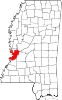
Unincorporated
communitiesBovina | Eagle Bend | Flowers | Redwood | Waltersville | Warrenton | Yokena
Categories:- Warren County, Mississippi
- National Register of Historic Places in Mississippi by county
- Buildings and structures in Warren County, Mississippi
-


Wikimedia Foundation. 2010.