- Union, Mississippi
Infobox Settlement
official_name = Union, Mississippi
settlement_type =Town
nickname =
motto =
imagesize =
image_caption =
image_
imagesize =
image_caption =
image_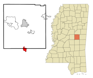
mapsize = 250px
map_caption = Location of Union, Mississippi
mapsize1 =
map_caption1 =subdivision_type = Country
subdivision_name =United States
subdivision_type1 = State
subdivision_name1 =Mississippi
subdivision_type2 = Counties
subdivision_name2 = Newton, Neshoba
government_footnotes =
government_type =
leader_title =
leader_name =
leader_title1 =
leader_name1 =
established_title =
established_date =unit_pref = Imperial
area_footnotes =area_magnitude =
area_total_km2 = 8.9
area_land_km2 = 8.9
area_water_km2 = 0.0
area_total_sq_mi = 3.4
area_land_sq_mi = 3.4
area_water_sq_mi = 0.0population_as_of = 2000
population_footnotes =
population_total = 2021
population_density_km2 = 227.4
population_density_sq_mi = 589.0timezone = Central (CST)
utc_offset = -6
timezone_DST = CDT
utc_offset_DST = -5
elevation_footnotes =
elevation_m = 147
elevation_ft = 482
latd = 32 |latm = 34 |lats = 17 |latNS = N
longd = 89 |longm = 7 |longs = 5 |longEW = Wpostal_code_type =
ZIP code
postal_code = 39365
area_code = 601
blank_name = FIPS code
blank_info = 28-75360
blank1_name = GNIS feature ID
blank1_info = 0679032
website =
footnotes =Union is a town in Neshoba and Newton Counties in the
U.S. state ofMississippi . The population was 2,021 at the 2000 census.Geography
Union is located at coor dms|32|34|17|N|89|7|5|W|city (32.571320, -89.118118)GR|1. Most of the town is in Newton County with a portion extending north into adjacent Neshoba County. [ [http://factfinder.census.gov/servlet/MapItDrawServlet?geo_id=16000US2875360&_bucket_id=50&tree_id=4001&context=AdvSearch&_lang=en American FactFinder Reference Map] ] In the 2000 census, 1,496 of the town's 2,021 residents (74.0%) lived in Newton County and 525 (26.0%) in Neshoba County. [cite web | url = http://www.census.gov/popest/cities/files/SUB-EST2006_28.csv | title = Subcounty population estimates: Mississippi 2000-2006| format = CSV | publisher =
United States Census Bureau , Population Division | date =2007-06-28 | accessdate = 2007-07-21]According to the
United States Census Bureau , the town has a total area of 3.4square mile s (8.9km² ).None of the area is covered with water.Demographics
As of the
census GR|2 of 2000, there were 2,021 people, 780 households, and 509 families residing in the town. Thepopulation density was 589.0 people per square mile (227.5/km²). There were 884 housing units at an average density of 257.6/sq mi (99.5/km²). The racial makeup of the town was 62.84% White, 35.53% African American, 0.35% Native American, 0.20% Asian, 0.05% from other races, and 1.04% from two or more races. Hispanic or Latino of any race were 0.64% of the population.There were 780 households out of which 31.8% had children under the age of 18 living with them, 43.1% were married couples living together, 18.8% had a female householder with no husband present, and 34.7% were non-families. 32.3% of all households were made up of individuals and 18.1% had someone living alone who was 65 years of age or older. The average household size was 2.46 and the average family size was 3.12.
In the town the population was spread out with 27.2% under the age of 18, 8.6% from 18 to 24, 23.1% from 25 to 44, 19.7% from 45 to 64, and 21.5% who were 65 years of age or older. The median age was 38 years. For every 100 females there were 79.0 males. For every 100 females age 18 and over, there were 74.0 males.
The median income for a household in the town was $21,696, and the median income for a family was $28,542. Males had a median income of $26,667 versus $17,328 for females. The
per capita income for the town was $12,176. About 28.4% of families and 35.2% of the population were below thepoverty line , including 49.7% of those under age 18 and 37.4% of those age 65 or over.Education
The Town of Union is served by the Union Public School District.
References
External links
Wikimedia Foundation. 2010.