- Greenville, Alabama
Infobox Settlement
official_name = Greenville, Alabama
settlement_type =City 
imagesize = 250px
image_caption = Butler County Courthouse in Greenville
image_
mapsize = 250px
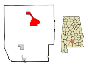
map_caption = Location in Butler County and the state ofAlabama
mapsize1 =
map_caption1 =
subdivision_type = Country
subdivision_type1 = State
subdivision_type2 = County
subdivision_name =United States
subdivision_name1 =Alabama
subdivision_name2 = Butler
government_type =
leader_title =
leader_name =
established_date =
area_magnitude =
area_total_km2 = 55.3
area_total_sq_mi = 21.4
area_land_km2 = 54.8
area_land_sq_mi = 21.2
area_water_km2 = 0.5
area_water_sq_mi = 0.2
elevation_ft = 440
elevation_m = 134
population_as_of = 2000
population_footnotes =
population_total = 7228
population_metro =
population_density_km2 = 130.7
population_density_sq_mi = 337.8
timezone = Central (CST)
utc_offset = -6
latd = 31 |latm = 49 |lats = 52 |latNS = N
longd = 86 |longm = 37 |longs = 39 |longEW = W
timezone_DST = CDT
utc_offset_DST = -5
postal_code_type =ZIP code
postal_code = 36037
area_code = 334
blank_name = FIPS code
blank_info = 01-31912
blank1_name = GNIS feature ID
blank1_info = 0119376
footnotes =
website =Greenville is a city in Butler County,
Alabama ,United States . At the 2000 census, the population was 7,228. The city is thecounty seat of Butler County and is known as theCamellia City, the state flower of Alabama. The push to change the state flower from thegoldenrod to thecamellia originated in Greenville.Greenville's original name was Butlerville. After becoming the County Seat in 1822 its name was changed to Greenville, in remembrance of the former locale in South Carolina of many of the original settlers. The first County Seat was at Fort Dale. This fortification was named for Sam Dale who fought to defend the area during the
Creek Indian War. The site of Fort Dale lies on the northern end of the city on Highway 185, near Fort Dale Cemetery.The namesake of the county, Captain William Butler, was killed during the Creek Indian War. He is buried in the Pioneer Cemetery, which is across from the oldest church in Butler County, the FirstUnited Methodist Church of Greenville.The downtown layout is interesting, as most small Southern towns laid out in the early nineteenth century have a central square. Greenville's downtown is bordered on one end by the Butler County Courthouse, which is at the intersection of Commerce and Conecuh Streets, with the streets forming a
roundabout around the building. The appearance of the courthouse was adversely affected by the early 1970s addition of amarble Greek Revival façade , which clashes with the red brick of the remainder of theFederal style edifice. Acopper dome sits upon a 75 feet tallclock tower at the front of the building.At the other end of the downtown area is a
Spanish Colonial Style train depot next to an early twentieth centurymasonry railroad bridge. Commerce Street dips under this bridge as it continues to the western parts of the city. The hundred-year-old buildings around the depot show signs of decay, but the depot itself is well maintained, although it is no longer used as a train stop.The
Post Office andCity Hall sit nearly in the middle of downtown, on Commerce Street, across from Confederate Park. Both buildings are attractive brick buildings, built in the 1920s and 1930s in the Federal style. Confederate Park covers one block and has a life-sized statue of a Confederate soldier and a large fountain. Also near the center of downtown is the Ritz Theater, a 1930sart deco style structure. The building is a beautiful movie theater that the Greenville Arts Council and Mrs. Roberta Gamble, a local drama teacher, saved from certain demolition in the 1980s. Most of the uptown and downtown business structures are of the neoclassic or Federal style. All of the power and communication lines are buried, giving the downtown area a cleaner look that period streetlights accent.The city's residents were featured on the premiere episode of the ABC reality/
game show series "My Kind of Town ", on Sunday,August 14 2005 .Greenville has gained national attention of late because it is home to one of the premier golf courses on the Robert Trent Jones golf trail, Cambrian Ridge. The clubhouse for the golf course was built on the highest point in Butler County. Greenville is also the home of the Watermelon Jubilee, a locally popular arts and crafts exposition.
Beth Chapman, the incumbent Alabama Secretary of State is a native of Greenville.
Geography
Greenville is located at 31°49'52.583" North, 86°37'39.241" West (31.831273, -86.627567)GR|1.
According to the
U.S. Census Bureau , the city has a total area of 21.3square mile s (55.2km² ), of which, 21.1 square miles (54.8 km²) of it is land and 0.2 square miles (0.5 km²) of it (0.84%) is water.Demographics
As of the
census GR|2 of 2000, there were 7,228 people, 2,919 households, and 1,929 families residing in the city. Thepopulation density was 341.7 people per square mile (132.0/km²). There were 3,324 housing units at an average density of 157.1/sq mi (60.7/km²). The racial makeup of the city was 50.69% White, 48.31% Black or African American, 0.28% Native American, 0.36% Asian, 0.06% from other races, and 0.30% from two or more races. 0.86% of the population were Hispanic or Latino of any race.There were 2,919 households out of which 31.6% had children under the age of 18 living with them, 38.6% were married couples living together, 23.9% had a female householder with no husband present, and 33.9% were non-families. 31.0% of all households were made up of individuals, and 15.3% had someone living alone who was 65 years of age or older. The average household size was 2.42 and the average family size was 3.02.
In the city the population was spread out with 26.8% under the age of 18, 8.9% from 18 to 24, 24.2% from 25 to 44, 21.9% from 45 to 64, and 18.3% who were 65 years of age or older. The median age was 38 years. For every 100 females, there were 80.8 males. For every 100 females age 18 and over, there were 73.6 males.
The median income for a household in the city was $22,106, and the median income for a family was $27,167. Males had a median income of $29,236 versus $20,125 for females. The
per capita income for the city was $17,439. About 24.8% of families and 30.4% of the population were below thepoverty line , including 40.4% of those under age 18 and 26.1% of those age 65 or over.References
External links
* [http://www.greenville-alabama.com Greenville's official web site ]
* [http://www.sanewsonline.com The South Alabama News]
* [http://www.fortdale.com/ Fort Dale Academy] , a K-12 college-preparatory school in Greenville
* [http://www.greenvilleadvocate.com The Greenville Advocate]
* [http://www.rtjgolf.com/courses/cambrian_ridge/ Cambrian Ridge Golf Course] , part of the Robert Trent Jones Golf Trail
* [http://www.salon.com/opinion/feature/2004/12/21/alabama/ Article on Greenville by Senator Russ Feingold (D-WI) in Salon magazine]
Wikimedia Foundation. 2010.