- Guntersville, Alabama
Infobox Settlement
official_name = Guntersville, Alabama
settlement_type =City
imagesize =
image_caption =
image_
imagesize =
image_caption =
image_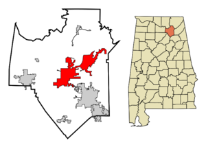
mapsize = 250px
map_caption = Location in Marshall County and the state ofAlabama
mapsize1 =
map_caption1 =
subdivision_type = Country
subdivision_type1 = State
subdivision_type2 = County
subdivision_name =United States
subdivision_name1 =Alabama
subdivision_name2 = Marshall
government_type =
leader_title =
leader_name =
established_date =
area_magnitude =
area_total_km2 = 105.1
area_total_sq_mi = 40.6
area_land_km2 = 61.2
area_land_sq_mi = 23.6
area_water_km2 = 43.9
area_water_sq_mi = 17
elevation_ft = 650
elevation_m = 198
population_as_of = 2000
population_footnotes =
population_total = 7395
population_metro =
population_density_km2 = 70.4
population_density_sq_mi = 182.1
timezone = Central (CST)
utc_offset = -6
latd = 34 |latm = 20 |lats = 53 |latNS = N
longd = 86 |longm = 17 |longs = 40 |longEW = W
timezone_DST = CDT
utc_offset_DST = -5
postal_code_type =ZIP code
postal_code = 35976
area_code = 256
blank_name = FIPS code
blank_info = 01-32416
blank1_name = GNIS feature ID
blank1_info = 0157977
footnotes =
website =Guntersville is a city in Marshall County,
Alabama ,United States and is included in theHuntsville-Decatur Combined Statistical Area . As of the 2000 census, the population of the city is 7,395. The city is thecounty seat of Marshall County.Geography
Guntersville is located at coor dms|34|20|54|N|86|17|40|W|city (34.348197, -86.294523).GR|1
According to the
U.S. Census Bureau , the city has a total area of 40.6square mile s (105.2km² ), of which, 23.6 square miles (61.3 km²) of it is land and 17.0 square miles (43.9 km²) of it (41.77%) is water.Guntersville is located at the southernmost point of the Tennessee River on
Lake Guntersville , formed by theGuntersville Dam . Geologically, the lake occupies a southern extension ofSequatchie Valley , which continues south as Browns Valley.History
Guntersville was founded by German immigrant John Gunter, the wealthy owner of a
salt mine in the early 1800s. In order to gain more mining areas, Gunter had to strike a deal with theCherokee tribe that inhabited the area. They did but he had to marry the chiefs daughter and give salt to the local tribe. They did and a town sprung up next to the mine and named it after Gunter.Demographics
As of the
census GR|2 of 2000, there were 7,395 people, 3,061 households, and 1,971 families residing in the city. Thepopulation density was 312.7 people per square mile (120.7/km²). There were 3,518 housing units at an average density of 148.8/sq mi (57.4/km²). The racial makeup of the city was 88.17% White, 8.53% Black or African American, 0.49% Native American, 0.41% Asian, 0.01% Pacific Islander, 0.95% from other races, and 1.45% from two or more races. 2.87% of the population were Hispanic or Latino of any race.There were 3,061 households out of which 27.5% had children under the age of 18 living with them, 47.5% were married couples living together, 13.7% had a female householder with no husband present, and 35.6% were non-families. 32.4% of all households were made up of individuals and 14.4% had someone living alone who was 65 years of age or older. The average household size was 2.28 and the average family size was 2.88.
In the city the population was spread out with 22.4% under the age of 18, 7.1% from 18 to 24, 27.0% from 25 to 44, 24.3% from 45 to 64, and 19.2% who were 65 years of age or older. The median age was 41 years. For every 100 females there were 88.8 males. For every 100 females age 18 and over, there were 84.8 males.
The median income for a household in the city was $29,882, and the median income for a family was $39,464. Males had a median income of $36,175 versus $20,480 for females. The
per capita income for the city was $18,503. About 11.2% of families and 14.2% of the population were below thepoverty line , including 15.2% of those under age 18 and 16.3% of those age 65 or over.Facts
*The [http://www.wholebackstage.com Whole Backstage Theatre] is a 501(c)3 non-profit, all volunteer arts orginaztion located in Guntersville, AL. WBS presents six full scale theatre productions each season in their newly renovated Dot Moore Auditorium. Presentations range from old favorites such as, "The Odd Couple" and "Steel Magnolias" to newer plays like "Lying in State" and "Marrying Walt." The Whole Backstage is also well known for their annual summer musical. ("The Sound of Music," "The King and I")
*One of two wet cities in a dry county.
*City School System independent of county system.
*Guntersville Dam was built by the
Tennessee Valley Authority .*Current mayor is Bob Hembree, the son of a previous but not the preceding mayor and is currently serving his second term in office. He was reelected in August by a 1,000 vote margain.
*The Guntersville High School
mascot is Wiley the Wildcat. The school colors are cardinal and white.*Carlisle Park Middle School was demolished in 2007; its successor Guntersville Middle School was built to take its place.
*The Guntersville Wildcats football team was named 4A State Champions for 2006 following the defeat of the Thomasville Tigers 28-27 on December 7, 2006 at Legion Field in Birmingham, Alabama. This is currently the first time the football team has been awarded a state championship.
*Ricky Nelson's final three performances were in Guntersville. Former bandmate Pat Upton ran a small nightclub there where
Ricky Nelson performed. His flight out of Guntersville Airport later crashed in Texas, killing everyone on board.*English travel writer
Jonathan Raban devotes a one hundred page chapter entitled "In Our Valley" in his 1991 book to his stay in Guntersville. In it, he deftly portrays much of the local color and history of the town.*Several celebrities live on Lake Guntersville such as
Jeff Cook of the bandAlabama andAmerican Idol winnerTaylor Hicks .*Guntersville is the home of the Lake Guntersville Music Academy.
*Guntersville is currently home to professional soccer coach and former professional soccer player Pete Ghandour.
*Guntersville was the former home of WAAY-TV sports reporter Dave Coffey.
Notable historical residents
*
M. E. Lazarus 19th centuryindividualist anarchist References
External links
* [http://www.guntersvilleal.org/index.php Official Site]
* [http://www.lakeguntersville.org Lake Guntersville Chamber of Commerce]
* [http://www.marshallteam.org Marshall County Economic Development Council]
* [http://www.marshallcountycvb.com/ Marshall County Convention and Visitors Bureau]
Wikimedia Foundation. 2010.