- Wetumpka, Alabama
Infobox Settlement
official_name = Wetumpka, Alabama
settlement_type =City
imagesize =
image_caption =
image_
imagesize =
image_caption =
image_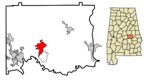
mapsize = 250px
map_caption = Location in Elmore County and the state ofAlabama
mapsize1 =
map_caption1 =
subdivision_type = Country
subdivision_type1 = State
subdivision_type2 = County
subdivision_name =United States
subdivision_name1 =Alabama
subdivision_name2 = Elmore
government_type =
leader_title =
leader_name =
established_date =
area_magnitude =
area_total_km2 = 23
area_total_sq_mi = 8.9
area_land_km2 = 22
area_land_sq_mi = 8.5
area_water_km2 = 1
area_water_sq_mi = 0.4
elevation_ft = 200
elevation_m = 61
population_as_of = 2000
population_footnotes =
population_total = 5726
population_metro =
population_density_km2 = 249
population_density_sq_mi = 643.4
timezone = Central (CST)
utc_offset = -6
latd = 32 |latm = 32 |lats = 27 |latNS = N
longd = 86 |longm = 12 |longs = 28 |longEW = W
timezone_DST = CDT
utc_offset_DST = -5
postal_code_type =ZIP code s
postal_code = 36092-36093
area_code = 334
blank_name = FIPS code
blank_info = 01-81720
blank1_name = GNIS feature ID
blank1_info = 0155305
footnotes =
website =Wetumpka is a city in Elmore County,
Alabama ,United States . At the 2000 census the population was 5,726. The city is thecounty seat of Elmore County, the third fastest growing county in the state. Together with Montgomery, Prattville, Millbrook, and Tallassee the city is considered part of theMontgomery Metropolitan Area , or River Region, with a population of 346,578.Wetumpka promotes itself as "The City of Natural Beauty". Among the notable landmarks are the
Wetumpka crater and the Jasmine Hill Gardens, with a full-sized replica of the Temple of Hera ofOlympia, Greece .Etymology
The name "Wetumpka" is a Creek place word meaning "rumbling waters", a description of sound of the nearby
Coosa River as the water falls over the rapids of the Devil's Staircase, which could be heard for miles before the construction of dams.Wetumka, Oklahoma was named by Creeks after being forced west to Oklahoma, then the Indian Territory, by theIndian Removal Act .History of Wetumpka
Arrival of the French
The area around Wetumpka was the heart of the Upper Creek lands, whose largest towns were located on the banks of the
Tallapoosa River andCoosa River at Wetumpka and Tallassee. After moving the 1702 settlement of Mobile toMobile Bay in 1711,Jean-Baptiste Le Moyne, Sieur de Bienville sent an expedition up the Alabama River to establish a fort in the interior ofNew France , both to stop the encroachment of the British and to foster trade and goodwill with the Native Americans.
[,_with_)
Alabama Territory created March 3, 1817.][http://www.forttoulouse.com Fort Toulouse] was constructed in 1714, four miles above the Coosa-Tallapoosa Rivers confluence at the Indian village of Taskigi. Bienville selected this area as the most strategic locale for a fortification. The French remained in Wetumpka until 1763, when financial difficulties forced the French to withdraw, and the land was included in the British province of Illinois. It remained under the rule of Great Britain until 1798, when it became part of the U.S.
Mississippi Territory .Jackson and the Creek War
Between 1800-1812, pioneers arrived in increasing numbers, causing growing unrest among the Indian population. Relations became increasingly strained until, in 1811, a Shawnee chief named
Tecumseh came to the Creek and urged them to exterminate the settlers. In June 1812, the U.S. declared war on Britain, and the tribes lost the assistance of the English; but this did not deter them from waging war on the whites. Upon receiving the news of the Massacre atFort Mims ,Andrew Jackson and militia from Tennessee, Mississippi, and Georgia marched into Alabama. The path they traveled became known as, "Jackson's Trace."After Andrew Jackson's decisive victory at the
Battle of Horseshoe Bend , he marched on to [http://www.forttoulouse.com Fort Toulouse] , where he directed its repair and renamed it Fort Jackson. He made the site his headquarters during the war and it was there that the newly created Montgomery County held its courts. The Creek "Red Sticks" were defeated in 1814 at the Battle of Horseshoe Bend, after which the Creeks were forced to sign theTreaty of Fort Jackson , which ceded to the United States 23 million acres (93,000 km²) of Creek lands. After the war, many of Jackson's Tennessee militia returned home, collected their families and belongings, and brought them back to settle near the fort."The Most Promising City of the West"
Settlers, mostly from Georgia and the Carolinas, flooded into the fertile land that the Creeks had been forced to abandon. With its strategic location at the conflux of three rivers, Wetumpka quickly became an important center of agricultural trade. The city was formally incorporated in 1834. Cotton, mostly transported by river, was the commercial lifeblood of the new state of Alabama. From the scattered fields and large farms of the interior, it was carted overland to Wetumpka, where boats, not being able to travel any further north over the Devil's Staircase, were loaded with cotton bales and sent back downriver to Mobile to be sold.
Wetumpka had become a cotton-made boom town. The new city was divided in half. The part of the city on the eastern bank of the river was commercial, with banks, stores, and hotels, and was located in Coosa County. The western section, in Autauga County was residential, with houses and churches laid out on a grid-like pattern of streets.
By 1836, the city's population was 1,200. A New York newspaper declared that "Wetumpka, Alabama and Chicago, Illinois are the most promising two cities of the West." The city commissioned its own steamboat, "The Coosa Belle", to ferry passengers and cotton between Wetumpka and Mobile.
Montgomery's clever coup
The same forces fueling Wetumpka's growth were shifting the balance of power within Alabama. A standoff between the farmers of the Tennessee Valley, centered in the former capital of Huntsville, and the old mercantile wealth of Mobile, had resulted in the capital being for many years at Tuscaloosa. By 1845, however, the cotton growers in the Black Belt had become some of the wealthiest in the country, and power was shifting towards the southern and central parts of the state. Both the Black Belt cotton barons and the Mobilians wanted the capital moved. The necessity for compromise pointed towards a new, centrally located capital, on the river and easily accessible by steamboat. The lead contenders were Wetumpka and the newer city of Montgomery, a few miles south. It appeared that neither city had a majority of support in the state, as representatives from north Alabama, enraged that the capital was being taken from Tuscaloosa, were indifferent as to which site would be chosen. Just before the election, the citizens of Montgomery managed to lure an expensive French chef to the new hotel they had built that would house the state's representatives while they were in session if Montgomery were selected. Elegant menus were printed and distributed to the statesmen. This promise of "good eating" was enough to sway the vote, and Montgomery won by a few votes. That same year, a fire broke out in downtown Wetumpka, burning warehouses and many commercial buildings. The charred bricks were carried downriver to Montgomery to supply the building boom in Alabama's new capital.
War and flood
Though its civic pride was wounded by losing the capital to Montgomery, the planters and merchants of the region continued to flourish throughout the antebellum period. A plan was promoted to build a lock and dam so that boats would be able to pass over the
Fall Line and travel up the Coosa as far asRome, Georgia . One famous resident wasWilliam Lowndes Yancey , a firebrand newspaper editor and statesman who was an influential advocate ofStates' rights and Southernsecession . In February 1861, representatives from seven Southern states met in nearby Montgomery to form the Confederate government, inaugurating Jefferson Davis as their president on the steps of the Alabama state capitol. The same year saw the majority of the male population of Wetumpka going off to war. Wetumpka was never harmed by Federal troops, who did not arrive in the area until early 1865 and were determined to push quickly on to Montgomery to punish the former Confederate capital before the war ended. Those men who returned after the war came home to a city and a region whose economy had been completely destroyed. In 1866, a Reconstruction government drew up a new plan of counties for the state, and Elmore County was created out of parts of Coosa, Autauga, and Montgomery counties, with Wetumpka as its county seat (Rockford was chosen as seat of the "new" Coosa County). Despite this, the future of the city seemed grim. Before the war, the population had reached more than 3,000. By 1879, it had declined to a scant 619. In 1886, the worst flood in the history of the city inundated the west bank and most of downtown. The bridge connecting the city's two halves was washed away, and more than a year passed before unfortunate Wetumpka was able to fuse itself back together.Progress
The first paved road linking Wetumpka with Montgomery was completed in 1924. Montgomery continued to grow during the two World Wars because of military spending and the growth of the state government. By the 1950s, the ubiquity of the automobile allowed Wetumpka's residents to commute daily to Montgomery for work.
In the past few decades, Highway 231 has become Wetumpka's major thoroughfare. Most businesses have moved to the 231 corridor, leaving older parts of the city in much the same state as they were in the 1930s and 1940s. Hollywood scouts have capitalized on the small-town ambiance, using Wetumpka as a backdrop in several films.
Despite its sleepy countenance, Wetumpka continues to grow. Elmore County is consistently ranked as one of the top five fastest growing counties in Alabama. The
Poarch Creek Indians have won the right to construct a new casino in the town. Already completed is a four story parking deck that towers over any other landmark in the area. Construction is underway on what will be one of the largest casinos in the country outside of Las Vegas, and residents are bracing themselves for a development that will redefine their city in the coming years, for better or worse.Geography
Wetumpka is located at coor dms|32|32|27|N|86|12|28|W|city (32.540972, -86.207726)GR|1, and sits at the joint of the Coosa and
Tallapoosa River s, where they merge to become theAlabama River .The city is situated astride the Fall Line, where the Appalachian foothills give way to the flat Gulf Coastal plain, a fact responsible for much of its natural beauty.
Downtown Wetumpka covers two city blocks, and is bordered on the northwest by the Coosa River. The
Bibb Graves Bridge crosses the river here, and is the city's most recognizable landmark. Directly across the bridge are the city's three antebellum churches, the First Methodist, First Presbyterian, and First Baptist.According to the
U.S. Census Bureau , the city has a total area of 8.9square mile s (23.1km² ), of which, 8.5 square miles (22.0 km²) of it is land and 0.4 square miles (1.0 km²) of it (4.49%) is water.Demographics
As of the
census GR|2 of 2000, there were 5,726 people, 1,797 households, and 1,128 families residing in the city. Thepopulation density was 672.9 people per square mile (259.8/km²). There were 2,139 housing units at an average density of 251.4/sq mi (97.0/km²). The racial makeup of the city was 64.88% White, 32.83% Black or African American, 0.40% Native American, 0.40% Asian, 0.07% Pacific Islander, 1.38% from other races, and 0.94% from two or more races. 2.32% of the population were Hispanic or Latino of any race.There were 1,797 households out of which 28.0% had children under the age of 18 living with them, 43.1% were married couples living together, 16.5% had a female householder with no husband present, and 37.2% were non-families. 34.2% of all households were made up of individuals and 16.0% had someone living alone who was 65 years of age or older. The average household size was 2.30 and the average family size was 2.97.
In the city the population was spread out with 18.4% under the age of 18, 8.5% from 18 to 24, 36.5% from 25 to 44, 20.6% from 45 to 64, and 16.0% who were 65 years of age or older. The median age was 38 years. For every 100 females there were 62.1 males. For every 100 females age 18 and over, there were 54.2 males.
The median income for a household in the city was $35,536, and the median income for a family was $41,500. Males had a median income of $32,403 versus $23,234 for females. The
per capita income for the city was $15,729. About 7.7% of families and 11.7% of the population were below thepoverty line , including 19.5% of those under age 18 and 10.7% of those age 65 or over.Wetumpka in movies
Three major films have been filmed on location in downtown Wetumpka.
*Big Fish (2003)
*The Grass Harp (1995)
*The Rosa Parks Story (2002)Wetumpka meteor crater
Wetumpka is the home of "Alabama's greatest natural disaster." A 1000-foot-wide meteorite hit the area about 80 million years ago. The hills just east of downtown showcase the eroded remains of the five mile wide impact crater that was blasted into the bedrock, with the area labeled the
Wetumpka crater or astrobleme ("star-wound") for the concentric rings of fractures and zones of shattered rock can be found beneath the surface. [http://www.wetumpkalibrary.com/Default.asp?ID=207 "Wetumpka Impact Crater"] Wetumpka Public Library, accessed Aug. 21, 2007.] ["The Wetumpka Astrobleme" by John C. Hall, Alabama Heritage, Fall 1996, Number 42.] In 2002, Auburn University researchers published evidence and established the site as an internationally recognized impact crater.Jasmine Hill Gardens
This outdoor museum was built in the 1930s on the estate of the Fitzpatrick family, who spent many years in Greece collecting replicas of ancient statuary to adorn their formal gardens at Jasmine Hill. Today the gardens are run as a non-profit foundation dedicated to promoting the arts and Greek culture. Frequently the site of local weddings, its attractions include a full-sized replica of the Temple of Hera at Olympia. [http://www.wetumpkaonline.com/images/gallery/JasmineHillGardens/jasmine_hill_gardens_index.html Jasmine Hill Photo Gallery]
Adventure sports
Wetumpka and the Coosa River play host to a unique point-to-point adventure race - the [http://www.coosariverchallenge.com Coosa River Challenge] . The CRC began in 2003 and regularly draws 150-200 adventure enthusiasts who test themselves against the elements and each other. The race starts at the 12 mile trail system of Swayback Bridge Trail with a cross country run and mountain bike leg ubefore following the Coosa River downstream to finish at Goldstar park in downtown Wetumpka.
The Swayback Bridge Trail is home to the annual mountain bike race [http://www.attackonswayback.com Attack on Swayback] . The AoS is produced by the Trails of Legends Association (TOLA)and is now included in the South Central Regional Championship Series (SCRCS).
Wetumpka is also a haven for white water sports enthusiasts, attracting paddlers from all over the country who enjoy travelling down the river and tackling the rapids around the Devil's Staircase and Moccasin Gap. The city hosts the annual Coosa River Whitewater Festival, and was the site of the 2005 U.S. Freestyle Kayaking Nationals. Recently, the Coosa River Paddling Club has constructed Corn Creek Park, which offers public access to the river, along with nature and walking trails.
Poarch Creek casino
Development is underway on a casino built on lands owned by the
Poarch Creek Indians abutting the city. The casino is being developed in partnership with Harrah's, the largest casino group in the country. Development of the casino has been a volatile issue of contention between local residents, the state of Alabama, and the Poarch Creek. The casino is currently open to the public, but is in the process of remodeling and expansion.Points of interest
* [http://www.wetumpkaonline.com/pages/things_to_do.asp Complete listing of area attractions]
* [http://forttoulouse.com Fort Toulouse Historic Park]
* [http://www.attackonswayback.com/sub_domains/tola/pages/maps.htm Swayback Bridge Trail]
*Wetumpka crater
*William Bartram Arboretum Notable citizens
*
Joe McInnes , businessman and state official
*Jim Rogers , author
*William Edgar Weldon , businessman and political leaderReferences
External links
* [http://wetumpka.al.us/ City of Wetumpka website]
* [http://wetumpkaonline.com/ WetumpkaOnline website]
* [http://visitelmoreco.com/ Elmore County Tourism website]
* [http://elmoreeda.com/ Elmore County Corporate Development website (ECEDA)]
* [http://wetumpkacitypages.com/ Wetumpka City Pages]
Wikimedia Foundation. 2010.