- Conecuh River
-
Conecuh River 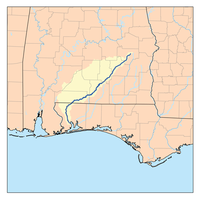
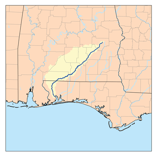
Origin 32°08′20″N 85°40′38″W / 32.1390°N 85.6771°W Mouth Gulf of Mexico 30°59′46″N 87°10′37″W / 30.9962°N 87.1769°W Basin countries United States Location Pensacola, Florida, Brewton, Alabama, East Brewton, Alabama, Pollard, Alabama, Flomaton, Alabama, Riverview, Alabama Length 258 miles (415 km)[1] The Conecuh River and Escambia River constitute a single 258-mile-long (415 km) river in Alabama and Florida in the United States.
The Conecuh River rises near Union Springs in the state and flows 198 miles (319 km)[1] in a general southwesterly direction into Florida near Century. The river's name changes from the Conecuh to the Escambia at the junction of Escambia Creek, 1.2 miles (1.9 km) downstream from the Florida-Alabama line. After this point, the Escambia River flows 60 miles (97 km)[1] south to Escambia Bay, an arm of Pensacola Bay.
The river is dredged in the lower course.
References
- ^ a b c U.S. Geological Survey. National Hydrography Dataset high-resolution flowline data. The National Map, accessed April 15, 2011
See also
- List of Alabama rivers
- List of Florida rivers
External links
Coordinates: 30°32′32″N 87°10′7″W / 30.54222°N 87.16861°W
Categories:- Rivers of Florida
- Rivers of Alabama
- Geography of Escambia County, Florida
- Place names in Alabama of Native American origin
- Florida geography stubs
- Alabama geography stubs
Wikimedia Foundation. 2010.