Okeechobee Waterway

Okeechobee Waterway
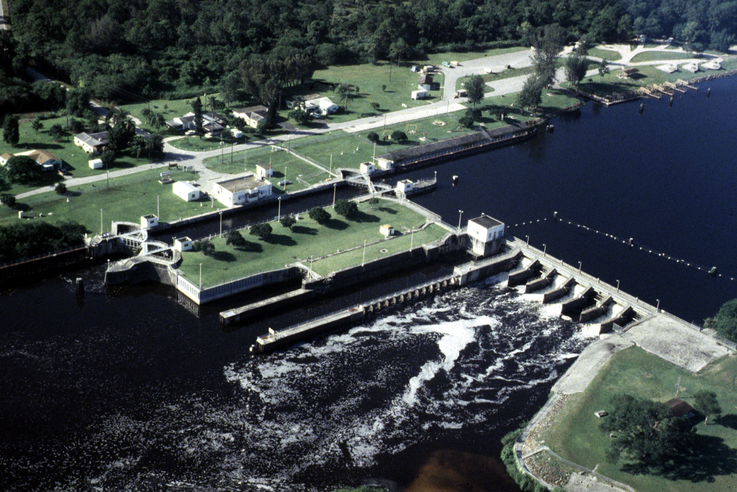
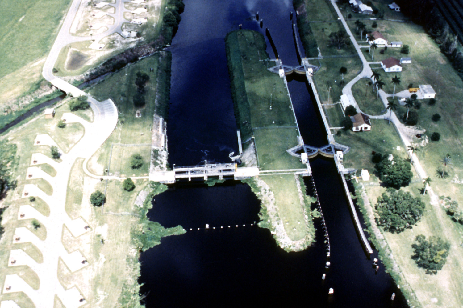
St. Lucie Lock and Dam on the Okeechobee Waterway, approximately 15 miles (24 km) southwest of Stuart, Florida
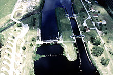
Ortona Lock and Dam on the Caloosahatchee River, part of the Okeechobee Waterway, in Glades County, Florida

The Okeechobee Waterway is a man-made waterway stretching from Fort Myers on the west coast to Stuart on the east coast of Florida. It was built/finished in 1937 to provide a water route across Florida, allowing boats to pass east–west across the state rather than travelling the long route around the southern end of the state.

External links

Coordinates: 26°48′22″N 81°06′46″W / 26.80611°N 81.11278°W / 26.80611; -81.11278


Wikimedia Foundation. 2010.

Игры ⚽ Нужна курсовая?

Look at other dictionaries:

  • Okeechobee Waterway — noun a waterway used by small boats to travel between the Atlantic Ocean and the Gulf of Mexico through Lake Okeechobee and the Caloosahatchee Canal and the Caloosahatchee River • Syn: ↑Cross Florida Waterway • Instance Hypernyms: ↑waterway …   Useful english dictionary

  • Okeechobee — [ō΄kē chō′bē] Lake [< AmInd] lake in SE Fla. at the N edge of the Everglades: 700 sq mi (1,813 sq km): main element of Okeechobee Waterway, a system of connected canals, rivers, & lakes across the Fla. peninsula …   English World dictionary

  • Okeechobee,Lake — O·kee·cho·bee (ō kĭ chōʹbē), Lake A lake of southeast Florida north of the Everglades. It is a link in the Okeechobee Waterway, or Cross Florida Waterway, a water route from the Atlantic Ocean to the Gulf of Mexico. The waterway is used by small… …   Universalium

  • Okeechobee, Lake — Lake, south central Florida, U.S. It is the largest lake in the southern U.S. and the third largest freshwater lake wholly within the country. It drains to the sea through the Everglades. It is a remnant of the prehistoric Pamlico Sea, and its… …   Universalium

  • Okeechobee —  Lake and inland waterway, Florida …   Bryson’s dictionary for writers and editors

  • Lake Okeechobee — Infobox lake lake name = Lake Okeechobee image lake = Okeechobee lake.jpg caption lake = from space, September 1988 image bathymetry = caption bathymetry = location = Florida coords = coord|26|56|N|80|48|W|type:waterbody region:US… …   Wikipedia

  • Lago Okeechobee — (Lake Okeechobee (o lake Macaco)) Vista de satélite (sep. 1988) Localización geográfica / administr …   Wikipedia Español

  • 1928 Okeechobee hurricane — San Felipe Segundo Hurricane Category 5 hurricane (SSHS) 1928 Okeechobee hurricane Formed September 6, 1928 (1 …   Wikipedia

  • Cross-Florida Waterway — noun a waterway used by small boats to travel between the Atlantic Ocean and the Gulf of Mexico through Lake Okeechobee and the Caloosahatchee Canal and the Caloosahatchee River • Syn: ↑Okeechobee Waterway • Instance Hypernyms: ↑waterway …   Useful english dictionary

  • Intracoastal Waterway — /in treuh koh steuhl, in / a mostly inland water route, partly natural and partly artificial, extending 1550 mi. (2500 km) along the Atlantic coast from Boston to Florida Bay (Atlantic Intracoastal Waterway) and 1116 mi. (1800 km) along the Gulf… …   Universalium

Share the article and excerpts

Direct link
Do a right-click on the link above
and select “Copy Link”