- Apalachicola River
Infobox River
river_name = Apalachicola River
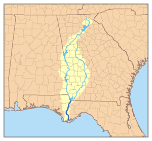
caption = Map of the Apalachicola River watershed showing the two main tributaries, the Chattahoochee River and the Flint River.
origin =Confluence of Chattahoochee andFlint River s atChattahoochee, Florida
mouth =Gulf of Mexico
atApalachicola, Florida
basin_countries =United States
length = 112 mi (180 km)
elevation = 77 ft
discharge = 16,600 ft3/s
watershed = 19,500 mi² (50,505 km²)The Apalachicola River is a river, approximately 112 mi (180 km) long in the
U.S. state Florida . The river's large watershed, known as theACF River Basin for short, drains an area of approximately 19,500 sq mi (50,505 km²) into theGulf of Mexico . The distance to its farthest headstream in northwest Georgia is approximately 500 mi (800 km). Its name comes from the Apalachicola tribe, which used to live along the river.It is formed on the state line between Florida and Georgia, near the town of
Chattahoochee, Florida , approximately 60 mi northeast of Panama City, by the confluence of the Flint and Chattahoochee rivers. The actual confluence is submerged in theLake Seminole reservoir formed by theJim Woodruff Dam . It flows generally south through the forests of theFlorida Panhandle , past Bristol. In northern Gulf County, it receives theChipola River from the west. It flows intoApalachicola Bay , an inlet of the Gulf of Mexico, at Apalachicola. The lower 30 mi (48 km) of the river is surrounded by extensiveswamp s andwetlands except at the coast. The channel of the river is being dredged by the U.S. Army Corps of Engineers to provide navigation due to a lawsuit with Florida.Fact|date=May 2008Except for the area around its mouth, the river provides the boundary between the Eastern and Central time zones in the United States.The Apalachicola River is famous for its tupelo honey, a high quality
Monofloral honey , which is produced wherever theTupelo trees bloom in the southeastern United States, but the purest and most expensive version (which is certified by pollen analysis) is produced mainly in this basin and, to a lesser extent, in other panhandle river basins. In a good harvest year, the value of the tupelo honey crop produced by a group of specialized Florida beekeepers approaches US$1,000,000. [http://impact.ifas.ufl.edu/impact_sum_2001.pdf]During Florida's British colonial period the river formed the boundary between
East Florida andWest Florida .List of crossings
ee also
*
List of Florida rivers
*Voices of the Apalachicola External links
* [http://water.sam.usace.army.mil/acfframe.htm U.S. Army Corps of Engineers: Flint-Chatahoochee-Apalachicola basin]
* [http://www.pepps.fsu.edu/APALACH/ Florida State Univ: Apalachicola River Ecological Management Plan]
* [http://www.dot.state.fl.us/Structures/botm/sr20/sr20.htm Blountstown Bridge]
* [http://www.nature.org/initiatives/freshwater/work/apalachicola.html The Nature Conservancy on the Apalachicola River] The river basin is home to a multitude of biological diversity.
* [http://www.apalachicolaamericantreasure.com Apalachicola River: an American Treasure]
* [http://www.apalachicolariverkeeper.org Apalachicola Riverkeeper]Further reading
*Light, H.M., M.R. Darst, and J.W. Grubbs. (1998). "Aquatic habitats in relation to river flow in the Apalachicola River floodplain, Florida" [U.S. Geological Survey Professional Paper 1594] . Washington, D.C.: U.S. Department of the Interior, U.S. Geological Survey.
Wikimedia Foundation. 2010.