- Apalachicola, Florida
Infobox Settlement
official_name = Apalachicola, Florida
other_name =
native_name =
nickname =
settlement_type =City
motto =
imagesize = 220px
image_caption = A street in Apalachicola
flag_size =
image_
seal_size =
image_shield =
shield_size =
image_blank_emblem =
blank_emblem_type =
blank_emblem_size =
flag_size =
image_
seal_size =
image_shield =
shield_size =
image_blank_emblem =
blank_emblem_type =
blank_emblem_size =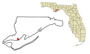
mapsize = 250x200px
map_caption = Location in Franklin County and the state ofFlorida
mapsize1 =
map_caption1 =
image_dot_
dot_mapsize =
dot_map_caption =
dot_x =
dot_y =
pushpin_
pushpin_label_position =
pushpin_map_caption =
pushpin_mapsize =
subdivision_type = Country
subdivision_name = flag|United States
subdivision_type1 = State
subdivision_name1 = flag|Florida
subdivision_type2 = County
subdivision_name2 = noflag|Franklin
subdivision_type3 =
subdivision_name3 =
subdivision_type4 =
subdivision_name4 =
government_footnotes =
government_type =
leader_title =
leader_name =
leader_title1 =
leader_name1 =
leader_title2 =
leader_name2 =
leader_title3 =
leader_name3 =
leader_title4 =
leader_name4 =
established_title =
established_date =
established_title2 =
established_date2 =
established_title3 =
established_date3 =
area_magnitude =
unit_pref = Imperial
area_footnotes =
area_total_km2 = 6.9
area_land_km2 = 4.9
area_water_km2 = 2
area_total_sq_mi = 2.7
area_land_sq_mi = 1.9
area_water_sq_mi = 0.8
area_water_percent =
area_urban_km2 =
area_urban_sq_mi =
area_metro_km2 =
area_metro_sq_mi =
area_blank1_title =
area_blank1_km2 =
area_blank1_sq_mi =
population_as_of = 2000
population_footnotes =
population_note =
population_total = 2334
population_density_km2 = 338.3
population_density_sq_mi = 864.4
population_metro =
population_density_metro_km2 =
population_density_metro_sq_mi =
population_urban =
population_density_urban_km2 =
population_density_urban_sq_mi =
population_blank1_title =
population_blank1 =
population_density_blank1_km2 =
population_density_blank1_sq_mi =
timezone = Eastern (EST)
utc_offset = -5
timezone_DST = EDT
utc_offset_DST = -4
latd = 29 |latm = 43 |lats = 31 |latNS = N
longd = 84 |longm = 59 |longs = 33 |longEW = W
elevation_footnotes =
elevation_m = 4
elevation_ft = 13
postal_code_type =ZIP code s
postal_code = 32320, 32329
area_code = 850
blank_name = FIPS code
blank_info = 12-01625GR|2
blank1_name = GNIS feature ID
blank1_info = 0277920GR|3
website =
footnotes =Apalachicola is a city in Franklin County,
Florida onUS 98 about 80 miles southwest ofTallahassee . The population was 2,334 at the 2000 census. The 2005 census estimates gave the city at 2,340. [http://www.census.gov/popest/cities/tables/SUB-EST2005-04-12.csv] Apalachicola is thecounty seat of Franklin CountyGR|6.Name
"Apalachicola" comes from the Apalachicola tribe and is a combination of
Hitchiti Indian words "apalahchi," meaning "on the other side," and "okli," meaning "people". In original reference to the settlement, it probably meant "people on the other side of the river." [http://www.flheritage.com/facts/reports/names/] [http://dhr.dos.state.fl.us/facts/reports/names/index.cfm#A] Many inhabitants of Apalachicola, however, choose to translate the name of their town as "land of the friendly people." [http://www.baynavigator.com/BriefHistory/briefhistory2.cfm]History
A trading post called Cottonton was located on the current site of Apalachicola. In 1827, the town was incorporated as West Point. Apalachicola received its current name in 1831, by an Act of the Legislative Council of the Territory of Florida.
Before the development of railways in the Gulf states, Apalachicola was the third busiest port in the Gulf of Mexico (behind
New Orleans and Mobile). In the late 1800s and early 1900s, the sponge trade, led by Greek immigrants, was a major industry in the town. Apalachicola is still the home port for a variety of seafood workers, includingoyster harvesters andshrimp ers. More than 90% of Florida's oyster production is harvested from Apalachicola Bay. Every year the town hosts theFlorida Seafood Festival . The bay is well protected by St. Vincent Island, Flag, Sand,St. George Island , andCape St. George Island .Trinity Episcopal Church was incorporated by an Act of the Legislative Council of the Territory of
Florida on Feb 11, 1837. The building was one of the earliest prefabricated buildings in America. The framework was shipped by schooner from New York and assembled in Apalachicola with wooden pegs.Botanist
Alvan Wentworth Chapman (1809-1899) settled in Apalachicola in 1846. In 1860, he published his major work, "Flora of the Southern United States". The local elementary school is named in his honor.In 1849, Apalachicola physician Dr.
John Gorrie (1802-1855) discovered the cold-air process of refrigeration and patented an ice-machine in 1850, as the result of experiments to lower the temperatures of fever patients, laying the groundwork for modern refrigeration and air-conditioning. The city has a monument to him, and a replica of his ice machine is on display in the John Gorrie Museum.The
AN Railway , formerly theApalachicola Northern Railroad , serves the city.Geography and Climate
Apalachicola is located in the northwest part of the state, at coor dms|29|43|31|N|84|59|33|W (29.725203, -84.992534),GR|1 on Apalachicola Bay and at the mouth of the Apalachicola river.
According to the
United States Census Bureau , the city has a total area of 6.9 km² (2.7 mi²). 4.9 km² (1.9 mi²) of it is land and 2.0 km² (0.8 mi²) of it (29.32%) is water.Demographics
As of the
census GR|2 of 2000, there were 2,334 people, 1,006 households, and 608 families residing in the city. Thepopulation density was 479.3/km² (1,242.1/mi²). There were 1,207 housing units at an average density of 247.9/km² (642.3/mi²). The racial makeup of the city was 63.41% White, 34.92% African American, 0.17% Native American, 0.39% Asian, 0.47% from other races, and 0.64% from two or more races. Hispanic or Latino of any race were 1.67% of the population.There were 1,006 households out of which 23.4% had children under the age of 18 living with them, 41.8% were married couples living together, 15.0% had a female householder with no husband present, and 39.5% were non-families. 34.7% of all households were made up of individuals and 14.8% had someone living alone who was 65 years of age or older. The average household size was 2.24 and the average family size was 2.87.
In the city the population was spread out with 21.9% under the age of 18, 7.0% from 18 to 24, 24.0% from 25 to 44, 26.7% from 45 to 64, and 20.5% who were 65 years of age or older. The median age was 43 years. For every 100 females there were 90.2 males. For every 100 females age 18 and over, there were 86.3 males.
The median income for a household in the city was $23,073, and the median income for a family was $28,464. Males had a median income of $22,500 versus $18,750 for females. The
per capita income for the city was $12,227. About 19.9% of families and 25.3% of the population were below thepoverty line , including 32.4% of those under age 18 and 15.0% of those age 65 or over.Education
Apalachicola is a part of the Franklin County School District system [ [http://www.franklincountyschools.org/schoolapahigh.htm Franklin County Schools website] ] . Residents are zoned to Chapman Elementary School and Apalachicola High School. Apalachicola Bay
Charter School is also located in Apalachicola.References
*
External links
* [http://www.apalachicolabay.org/ Apalachicola Chamber of Commerce]
* [http://www.uflib.ufl.edu/UFDC/?c=fdnl1&b=UF00048473 "Commercial Advertiser"] newspaper that serves Apalachicola, Florida is available in full-text with images in [http://www.uflib.ufl.edu/UFDC/?c=fdnl1 Florida Digital Newspaper Library]
Wikimedia Foundation. 2010.