- Carrabelle, Florida
Infobox Settlement
official_name = Carrabelle, Florida
other_name =
native_name =
nickname =
settlement_type =City
motto =
imagesize =
image_caption =
flag_size =
image_
seal_size =
image_shield =
shield_size =
image_blank_emblem =
blank_emblem_type =
blank_emblem_size =
imagesize =
image_caption =
flag_size =
image_
seal_size =
image_shield =
shield_size =
image_blank_emblem =
blank_emblem_type =
blank_emblem_size =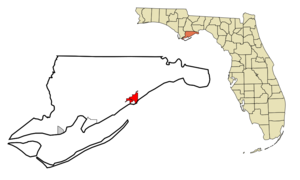
mapsize = 250x200px
map_caption = Location in Franklin County and the state ofFlorida
mapsize1 =
map_caption1 =
image_dot_
dot_mapsize =
dot_map_caption =
dot_x =
dot_y =
pushpin_
pushpin_label_position =
pushpin_map_caption =
pushpin_mapsize =
subdivision_type = Country
subdivision_name = flag|United States
subdivision_type1 = State
subdivision_name1 = flag|Florida
subdivision_type2 = County
subdivision_name2 = noflag|Franklin
subdivision_type3 =
subdivision_name3 =
subdivision_type4 =
subdivision_name4 =
government_footnotes =
government_type =
leader_title =
leader_name =
leader_title1 =
leader_name1 =
leader_title2 =
leader_name2 =
leader_title3 =
leader_name3 =
leader_title4 =
leader_name4 =
established_title =
established_date =
established_title2 =
established_date2 =
established_title3 =
established_date3 =
area_magnitude =
unit_pref = Imperial
area_footnotes =
area_total_km2 = 12.5
area_land_km2 = 9.7
area_water_km2 = 2.8
area_total_sq_mi = 4.8
area_land_sq_mi = 3.7
area_water_sq_mi = 1.1
area_water_percent =
area_urban_km2 =
area_urban_sq_mi =
area_metro_km2 =
area_metro_sq_mi =
area_blank1_title =
area_blank1_km2 =
area_blank1_sq_mi =
population_as_of = 2000
population_footnotes =
population_note =
population_total = 1303
population_density_km2 = 104.2
population_density_sq_mi = 271.5
population_metro =
population_density_metro_km2 =
population_density_metro_sq_mi =
population_urban =
population_density_urban_km2 =
population_density_urban_sq_mi =
population_blank1_title =
population_blank1 =
population_density_blank1_km2 =
population_density_blank1_sq_mi =
timezone = Eastern (EST)
utc_offset = -5
timezone_DST = EDT
utc_offset_DST = -4
latd = 29 |latm = 51 |lats = 14 |latNS = N
longd = 84 |longm = 39 |longs = 57 |longEW = W
elevation_footnotes =
elevation_m = 8
elevation_ft = 26
postal_code_type =ZIP code
postal_code = 32322
area_code = 850
blank_name = FIPS code
blank_info = 12-10725GR|2
blank1_name = GNIS feature ID
blank1_info = 0280069GR|3
website =
footnotes =Carrabelle is a city in Franklin County,
Florida ,United States . The population was 1,303 at the 2000 census. According to the U.S Census estimates of 2005, the city had a population of 1,290. [http://www.census.gov/popest/cities/tables/SUB-EST2005-04-12.csv]Location
Carrabelle is located at about 20 miles east of
Apalachicola, Florida on St. James Island at the mouth of theCarrabelle River . Carrabelle is surrounded by the Carrabelle River, Crooked River,Ochlockonee River and theGulf of Mexico . To the south is Dog Island. According to theUnited States Census Bureau , the city has a total area of 12.5 km² (4.8 mi²). 9.7 km² (3.7 mi²) of it is land and 2.8 km² (1.1 mi²) of it (22.45%) is water.Coordinates
Demographics
As of the
census GR|2 of 2000, there were 1,303 people, 562 households, and 370 families residing in the city. Thepopulation density was 134.9/km² (349.2/mi²). There were 790 housing units at an average density of 81.8/km² (211.7/mi²). The racial makeup of the city was 91.48% White, 5.68% African American, 0.31% Native American, 0.08% Asian, 0.08% Pacific Islander, 0.84% from other races, and 1.53% from two or more races. Hispanic or Latino of any race were 1.61% of the population.There were 562 households out of which 26.9% had children under the age of 18 living with them, 48.0% were married couples living together, 12.1% had a female householder with no husband present, and 34.0% were non-families. 30.6% of all households were made up of individuals and 12.3% had someone living alone who was 65 years of age or older. The average household size was 2.30 and the average family size was 2.83.
In the city the population was spread out with 23.3% under the age of 18, 7.8% from 18 to 24, 24.1% from 25 to 44, 27.5% from 45 to 64, and 17.3% who were 65 years of age or older. The median age was 41 years. For every 100 females there were 93.3 males. For every 100 females age 18 and over, there were 92.3 males.
The median income for a household in the city was $23,749, and the median income for a family was $27,955. Males had a median income of $26,719 versus $19,018 for females. The
per capita income for the city was $14,677. About 14.8% of families and 19.4% of the population were below thepoverty line , including 18.9% of those under age 18 and 24.2% of those age 65 or over.For many decades, Carrabelle had the only tertiary sewage treatment facility in the State of Florida, but this may have been updated in recent years.
History
In
1528 the first Spanishexpedition ofPanfilo de Narvaez passed through the area on its way fromTampa Bay to theRio Grande . From the late1600s through early1700s a few passages referring to the area are mentioned. Carrabelle, Dog Island, and St. George Island served as points to stage raids on local ports as well asSan Marcos de Apalache in1677 and1682 .In
1876 explorer Nathaniel Holmes Bishop ofMedford, Massachusetts navigated the Crooked River through the lowlands to theOchlockonee River . In1877 Oliver Hudson Kelly, from Massachusetts founded the town and named it Rio Carrabelle. The following year the first U.S. Post office was established with its address as Rio Carrabelle. By1881 the population was between 500 and 600 people.In
1891 TheCarrabelle, Tallahassee and Georgia Railroad was established to connect Carrabelle northward through Tallahassee to the Florida-Georgia line. [ [http://www.gulfpirate.com/history.htm Gulf Pirate: History of Carrabelle & Franklin County] ]On August 1,
1899 , the 2nd hurricane of the season struck the area almost destroying the town leaving just nine homes. [ [http://query.nytimes.com/mem/archive-free/pdf?_r=1&res=980DE2DD173DE433A25756C0A96E9C94689ED7CF&oref=slogin NY Times article archives:1899 storm] ]On August 23,
2008 , Tropical Storm Fay made its record fourth landfall in the state of Florida at Carrabelle.Attractions
Carrabelle is the home of the "World's Smallest Police Station". [http://www.carrabelle.org/worldssmallestpolicestation.asp]
Education
Carrabelle is a part of the
Franklin County School District system.Residents are zoned to the Carrabelle School, a K-12 school.
It was the home of the now closed
Anneewakee Treatment Center for Emotionally Disturbed Youth .References
External links
* [http://www.carrabelle.org/ Carrabelle Chamber of Commerce]
* [http://www.mycarrabelle.com/ Official Carrabelle City Website]
* [http://carrabelle-florida.santopia.com/ Carrabelle Homepage]
Wikimedia Foundation. 2010.