- East Brewton, Alabama
Infobox Settlement
official_name = East Brewton, Alabama
settlement_type =City
imagesize =
image_caption =
image_
imagesize =
image_caption =
image_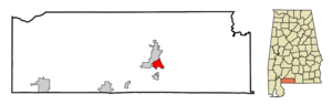
mapsize = 250px
map_caption = Location in Escambia County and the state ofAlabama
mapsize1 =
map_caption1 =
subdivision_type = Country
subdivision_type1 = State
subdivision_type2 = County
subdivision_name =United States
subdivision_name1 =Alabama
subdivision_name2 = Escambia
government_type =
leader_title =
leader_name =
established_date =
area_magnitude =
area_total_km2 = 9.1
area_total_sq_mi = 3.5
area_land_km2 = 9.1
area_land_sq_mi = 3.5
area_water_km2 = 0
area_water_sq_mi = 0
elevation_ft = 98
elevation_m = 30
population_as_of = 2000
population_footnotes =
population_total = 2496
population_metro =
population_density_km2 = 274.3
population_density_sq_mi = 713.1
timezone = Central (CST)
utc_offset = -6
latd = 31 |latm = 5 |lats = 32 |latNS = N
longd = 87 |longm = 3 |longs = 11 |longEW = W
timezone_DST = CDT
utc_offset_DST = -5
postal_code_type =ZIP code
postal_code = 36426-36427
area_code = 251
blank_name = FIPS code
blank_info = 01-22216
blank1_name = GNIS feature ID
blank1_info = 0117739
footnotes =
website =East Brewton is a city in Escambia County,
Alabama ,United States . At the 2000 census the population was 2,496.Geography
East Brewton is located at coor dms|31|5|33|N|87|3|11|W|city (31.092408, -87.053174)GR|1.
According to the
U.S. Census Bureau , the city has a total area of 3.5square mile s (9.1km² ), of which, 3.5 square miles (9.1 km²) of it is land and 0.28% is water.Demographics
As of the
census GR|2 of 2000, there were 2,496 people, 1,043 households, and 688 families residing in the city. Thepopulation density was 712.3 people per square mile (275.3/km²). There were 1,249 housing units at an average density of 356.4/sq mi (137.8/km²). The racial makeup of the city was 80.29% White, 17.07% Black or African American, 0.48% Native American, 0.08% Pacific Islander, 1.44% from other races, and 0.64% from two or more races. 1.96% of the population were Hispanic or Latino of any race.There were 1,043 households out of which 31.6% had children under the age of 18 living with them, 46.4% were married couples living together, 15.3% had a female householder with no husband present, and 34.0% were non-families. 29.9% of all households were made up of individuals and 12.2% had someone living alone who was 65 years of age or older. The average household size was 2.39 and the average family size was 2.94.
In the city the population was spread out with 26.1% under the age of 18, 10.0% from 18 to 24, 27.8% from 25 to 44, 22.2% from 45 to 64, and 13.9% who were 65 years of age or older. The median age was 35 years. For every 100 females there were 88.4 males. For every 100 females age 18 and over, there were 84.4 males.
The median income for a household in the city was $23,125, and the median income for a family was $30,610. Males had a median income of $26,281 versus $17,500 for females. The
per capita income for the city was $12,531. About 18.5% of families and 23.9% of the population were below thepoverty line , including 36.7% of those under age 18 and 22.0% of those age 65 or over.References
External links
* [http://www.escambiaida.com/east_brewton.htm East Brewton page] of Escambia County Industrial Development Authority website
* [http://www.escambiaida.com/ Escambia County Industrial Development Authority]
* [http://www.cgeda.net Coastal Gateway Regional Economic Development Authority]
Wikimedia Foundation. 2010.