- Grove Hill, Alabama
Infobox Settlement
official_name = Grove Hill, Alabama
settlement_type =Town
imagesize =
image_caption =
image_
imagesize =
image_caption =
image_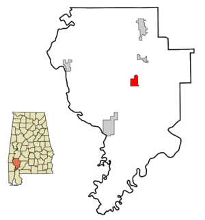
mapsize = 250px
map_caption = Location in Clarke County and the state ofAlabama
mapsize1 =
map_caption1 =
subdivision_type = Country
subdivision_type1 = State
subdivision_type2 = County
subdivision_name =United States
subdivision_name1 =Alabama
subdivision_name2 = Clarke
government_type =
leader_title =
leader_name =
established_date =
area_magnitude =
area_total_km2 = 12.9
area_total_sq_mi = 5
area_land_km2 = 12.9
area_land_sq_mi = 5
area_water_km2 = 0
area_water_sq_mi = 0
elevation_ft = 505
elevation_m = 154
population_as_of = 2000
population_footnotes =
population_total = 1438
population_metro =
population_density_km2 = 111.5
population_density_sq_mi = 287.6
timezone = Central (CST)
utc_offset = -6
latd = 31 |latm = 42 |lats = 22 |latNS = N
longd = 87 |longm = 46 |longs = 27 |longEW = W
timezone_DST = CDT
utc_offset_DST = -5
postal_code_type =ZIP code
postal_code = 36451
area_code = 251
blank_name = FIPS code
blank_info = 01-32080
blank1_name = GNIS feature ID
blank1_info = 0155087
footnotes =
website =Grove Hill is a town in Clarke County,
Alabama ,United States . At the 2000 census the population was 1,438. The city is thecounty seat of Clarke County and home of theClarke County Museum .Geography
Grove Hill is located at 31°42'22.093" North, 87°46'27.386" West (31.706137, -87.774274)GR|1.
According to the
U.S. Census Bureau , the town has a total area of 5.0square mile s (12.9km² ), all of it land.Demographics
As of the
census GR|2 of 2000, there were 1,438 people, 582 households, and 387 families residing in the town. Thepopulation density was 289.6 people per square mile (111.7/km²). There were 684 housing units at an average density of 137.8/sq mi (53.1/km²). The racial makeup of the town was 61.96% White, 37.27% Black or African American, 0.21% Native American, 0.21% from other races, and 0.35% from two or more races. 0.35% of the population were Hispanic or Latino of any race.There were 582 households out of which 27.5% had children under the age of 18 living with them, 46.9% were married couples living together, 17.4% had a female householder with no husband present, and 33.5% were non-families. 32.1% of all households were made up of individuals and 17.7% had someone living alone who was 65 years of age or older. The average household size was 2.35 and the average family size was 2.99.
In the town the population was spread out with 23.2% under the age of 18, 9.9% from 18 to 24, 25.8% from 25 to 44, 23.2% from 45 to 64, and 18.0% who were 65 years of age or older. The median age was 40 years. For every 100 females there were 91.0 males. For every 100 females age 18 and over, there were 82.6 males.
Notable natives
*
Doug Barfield - Head football coach atAuburn University from 1976 to 1980.
*John W. Cranford - Representative for Texas.
*Grant Gillis -Major League Baseball player from 1927 to 1929.
*F. David Mathews -United States Secretary of Health, Education, and Welfare underGerald Ford .
*Jim Herod author ofGathering Moss References
External links
Wikimedia Foundation. 2010.