- Waynesboro, Georgia
Infobox Settlement
official_name = Waynesboro, Georgia
other_name =
native_name =
nickname =
settlement_type =City
motto =
imagesize =
image_caption =
flag_size =
image_
seal_size =
image_shield =
shield_size =
image_blank_emblem =
blank_emblem_type =
blank_emblem_size =
imagesize =
image_caption =
flag_size =
image_
seal_size =
image_shield =
shield_size =
image_blank_emblem =
blank_emblem_type =
blank_emblem_size =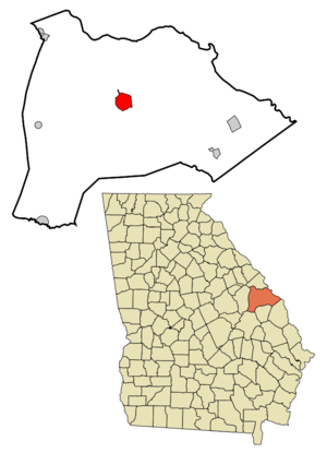
mapsize = 250px
map_caption = Location in Burke County and the state of Georgia
mapsize1 =
map_caption1 =
image_dot_
dot_mapsize =
dot_map_caption =
dot_x =
dot_y =
pushpin_
pushpin_label_position =
pushpin_map_caption =
pushpin_mapsize =
subdivision_type = Country
subdivision_name =United States
subdivision_type1 = State
subdivision_name1 = Georgia
subdivision_type2 = County
subdivision_name2 = Burke
subdivision_type3 =
subdivision_name3 =
subdivision_type4 =
subdivision_name4 =
government_footnotes =
government_type =
leader_title =
leader_name =
leader_title1 =
leader_name1 =
leader_title2 =
leader_name2 =
leader_title3 =
leader_name3 =
leader_title4 =
leader_name4 =
established_title =
established_date =
established_title2 =
established_date2 =
established_title3 =
established_date3 =
area_magnitude =
unit_pref = Imperial
area_footnotes =
area_total_km2 = 14.2
area_land_km2 = 14.1
area_water_km2 = 0.1
area_total_sq_mi = 5.6
area_land_sq_mi = 5.5
area_water_sq_mi = 0.1
area_water_percent =
area_urban_km2 =
area_urban_sq_mi =
area_metro_km2 =
area_metro_sq_mi =
area_blank1_title =
area_blank1_km2 =
area_blank1_sq_mi =
population_as_of = 2000
population_footnotes =
population_note =
population_total = 5813
population_density_km2 = 409.4
population_density_sq_mi = 1038
population_metro =
population_density_metro_km2 =
population_density_metro_sq_mi =
population_urban =
population_density_urban_km2 =
population_density_urban_sq_mi =
population_blank1_title =
population_blank1 =
population_density_blank1_km2 =
population_density_blank1_sq_mi =
timezone = Eastern (EST)
utc_offset = -5
timezone_DST = EDT
utc_offset_DST = -4
latd = 33 |latm = 5 |lats = 26 |latNS = N
longd = 82 |longm = 0 |longs = 55 |longEW = W
elevation_footnotes =
elevation_m = 90
elevation_ft = 295
postal_code_type =ZIP code
postal_code = 30830
area_code = 706
blank_name = FIPS code
blank_info = 13-80984GR|2
blank1_name = GNIS feature ID
blank1_info = 0347180GR|3
website =
footnotes =Waynesboro is a city in Burke County, Georgia,
United States . The population was 5,813 at the 2000 census. The city is thecounty seat of Burke CountyGR|6.Waynesboro is also known as "The Bird Dog Capital of the World."
Near Waynesboro during the
American Civil War onDecember 4 ,1864 , forces under Union GeneralJudson Kilpatrick prevented troops led by Confederate GeneralJoseph Wheeler from interfering with Union GeneralWilliam T. Sherman campaign of destroying a wide swath of the South on his march to Savannah, Georgia and the Atlantic Ocean (Union forces did suffer more than three times the casualties as the Confederates, however).The City of Waynesboro, Georgia is located in Burke County, which is one of the eight original counties of Georgia. It was named after General Anthony Wayne whose daring efforts during the Revolutionary War earned him the nickname "Mad Anthony Wayne." Although the residents lived in the area before the Revolutionary War, the town was not laid out until 1783. The City was officially incorporated in 1883 as the City of Waynesborough.
President George Washington spent the night of May 17, 1791 in Waynesboro. As of 2007, there is a stone monument marking the historical location in front of the Kwik Stop on Liberty Street in Waynesboro. http://www.cviog.uga.edu/Projects/gainfo/tdgh-may/may17.htm
Some claim that President George Washington owned land in Waynesboro. He had planned to develop it as a sugar plantation prior to his involvement with the American revolutionaries. He later sold it upon purchase of his Mt. Vernon property in northern Virginia.
Geography
Waynesboro is located at coor dms|33|5|26|N|82|0|55|W|city (33.090482, -82.015404)GR|1.
According to the
United States Census Bureau , the city has a total area of 5.5square mile s (14.3km² ), of which, 5.5 square miles (14.1 km²) of it is land and 0.1 square miles (0.2 km²) of it (1.09%) is water.Demographics
As of the
census GR|2 of 2000, there were 5,813 people, 2,151 households, and 1,473 families residing in the city. Thepopulation density was 1,064.1 people per square mile (411.1/km²). There were 2,395 housing units at an average density of 438.4/sq mi (169.4/km²). The racial makeup of the city was 62.55% African American, 35.89% White, 0.10% Native American, 0.09% Asian, 0.41% from other races, and 0.96% from two or more races. Hispanic or Latino of any race were 1.20% of the population.There were 2,151 households out of which 37.4% had children under the age of 18 living with them, 32.1% were married couples living together, 32.7% had a female householder with no husband present, and 31.5% were non-families. 28.8% of all households were made up of individuals and 14.5% had someone living alone who was 65 years of age or older. The average household size was 2.62 and the average family size was 3.21.
In the city the population was spread out with 33.3% under the age of 18, 10.0% from 18 to 24, 24.6% from 25 to 44, 17.9% from 45 to 64, and 14.2% who were 65 years of age or older. The median age was 31 years. For every 100 females there were 78.8 males. For every 100 females age 18 and over, there were 69.8 males.
The median income for a household in the city was $20,346, and the median income for a family was $24,012. Males had a median income of $30,750 versus $19,462 for females. The
per capita income for the city was $12,151. About 35.3% of families and 42.6% of the population were below thepoverty line , including 60.6% of those under age 18 and 28.9% of those age 65 or over.
= Education = [School, College, and Library Search. 2008. U.S. Department of Education. April 25, 2008 < http://www.nces.ed.gov > ]Public Schools
Marie’s Creative Kids Kindergarten (K)
Waynesboro Primary (Pre K-2nd)
Blankney Elementary (3rd-5th)
Burke County Middle (6th-8th)
Burke County High (9th-12th)
Private Schools
Edmund Burke Academy (Pre K-12)
Burke Haven Christian (K-8)
Lords House of Praise Christian (Pre K-11)
Waynesboro Minnonite School (1-12)
Alternative Schools
Burke County Alternative (6th-12th)
Colleges
Augusta Technical College Waynesboro Campus
References
External links
Wikimedia Foundation. 2010.