- Sandersville, Georgia
Infobox Settlement
official_name = Sandersville, Georgia
other_name =
native_name =
nickname =
settlement_type =City
motto =
imagesize =
image_caption =
flag_size =
image_
seal_size =
image_shield =
shield_size =
image_blank_emblem =
blank_emblem_type =
blank_emblem_size =
imagesize =
image_caption =
flag_size =
image_
seal_size =
image_shield =
shield_size =
image_blank_emblem =
blank_emblem_type =
blank_emblem_size =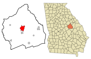
mapsize = 250px
map_caption = Location in Washington County and the state of Georgia
mapsize1 =
map_caption1 =
image_dot_
dot_mapsize =
dot_map_caption =
dot_x =
dot_y =
pushpin_
pushpin_label_position =
pushpin_map_caption =
pushpin_mapsize =
subdivision_type = Country
subdivision_name =United States
subdivision_type1 = State
subdivision_name1 = Georgia
subdivision_type2 = County
subdivision_name2 = Washington
subdivision_type3 =
subdivision_name3 =
subdivision_type4 =
subdivision_name4 =
government_footnotes =
government_type =
leader_title =
leader_name =
leader_title1 =
leader_name1 =
leader_title2 =
leader_name2 =
leader_title3 =
leader_name3 =
leader_title4 =
leader_name4 =
established_title =
established_date =
established_title2 =
established_date2 =
established_title3 =
established_date3 =
area_magnitude =
unit_pref = Imperial
area_footnotes =
area_total_km2 = 23.9
area_land_km2 = 23.7
area_water_km2 = 0.2
area_total_sq_mi = 9.2
area_land_sq_mi = 9.1
area_water_sq_mi = 0.1
area_water_percent =
area_urban_km2 =
area_urban_sq_mi =
area_metro_km2 =
area_metro_sq_mi =
area_blank1_title =
area_blank1_km2 =
area_blank1_sq_mi =
population_as_of = 2000
population_footnotes =
population_note =
population_total = 6144
population_density_km2 = 257.1
population_density_sq_mi = 667.8
population_metro =
population_density_metro_km2 =
population_density_metro_sq_mi =
population_urban =
population_density_urban_km2 =
population_density_urban_sq_mi =
population_blank1_title =
population_blank1 =
population_density_blank1_km2 =
population_density_blank1_sq_mi =
timezone = Eastern (EST)
utc_offset = -5
timezone_DST = EDT
utc_offset_DST = -4
latd = 32 |latm = 58 |lats = 55 |latNS = N
longd = 82 |longm = 48 |longs = 35 |longEW = W
elevation_footnotes =
elevation_m = 137
elevation_ft = 449
postal_code_type =ZIP code
postal_code = 31082
area_code = 478
blank_name = FIPS code
blank_info = 13-68208GR|2
blank1_name = GNIS feature ID
blank1_info = 0322445GR|3
website =
footnotes =Sandersville is a city in Washington County, Georgia,
United States . The population was 6,144 at the 2000 census. The city is thecounty seat of Washington CountyGR|6. Sandersville is the birthplace ofPhiladelphia Eagles Pro Bowl linebacker Takeo Spikes , as well asNation of Islam leaderElijah Muhammad .Geography
Sandersville is located at coor dms|32|58|55|N|82|48|35|W|city (32.981887, -82.809659)GR|1.
According to the
United States Census Bureau , the city has a total area of 10.2square mile s (23.9km² ), of which, 9.1 square miles (23.7 km²) of it is land and 0.1 square miles (0.2 km²) of it (0.87%) is water.Demographics
As of the
census GR|2 of 2000, there were 6,144 people, 2,362 households, and 1,591 families residing in the city. Thepopulation density was 672.1 people per square mile (259.5/km²). There were 2,589 housing units at an average density of 283.2/sq mi (109.4/km²). The racial makeup of the city was 59.03% African American, 39.76% White, 0.11% Native American, 0.60% Asian, 0.05% Pacific Islander, 0.03% from other races, and 0.41% from two or more races. Hispanic or Latino of any race were 0.24% of the population.There were 2,362 households out of which 31.8% had children under the age of 18 living with them, 37.2% were married couples living together, 25.8% had a female householder with no husband present, and 32.6% were non-families. 30.0% of all households were made up of individuals and 13.3% had someone living alone who was 65 years of age or older. The average household size was 2.52 and the average family size was 3.13.
In the city the population was spread out with 28.0% under the age of 18, 7.8% from 18 to 24, 26.5% from 25 to 44, 21.8% from 45 to 64, and 15.9% who were 65 years of age or older. The median age was 37 years. For every 100 females there were 79.6 males. For every 100 females age 18 and over, there were 72.4 males.
The median income for a household in the city was $27,201, and the median income for a family was $32,462. Males had a median income of $36,089 versus $21,765 for females. The
per capita income for the city was $18,226. About 24.3% of families and 27.5% of the population were below thepoverty line , including 36.2% of those under age 18 and 24.1% of those age 65 or over.Notable people
*Two
Major League Baseball players were born in Sandersville:Shortstop Coot Veal (1932) andoutfielder Marvin Lane (1950).
*NFL linebackerTakeo Spikes was born in Sandersville.References
External links
* [http://www.sandersville.net/site/ Official website for the City of Sandersville]
* [http://sandersville.georgia.gov/ Sandersville page on Georgia.gov]
Wikimedia Foundation. 2010.