- National Register of Historic Places listings in Oconee County, South Carolina
-
 Location of Oconee County in South Carolina
This is a list of the National Register of Historic Places listings in Oconee County, South Carolina.
This is intended to be a complete list of the properties and districts on the National Register of Historic Places in Oconee County, South Carolina, United States. The locations of National Register properties and districts for which the latitude and longitude coordinates are included below, may be seen on a map.[1]
There are 19 properties and districts listed on the National Register in the county. Another 2 properties were once listed but have been removed.
-
- This National Park Service list is complete through NPS recent listings posted November 10, 2011.[2]
Current listings
[3] Landmark name [4] Image Date listed Location City or town Summary 1 Alexander-Hill House July 24, 1972 About 10 miles north of Seneca off South Carolina Highway 183
34°47′48″N 82°55′49″W / 34.796667°N 82.930278°WSeneca 2 Ellicott Rock 
July 24, 1973 North of Walhalla off SC 107
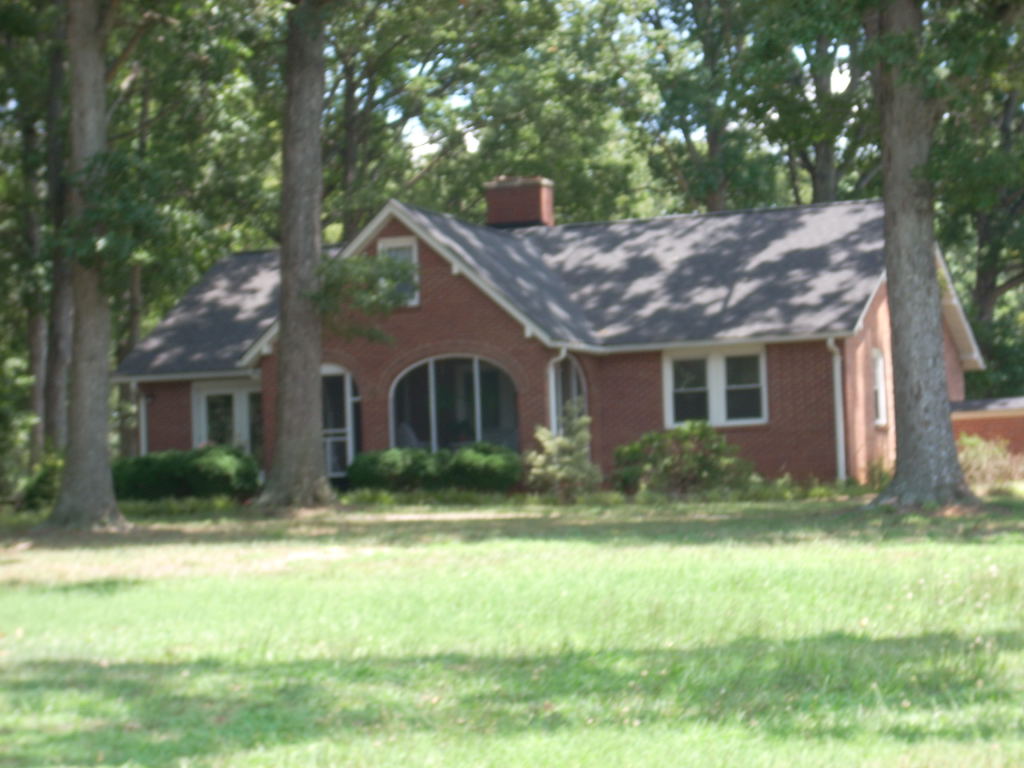
35°00′02″N 83°06′30″W / 35.000556°N 83.108333°WWalhalla 3 Keil Farm May 20, 1998 178 Keil Farm Rd.
34°43′54″N 83°03′23″W / 34.731667°N 83.056389°WWalhalla 4 Long Creek Academy 
November 20, 1987 1251 Academy Rd.
34°47′25″N 83°14′52″W / 34.790278°N 83.247778°WLong Creek 5 McPhail Angus Farm 
November 7, 2007 320 Coyote Lane
34°33′18″N 82°56′24″W / 34.555°N 82.94°WSeneca 6 Newry Historic District 
March 19, 1982 Broadway, River Ridge Rd., and South, Branch, and Palmetto Aves.
34°43′28″N 82°54′32″W / 34.724444°N 82.908889°WNewry 7 Oconee County Cage 
November 14, 1982 Church St.
34°45′51.5″N 83°4′.8″W / 34.764306°N 83.066889°WWalhalla Moved to Oconee Heritage Center 8 Oconee State Park Historic District June 16, 2004 624 State Park Rd.
34°51′57″N 83°06′12″W / 34.865833°N 83.103333°WMountain Rest 9 Oconee Station and Richards House 
February 24, 1971 11 miles north of Walhalla via South Carolina Highway 11 and County Road 95
34°50′46″N 83°04′14″W / 34.846111°N 83.070556°WWalhalla 10 Old Pickens Presbyterian Church April 4, 1996 South Carolina Highway 183, 0.25 miles west of the Oconee-Pickens county line
34°47′29″N 82°53′12″W / 34.791389°N 82.886667°WSeneca 11 Pendleton Historic District August 25, 1970 Bounded on the west by Hopewell and Treaty Oak, on the north by the Old Stone Church, on the east by Montpelier, and on the south by the town limits
34°12′03″N 82°47′40″W / 34.200833°N 82.794444°WPendleton Extends into Anderson and Pickens counties 12 Ram Cat Alley Historic District March 24, 2000 Ram Cat Alley and North Townville St.
34°41′06″N 82°57′09″W / 34.685°N 82.9525°WSeneca 13 Retreat Rosenwald School September 15, 2011 150 Pleasant Hill Cir.
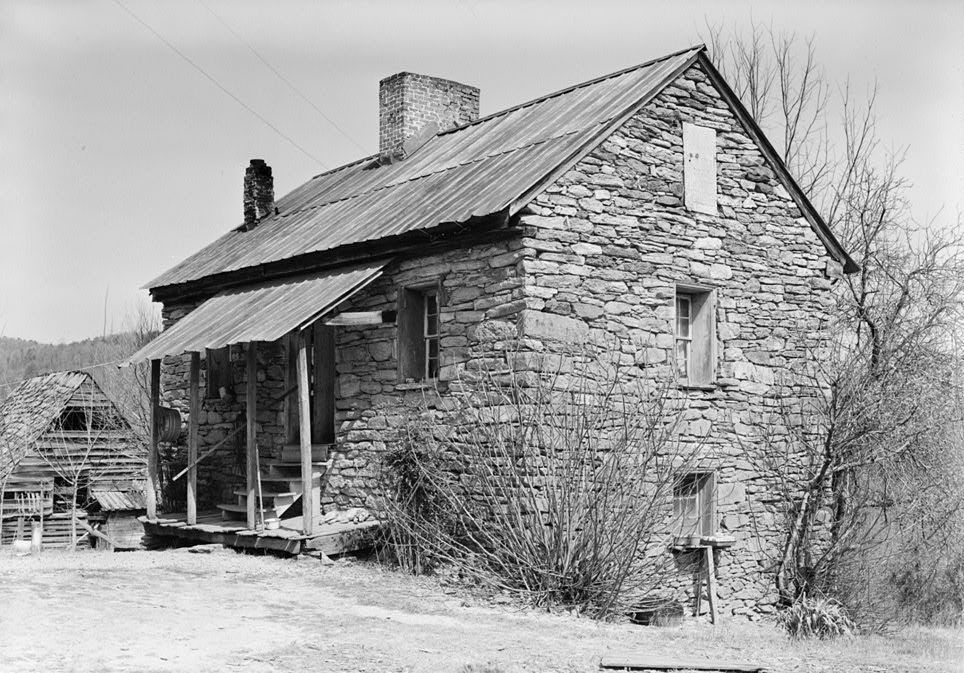
34°38′28″N 83°03′50″W / 34.641111°N 83.063889°WWestminster 14 Russell House February 29, 1988 Northwest of Mountain Rest on South Carolina Highway 28
34°54′34″N 83°10′21″W / 34.909444°N 83.1725°WMountain Rest 15 St. John's Lutheran Church 
November 24, 1980 301 W. Main St.
34°45′54″N 83°04′11″W / 34.765°N 83.069722°WWalhalla 16 Seneca Historic District 
December 31, 1974 Roughly bounded by S. 1st, S. 3rd, Townsville, and Poplar Sts.; also 300 S. Fairplay St.
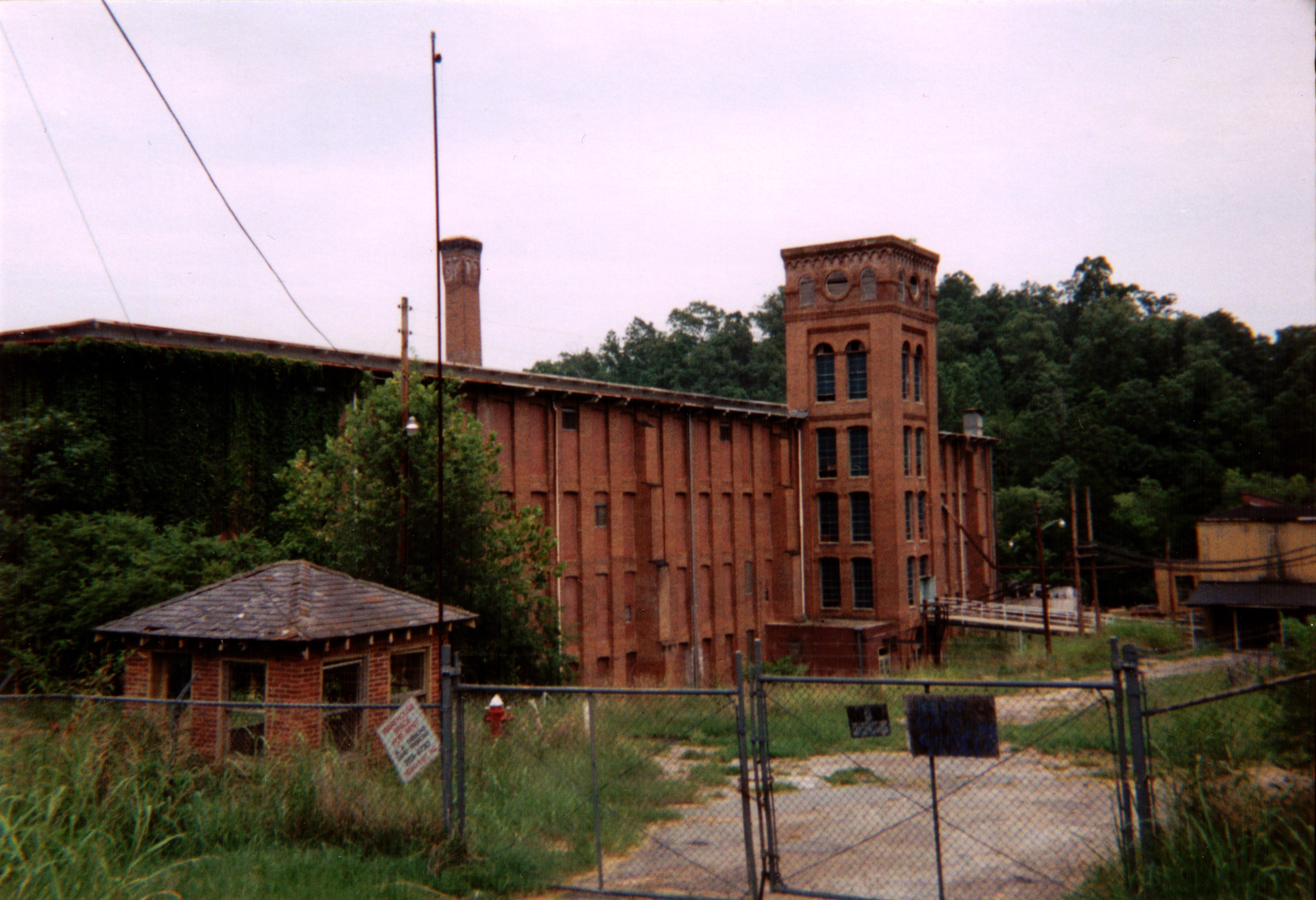
34°41′01″N 82°57′25″W / 34.683611°N 82.956944°WSeneca 300 S. Fairplay represents a boundary increase of April 23, 1987 17 Southern Railway Passenger Station 
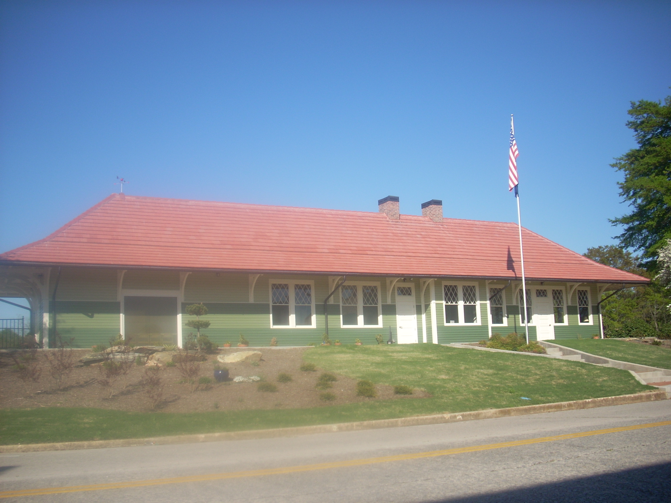
November 7, 1976 129 Main St.
34°39′57″N 83°05′46″W / 34.665833°N 83.096111°WWestminster 18 Stumphouse Tunnel Complex April 7, 1971 5 miles north of Walhalla via South Carolina Highways 28 and 226
34°48′43″N 83°07′03″W / 34.811944°N 83.1175°WWalhalla 19 Walhalla Graded School 
February 13, 1992 101 E. N. Broad St.
34°46′00″N 83°03′55″W / 34.766667°N 83.065278°WWalhalla Walhalla Civic Auditorium Former listings
Landmark name Image Dates Location City or Town Summary 1 Oconee County Jail December 12, 1989 (delisted) Walhalla It was demolished. 2 Prather's Bridge 
April 17, 1978 (delisted) 34°38′50″N 83°16′46″W / 34.64722°N 83.27944°W It was burned. See also
- List of National Historic Landmarks in South Carolina
- National Register of Historic Places listings in South Carolina
References
- ^ The latitude and longitude information provided in this table was derived originally from the National Register Information System, which has been found to be fairly accurate for about 99% of listings. For about 1% of NRIS original coordinates, experience has shown that one or both coordinates are typos or otherwise extremely far off; some corrections may have been made. A more subtle problem causes many locations to be off by up to 150 yards, depending on location in the country: most NRIS coordinates were derived from tracing out latitude and longitudes off of USGS topographical quadrant maps created under the North American Datum of 1927, which differs from the current, highly accurate WGS84 GPS system used by Google maps. Chicago is about right, but NRIS longitudes in Washington are higher by about 4.5 seconds, and are lower by about 2.0 seconds in Maine. Latitudes differ by about 1.0 second in Florida. Some locations in this table may have been corrected to current GPS standards.
- ^ "National Register of Historic Places: Weekly List Actions". National Park Service, United States Department of the Interior. Retrieved on November 10, 2011.
- ^ Numbers represent an ordering by significant words. Various colorings, defined here, differentiate National Historic Landmark sites and National Register of Historic Places Districts from other NRHP buildings, structures, sites or objects.
- ^ "National Register Information System". National Register of Historic Places. National Park Service. . http://nrhp.focus.nps.gov/natreg/docs/All_Data.html.
U.S. National Register of Historic Places in South Carolina Lists by county Abbeville • Aiken • Allendale • Anderson • Bamberg • Barnwell • Beaufort • Berkeley • Calhoun • Charleston • Cherokee • Chester • Chesterfield • Clarendon • Colleton • Darlington • Dillon • Dorchester • Edgefield • Fairfield • Florence • Georgetown • Greenville • Greenwood • Hampton • Horry • Jasper • Kershaw • Lancaster • Laurens • Lee • Lexington • Marion • Marlboro • McCormick • Newberry • Oconee • Orangeburg • Pickens • Richland • Saluda • Spartanburg • Sumter • Union • Williamsburg • York

Lists by city Other lists Municipalities and communities of Oconee County, South Carolina Cities 
Towns CDPs Unincorporated
communitiesLong Creek | Mountain Rest | Tamassee
Categories:- Oconee County, South Carolina
- National Register of Historic Places in Oconee County, South Carolina
-


Wikimedia Foundation. 2010.