- McBee, South Carolina
-
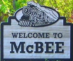
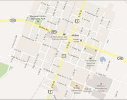
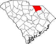
McBee, South Carolina — City — Welcome To McBee, SC Sign Location of McBee, South Carolina Map of McBee, SC Coordinates: 34°28′4″N 80°15′29″W / 34.46778°N 80.25806°WCoordinates: 34°28′4″N 80°15′29″W / 34.46778°N 80.25806°W Country  United States
State  South Carolina
County Chesterfield Founded 1901 Government – Mayor John Capolong Area – Total 1.2 sq mi (3.0 km2) – Land 1.2 sq mi (3.0 km2) – Water 0.0 sq mi (0.0 km2) Elevation 479 ft (146 m) Population (2010) – Total 867 – Density 613.3/sq mi (236.8/km2) Time zone Eastern (EST) (UTC-5) – Summer (DST) EDT (UTC-4) ZIP code 29101 Area code(s) 843 FIPS code 45-43495[1] GNIS feature ID 1231526[2] Website McBee Online McBee (
 /ˈmækbi/) is a town in Chesterfield County, South Carolina, United States. The population was 867 at the 2010 census. McBee is located at 34°28'7.14"N 80°15'22.02"W, approximately 36 miles to Florence and approximately 62 miles to Columbia.
Contents
History
About Bunch McBee
The same as Patrick and Pageland, McBee was named after a railroad executive; in this case, V.E. "Bunch" McBee, born July 26, 1849, in Greenville Co., SC, the son of William Pinkney and Harriett Butler McBee. Bunch McBee was one of South Carolina's leading forces in the building of railroads, was responsible for the Columbia, South Carolina to Hamlet, North Carolina line, which runs through McBee, and was at one time superintendent of the Seaboard Air Line Railway.
Incorporated
McBee was incorporated in 1902, when it became the starting point of the Columbia, Monroe, and Charlotte Railroad. In 1945 the straight of U.S. Route 1 going thou McBee was named a Blue Star Memorial Highway Number 6.
Alligator Fire Dist
McBee is famous for one of the biggest Fire Districts in Chesterfield County. Alligator Fire Dist was formed with Mcbee Fire department back in the late 1980s, with five fully operating stations spread all over the district, which they cover with no problems with their highly trained Firefighters, certified through the SC fire academy located in Columbia. The name was taken from the historical creek "Alligator Creek & Alligator Township which is located North of McBee on U.S. Route 1.
Alligator Fire District Website
Today
In McBee there are industries around the area that supports the 867 inhabitants. In fact,within 5 miles of the town about 2,500 people work. Two large firms operate there, A.O. Smith and Talley Metals. And, of course, McBee is well known for the peach industry McLeod Farms. The Old McBee Train Depot still stands today, and has been converted into a Railroad Museum and the town library, within holds the history of the railroad system with many displays covering many aspects of a bygone era.
Geography and Climate
McBee is located at 34°28′4″N 80°15′29″W / 34.46778°N 80.25806°W (34.467803, -80.258075)[3]. According to the United States Census Bureau, the town has a total area of 1.2 square miles (3.0 km²), all of it land. The largest man made water tower is located in McBee, SC
McBee has a humid subtropical climate, characterized by humid summers and cool dry winters. Precipitation does not vary greatly between seasons. July is the hottest month, with an average high temperature of below 91°F and an average low temperature of around 69°F.[6] The coldest month of the year is January, when the average high temperature is near 54°F and the average low temperature is below 32°F.[6] The warmest temperature ever recorded in the city was 106°F.[7] The coldest temperature ever recorded in the city was -2°F.[8] While McBee is near a coastal area, hurricanes are not a major concern, but are possible in this part of South Carolina.
Climate data for McBee, South Carolina Month Jan Feb Mar Apr May Jun Jul Aug Sep Oct Nov Dec Year Average high °F (°C) 48
(9)54
(12)65
(18)74
(23)80
(27)88
(31)90
(32)89
(32)83
(28)73
(23)58
(14)48
(9)70.8
(21.6)Average low °F (°C) 28
(−2)32
(0)42
(6)48
(9)58
(14)68
(20)70
(21)70
(21)64
(18)52
(11)38
(3)30
(−1)50.0
(10.0)Precipitation inches (mm) 4.64
(117.9)3.97
(100.8)5.04
(128)3.33
(84.6)3.42
(86.9)4.33
(110)4.12
(104.6)3.88
(98.6)4.68
(118.9)3.80
(96.5)3.59
(91.2)3.52
(89.4)48.32
(1,227.3)Snowfall inches (cm) 2.1
(5.3)1.9
(4.8)1.6
(4.1)0.0
(0)0.0
(0)0.0
(0)0.0
(0)0.0
(0)0.0
(0)0.1
(0.3)0.3
(0.8)0.9
(2.3)6.9
(17.5)Avg. precipitation days 11.2 9.3 10.8 8.6 10.1 10.3 11.0 9.6 7.9 6.5 8.6 10.0 113.9 Avg. snowy days (≥ 0.3 in) 1.8 0.8 0.8 0.0 0.0 0.0 0.0 0.0 0.0 0.2 0.5 0.8 4.9 Sunshine hours 173.6 180.8 235.5 270.0 291.4 288.0 291.5 272.8 240.0 229.4 177.0 167.4 2,817.4 Source: http://www.weather.com/outlook/health/fitness/wxclimatology/monthly/graph/29101 Demographics
Historical populations Census Pop. %± 1990 715 — 2000 714 −0.1% 2010 867 21.4% U.S. Decennial Census As of the census[1] of 2010, there were 867 people, 282 households, and 195 families residing in the town. The population density was 613.3 people per square mile (237.7/km²). There were 329 housing units at an average density of 282.6 per square mile (109.5/km²). The racial makeup of the town was 53.36% White, 45.52% African American, 0.56% Native American, and 0.56% from two or more races. Hispanic or Latino of any race were 0.70% of the population.
There were 282 households out of which 29.8% had children under the age of 18 living with them, 44.3% were married couples living together, 18.8% had a female householder with no husband present, and 30.5% were non-families. 27.3% of all households were made up of individuals and 8.9% had someone living alone who was 65 years of age or older. The average household size was 2.53 and the average family size was 3.09.
In the town the population was spread out with 26.1% under the age of 18, 8.7% from 18 to 24, 26.1% from 25 to 44, 26.9% from 45 to 64, and 12.3% who were 65 years of age or older. The median age was 38 years. For every 100 females there were 83.5 males. For every 100 females age 18 and over, there were 79.6 males.
The median income for a household in the town was $27,083, and the median income for a family was $34,688. Males had a median income of $28,667 versus $21,500 for females. About 3.1% of families and 5.4% of the population were below the poverty line, including 33.2% of those under age 18 and 28.7% of those age 65 or over.
Economy
Major employers in McBee, South Carolina include Mar Mac Manufacturing, Mar Mac Wire, Vinci Clothiers, A.O. Smith, Southern Graphic Systems and McBee is well know for McLeod Farms.
Churches
Presbyterian
McBee Presbyterian Church, is the first church built in McBee, SC, it was completed on June 30, 1901. MPC is located on Hwy 151 near the intersection of Hwy 1 and Hwy 151 in McBee, South Carolina. MPC has worship every Sunday at 11:00am with Rev. Mike Allen as their pastor.
Baptist
McBee Baptist Church is located on North Fifth Street near Hwy 151 in McBee, South Carolina. MBC has worship every Sunday at 11:00am with Rev. Dr. Wayne Williams as their pastor.
- Hopewell Missionary Baptist Church
Hopewell Missionary Baptist Church is located near Hwy 1 in McBee, South Carolina. HMBC has worship every Sunday at 11:00am with Rev. Milton B. Corley as their pastor.
Methodist
- McBee United Methodist Church
McBee Methodist Church is the second church built in McBee, it was built on 1907. MUMC is located on U.S. Highway 1 near the intersection of Hwy 1 and Hwy 151 in McBee, South Carolina. MUMC has worship every Sunday at 11:00am with Gary Compton as there pastor.
- Hope United Methodist Church
Hope United Methodist Church is located on 132 East Maple Avenue near the Hwy 1 in McBee, South Carolina. HUMC has worship every Sunday at 11:00am.
Education
McBee's public schools is under the jurisdiction of Chesterfield County School District.
McBee Elementary School
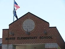
McBee Elementary School is a public secondary school serving grades 4k through 6 in McBee, South Carolina. The school is located on McBee's West side, near Highway 1. McBee Elementary has an approximate enrollment of 401 and has 15.4 Student to Teacher Ratio, and is one of six elementary schools under the jurisdiction of Chesterfield County Public School District.
McBee Elementary School Webpage
McBee High School
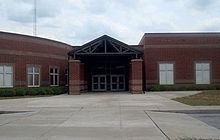
McBee High School is a public secondary school serving grades 7 through 12 in McBee, South Carolina. The school is located on McBee's West side, near the intersection of Highway 151 and 1. McBee High has an approximate enrollment of 600 students and is one of four high schools under the jurisdiction of Chesterfield County Public School District. McBee High School Webpage
Events
- McLeod Farms Strawberry Festival - Mid May
- McLeod Farms Peach Festival - Early July
- McLeod Farms Fall Festival - Late October
- McBee Homecoming Parade - Late October
- McBee Christmas Parade - Early December
Points of interest
- McLeod Farms
- Lake Robinson
- McBee Depot Library
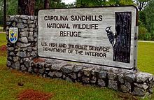
- Carolina Sandhills National Wildlife Refuge
- Mcbee Railroad Museum
Notable Natives
- Don King, NFL player was born here.
- Noah O. Knight, Medal of Honor recipient was born here.
- Rick Henry, On WIS News 10.
External links
References
- ^ a b "American FactFinder". United States Census Bureau. http://factfinder.census.gov. Retrieved 2008-01-31.
- ^ "US Board on Geographic Names". United States Geological Survey. 2007-10-25. http://geonames.usgs.gov. Retrieved 2008-01-31.
- ^ "US Gazetteer files: 2010, 2000, and 1990". United States Census Bureau. 2011-02-12. http://www.census.gov/geo/www/gazetteer/gazette.html. Retrieved 2011-04-23.
Municipalities and communities of Chesterfield County, South Carolina Towns Cheraw | Chesterfield | Jefferson | McBee | Mount Croghan | Pageland | Patrick | Ruby
Unincorporated
communityCategories:- Chesterfield County, South Carolina
- Towns in South Carolina
Wikimedia Foundation. 2010.

