- National Register of Historic Places listings in Cherry County, Nebraska
-
 Location of Cherry County in Nebraska
This is a list of the National Register of Historic Places listings in Cherry County, Nebraska. It is intended to be a complete list of the properties and districts on the National Register of Historic Places in Cherry County, Nebraska, United States. The locations of National Register properties and districts for which the latitude and longitude coordinates are included below, may be seen in a Google map.[1]
There are 13 properties and districts listed on the National Register in the county.
-
- This National Park Service list is complete through NPS recent listings posted November 10, 2011.[2]
Listings county-wide
[3] Landmark name Image Date listed Location City or town Summary 1 Adamson Bridge June 29, 1992 Nebraska Highway 97 over the Niobrara River, 7.8 miles southwest of Valentine
42°48′26″N 100°40′20″W / 42.807222°N 100.672222°WValentine 2 Bell Bridge June 29, 1992 County road over the Niobrara River, 11.9 miles northeast of Valentine
42°53′42″N 100°19′20″W / 42.895°N 100.322222°WValentine 3 Berry State Aid Bridge June 29, 1992 County road over the Niobrara River, 10 miles northeast of Valentine
42°54′07″N 100°21′44″W / 42.901944°N 100.362222°WValentine 4 Borman Bridge June 29, 1992 County road over the Niobrara River, 2.3 miles southeast of Valentine
42°51′07″N 100°31′15″W / 42.851944°N 100.520833°WValentine 5 Brewer Bridge June 29, 1992 County road over the Niobrara River, 14.7 miles east of Valentine
42°52′34″N 100°15′58″W / 42.876111°N 100.266111°WValentine 6 Bryan Bridge June 23, 1988 U.S. Route 20
42°49′56″N 100°31′41″W / 42.832222°N 100.528056°WValentine 7 Cherry County Courthouse 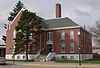
January 10, 1990 4th and Main Sts.
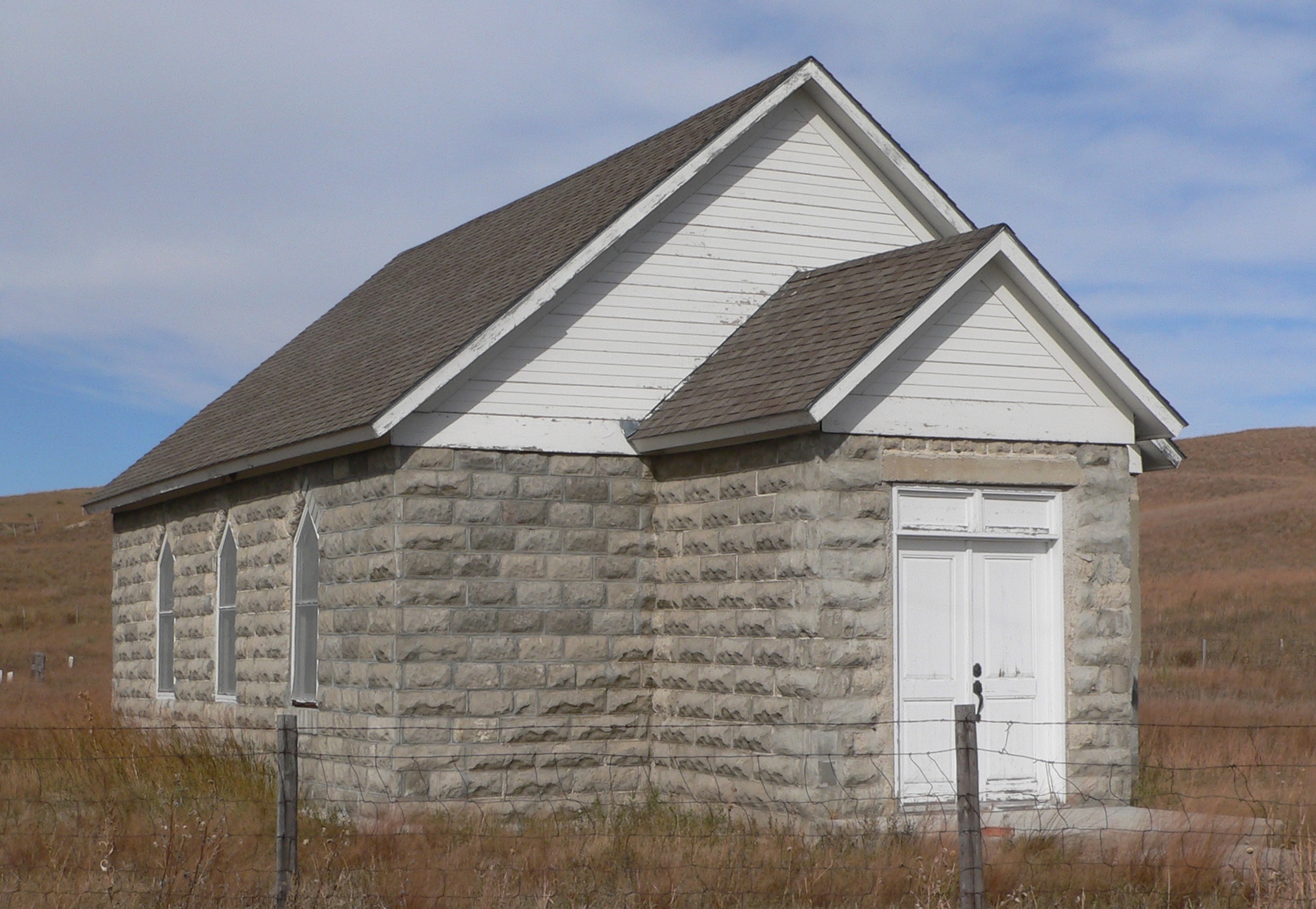
42°52′34″N 100°33′04″W / 42.876111°N 100.551111°WValentine 8 Dry Valley Church and Cemetery 
July 3, 2007 Address Restricted Mullen 9 Spade Ranch 
February 28, 1980 Northwest of Ellsworth
42°18′23″N 102°04′47″W / 42.306389°N 102.079722°WEllsworth 10 Twin Bridge June 29, 1992 County road over the North Loup River, 7.9 miles northwest of Brownlee
42°20′00″N 100°45′43″W / 42.333333°N 100.761944°WBrownlee 11 US Post Office-Valentine December 13, 1991 348 N. Main St.
42°52′33″N 100°32′59″W / 42.875833°N 100.549722°WValentine 12 Valentine Public School June 14, 1984 3rd and Macomb Sts.
42°52′31″N 100°32′48″W / 42.875278°N 100.546667°WValentine 13 F.M. Walcott House 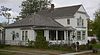
October 7, 1982 431 N. Hall St.
42°52′40″N 100°32′58″W / 42.877694°N 100.549444°WValentine See also
- List of National Historic Landmarks in Nebraska
- National Register of Historic Places listings in Nebraska
References
- ^ The latitude and longitude information provided in this table was derived originally from the National Register Information System, which has been found to be fairly accurate for about 99% of listings. For about 1% of NRIS original coordinates, experience has shown that one or both coordinates are typos or otherwise extremely far off; some corrections may have been made. A more subtle problem causes many locations to be off by up to 150 yards, depending on location in the country: most NRIS coordinates were derived from tracing out latitude and longitudes off of USGS topographical quadrant maps created under the North American Datum of 1927, which differs from the current, highly accurate WGS84 GPS system used by Google maps. Chicago is about right, but NRIS longitudes in Washington are higher by about 4.5 seconds, and are lower by about 2.0 seconds in Maine. Latitudes differ by about 1.0 second in Florida. Some locations in this table may have been corrected to current GPS standards.
- ^ "National Register of Historic Places: Weekly List Actions". National Park Service, United States Department of the Interior. Retrieved on November 10, 2011.
- ^ Numbers represent an ordering by significant words. Various colorings, defined here, differentiate National Historic Landmark sites and National Register of Historic Places Districts from other NRHP buildings, structures, sites or objects.
U.S. National Register of Historic Places Topics Lists by states Alabama • Alaska • Arizona • Arkansas • California • Colorado • Connecticut • Delaware • Florida • Georgia • Hawaii • Idaho • Illinois • Indiana • Iowa • Kansas • Kentucky • Louisiana • Maine • Maryland • Massachusetts • Michigan • Minnesota • Mississippi • Missouri • Montana • Nebraska • Nevada • New Hampshire • New Jersey • New Mexico • New York • North Carolina • North Dakota • Ohio • Oklahoma • Oregon • Pennsylvania • Rhode Island • South Carolina • South Dakota • Tennessee • Texas • Utah • Vermont • Virginia • Washington • West Virginia • Wisconsin • WyomingLists by territories Lists by associated states Other Municipalities and communities of Cherry County, Nebraska City 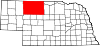
Villages Unincorporated
communitiesGhost town Categories:- National Register of Historic Places in Nebraska by county
- Cherry County, Nebraska
- Buildings and structures in Cherry County, Nebraska
-


Wikimedia Foundation. 2010.