- National Register of Historic Places listings in Anderson County, Kentucky
-
 Location of Anderson County in Kentucky
This is a list of the National Register of Historic Places listings in Anderson County, Kentucky. It is intended to be a complete list of the properties and districts on the National Register of Historic Places in Anderson County, Kentucky, United States. The locations of National Register properties and districts for which the latitude and longitude coordinates are included below, may be seen in a Google map.[1]
There are approximately 12 properties and districts listed on the National Register in the county.
-
- This National Park Service list is complete through NPS recent listings posted November 10, 2011.[2]
Listings county-wide
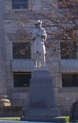
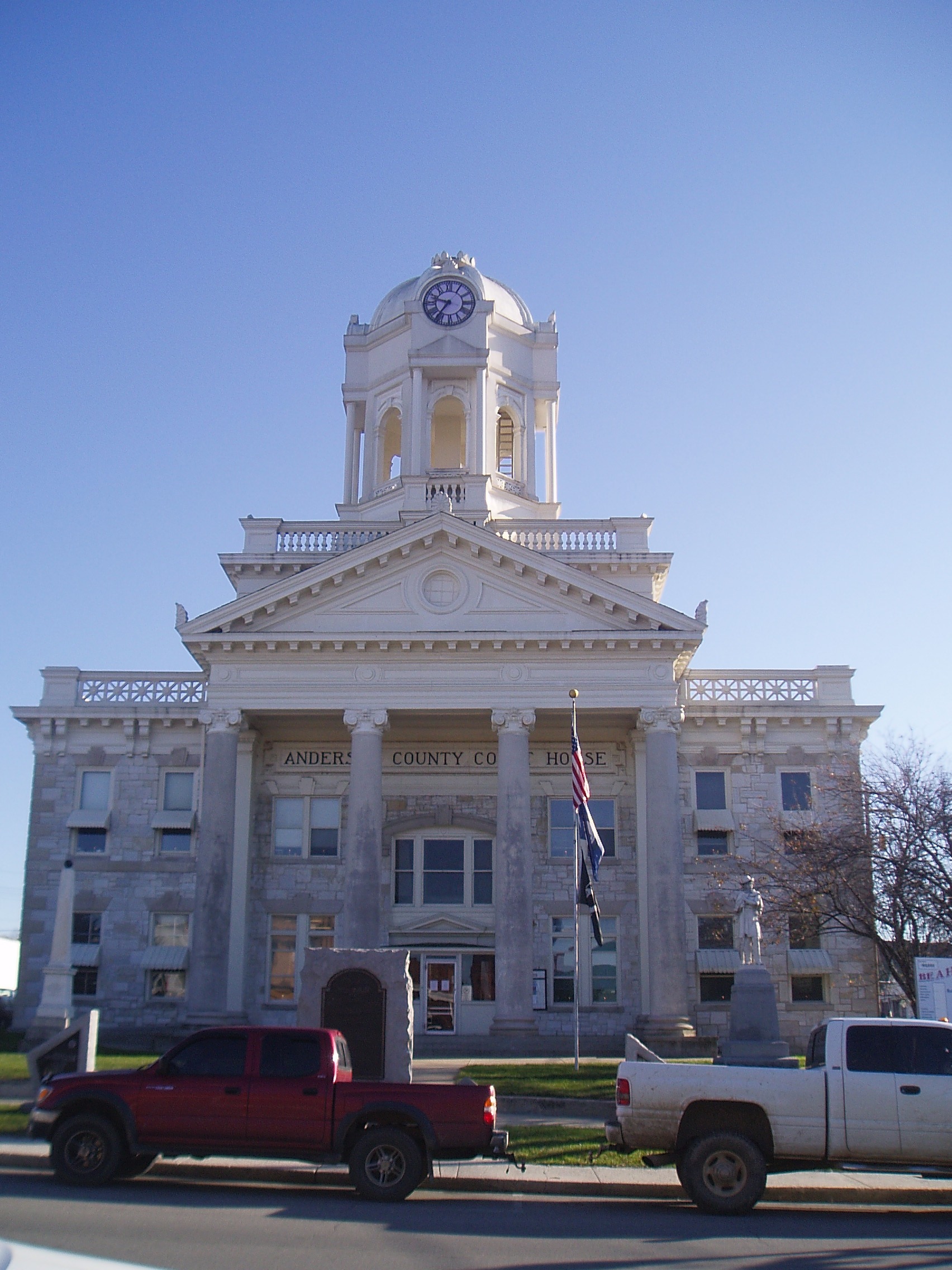
[3] Landmark name Image Date listed Location City or town Summary 1 Confederate Monument in Lawrenceburg 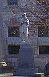
July 17, 1997 Courthouse Lawn, 0.5 miles south of U.S. Route 127 and KY 44
38°02′06″N 84°53′44″W / 38.035°N 84.895556°WLawrenceburg 2 R. H. Crossfield House June 11, 1975 Southwest of Lawrenceburg off Anderson City Rd.
37°59′06″N 84°58′57″W / 37.985°N 84.9825°WLawrenceburg 3 Dowling House July 10, 1979 321 S. Main St.
38°01′58″N 84°53′40″W / 38.032778°N 84.894444°WLawrenceburg 4 Thomas H. Hanks House May 14, 1980 516 E. Woodford St.
38°02′21″N 84°53′11″W / 38.039167°N 84.886389°WLawrenceburg 5 Kavanaugh Academy September 19, 1973 241 E. Woodford St.
38°02′18″N 84°53′32″W / 38.038333°N 84.892222°WLawrenceburg 6 Lawrenceburg Commercial Historic District 
August 5, 1994 Roughly Main St. from North Alley to Court St. and Court from Main to the Southern Railway tracks
38°02′11″N 84°53′44″W / 38.036389°N 84.895556°WLawrenceburg 7 Lexington Extension of the Louisville Southern Railroad August 4, 2004 Eastern Lawrenceburg to Milner
38°02′08″N 84°50′00″W / 38.035556°N 84.833333°WLawrenceburg 8 McBrayer-Clark House September 19, 1973 North of Lawrenceburg on KY 326
38°04′05″N 84°54′19″W / 38.068056°N 84.905278°WLawrenceburg 9 Rev. William Dudley Moore House February 21, 1979 4 mi. (6.4 km) south of Lawrenceburg
37°59′00″N 84°52′31″W / 37.983333°N 84.875278°WLawrenceburg 10 Old Prentice Distillery March 19, 1987 KY 513
37°58′23″N 84°53′54″W / 37.973056°N 84.898333°WLawrenceburg 11 Old Wash Place June 11, 1975 9 miles west of Lawrenceburg at the junction of U.S. Route 62 and KY 53
37°57′36″N 85°01′28″W / 37.96°N 85.024444°WLawrenceburg 12 T. B. Ripy House February 20, 1980 320 S. Main St.
38°01′57″N 84°53′44″W / 38.0325°N 84.895556°WLawrenceburg See also
- List of National Historic Landmarks in Kentucky
- National Register of Historic Places listings in Kentucky
References
- ^ The latitude and longitude information provided in this table was derived originally from the National Register Information System, which has been found to be fairly accurate for about 99% of listings. For about 1% of NRIS original coordinates, experience has shown that one or both coordinates are typos or otherwise extremely far off; some corrections may have been made. A more subtle problem causes many locations to be off by up to 150 yards, depending on location in the country: most NRIS coordinates were derived from tracing out latitude and longitudes off of USGS topographical quadrant maps created under the North American Datum of 1927, which differs from the current, highly accurate WGS84 GPS system used by Google maps. Chicago is about right, but NRIS longitudes in Washington are higher by about 4.5 seconds, and are lower by about 2.0 seconds in Maine. Latitudes differ by about 1.0 second in Florida. Some locations in this table may have been corrected to current GPS standards.
- ^ "National Register of Historic Places: Weekly List Actions". National Park Service, United States Department of the Interior. Retrieved on November 10, 2011.
- ^ Numbers represent an ordering by significant words. Various colorings, defined here, differentiate National Historic Landmark sites and National Register of Historic Places Districts from other NRHP buildings, structures, sites or objects.
U.S. National Register of Historic Places Topics Lists by states Alabama • Alaska • Arizona • Arkansas • California • Colorado • Connecticut • Delaware • Florida • Georgia • Hawaii • Idaho • Illinois • Indiana • Iowa • Kansas • Kentucky • Louisiana • Maine • Maryland • Massachusetts • Michigan • Minnesota • Mississippi • Missouri • Montana • Nebraska • Nevada • New Hampshire • New Jersey • New Mexico • New York • North Carolina • North Dakota • Ohio • Oklahoma • Oregon • Pennsylvania • Rhode Island • South Carolina • South Dakota • Tennessee • Texas • Utah • Vermont • Virginia • Washington • West Virginia • Wisconsin • WyomingLists by territories Lists by associated states Other Municipalities and communities of Anderson County, Kentucky City 
Unincorporated
communitiesAlton | Alton Station | Anderson City | Ashbrook | Avenstoke | Ballard | Birdie | Drydock | Fairview | Fox Creek | Gee | Glensboro | Hickory Grove | Johnsonville | Klondyke | McBrayer | Nevin | Ninevah | Sinai | Sparrow | Stringtown | Tyrone | Van Buren | Wayside
Categories:- National Register of Historic Places in Kentucky by county
- Anderson County, Kentucky
-


Wikimedia Foundation. 2010.