- National Register of Historic Places listings in Barren County, Kentucky
-
 Location of Barren County in Kentucky
This is a list of the National Register of Historic Places listings in Barren County, Kentucky. It is intended to be a complete list of the properties and districts on the National Register of Historic Places in Barren County, Kentucky, United States. The locations of National Register properties and districts for which the latitude and longitude coordinates are included below, may be seen in a Google map.[1]
There are approximately 33 properties and districts listed on the National Register in the county.
-
- This National Park Service list is complete through NPS recent listings posted November 10, 2011.[2]
Listings county-wide
[3] Landmark name Image Date listed Location City or town Summary 1 Belle's Tavern January 8, 1987 KY 255
37°05′30″N 86°02′59″W / 37.091667°N 86.049722°WPark City 2 Cave City Commercial District July 20, 1983 Broadway between 1st and 2nd Sts.
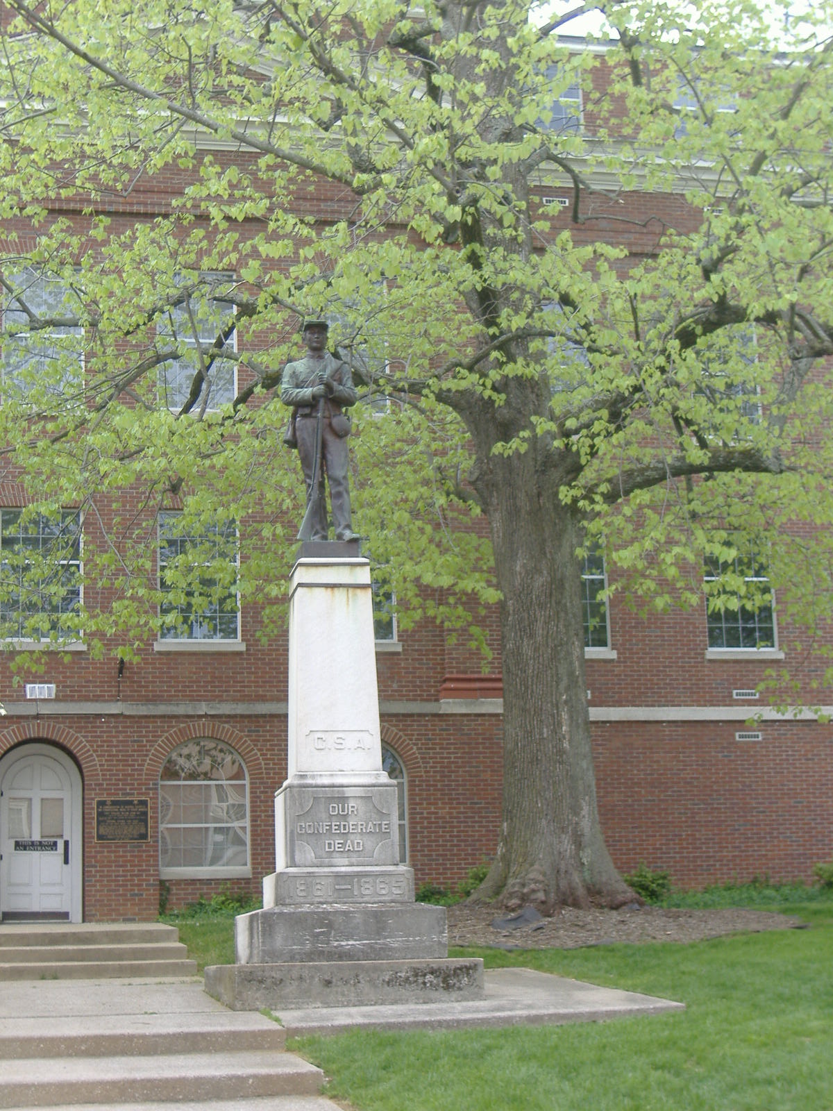
37°08′17″N 85°57′32″W / 37.138056°N 85.958889°WCave City 3 Confederate Monument in Glasgow 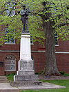
July 17, 1997 Junction of Main and Green Sts.
36°59′44″N 85°54′45″W / 36.995556°N 85.9125°WGlascow 4 Charles Penn Edmunds House May 20, 1983 East of Becton
36°59′06″N 86°01′14″W / 36.985°N 86.020556°WBeckton 5 First National Bank May 20, 1983 Main St.
36°59′47″N 85°54′45″W / 36.996389°N 85.9125°WGlasgow 6 First Presbyterian Church May 20, 1983 Washington and Broadway
36°59′39″N 85°54′40″W / 36.994167°N 85.911111°WGlasgow 7 Fort Williams June 10, 1975 Between Glasgow Municipal Cemetery and U.S. Route 31E Bypass
36°59′54″N 85°55′35″W / 36.998333°N 85.926389°WGlasgow 8 Glasgow Central Business District February 11, 1993 207 W. Main-117 E. Main, 100-114 S. Green, and 104 and 109 N. Race Sts.; also roughly bounded by Water St., Broadway St., Wayne St., and Liberty St.
36°59′46″N 85°54′44″W / 36.996111°N 85.912222°WGlasgow Second group of addresses represents a boundary increase 9 Glasgow OMS#9 September 6, 2002 Cavalry Dr.
36°58′49″N 85°56′07″W / 36.980278°N 85.935278°WGlasgow 10 Gullian Gerig's Mill October 5, 1987 Beaver Valley Rd.
37°01′32″N 85°57′53″W / 37.025556°N 85.964722°WGlasgow 11 William Hicks House May 20, 1983 Jeff Hicks Rd.
36°48′45″N 86°01′56″W / 36.8125°N 86.032222°WAustin 12 Landrum May 20, 1983 KY 1318
36°52′56″N 85°56′05″W / 36.882222°N 85.934722°WRoseville 13 Benjamin Martin House May 20, 1983 Berry Store Rd.
36°55′44″N 86°07′34″W / 36.928889°N 86.126111°WFinney 14 John Mayfield House May 20, 1983 Southwest of Glasgow
36°59′06″N 85°58′54″W / 36.985°N 85.981667°WGlasgow 15 Andrew McCoy House May 20, 1983 Railroad Ave.
37°08′17″N 85°57′43″W / 37.138056°N 85.961944°WCave City 16 Morris Building May 20, 1983 Washington and Green Sts.
36°59′42″N 85°54′45″W / 36.995°N 85.9125°WGlasgow 17 North Race Street Historic District July 20, 1983 N. Race St. between Front and Cherry Sts.; also roughly bounded by Happy Valley Rd., Green St., Garmon Ave. and Front St.
36°59′57″N 85°54′50″W / 36.999167°N 85.913889°WGlasgow Second group of addresses represents a boundary increase 18 Octagon Cottage July 20, 1983 Off KY 1297
36°58′10″N 86°02′44″W / 36.969444°N 86.045556°WRocky Hill 19 Old Zion Methodist Church May 20, 1983 KY 1297
36°59′00″N 86°03′53″W / 36.983333°N 86.064722°WPark City 20 William Page House May 20, 1983 South of Glasgow off of KY 249
45°55′30″N 85°45′42″W / 45.925°N 85.761667°WGlasgow 21 G. F. Quigley and Son Grocery May 20, 1983 Off U.S. Route 31E
37°05′34″N 85°52′50″W / 37.092778°N 85.880556°WGoodnight 22 Ralph Bunche Historic District March 31, 2004 Roughly bound by E. College St., Landrum St., Twyman Court, and S. Lewis St.
36°59′10″N 85°54′36″W / 36.986111°N 85.91°WGlasgow 23 Renfro Hotel May 20, 1983 S. Dixie Ave.
37°05′31″N 86°02′53″W / 37.091944°N 86.048056°WPark City 24 Franklin Settle House May 20, 1983 KY 252 and KY 255
36°56′13″N 86°04′14″W / 36.936944°N 86.070556°WRocky Hill 25 Site Bn-54 May 20, 1983 Roseville Rd.
36°54′52″N 85°55′17″W / 36.914444°N 85.921389°WBristle Town 26 Southwest Glasgow Residential District August 30, 1983 Green St. between Cottage and College Sts., Leslie Ave., Liberty, Brown, and Washington Sts.; also roughly bounded by Washington St., Broadway St., Brookdale Dr., Cottage Ave., and Jefferson St.
36°59′28″N 85°55′10″W / 36.991111°N 85.919444°WGlasgow Second group of addresses represents a boundary increase 27 Third National Bank May 20, 1983 N. Green and Main Sts.
36°59′46″N 85°54′41″W / 36.996111°N 85.911389°WGlasgow 28 U.S. Post Office/Board of Education Building May 20, 1983 202 W. Washington St.
36°59′44″N 85°54′49″W / 36.995556°N 85.913611°WGlasgow 29 Jesse and Simon White House May 20, 1983 Off U.S. Route 31E
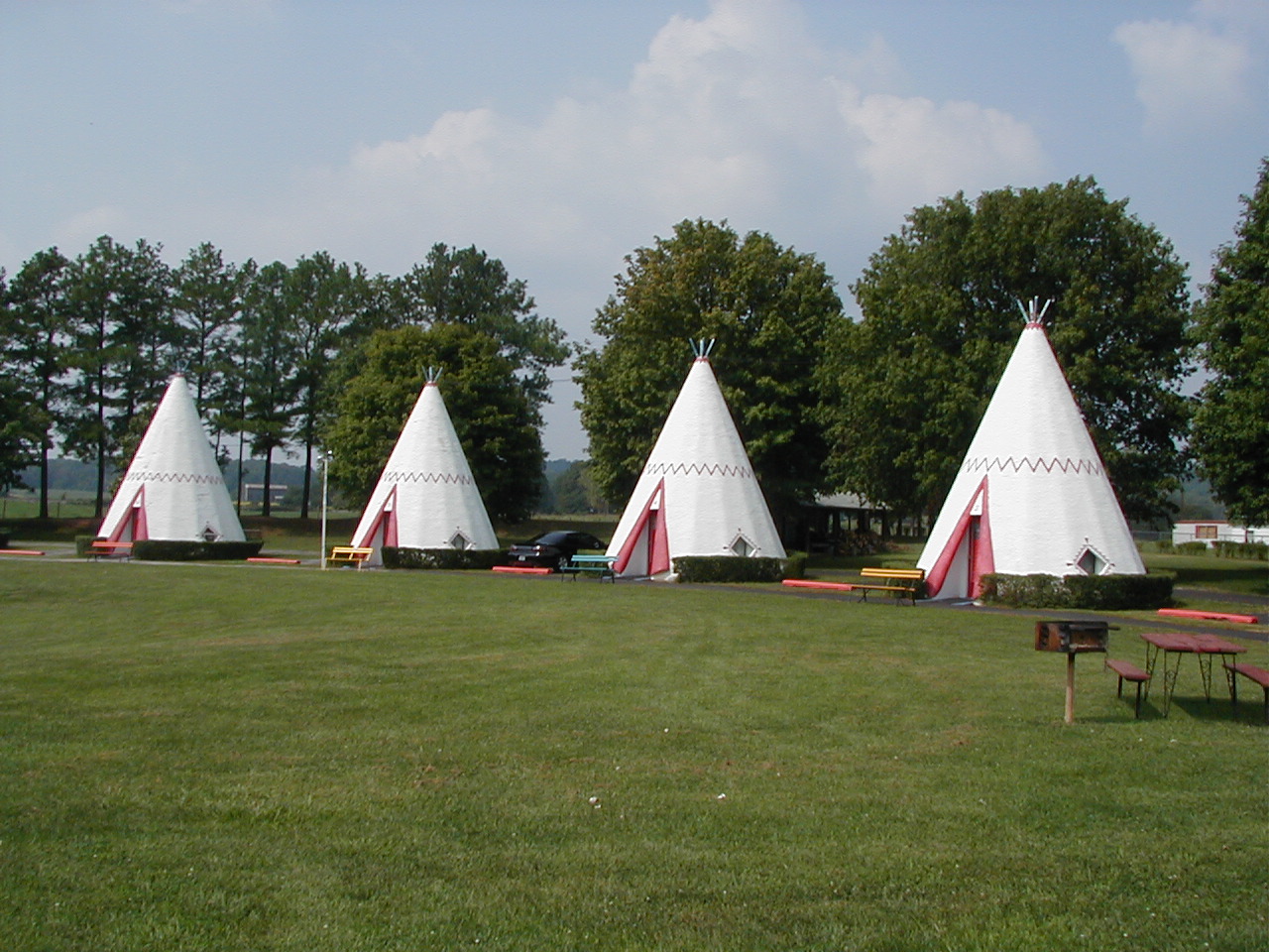
37°46′50″N 86°00′44″W / 37.780556°N 86.012222°WLucas 30 Wigwam Village No. 2 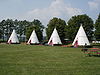
March 16, 1988 Northwestern side of U.S. Route 31W 1.6 miles northeast of its junction with KY 70
37°08′41″N 85°56′43″W / 37.144722°N 85.945278°WCave City 31 William Johnson Wood House May 20, 1983 East of Hiseville
37°05′46″N 85°45′46″W / 37.096111°N 85.762778°WHiseville 32 Joseph Wooten House May 20, 1983 Crabtree Rd.
36°50′13″N 85°47′40″W / 36.836944°N 85.794444°WTracy 33 Asa E. Young House May 20, 1983 Off KY 921
36°47′50″N 85°55′42″W / 36.797222°N 85.928333°WTracy See also
- List of National Historic Landmarks in Kentucky
- National Register of Historic Places listings in Kentucky
References
- ^ The latitude and longitude information provided in this table was derived originally from the National Register Information System, which has been found to be fairly accurate for about 99% of listings. For about 1% of NRIS original coordinates, experience has shown that one or both coordinates are typos or otherwise extremely far off; some corrections may have been made. A more subtle problem causes many locations to be off by up to 150 yards, depending on location in the country: most NRIS coordinates were derived from tracing out latitude and longitudes off of USGS topographical quadrant maps created under North American Datum of 1927, which differs from the current, highly accurate GPS system used by Google maps. Chicago is about right, but NRIS longitudes in Washington are higher by about 4.5 seconds, and are lower by about 2.0 seconds in Maine. Latitudes differ by about 1.0 second in Florida. Some locations in this table may have been corrected to current GPS standards.
- ^ "National Register of Historic Places: Weekly List Actions". National Park Service, United States Department of the Interior. Retrieved on November 10, 2011.
- ^ Numbers represent an ordering by significant words. Various colorings, defined here, differentiate National Historic Landmark sites and National Register of Historic Places Districts from other NRHP buildings, structures, sites or objects.
U.S. National Register of Historic Places Topics Lists by states Alabama • Alaska • Arizona • Arkansas • California • Colorado • Connecticut • Delaware • Florida • Georgia • Hawaii • Idaho • Illinois • Indiana • Iowa • Kansas • Kentucky • Louisiana • Maine • Maryland • Massachusetts • Michigan • Minnesota • Mississippi • Missouri • Montana • Nebraska • Nevada • New Hampshire • New Jersey • New Mexico • New York • North Carolina • North Dakota • Ohio • Oklahoma • Oregon • Pennsylvania • Rhode Island • South Carolina • South Dakota • Tennessee • Texas • Utah • Vermont • Virginia • Washington • West Virginia • Wisconsin • WyomingLists by territories Lists by associated states Other  Category:National Register of Historic Places •
  Portal:National Register of Historic Places
Municipalities and communities of Barren County, Kentucky County seat: Glasgow Cities 
Unincorporated
communitiesApple Grove | Austin | Bear Wallow | Beckton | Berry Store | Bon Ayr | Bristletown | Carden | Cooktown | Coral Hill | Dry Fork | Eighty Eight | Etoile | Finney | Goodnight | Griderville | Halfway | Haywood | Highland Springs | Hiseville | Kino | Lecta | Lucas | Merry Oaks | Nobob | Oil City | Park | Peter Creek | Pritchardsville | Railton | Red Cross | Rocky Hill | Roseville | Slick Rock | Stovall | Temple Hill | Tracy
Categories:- National Register of Historic Places in Kentucky by county
- Barren County, Kentucky
-


Wikimedia Foundation. 2010.