- National Register of Historic Places listings in Green County, Kentucky
-
 Location of Green County in Kentucky
This is a list of the National Register of Historic Places listings in Green County, Kentucky.
This is intended to be a complete list of the properties and districts on the National Register of Historic Places in Green County, Kentucky, United States. The locations of National Register properties and districts for which the latitude and longitude coordinates are included below, may be seen in a Google map.[1]
There are 46 properties and districts listed on the National Register in the county.
-
- This National Park Service list is complete through NPS recent listings posted November 10, 2011.[2]
Current listings
[3] Landmark name Image Date listed Location City or town Summary 1 James Allen's Inn 
January 8, 1987 103 E. Court St.
37°15′38″N 85°30′05″W / 37.260444°N 85.50125°WGreensburg 2 John C. Allen House April 19, 1985 Kentucky Route 61
37°18′41″N 85°30′44″W / 37.311389°N 85.512222°WSummersville 3 Anderson House August 24, 1984 Kentucky Route 1913
37°11′37″N 85°23′09″W / 37.193611°N 85.385833°WHaskingsville 4 Barrett-Blakeman House April 19, 1985 Hodgenville Rd.
37°15′51″N 85°30′14″W / 37.264167°N 85.503889°WGreensburg 5 Brents-Lisle House August 24, 1984 U.S. Route 68
37°13′45″N 85°30′17″W / 37.229167°N 85.504722°WGreensburg 6 Chewning House August 24, 1984 Kentucky Route 88
37°14′13″N 85°37′35″W / 37.236944°N 85.626389°WDonansburg 7 Christopher Columbus Christie House 
August 24, 1984 Kentucky Route 1915
37°11′26″N 85°23′18″W / 37.190556°N 85.388333°WHaskingsville 8 Court Clerk's Office-County & Circuit 
January 8, 1987 East Court St.
37°15′37″N 85°30′04″W / 37.260361°N 85.501111°WGreensburg 9 Francis Cowherd House April 19, 1985 Off U.S. Route 68
37°18′41″N 85°30′44″W / 37.311389°N 85.512222°WGreensburg 10 Creal Store August 24, 1984 Kentucky Route 61
37°25′40″N 85°38′13″W / 37.427778°N 85.636944°WCreal 11 Elijah Creel House 
December 3, 2008 E. Columbia Ave.
37°15′28″N 85°29′57″W / 37.257778°N 85.499167°WGreensburg 12 Downtown Greensburg Historic District 
February 28, 2003 Public Square and area bounded by N. and S. Main St. and E. and W. Court Sts.
37°15′40″N 85°30′08″W / 37.261111°N 85.502222°WGreensburg 13 Ebenezer School August 24, 1984 Off Kentucky Route 61
37°12′39″N 85°26′32″W / 37.210833°N 85.442222°WGreensburg 14 Edwards House August 24, 1984 Kentucky Route 745
37°07′41″N 85°32′08″W / 37.128056°N 85.535556°WExie 15 David Edwards House August 24, 1984 Off Kentucky Route 745
37°06′54″N 85°33′21″W / 37.115°N 85.555833°WExie 16 Elmore-Carter House August 24, 1984 Kentucky Route 793
37°19′20″N 85°30′18″W / 37.322222°N 85.505°WSummersville 17 Emory-Blakeman-Penick House August 24, 1984 Off Kentucky Route 487
37°15′21″N 85°27′43″W / 37.255833°N 85.461944°WGreensburg 18 Federal House 
April 19, 1985 S. Main and E. Columbia
37°15′33″N 85°30′09″W / 37.259167°N 85.5025°WGreensburg 19 Goose Creek Foot Bridge 
April 19, 1985 Court and Depot Sts.
37°15′37″N 85°30′00″W / 37.260222°N 85.5°WGreensburg 20 Greensburg Academy 
December 12, 1976 101 2nd St.
37°15′41″N 85°30′18″W / 37.261389°N 85.505°WGreensburg 21 Greensburg Bank Building 
August 21, 1979 E. Court St.
37°15′37″N 85°30′05″W / 37.260278°N 85.501389°WGreensburg 22 Greensburg Cumberland Presbyterian Church 
April 19, 1985 Hodgenville Ave. and N. 1st St.
37°15′45″N 85°30′08″W / 37.2625°N 85.502222°WGreensburg 23 Groves-Cabell House August 24, 1984 Off Kentucky Route 61
37°11′02″N 85°25′34″W / 37.183889°N 85.426111°WGresham 24 William H. Herndon House 
April 19, 1985 203 S. Main St.
37°15′31″N 85°30′10″W / 37.258611°N 85.502778°WGreensburg 25 David Hilliard House August 24, 1984 Off Kentucky Route 487
37°14′55″N 85°26′27″W / 37.248611°N 85.440833°WGreensburg 26 William Hobson House 
April 19, 1985 102 S. Depot St.
37°15′33″N 85°29′56″W / 37.259167°N 85.498889°WGreensburg 27 Keltner House 
August 24, 1984 Kentucky Route 1913
37°11′38″N 85°22′42″W / 37.193889°N 85.378333°WHaskingsville 28 L & N Passenger Depot 
August 24, 1984 103 N. Depot St.
37°15′36″N 85°29′57″W / 37.26°N 85.499167°WGreensburg 29 Woodson Lewis House 
April 19, 1985 Main St. and Hodgenville Ave.
37°15′45″N 85°30′04″W / 37.2625°N 85.501111°WGreensburg 30 Livesay House August 24, 1984 Off Kentucky Route 208
37°16′09″N 85°25′36″W / 37.269167°N 85.426667°WCampbellsville 31 Mears House August 24, 1984 Kentucky Route 61
37°18′06″N 85°30′57″W / 37.301667°N 85.515833°WGreensburg 32 Montgomery House August 24, 1984 Off Kentucky Route 1464
37°16′27″N 85°38′25″W / 37.274167°N 85.640278°WDonansburg 33 Montgomery's Mill August 24, 1984 Off Kentucky Route 88
37°16′24″N 85°33′14″W / 37.273333°N 85.553889°WGreensburg 34 Mt. Gilead Baptist Church August 24, 1984 Kentucky Route 767
37°10′14″N 85°22′56″W / 37.170556°N 85.382222°WHaskingsville 35 Mud Brick House in Greensburg 
February 3, 2010 429 Campbellsville Rd.
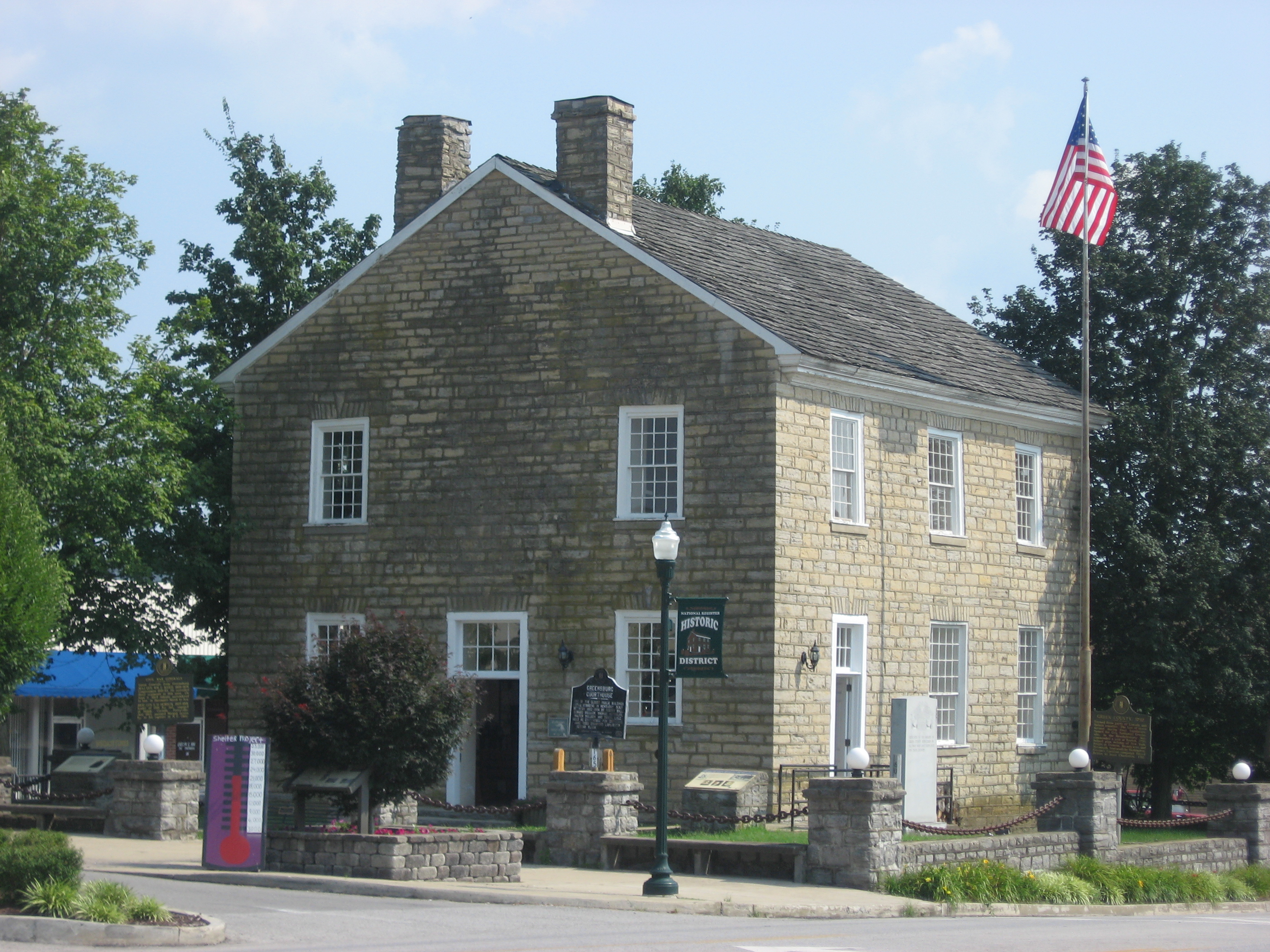
37°16′08″N 85°29′54″W / 37.268889°N 85.498333°WGreensburg 36 Old Courthouse 
April 10, 1972 Public Sq.
37°15′38″N 85°30′06″W / 37.260556°N 85.501667°WGreensburg 37 Philpot House April 19, 1985 Kentucky Route 729
37°08′46″N 85°36′07″W / 37.146111°N 85.601944°WExie 38 Sandidge House August 24, 1984 Kentucky Route 88
37°13′31″N 85°39′42″W / 37.225278°N 85.661667°WDonansburg 39 Simpson Log House August 24, 1984 Kentucky Route 1464
37°15′30″N 85°36′43″W / 37.258333°N 85.611944°WWebbs 40 Napoleon Wallace House August 24, 1984 Off Kentucky Route 218
37°11′01″N 85°37′25″W / 37.183611°N 85.623611°WPierce 41 Webbs Female Academy August 24, 1984 Off Kentucky Route 88
37°15′33″N 85°36′08″W / 37.259167°N 85.602222°WWebbs 42 White-Penick House 
April 19, 1985 106 S. Depot St.
37°15′30″N 85°29′58″W / 37.258472°N 85.499444°WGreensburg 43 Whitlock Log Cabin August 24, 1984 U.S. Route 68
37°09′31″N 85°32′14″W / 37.158611°N 85.537222°WExie 44 Daniel Motley Williams House August 24, 1984 Kentucky Route 323
37°21′11″N 85°29′28″W / 37.353056°N 85.491111°WSummersville 45 R.H. Wilson House 
August 24, 1984 402 N. Water St.
37°15′43″N 85°29′56″W / 37.261944°N 85.498889°WGreensburg 46 Woodward House August 24, 1984 Off U.S. Route 68
37°12′53″N 85°33′29″W / 37.214722°N 85.558056°WGreensburg See also
- List of National Historic Landmarks in Kentucky
- National Register of Historic Places listings in Kentucky
References
- ^ The latitude and longitude information provided in this table was derived originally from the National Register Information System, which has been found to be fairly accurate for about 99% of listings. For about 1% of NRIS original coordinates, experience has shown that one or both coordinates are typos or otherwise extremely far off; some corrections may have been made. A more subtle problem causes many locations to be off by up to 150 yards, depending on location in the country: most NRIS coordinates were derived from tracing out latitude and longitudes off of USGS topographical quadrant maps created under the North American Datum of 1927, which differs from the current, highly accurate WGS84 GPS system used by Google maps. Chicago is about right, but NRIS longitudes in Washington are higher by about 4.5 seconds, and are lower by about 2.0 seconds in Maine. Latitudes differ by about 1.0 second in Florida. Some locations in this table may have been corrected to current GPS standards.
- ^ "National Register of Historic Places: Weekly List Actions". National Park Service, United States Department of the Interior. Retrieved on November 10, 2011.
- ^ Numbers represent an ordering by significant words. Various colorings, defined here, differentiate National Historic Landmark sites and National Register of Historic Places Districts from other NRHP buildings, structures, sites or objects.
U.S. National Register of Historic Places Topics Lists by states Alabama • Alaska • Arizona • Arkansas • California • Colorado • Connecticut • Delaware • Florida • Georgia • Hawaii • Idaho • Illinois • Indiana • Iowa • Kansas • Kentucky • Louisiana • Maine • Maryland • Massachusetts • Michigan • Minnesota • Mississippi • Missouri • Montana • Nebraska • Nevada • New Hampshire • New Jersey • New Mexico • New York • North Carolina • North Dakota • Ohio • Oklahoma • Oregon • Pennsylvania • Rhode Island • South Carolina • South Dakota • Tennessee • Texas • Utah • Vermont • Virginia • Washington • West Virginia • Wisconsin • WyomingLists by territories Lists by associated states Other Municipalities and communities of Green County, Kentucky City 
Unincorporated
communitiesBlack Gnat | Exie | Pierce | Summersville
Categories:- National Register of Historic Places in Kentucky by county
- Green County, Kentucky
-


Wikimedia Foundation. 2010.