- National Register of Historic Places listings in Mercer County, Kentucky
-
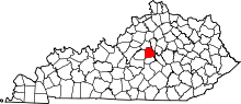 Location of Mercer County in Kentucky
This is a list of the National Register of Historic Places listings in Mercer County, Kentucky.
This is intended to be a complete list of the properties and districts on the National Register of Historic Places in Mercer County, Kentucky, United States. The locations of National Register properties and districts for which the latitude and longitude coordinates are included below, may be seen in a Google map.[1]
There are 68 properties and districts listed on the National Register in the county; 1 of these is a National Historic Landmark.
-
- This National Park Service list is complete through NPS recent listings posted November 10, 2011.[2]
Current listings
[3] Landmark name Image Date listed Location City or town Summary 1 Adams House February 8, 1989 Van Arsdell Pike
37°53′01″N 84°55′24″W / 37.883611°N 84.923333°WSalvisa 2 Archeological Site 15ME15 July 11, 1985 Address Restricted Harrodsburg 3 Aspen Hall 
February 8, 1989 558 Aspen Hall Dr.
37°50′23″N 84°50′08″W / 37.839722°N 84.835556°WHarrodsburg 4 Baldin House February 8, 1989 South of Ebenezer on Ebenezer Rd.
37°52′32″N 84°48′57″W / 37.875556°N 84.815833°WEbenezer 5 Beaumont Avenue Residential District 
February 8, 1989 338-538 Beaumont Ave.
37°45′24″N 84°50′36″W / 37.756667°N 84.843333°WHarrodsburg 6 Boise House February 8, 1989 Bohon Rd. east of Salt River
37°48′11″N 84°52′40″W / 37.803056°N 84.877778°WHarrodsburg 7 Bonta House February 8, 1989 Northeast of Danville on U.S. Route 127
37°43′11″N 84°49′07″W / 37.719722°N 84.818611°WDanville 8 Col. John Bowman House February 8, 1989 Kennedy Bridge Rd.
37°44′21″N 84°43′39″W / 37.739167°N 84.7275°WHarrodsburg 9 Burford Hill 
February 8, 1989 Greenville St.
37°46′21″N 84°50′26″W / 37.7725°N 84.840556°WHarrodsburg 10 Burris House February 8, 1989 South of Kirkwood Rd.
37°54′33″N 84°53′03″W / 37.909167°N 84.884167°WSalvisa 11 Nathaniel Burrus House August 1, 1984 955 Vanarsdall Rd.
37°53′45″N 84°53′31″W / 37.895833°N 84.891944°WHarrodsburg 12 Ambrose Burton House August 11, 1983 Unity Rd.
37°51′09″N 84°50′18″W / 37.8525°N 84.838333°WHarrodsburg 13 Cardwellton 
November 17, 1977 103 E. Broadway
37°45′49″N 84°50′34″W / 37.763611°N 84.842778°WHarrodsburg 14 Clay Hill 
November 7, 1976 433 Beaumont Ave.
37°45′29″N 84°50′33″W / 37.758056°N 84.8425°WHarrodsburg 15 College Street Historic District 
February 9, 1979 College St. from North Lane to Factory St.
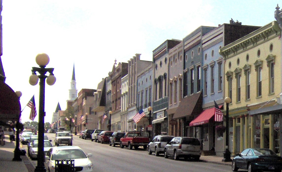
37°45′59″N 84°50′43″W / 37.766389°N 84.845278°WHarrodsburg 16 Confederate Monument in Harrodsburg 
July 17, 1997 Springhill Cemetery, 0.5 miles southeast of the junction of U.S. Route 127 and Kentucky Route 1989
37°46′09″N 84°50′29″W / 37.769167°N 84.841389°WHarrodsburg 17 Cunningham House February 9, 1989 West of railroad tracks in Bondville
37°55′15″N 84°52′24″W / 37.920833°N 84.873333°WSalvisa 18 Daniel Curry House 
February 9, 1989 414 N. Main St.
37°46′03″N 84°50′36″W / 37.7675°N 84.843333°WHarrodsburg 19 Benjamin Daniel House August 2, 1983 Northeast of Harrodsburg off U.S. Route 68
37°50′43″N 84°44′22″W / 37.845278°N 84.739444°WHarrodsburg 20 Daughters' College April 2, 1980 638 Beaumont Dr.
37°45′09″N 84°50′34″W / 37.7525°N 84.842778°WHarrodsburg 21 Doricham 
October 22, 1976 409 N. College St.
37°46′04″N 84°50′41″W / 37.767778°N 84.844722°WHarrodsburg 22 Peter Dunn House February 9, 1989 South of McAfee off Old U.S. Route 127
37°50′42″N 84°51′19″W / 37.845°N 84.855278°WMcAfee 23 Dutch Reformed Church February 16, 1973 3 miles southwest of Harrodsburg on Dry Branch Rd.
37°43′27″N 84°51′48″W / 37.724167°N 84.863333°WHarrodsburg 24 The Elms 
February 9, 1989 354 E. Lexington
37°45′42″N 84°50′20″W / 37.761667°N 84.838889°WHarrodsburg 25 Fairview August 1, 1984 2408 Lexington Rd.
37°48′22″N 84°46′41″W / 37.806111°N 84.778056°WHarrodsburg 26 Froman-McCann House July 27, 2004 532 Bailey Pike
37°46′22″N 84°46′52″W / 37.772778°N 84.781111°WHarrodsburg 27 Greek Revival Houses of Mercer County: Lynnwood, Walnut Hall, Glenworth March 30, 1978 North and east of Harrodsburg off U.S. Route 127
37°45′45″N 84°47′16″W / 37.7625°N 84.787778°WHarrodsburg 28 Greystone February 9, 1989 618 Beaumont Ave.
37°45′13″N 84°50′33″W / 37.753611°N 84.8425°WHarrodsburg 29 Floyd Gritton House February 9, 1989 Bondville Rd. west of Salt River
37°56′06″N 84°54′13″W / 37.935°N 84.903611°WSalvisa 30 Harrodsburg Armory 
March 24, 2000 130 N. College St.
37°45′48″N 84°50′45″W / 37.763472°N 84.845833°WHarrodsburg 31 Harrodsburg Commercial District 
April 3, 1980 Roughly bounded by Lexington, Greenville, and Chiles Sts. and Moreland and Beaumont Aves.
37°45′37″N 84°50′36″W / 37.760278°N 84.843333°WHarrodsburg 32 Honeysuckle Hill 
August 11, 1983 712 Beaumont Ave.
37°45′01″N 84°50′18″W / 37.750278°N 84.838333°WHarrodsburg 33 Moses Jones House February 9, 1979 North of Harrodsburg on Oregon Rd.
37°54′45″N 84°48′21″W / 37.9125°N 84.805833°WHarrodsburg 34 Lexington, Harrodsburg, and Perryville Turnpike Rural Historic District October 23, 2003 U.S. Route 68
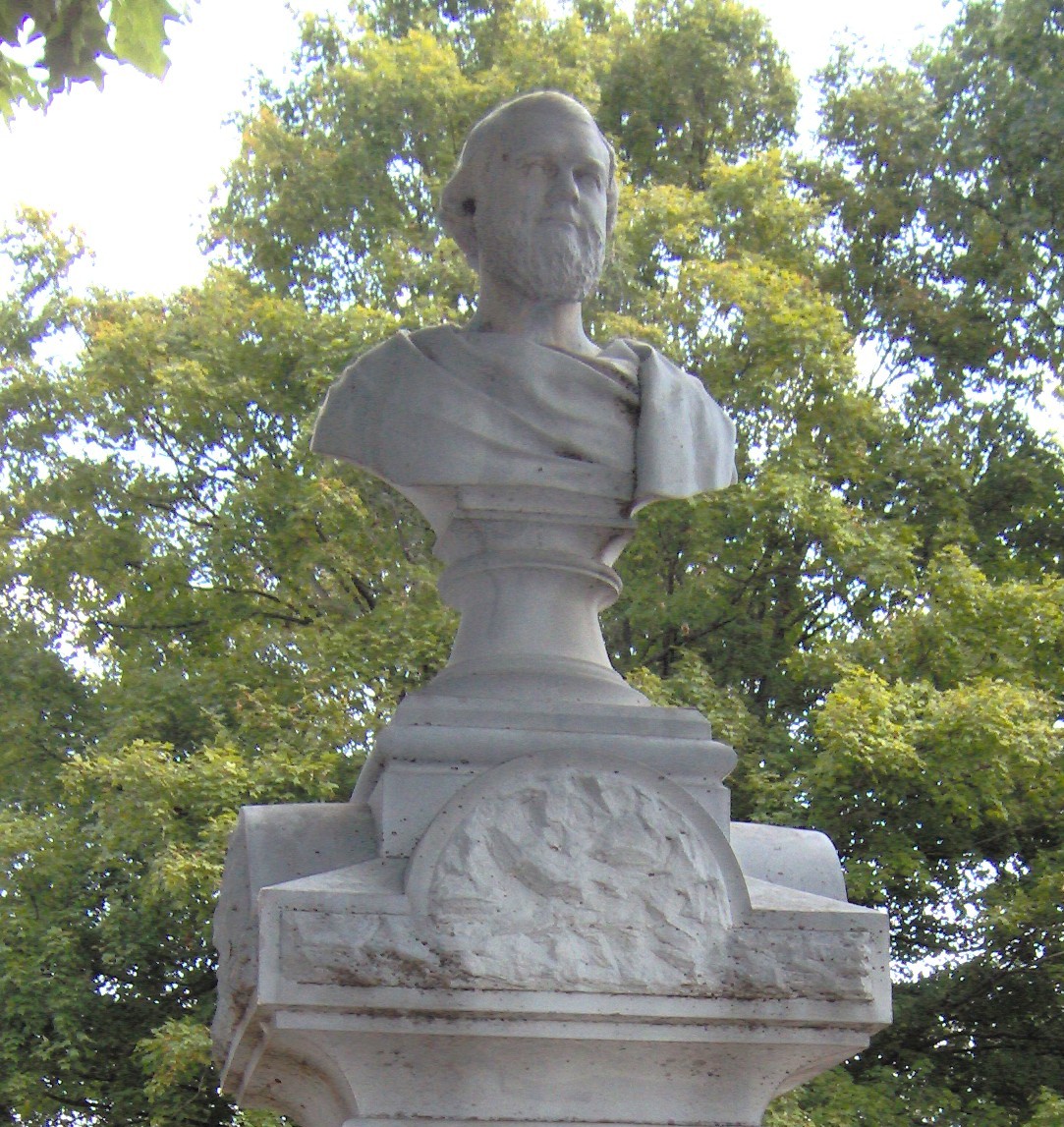
37°48′35″N 84°46′52″W / 37.809722°N 84.781111°WHarrodsburg 35 Beriah Magoffin Monument 
July 17, 1997 Springhill Cemetery, 0.5 miles southeast of the junction of U.S. Route 127 and KY 1989
37°46′10″N 84°50′20″W / 37.769444°N 84.838889°WHarrodsburg 36 Matheny-Taylor House 
February 9, 1989 Poplar and College Sts.
37°45′42″N 84°50′45″W / 37.761667°N 84.845833°WHarrodsburg 37 McAfee Farm Historic District February 9, 1989 South of McAfee on Old Louisville Rd.
37°50′18″N 84°51′49″W / 37.838333°N 84.863611°WMcAfee 38 George McAfee House June 23, 1983 Off KY 1160
37°50′51″N 84°52′46″W / 37.8475°N 84.879444°WCornishville 39 James McAfee House June 23, 1983 Talmage Rd
37°51′24″N 84°52′20″W / 37.856667°N 84.872222°WHarrodsburg 40 Joseph McCoun-D.S. Sharp House August 3, 2005 Junction of Bondville Rd. and Crews St.
37°55′13″N 84°52′16″W / 37.920278°N 84.871111°WBondville/Salvisa 41 McGee House February 9, 1989 Jackson Rd.
37°49′29″N 84°51′49″W / 37.824722°N 84.863611°WHarrodsburg 42 John McGee House June 23, 1983 Jackson Rd.
37°49′48″N 84°52′43″W / 37.83°N 84.878611°WCornishville 43 Mercer County Jailer's Residence 
February 9, 1989 320 S. Chiles St.
37°45′35″N 84°50′42″W / 37.759722°N 84.845°WHarrodsburg 44 Millwood July 6, 1976 South of Salvisa off U.S. Route 127
37°52′57″N 84°52′23″W / 37.8825°N 84.873056°WSalvisa 45 Moreland House February 9, 1989 Off U.S. Route 68
37°45′58″N 84°49′47″W / 37.766111°N 84.829722°WHarrodsburg 46 Morgan Row 
February 16, 1973 222, 230, 232 S. Chiles St.
37°45′38″N 84°50′43″W / 37.760556°N 84.845278°WHarrodsburg 47 Joseph Morgan House April 18, 1990 Moberly Rd.
37°46′48″N 84°51′48″W / 37.78°N 84.863333°WHarrodsburg 48 New Providence Presbyterian Church October 10, 1975 3 miles south of Salvisa on U.S. Route 127
37°51′53″N 84°51′10″W / 37.864722°N 84.852778°WSalvisa 49 Benjamin Passmore Hotel 
June 18, 1990 N. Main St. and Broadway
37°45′50″N 84°50′36″W / 37.763889°N 84.843333°WHarrodsburg 50 Benjamin Passmore House 
February 8, 1989 111 W. Broadway
37°45′49″N 84°50′39″W / 37.763611°N 84.844167°WHarrodsburg 51 George Passmore House 
February 9, 1989 Poplar and Greenville Sts.
37°45′39″N 84°50′32″W / 37.760833°N 84.842222°WHarrodsburg 52 Pioneer Memorial State Park 
February 9, 1989 College Ave. between Lexington and Poplar Sts.
37°45′42″N 84°50′53″W / 37.761667°N 84.848056°WHarrodsburg 53 Dr. A.D. Price House 
February 9, 1989 115 W. Poplar St.
37°45′41″N 84°50′39″W / 37.761389°N 84.844167°WHarrodsburg 54 Roach-Ison House 
February 9, 1989 Northeast of Harrodsburg off U.S. Route 68
37°46′13″N 84°49′38″W / 37.770278°N 84.827222°WHarrodsburg 55 St. Peter's AME Church 
February 9, 1989 Lexington St. and U.S. Route 127
37°45′46″N 84°50′43″W / 37.762639°N 84.84525°WHarrodsburg 56 St. Philip's Episcopal Church 
January 31, 1978 Short and Chiles Sts.
37°45′39″N 84°50′40″W / 37.760833°N 84.844444°WHarrodsburg 57 Shaker West Lot Farm 
June 23, 1983 Off U.S. Route 68
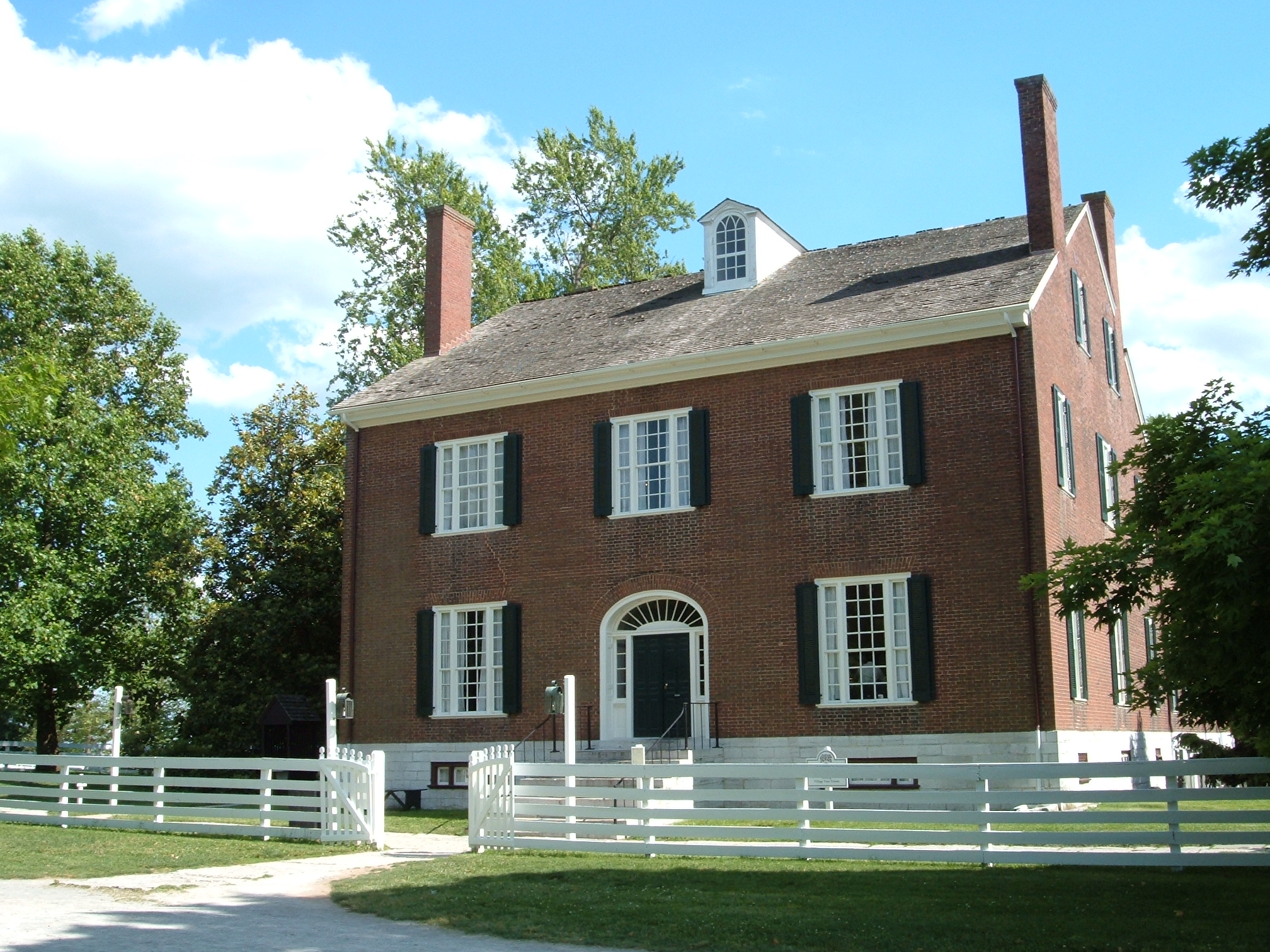
37°49′35″N 84°45′18″W / 37.826389°N 84.755°WHarrodsburg 58 Shakertown at Pleasant Hill Historic District 
November 11, 1971 On U.S. Route 68
37°49′14″N 84°44′36″W / 37.82056°N 84.74333°WPleasant Hill 59 Shawnee Springs July 19, 1976 4 miles northeast of Harrodsburg on Curry Rd.
37°49′01″N 84°48′07″W / 37.816944°N 84.801944°WHarrodsburg 60 Smith-Williams House February 9, 1989 South of Cane Run Pike
37°44′57″N 84°47′01″W / 37.749167°N 84.783611°WBurgin 61 Stone Quarters on Burgin Road June 23, 1983 KY 152
37°45′40″N 84°49′15″W / 37.761111°N 84.820833°WHarrodsburg 62 Sutfield House 
February 9, 1989 304 N. Main St.
37°45′54″N 84°50′36″W / 37.765°N 84.843333°WHarrodsburg 63 Sutfield-Thompson House 
September 13, 1977 362 N. Main
37°45′59″N 84°50′36″W / 37.766389°N 84.843333°WHarrodsburg 64 Capt. Samuel Taylor House April 13, 1977 Northeast of Harrodsburg on Chatham Pike
37°47′56″N 84°45′49″W / 37.798889°N 84.763611°WHarrodsburg 65 US Post Office-Harrodsburg 
March 1, 1989 105 N. Main St.
37°45′45″N 84°50′35″W / 37.7625°N 84.843056°WHarrodsburg 66 Wildwood February 9, 1989 388 Curry Pike
37°48′19″N 84°48′43″W / 37.805278°N 84.811944°WHarrodsburg 67 Williams House June 18, 1990 Warwick Rd.
37°49′50″N 84°49′35″W / 37.830556°N 84.826389°WHarrodsburg 68 Archibald Woods House 
October 29, 1983 129 N. East St.
37°45′46″N 84°50′27″W / 37.762778°N 84.840833°WHarrodsburg See also
- List of National Historic Landmarks in Kentucky
- National Register of Historic Places listings in Kentucky
References
- ^ The latitude and longitude information provided in this table was derived originally from the National Register Information System, which has been found to be fairly accurate for about 99% of listings. For about 1% of NRIS original coordinates, experience has shown that one or both coordinates are typos or otherwise extremely far off; some corrections may have been made. A more subtle problem causes many locations to be off by up to 150 yards, depending on location in the country: most NRIS coordinates were derived from tracing out latitude and longitudes off of USGS topographical quadrant maps created under the North American Datum of 1927, which differs from the current, highly accurate WGS84 GPS system used by Google maps. Chicago is about right, but NRIS longitudes in Washington are higher by about 4.5 seconds, and are lower by about 2.0 seconds in Maine. Latitudes differ by about 1.0 second in Florida. Some locations in this table may have been corrected to current GPS standards.
- ^ "National Register of Historic Places: Weekly List Actions". National Park Service, United States Department of the Interior. Retrieved on November 10, 2011.
- ^ Numbers represent an ordering by significant words. Various colorings, defined here, differentiate National Historic Landmark sites and National Register of Historic Places Districts from other NRHP buildings, structures, sites or objects.
U.S. National Register of Historic Places Topics Lists by states Alabama • Alaska • Arizona • Arkansas • California • Colorado • Connecticut • Delaware • Florida • Georgia • Hawaii • Idaho • Illinois • Indiana • Iowa • Kansas • Kentucky • Louisiana • Maine • Maryland • Massachusetts • Michigan • Minnesota • Mississippi • Missouri • Montana • Nebraska • Nevada • New Hampshire • New Jersey • New Mexico • New York • North Carolina • North Dakota • Ohio • Oklahoma • Oregon • Pennsylvania • Rhode Island • South Carolina • South Dakota • Tennessee • Texas • Utah • Vermont • Virginia • Washington • West Virginia • Wisconsin • WyomingLists by territories Lists by associated states Other Municipalities and communities of Mercer County, Kentucky Cities 
Unincorporated
communitiesDuncan | Mayo | Pleasant Hill | Salvisa | Talmage
Categories:- National Register of Historic Places in Kentucky by county
- Mercer County, Kentucky
-


Wikimedia Foundation. 2010.