- National Register of Historic Places listings in Boyd County, Kentucky
-
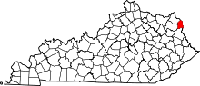 Location of Boyd County in Kentucky
This is a list of the National Register of Historic Places listings in Boyd County, Kentucky. It is intended to be a complete list of the properties and districts on the National Register of Historic Places in Boyd County, Kentucky, United States. The locations of National Register properties and districts for which the latitude and longitude coordinates are included below, may be seen in a Google map.[1]
There are approximately 25 properties and districts listed on the National Register in the county.
-
- This National Park Service list is complete through NPS recent listings posted November 10, 2011.[2]
Listings county-wide
[3] Landmark name Image Date listed Location City or town Summary 1 Ashland Armory September 6, 2002 2519 Lexington Ave.
38°28′07″N 82°37′53″W / 38.468611°N 82.631389°WAshland 2 Ashland Coal and Iron Railroad Office July 3, 1979 1100 Front St. Ashland 3 Ashland Coal and Iron Railroad Store July 3, 1979 900 Front St. Ashland 4 Ashland Commercial Historic District August 5, 1994 Roughly bounded by 13th St., Carter Ave., 18th St. and Front St.
38°28′45″N 88°38′24″W / 38.479167°N 88.64°WAshland 5 Ashland Tuberculosis Hospital February 7, 2008 3700 Landsdowne Dr. Ashland 6 Alexander Bagby House July 3, 1979 1520 Lexington Ave. Ashland 7 Bath Avenue Historic District July 3, 1979 Bath Ave. from 13th to 17th Sts. Ashland 8 Catlett House May 25, 1973 25th and Walnut Sts.
38°25′01″N 82°36′02″W / 38.416944°N 82.600556°WCatlettsburg 9 Catlettsburg National Bank May 25, 1973 110 26th St.
38°25′02″N 82°35′51″W / 38.417222°N 82.5975°WCatlettsburg 10 Crump and Field Grocery Company July 3, 1979 1401-1405 Greenup Ave. Ashland 11 Culbertson House July 3, 1979 1520 Chestnut Dr. Ashland 12 Nando Felty Saloon July 3, 1979 1500 Front St. Ashland 13 Timothy Fields House July 3, 1979 1520 Lexington Ave. Ashland 14 First Christian Church of Ashland March 22, 1990 315 17th St.
38°28′42″N 82°38′19″W / 38.478333°N 82.638611°WAshland 15 First Presbyterian Church June 19, 1973 1600 Winchester Ave.
38°28′41″N 82°38′23″W / 38.478056°N 82.639722°WAshland 16 First United Methodist Church November 19, 1974 2712 Louisa St.
38°24′26″N 82°35′53″W / 38.407222°N 82.598056°WCatlettsburg 17 Henry Clay Hotel August 3, 1984 1736 Winchester Ave.
38°28′39″N 82°38′17″W / 38.4775°N 82.638056°WAshland 18 Martin Hilton House July 3, 1979 1314 Hilton Ct. Ashland 19 Indian Mounds in Central Park January 21, 1974 Central Park, Carter Ave.
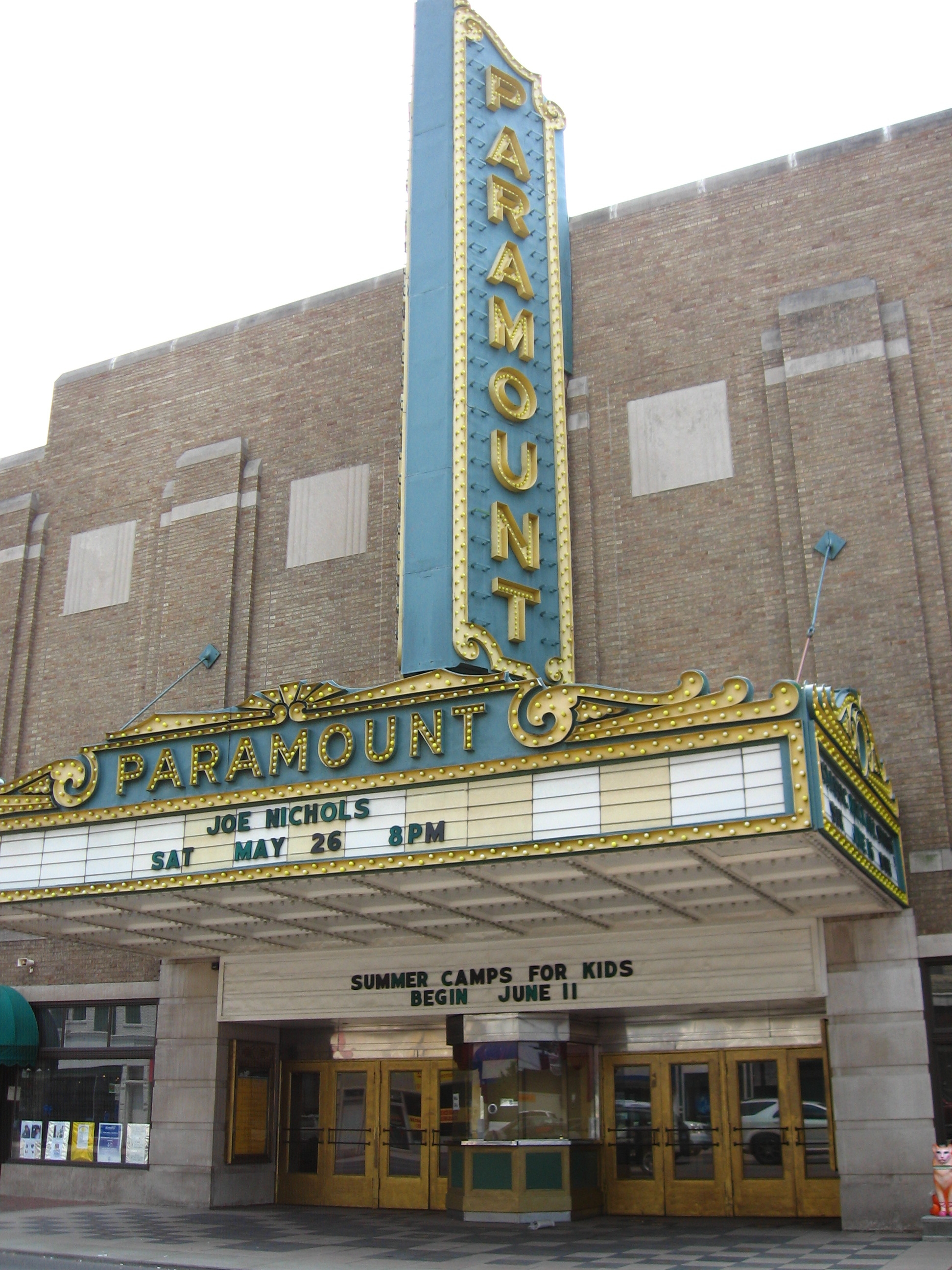
38°28′29″N 82°37′43″W / 38.474722°N 82.628611°WAshland 20 Paramount Theatre 
June 30, 1975 1304 Winchester Ave.
38°28′46″N 82°38′35″W / 38.479444°N 82.643056°WAshland 21 Lon Rogers House July 3, 1979 2008 Lexington Ave. Ashland 22 St. James AME Church July 3, 1979 12th St. and Carter Ave. Ashland 23 Jacob Savageot House and Saloon July 3, 1979 1512 Front St. Ashland 24 Stone Serpent Mound January 21, 1974 Address Restricted Catlettsburg 25 US Post Office-Ashland November 15, 1988 1645 Winchester Ave.
38°28′42″N 82°38′18″W / 38.478333°N 82.638333°WAshland See also
- List of National Historic Landmarks in Kentucky
- National Register of Historic Places listings in Kentucky
References
- ^ The latitude and longitude information provided in this table was derived originally from the National Register Information System, which has been found to be fairly accurate for about 99% of listings. For about 1% of NRIS original coordinates, experience has shown that one or both coordinates are typos or otherwise extremely far off; some corrections may have been made. A more subtle problem causes many locations to be off by up to 150 yards, depending on location in the country: most NRIS coordinates were derived from tracing out latitude and longitudes off of USGS topographical quadrant maps created under North American Datum of 1927, which differs from the current, highly accurate GPS system used by Google maps. Chicago is about right, but NRIS longitudes in Washington are higher by about 4.5 seconds, and are lower by about 2.0 seconds in Maine. Latitudes differ by about 1.0 second in Florida. Some locations in this table may have been corrected to current GPS standards.
- ^ "National Register of Historic Places: Weekly List Actions". National Park Service, United States Department of the Interior. Retrieved on November 10, 2011.
- ^ Numbers represent an ordering by significant words. Various colorings, defined here, differentiate National Historic Landmark sites and National Register of Historic Places Districts from other NRHP buildings, structures, sites or objects.
U.S. National Register of Historic Places Topics Lists by states Alabama • Alaska • Arizona • Arkansas • California • Colorado • Connecticut • Delaware • Florida • Georgia • Hawaii • Idaho • Illinois • Indiana • Iowa • Kansas • Kentucky • Louisiana • Maine • Maryland • Massachusetts • Michigan • Minnesota • Mississippi • Missouri • Montana • Nebraska • Nevada • New Hampshire • New Jersey • New Mexico • New York • North Carolina • North Dakota • Ohio • Oklahoma • Oregon • Pennsylvania • Rhode Island • South Carolina • South Dakota • Tennessee • Texas • Utah • Vermont • Virginia • Washington • West Virginia • Wisconsin • WyomingLists by territories Lists by associated states Other  Category:National Register of Historic Places •
  Portal:National Register of Historic Places
Municipalities and communities of Boyd County, Kentucky County seat: Catlettsburg Cities 
CDP Unincorporated
communitiesFootnotes ‡This populated place also has portions in an adjacent county or counties
Categories:- National Register of Historic Places in Kentucky by county
- Boyd County, Kentucky
-


Wikimedia Foundation. 2010.