- Meads, Kentucky
-
Meads — Unincorporated community — Location within the state of Kentucky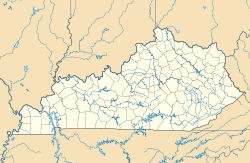
 Meads
MeadsCoordinates: 38°24′45″N 82°42′33″W / 38.4125°N 82.70917°WCoordinates: 38°24′45″N 82°42′33″W / 38.4125°N 82.70917°W Country United States State Kentucky County Boyd Population (2000) – Total 288,649 Time zone Eastern (EST) (UTC-5) – Summer (DST) EDT (UTC-4) ZIP codes FIPS code GNIS feature ID Meads is an unincorporated community in Boyd County, Kentucky, United States. It is located along the U.S. Highway 60 corridor south of Ashland.
Meads is centered around the junction of U.S. Route 60, Kentucky Route 538 and Mead-Springer Road. It was named for the long closed Mead's station, a train station and general store located on the C&O(now CSX) railroad that still runs through the community. Very little if anything remains of the original community besides the railroad and a few homes. With the upgrading of U.S. 60 beginning in the early 1970s, new growth began to happen at Meads, as it was reborn as a suburb of Ashland. In 1974 a large subdivision named Rockdale was developed on the hills above Meads, with several hundred tract homes. In 1991, Mead Station Plaza was constructed with over 20 commercial units and serves the nearby communities along U.S. 60. Several other commercial units have followed suit in recent years. Meads is a part of the Huntington-Ashland, WV-KY-OH, Metropolitan Statistical Area (MSA). As of the 2000 census, the MSA had a population of 288,649.
Education
External links
Municipalities and communities of Boyd County, Kentucky Cities 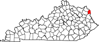
CDP Unincorporated
communitiesFootnotes ‡This populated place also has portions in an adjacent county or counties
Categories:- Populated places in Boyd County, Kentucky
- Unincorporated communities in Kentucky
- Huntington–Ashland metropolitan area
- Kentucky geography stubs


Wikimedia Foundation. 2010.