- National Register of Historic Places listings in Johnson County, Kentucky
-
 Location of Johnson County in Kentucky
This is a list of the National Register of Historic Places listings in Johnson County, Kentucky.
This is intended to be a complete list of the properties and districts on the National Register of Historic Places in Johnson County, Kentucky, United States. The locations of National Register properties and districts for which the latitude and longitude coordinates are included below, may be seen in a Google map.[1]
There are 39 properties and districts listed on the National Register in the county.
-
- This National Park Service list is complete through NPS recent listings posted November 10, 2011.[2]
Current listings
[3] Landmark name Image Date listed Location City or town Summary 1 Archer House January 26, 1989 170 Euclid St.
37°48′53″N 82°47′59″W / 37.814722°N 82.799722°WPaintsville 2 Blanton Archeological Site July 30, 1975 Address Restricted Oil Springs 3 Jeff Bond House January 26, 1989 Kentucky Route 172
37°55′31″N 82°57′22″W / 37.925278°N 82.956111°WRedbush 4 Dameron Shelter Archeological Site August 1, 1975 Address Restricted Paintsville 5 Daniel Davis House October 9, 1974 Northwest of Paintsville on U.S. Route 460
37°49′21″N 82°50′05″W / 37.8225°N 82.834722°WPaintsville 6 First Baptist Church January 26, 1989 College St.
37°48′59″N 82°48′24″W / 37.816389°N 82.806667°WPaintsville 7 First Methodist Church 
January 26, 1989 Main and Church Sts.
37°48′49″N 82°48′33″W / 37.813611°N 82.809167°WPaintsville 8 First National Bank Building 
January 26, 1989 Main and College Sts.
37°48′49″N 82°48′20″W / 37.813611°N 82.805556°WPaintsville 9 Flat Gap School January 26, 1989 Kentucky Route 689 near the junction with Kentucky Route 1092
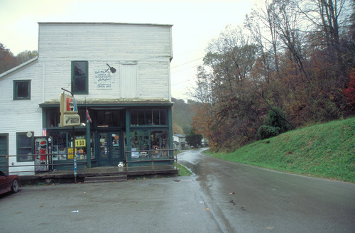
37°56′11″N 82°53′15″W / 37.936389°N 82.8875°WFlat Gap 10 Foster Hardware 
January 26, 1989 Main and Court Sts.
37°48′47″N 82°48′27″W / 37.813056°N 82.8075°WPaintsville 11 John J. and Ellen Lemaster House January 26, 1989 0.6 miles northeast of Low Gap on Low Gap Fork
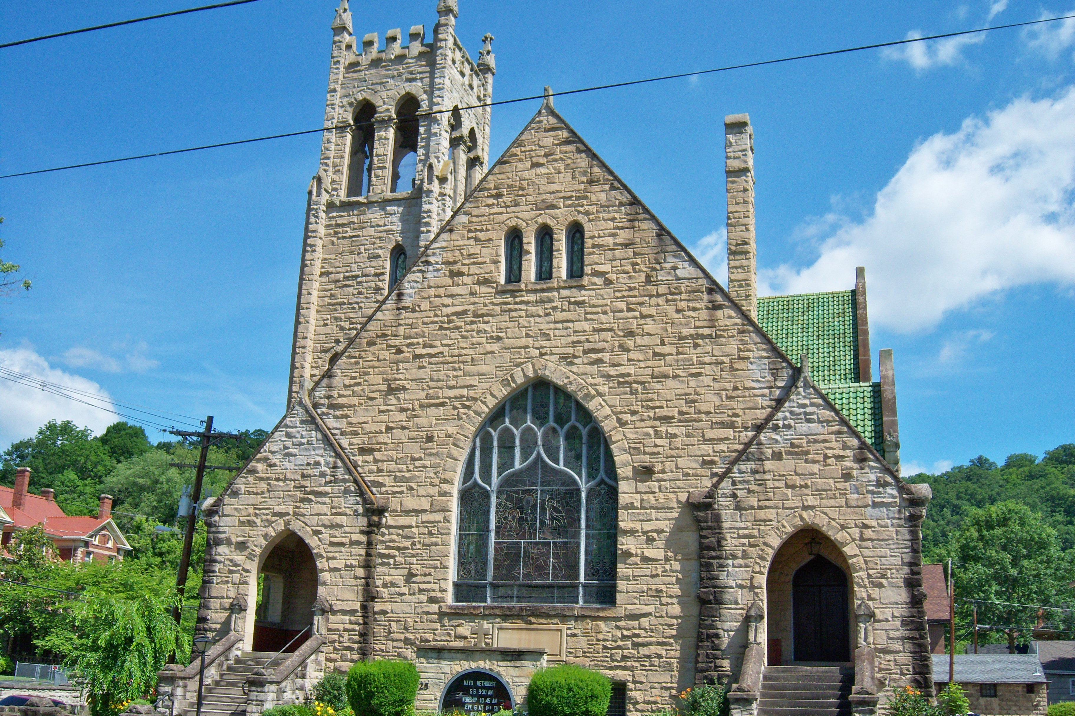
37°52′11″N 82°56′26″W / 37.869722°N 82.940556°WLow Gap 12 Mayo Memorial United Methodist Church 
January 26, 1989 3rd St.
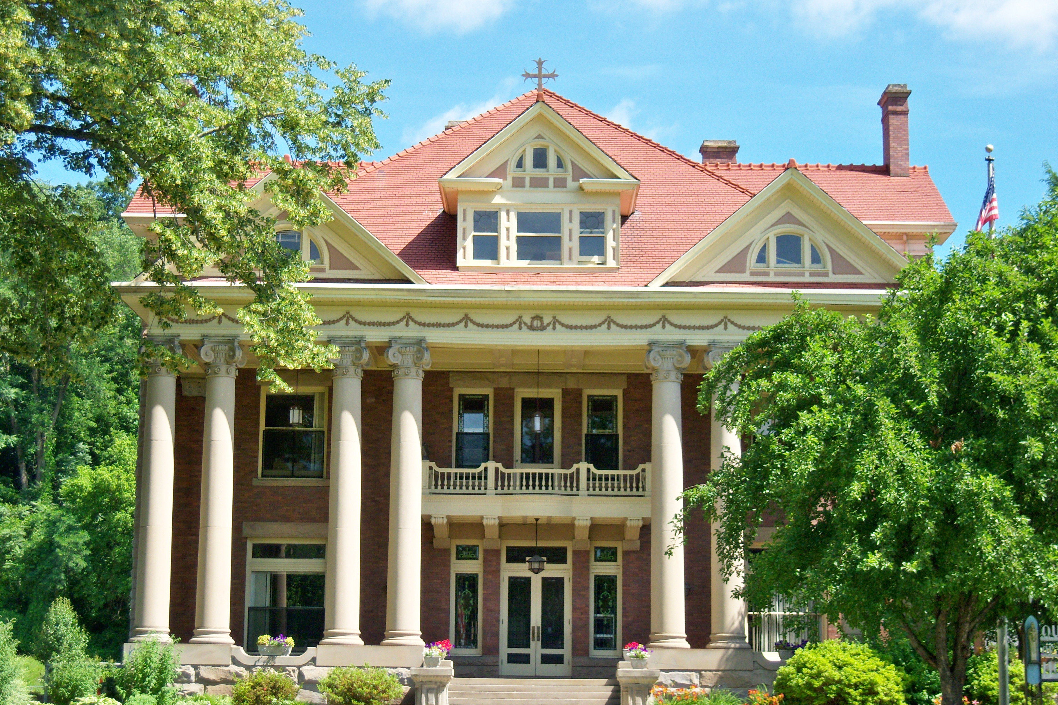
37°48′57″N 82°48′26″W / 37.815833°N 82.807222°WPaintsville 13 John C. C. Mayo Mansion and Office 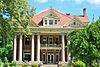
May 3, 1974 405 3rd St.
37°48′59″N 82°48′30″W / 37.816389°N 82.808333°WPaintsville 14 Thomas Mayo House January 26, 1989 228 2nd St.
37°48′53″N 82°48′36″W / 37.814722°N 82.81°WPaintsville 15 David McKenzie Log Cabin 
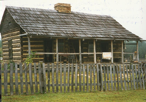
August 26, 1982 McKenzie Branch
37°52′56″N 82°54′44″W / 37.882222°N 82.912222°WVolga 16 Meade Memorial Gymnasium January 26, 1989 Junction of Kentucky Route 40 and Kentucky Route 2040
37°50′11″N 82°43′20″W / 37.836389°N 82.722222°WWilliamsport 17 Mine No. 5 Store 
January 26, 1989 Kentucky Route 302
37°46′22″N 82°43′41″W / 37.772778°N 82.728056°WVan Lear 18 Ben Mollett Cabin January 26, 1989 Off Kentucky Route 40 at Pigeon Roost Fork of Greasy Creek
37°48′09″N 82°42′19″W / 37.8025°N 82.705278°WWilliamsport 19 Lloyd Hamilton Mott House January 26, 1989 Kentucky Route 172
37°55′31″N 82°57′06″W / 37.925278°N 82.951667°WRedbush 20 Oil Springs High School Gymnasium January 26, 1989 Kentucky Route 580 off Kentucky Route 40
37°48′40″N 82°56′37″W / 37.811111°N 82.943611°WOil Springs 21 Oil Springs Methodist Church January 26, 1989 Junction of Kentucky Route 580 and Kentucky Route 40
37°48′37″N 82°56′35″W / 37.810278°N 82.943056°WOil Springs 22 Paintsville City Hall January 26, 1989 Main St. and spur of Kentucky Route 40
37°48′54″N 82°48′09″W / 37.815°N 82.8025°WPaintsville 23 Paintsville Country Club January 26, 1989 Kentucky Route 1107 at Davis Branch
37°48′08″N 82°46′34″W / 37.802222°N 82.776111°WPaintsville 24 Paintsville High School 
January 26, 1989 2nd St.
37°48′54″N 82°48′24″W / 37.815°N 82.806667°WPaintsville 25 Paintsville Public Library January 26, 1989 2nd St.
37°48′55″N 82°48′23″W / 37.815278°N 82.806389°WPaintsville 26 Patterson House January 26, 1989 West and 2nd St.
37°48′52″N 82°48′41″W / 37.814444°N 82.811389°WPaintsville 27 H.B. Rice Insurance Building 
January 26, 1989 Court and Main Sts.
37°48′49″N 82°48′25″W / 37.813611°N 82.806944°WPaintsville 28 Wiley Rice House January 26, 1989 Kentucky Route 825 at Asa Creek
37°45′35″N 82°52′40″W / 37.759722°N 82.877778°WAsa 29 Salyer House January 26, 1989 Off Kentucky Route 825 at Asa Creek
37°46′11″N 82°55′04″W / 37.769722°N 82.917778°WAsa 30 Addison Salyer House January 26, 1989 Off Kentucky Route 825 at Middle Fork of Jenny's Creek
37°45′50″N 82°50′43″W / 37.763889°N 82.845278°WPaintsville 31 Sparks Shelter Archeological Site July 30, 1975 Address Restricted Oil Springs 32 Francis M. Stafford House 
October 29, 1975 102 Broadway
37°48′45″N 82°48′22″W / 37.8125°N 82.806111°WPaintsville 33 Stambaugh Church of Christ January 26, 1989 Kentucky Route 1559 at Frog Ornery Branch
37°53′25″N 82°48′26″W / 37.890278°N 82.807222°WStambaugh 34 Stambaugh House January 26, 1989 Kentucky Route 1559 at Van Hoose Branch
37°53′28″N 82°49′11″W / 37.891111°N 82.819722°WStambaugh 35 Judge Jim Turner House January 26, 1989 315 3rd St.
37°48′55″N 82°48′31″W / 37.815278°N 82.808611°WPaintsville 36 Webb House January 26, 1989 139 Main St.
37°48′52″N 82°48′08″W / 37.814444°N 82.802222°WPaintsville 37 Byrd and Leona Webb House January 26, 1989 137 Main St.
37°48′52″N 82°48′09″W / 37.814444°N 82.8025°WPaintsville 38 Tobe Wiley House January 26, 1989 141 Euclid St.
37°48′52″N 82°48′07″W / 37.814444°N 82.801944°WPaintsville (Nonextant) 39 Williams House January 26, 1989 Kentucky Route 689/Elna Rd.
37°55′17″N 82°57′25″W / 37.921389°N 82.956944°WRedbush See also
- List of National Historic Landmarks in Kentucky
- National Register of Historic Places listings in Kentucky
References
- ^ The latitude and longitude information provided in this table was derived originally from the National Register Information System, which has been found to be fairly accurate for about 99% of listings. For about 1% of NRIS original coordinates, experience has shown that one or both coordinates are typos or otherwise extremely far off; some corrections may have been made. A more subtle problem causes many locations to be off by up to 150 yards, depending on location in the country: most NRIS coordinates were derived from tracing out latitude and longitudes off of USGS topographical quadrant maps created under the North American Datum of 1927, which differs from the current, highly accurate WGS84 GPS system used by Google maps. Chicago is about right, but NRIS longitudes in Washington are higher by about 4.5 seconds, and are lower by about 2.0 seconds in Maine. Latitudes differ by about 1.0 second in Florida. Some locations in this table may have been corrected to current GPS standards.
- ^ "National Register of Historic Places: Weekly List Actions". National Park Service, United States Department of the Interior. Retrieved on November 10, 2011.
- ^ Numbers represent an ordering by significant words. Various colorings, defined here, differentiate National Historic Landmark sites and National Register of Historic Places Districts from other NRHP buildings, structures, sites or objects.
U.S. National Register of Historic Places Topics Lists by states Alabama • Alaska • Arizona • Arkansas • California • Colorado • Connecticut • Delaware • Florida • Georgia • Hawaii • Idaho • Illinois • Indiana • Iowa • Kansas • Kentucky • Louisiana • Maine • Maryland • Massachusetts • Michigan • Minnesota • Mississippi • Missouri • Montana • Nebraska • Nevada • New Hampshire • New Jersey • New Mexico • New York • North Carolina • North Dakota • Ohio • Oklahoma • Oregon • Pennsylvania • Rhode Island • South Carolina • South Dakota • Tennessee • Texas • Utah • Vermont • Virginia • Washington • West Virginia • Wisconsin • WyomingLists by territories Lists by associated states Other Municipalities and communities of Johnson County, Kentucky City 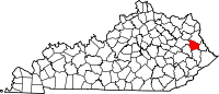
Unincorporated
communitiesAsa | Boonscamp | Chandlerville | Collista | Denver | Dobson | East Point | Elna | Flat Gap | Fuget | Hager Hill | Hargis | Keaton | Kerz | Leander | Low Gap | Manila | Meally | Nero | Nippa | Odds | Offutt | Oil Springs | Redbush | Riceville | River | Sip | Sitka | Staffordsville | Stambaugh | Swamp Branch | Thealka | Thelma | Tutor Key | Van Lear | Volga | West Van Lear | Whitehouse | Williamsport | Winifred | Wittensville
Categories:- National Register of Historic Places in Kentucky by county
- Johnson County, Kentucky
-


Wikimedia Foundation. 2010.