- Hampton, Virginia
-
City of Hampton 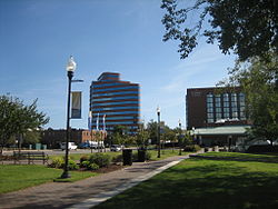

SealMotto: From the Sea to the Stars Location in the State of Virginia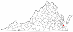
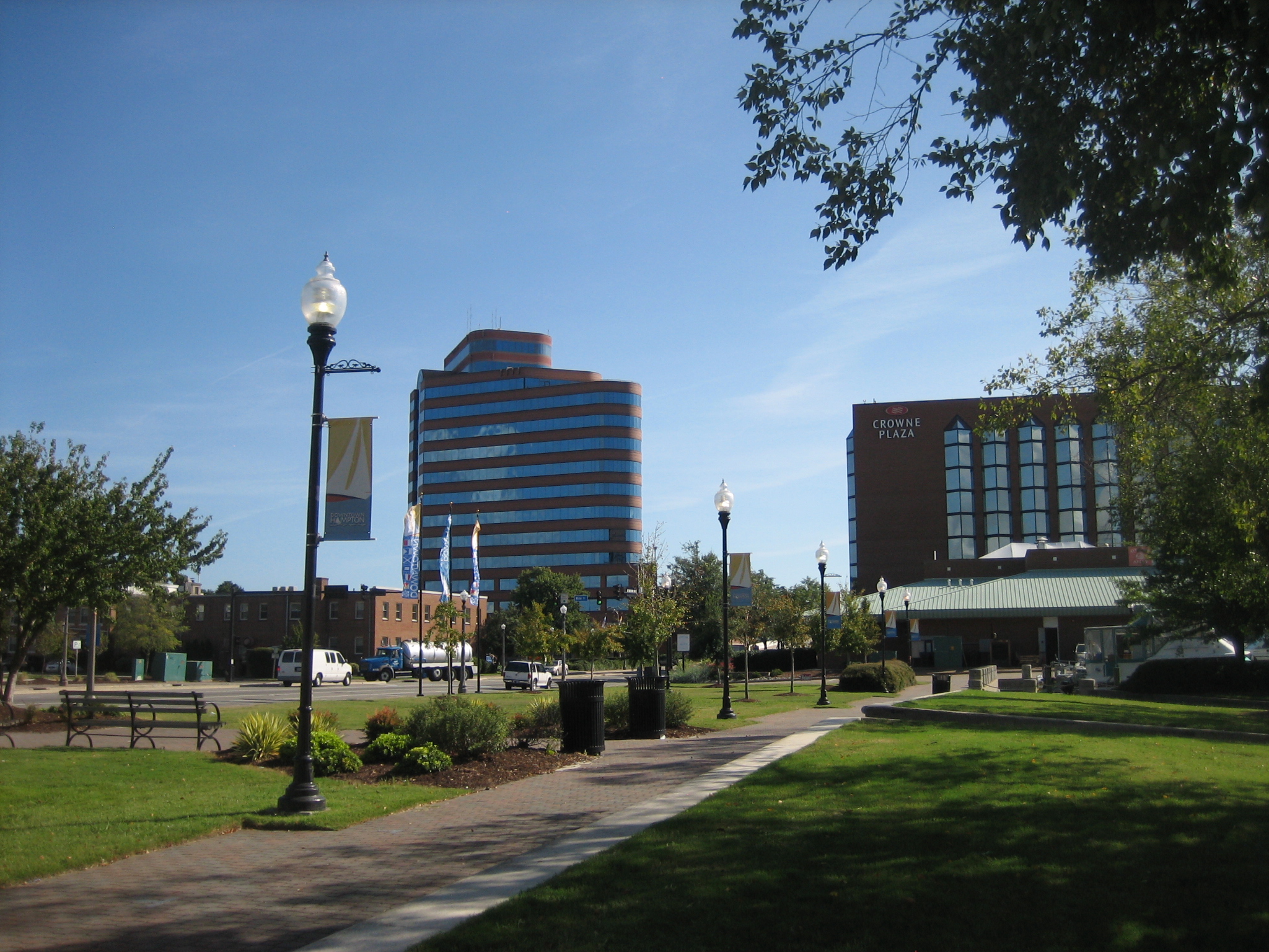
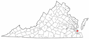
Coordinates: 37°2′5″N 76°21′36″W / 37.03472°N 76.36°W Country United States State Virginia Settled July 9, 1610 Incorporated (town) 1849[1] Incorporated (city) March 30, 1908[2] Government – Mayor Molly Joseph Ward (I) Area – City 136.2 sq mi (352.8 km2) – Land 54.8 sq mi (134.1 km2) – Water 84.4 sq mi (218.7 km2) 61.99% Elevation 10 ft (3 m) Population (2010) – City 137,436 – Density 2,919.3/sq mi (1,193.0/km2) – Metro 1,674,498 Census Time zone EST (UTC-5) – Summer (DST) EDT (UTC-4) Area code(s) 757 FIPS code 51-35000[3] GNIS feature ID 1495650[4] Website http://www.hampton.gov  Queens Way in Downtown Hampton. The city is part of the Hampton Roads metro area.
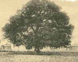
 On September 17, 1861, Mrs. Mary Smith Peake taught the first classes to African American children on the grounds of what is now Hampton University at Hampton Roads in Virginia under the shade of the Emancipation Oak.
 Hampton City Hall
Hampton is an independent city that is not part of any county in Southeast Virginia. Its population is 137,436[5]. As one of the seven major cities that compose the Hampton Roads metropolitan area, it is on the southeastern end of the Virginia Peninsula. Located on the Hampton Roads Beltway, it hosts the Hampton Roads Bridge-Tunnel (HRBT) on Interstate 64. First opened in 1957, it was the world's first bridge-tunnel, crossing the channel which serves as the gateway to the Chesapeake Bay and the Atlantic Ocean from the eastern United States' largest ice-free harbor and its tributary rivers. Expanded in the 1970s, the HRBT remains Virginia's busiest and deepest such facility.
Hampton traces its history to 1610. The city's Old Point Comfort, home of Fort Monroe for almost 400 years, was named by the voyagers of 1607 led by Captain Christopher Newport on the mission which first established Jamestown as a British colony. Since 1952, Hampton has included the former Elizabeth City County and the incorporated town of Phoebus, consolidating by mutual agreement. After the end of the American Civil War, historic Hampton University was established here, providing an education for many of the newly freed former slaves. In the 20th century, the area became the location of Langley Air Force Base, NASA Langley Research Center, and the Virginia Air and Space Center. Hampton features many miles of waterfront and beaches.
In modern times, Hampton has become the sixth most populous city in Virginia. According to the 2010 Census, the city population is 137,436.[6] For residents and visitors alike, the city features a wide array of business and industrial enterprises, retail and residential areas, and historical sites. Most recently, the new Peninsula Town Center development opened in May 2010 on the site of the former Coliseum Mall. Located in the area adjacent to the Hampton Coliseum and the Convention Center, the new urbanism-type project features a wide mix of retail stores, housing and other attractions.[7] Development of new residential development and additional public facilities (such as the new fishing pier recently opened) are underway at Buckroe Beach, long a noted resort area.[8]
Contents
History
In December 1606, three ships carrying men and boys left England on a mission sponsored by a proprietary company. Headed by Captain Christopher Newport, they sailed across the Atlantic Ocean to North America. After a long voyage, they first landed at the entrance to the Chesapeake Bay on the south shore at a place they named Cape Henry (for the Henry Frederick, Prince of Wales, the elder son of their king).
During the first few days of exploration, they identified the site of Old Point Comfort (which they originally named "Point Comfort") as a strategic defensive location at the entrance to the body of water that became known as Hampton Roads. This is formed by the confluence of the Elizabeth, Nansemond, and James rivers. The latter is the longest river in Virginia.
A few weeks later, on May 14, 1607, they established the first permanent English settlement in the present-day United States about 25 miles (40 km) further inland from the Bay along the James River at Jamestown. The area around Old Point Comfort became the site of several successive fortifications during the following 200 years.
Slightly south, near the entrance to Hampton River, the colonists seized the Native American community of Kecoughtan under Virginia's Governor, Sir Thomas Gates. The colonists established their own small town, with a small Anglican church (known now as St. John's Episcopal Church), on July 9, 1610. This came to be known as part of Hampton. (Hampton claims to be the oldest continuously occupied English settlement in the United States).[9] Hampton was named for Henry Wriothesley, 3rd Earl of Southampton, an important leader of the Virginia Company of London, for whom the Hampton River, Hampton Roads, Southampton County and Northampton County were also named. The area became part of Elizabeth Cittie [sic] in 1619, Elizabeth River Shire in 1634, and was included in Elizabeth City County when it was formed in 1643.
In the latter part of August 1619, a Dutch ship, the White Lion, appeared off the coast of Old Point Comfort. Its cargo included 20 plus Africans captured from the slave ship Sao Joao Bautista. These were the first Africans to come ashore on English-occupied land in what would become the United States. John Rolfe, the widower of Pocahontas, wrote in a letter that he was at Point Comfort and witnessed the arrival of the first Africans. Although these first Bantu men from Angola were considered indentured servants, their arrival marked the beginning of slavery in North America. Two of the first Africans to arrive at Old Point Comfort in 1619 were Antonio and Isabella. Their child, the first of African descent born in North America, was born in January 1624.
Shortly after the War of 1812, the US Army built a more substantial stone facility at Old Point Comfort. It was called Fort Monroe in honor of President James Monroe. The new installation and adjacent Fort Calhoun (on a man-made island across the channel) were completed in 1834.
Fort Monroe, Hampton and the surrounding area played several important roles during the American Civil War (1861–1865). Although most of Virginia became part of the Confederate States of America, Fort Monroe remained in Union hands. It became notable as a historic and symbolic site of early freedom for former slaves under the provisions of contraband policies and later the Emancipation Proclamation. After the War, former Confederate President, Jefferson Davis was imprisoned in the area now known as the Casemate Museum on the base.
To the south of Fort Monroe, the Town of Hampton had the misfortune to be burned during both the American Revolutionary War and the American Civil War. From the ruins of Hampton left by evacuating Confederates in 1861, "Contraband" slaves (formerly owned by Confederates and under a degree of Union protection) built the Grand Contraband Camp, the first self-contained African American community in the United States. A number of modern-day Hampton streets retain their names from that community. The large number of contrabands who sought the refuge of Fort Jefferson and the Grand Contraband Camp led to educational efforts which eventually included establishment of Hampton University, site of the famous Emancipation Oak.
The original site of the Native American's Kecoughtan Settlement was near the present site of a Hampton Roads Transit facility.[10] To the south of present-day Hampton, a small unrelated incorporated town also named Kecoughtan many years later and also located in Elizabeth City County was annexed by the City of Newport News in 1927. It is now part of that city's East End.
Long a town in Elizabeth City County, Hampton became an independent city from Elizabeth City County on March 30, 1908,[2] although it remained the county seat and continued to share many services with the county. On July 1, 1952, following approval of voters of each locality by referendum, the City of Hampton, the incorporated town of Phoebus and Elizabeth City County were all politically consolidated into a single independent city under the name of Hampton.[2] It was the first of a series of political consolidations in the Hampton Roads region during the third quarter of the 20th century.
Modern Military History
Hampton also has a rich and extensive 20th Century military history, home of Langley Air Force Base, the nation's first military installation dedicated solely to airpower and the home of the U.S. Air Force's 633d Air Base Wing and 1st and 192nd Fighter Wings. Hampton has been a center of military aviation training, research and development for nearly a hundred years, from early prop planes and Zeppelins to rocket parts and advanced fighters. It's proximity to Norfolk means that Hampton has also long been home to many Navy families. Together many Air Force and Navy families in the Hampton area experienced significant losses both in war and also peacetime due to husbands and fathers in combat and also peacetime military accidents.
Hamptons waiting families: The "waiting family" is one of the enduring stories of Hampton and the wider Hampton Roads area as thousands of military families stationed in the Hampton area have long waited for airmen and sailors on deployment both during wartime and peacetime. Consequently, many military families who were stationed in Hampton feel a strong connection to the area. Langley AFB During the Vietnam War: In particular, during the Vietnam War, Langley Air Force Base was a designated 'waiting base' and thousands of Air Force families were transferred to Hampton from all over the world in order to wait while their husbands and fathers served in Vietnam.[11] Thousands of Navy families associated with Naval bases in Norfolk next door also waited in Hampton during this era.[11] Vietnam was a very high casualty war for both Air Force and Navy pilots (some types of planes experienced a 50% casualty rate), and Naval "river rats" who fought on the rivers of the Mekong Delta experienced high casualties as well. There consequently accumulated over time, in the Hampton area, a high concentration of families of unnaccounted for wartime casualties.[11] In many cases Hampton-stationed military families of "Missing in Action" or "Prisoner of War" pilots and sailors spent many years in the Hampton area waiting to find out what had happened to their missing or captured airmen and sailors, and so the service and, in some cases sacrifice, of these pilots, airmen, sailors and their families, despite not having lifelong connections to the area, are also a poignant and inspiring part of Hampton's history.[11][12]
Geography
Hampton is located at 37°2′5″N 76°21′36″W / 37.03472°N 76.36°W (37.034946, -76.360126)[13].
According to the United States Census Bureau, the city has a total area of 352.8 square kilometers (136.2 sq mi). 134.1 square kilometers (51.8 sq mi) of it is land and 218.7 square kilometers (84.4 sq mi) of it (61.99%) is water.
Adjacent counties and cities
- York County, Virginia (north)
- Poquoson, Virginia (northeast)
- Norfolk, Virginia (south; border within the waters of Hampton Roads)
- Newport News, Virginia (south and west)
- Portsmouth, Virginia (south; border within the waters of Hampton Roads)
- Northampton County, Virginia - (east; border within the waters of the Chesapeake Bay)
Climate
Hampton's mild four season climate means outdoor activities can be enjoyed year round. The weather in Hampton is temperate and seasonal. Summers are hot and humid with cool evenings. The mean annual temperature is 70 °F (21 °C), with an average annual snowfall of 6 inches (150 mm) and an average annual rainfall of 47 inches (1,200 mm). No measurable snow fell in 1999. The wettest seasons are the spring and summer, although rainfall is fairly constant all year round. The highest recorded temperature was 105.0 °F (40.6 °C) in 1980. The lowest recorded temperature was −7 °F (−21.7 °C) on January 21, 1985.[14][15]
Additionally, the geographic location of the city, with respect to the principal storm tracks, is especially favorable, as it is south of the average path of storms originating in the higher latitudes, and north of the usual tracks of hurricanes and other major tropical storms. With the exception of Hurricane Isabel in 2003.[16]
Climate data for Hampton, Virginia Month Jan Feb Mar Apr May Jun Jul Aug Sep Oct Nov Dec Year Record high °F 84 82 92 97 100 102 104 105 100 95 86 80 105 Average high °F 53 58 64 69 75 83 87 85 79 69 61.5 55 69.9 Average low °F 35 37 40 50 58 66 71 70 65 53 44 36 52.1 Record low °F −7 16 14 23 36 45 54 49 40 27 17 15 −7 Precipitation inches 3.93 3.34 4.08 3.38 3.74 3.77 5.17 4.79 4.06 3.47 2.98 3.03 45.74 Record high °C 29 28 33 36 38 39 40 41 38 35 30 27 41 Average high °C 12 14 18 21 24 28 31 29 26 21 16.4 13 21.0 Average low °C 2 3 4 10 14 19 22 21 18 12 7 2 11.2 Record low °C −22 −9 −10 −5 2 7 12 9 4 −3 −8 −9 −22 Precipitation mm 99.8 84.8 103.6 85.9 95 95.8 131.3 121.7 103.1 88.1 75.7 77 1,161.8 Source: The Weather Channel [17] Demographics
Historical populations Census Pop. %± 1850 787 — 1860 1,848 134.8% 1870 2,300 24.5% 1880 2,684 16.7% 1890 2,513 −6.4% 1900 2,764 10.0% 1910 5,505 99.2% 1920 6,138 11.5% 1930 6,382 4.0% 1940 5,898 −7.6% 1950 5,966 1.2% 1960 89,258 1,396.1% 1970 120,779 35.3% 1980 122,617 1.5% 1990 133,811 9.1% 2000 146,437 9.4% 2010 137,436 −6.1% 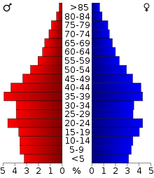 Age distribution in Hampton
As of the census[3] of 2010, there were 137,436 people, 53,887 households, and 35,888 families residing in the city. The population density was 2,828.0 people per square mile (1,091.9/km²). There were 57,311 housing units at an average density of 1,106.8 per square mile (427.3/km²). The racial makeup of the city was 42.7% White, 49.6% Black or African American, 0.4% Native American, 2.2% Asian, 0.1% Pacific Islander, 1.3% from other races, and 3.7% from two or more races. 4.5% of the population were Hispanic or Latino of any race.
There were 53,887 households out of which 32.5% had children under the age of 18 living with them, 46.2% were married couples living together, 16.4% had a female householder with no husband present, and 33.4% were non-families. 26.6% of all households were made up of individuals and 7.9% had someone living alone who was 65 years of age or older. The average household size was 2.49 and the average family size was 3.02.
The age distribution is 24.2% under the age of 18, 12.6% from 18 to 24, 32.5% from 25 to 44, 20.4% from 45 to 64, and 10.3% who were 65 years of age or older. The median age was 34 years. For every 100 females there were 98.3 males. For every 100 females age 18 and over, there were 96.6 males.
Population update: estimated population in July 2002: 145,921 (-0.4% change) Males: 72,579 (49.6%), Females: 73,858 (50.4%) Source
The Census estimate for 2005 shows that the city's population was down slightly to more, 145,579.[18]
The median income for a household in the city was $39,532, and the median income for a family was $46,110. Males had a median income of $31,666 versus $24,578 for females. The per capita income for the city was $19,774. About 8.8% of families and 11.3% of the population were below the poverty line, including 15.9% of those under age 18 and 8.6% of those age 65 or over.
Media
Hampton's daily newspaper is the Newport News-based Daily Press. Other papers include Norfolk's The Virginian-Pilot, Port Folio Weekly, the New Journal and Guide, and the Hampton Roads Business Journal.[19] Hampton Roads Magazine serves as a bi-monthly regional magazine for Hampton and the Hampton Roads area.[20] Hampton is served by a variety of radio stations on the AM and FM dials, with towers located around the Hampton Roads area.[21]
Hampton is also served by several television stations. The Hampton Roads designated market area (DMA) is the 42nd largest in the U.S. with 712,790 homes (0.64% of the total U.S.).[22] The major network television affiliates are WTKR-TV 3 (CBS), WAVY 10 (NBC), WVEC-TV 13 (ABC), WGNT 27 (CW), WTVZ 33 (MyNetworkTV), WVBT 43 (Fox), and WPXV 49 (ION Television). The Public Broadcasting Service station is WHRO-TV 15. Hampton residents also can receive independent stations, such as WSKY broadcasting on channel 4 from the Outer Banks of North Carolina and WGBS broadcasting on channel 7. Hampton is served by Verizon FiOS and Cox Cable which provides LNC 5, a local 24-hour cable news television network. DirecTV and Dish Network are also popular as an alternative to cable television in Hampton.
Culture
Sports
Hampton is home to the Peninsula Pilots of the Coastal Plain League, a collegiate summer baseball league. The Pilots play at War Memorial Stadium in Hampton. The team began playing in Hampton in the 1980s.
Education
Primary and secondary schools
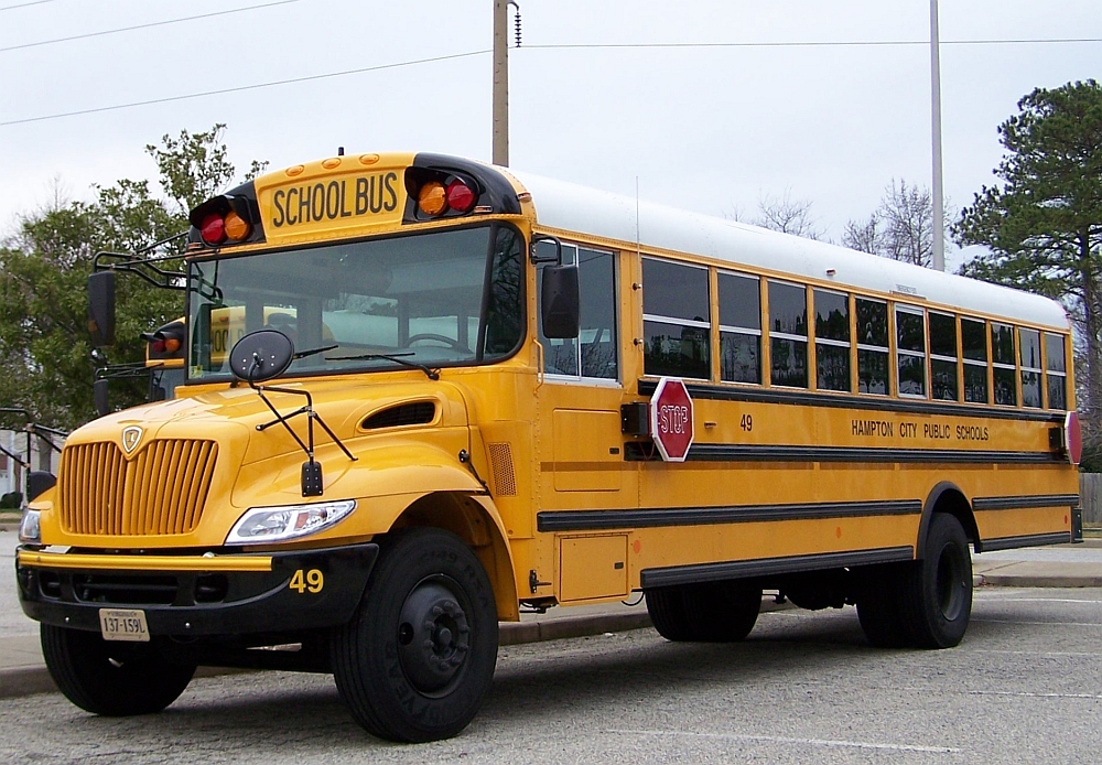
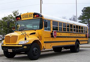 Hampton City Public Schools bus.
America's first free public school, the Syms-Eaton Academy, was established in Hampton in 1634. It was later renamed Hampton Academy and in 1852 became part of the public school system. Hampton High School traces its origin to the Syms-Eaton school and thus lays claim to being the oldest public school in the United States. The trust fund created from the Syms and Eaton donations has remained intact since the 17th century and was incorporated into support for the Hampton public school system. Hampton City Public Schools currently operates the following schools.
- Moton Early Childhood Center
- Andrews Pre K-8 school
- Aberdeen Elementary School
- Armstrong Fundamental Elementary School
- Asbury Elementary School
- Barron Elementary School
- Bassette Elementary School
- Booker Elementary School
- Bryan Elementary School
- Burbank Elementary School
- Cary Elementary School
- Cooper Magnet Elementary School
- Forrest Elementary School
- Kraft Elementary School
- Langley Elementary School
- Lee Elementary School (closing in 2010)
- Machen Elementary School
- Mallory Elementary School (closing in 2010)
- Mary Peake Elementary School
- Merrimack Elementary School
- Phillips Elementary School
- Phenix Pre K-8 school
- Smith Elementary School
- Tarrant Elementary School
- Tucker-Capps Fundamental Elementary School
- Tyler Elementary School
- Wythe Elementary School
- Eaton Fundamental Middle School
- Jefferson Davis Middle School
- Jones Magnet Middle School
- Lindsay Middle School
- Spratley Middle School
- Syms Middle School
- Bethel High School
- Hampton High School
- Kecoughtan High School
- Phoebus High School
Private schools include:
- Hampton Christian Schools[23]
- Robert Sugden (Closed? Was operating in the late 60's).
- Saint Mary's Star of the Sea Catholic School
- Calvary Classical School (Private K3-8th)
- Gloria Dei Lutheran School
School naming
Hampton city public school has a unique policy of the naming of the high school as all the elementry schools and middle schools are named after famous people the high schools are not allowed to be named after people only the areas of hampton for example Hampton high was named after the city Bethel high was named after the bethel section of hampton kecoughtan high school was named after the kecoughtan area and phoebus was named after the phoebus sction of the city the formal Georgie P phenix high school was renamed after segregation because of the this policy it was renamed pembroke high school after the street it was off of.
Colleges and universities
Hampton University provides a private collegiate education. Thomas Nelson Community College serves as the community college. Located in the north side of Hampton and in nearby Williamsburg, Thomas Nelson offers college and career training programs. Newport News contains Christopher Newport University, a public university. Other nearby public universities include Old Dominion University, Norfolk State University and The College of William and Mary.[24][25][26][27][28][29]
Defunct schools
- The original Phenix High School on the campus of Hampton University became Phenix Hall. It was named for George Perly Phenix, a native of Maine who was the first president of the school which became Hampton University.[30]
- A second Phenix High School was renamed Pembroke High School with the end of segregation, and was closed in 1980. The building now houses the Hampton Family YMCA and social services offices of the Hampton city government. (A third school bearing the name Phenix was under construction in 2010).
- Y.H. Thomas Middle School is now the Adult Education Center and a community center.
- The first Sinclair Elementary School was later torn down and is now a site for hotels.
- Syms-Eaton Elementary School was torn down in the 1970s or 80s and is now a pavilion and a site for town homes in Downtown Hampton.
- The first Hampton High School became John M. Willis Elementary School, which closed in 1974.
- The second Hampton High School became Thorpe Junior High School which was closed in 1976. The area where these two schools were is now the site of the Charles H. Taylor Memorial Library and Darling Memorial Stadium.
- Mallory Elementary School is closing in 2010 due to the two new pre K-8 schools and budget cuts. It may become a retirement center or an office building.
- Robert Sugden (Closed? Was operating in the late 60's).
- Robert E. Lee Elementary is closing in 2010 due to the new schools and budget cuts. The site of the school is currently slated to become a park.
- Spratley Middle School is closing in 2010 and will become the site of the Gifted Program (formerly housed at Jones Middle School and the Mary Peake Center).
- Wythe Elementary School Will be closing in 2010 due to the new school. It is set to be housed as an adult education center like the Y.H. Thomas Center.
- Marypeak Center is closing in 2010 due to the budget cuts and will used as an addition to the Y.H Thomas Center.
- Buckroe Junior High School (Closed in the 1970s because of the opening of Jones Middle School)
Major neighborhoods
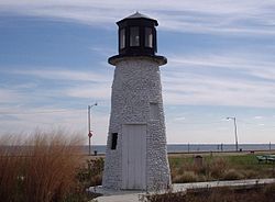 The old "lighthouse" at Buckroe Beach was built as a part of the amusement park.
- Aberdeen Gardens
- Bethel Park
- Briarfield Terrace
- Buckroe
- Buckroe Beach
- Coliseum Central
- Elizabeth Lake Estates
- Farmington
- Fox Hill
- Grandview
- Grist Mill
- Hampton Woods
- Howe Farms
- Magnolia
- Michael's Woods
- Northampton
- Orcutt-Farmington
- Phoebus
- Pine Chapel
- Pine Grove
- Riverdale
- Sinclair Farms
- Tide Mill
- Wythe
- Westview lakes
- Willow Oaks
Points of interest
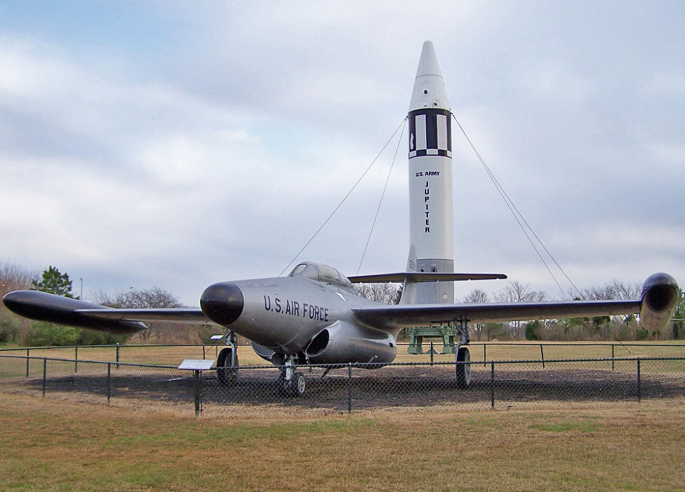
 F-89J s/n 52-2129 on display at the Air Power Park and Museum in Hampton, Virginia.
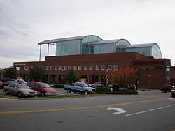 The Virginia Air and Space Center, the official visitors center for both Langley Air Force Base and NASA Langley Research Center.
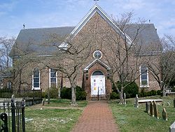 St. John's Church is the oldest English-speaking church in continuous existence the United States and the only colonial structure in downtown Hampton.[9]
- Air Power Park
- Bluebird Gap Farm
- Buckroe Beach
- Buckroe Fishing Pier
- Charles Taylor Arts Centre
- Downtown Hampton Historic District
- Emancipation Oak
- Fort Monroe
- Fort Wool
- Gosnold Hope Park
- Grandview Nature Preserve
- Hampton Coliseum
- Hampton History Museum
- Hampton National Cemetery - two branches
- Hampton Plaza
- Hampton Roads Convention Center
- Hampton Roads Harbor
- Hampton University
- Hampton University Museum
- Jacques Cousteau Centre
- Jefferson Davis Casemate Museum
- Langley Air Force Base
- Langley Speedway
- Mercury Central Shopping District
- NASA–Langley Research Center
- New American Theatre
- Old Point Comfort
- Phoebus Historic District
- Peninsula Town Center
- Robert Ogden Auditorium
- Sandy Bottom Nature Park
- Strawberry Banks and First Landing Monument
- St. John's Church
- Veterans Affairs Medical Center
- Virginia Air and Space Center
- War Memorial Stadium
Transportation
Main article: Transportation in Hampton RoadsRoads and Highways
In the Hampton Roads region, water crossings are a major issue for land-based transportation. The city is fortunate to have a good network of local streets and bridges to cross the various rivers and creeks. Many smaller bridges, especially those along Mercury Boulevard, were named to honor the original NASA astronauts, who had trained extensively at NASA's Langley facilities.
The city is located contiguously to the neighboring independent cities of both Newport News and Poquoson. Many roads and streets are available to travel between them. Likewise, Williamsburg, Yorktown and the counties of James City and York are also located nearby in the Peninsula subregion, and many roads lead to them.
To reach most of its other neighbors in the South Hampton Roads subregion, it is necessary to cross the harbor and/or the mouth of the James River. There are 3 major motor vehicle crossings. Among these are the Hampton Roads Bridge-Tunnel (HRBT) and the Monitor-Merrimac Memorial Bridge-Tunnel (MMMBT), each forming part of the Hampton Roads Beltway. The HRBT is located on Interstate 64 near downtown Hampton and the MMMBT is a few miles away on Interstate 664 near downtown Newport News. (These two major interstates converge in Hampton near the Hampton Coliseum). The third crossing option is the James River Bridge, also in Newport News, which connects to Isle of Wight County and the town of Smithfield.
Hampton is also served by several major primary and secondary highways. These notably include U.S. Routes 17, 60 and 258, and Virginia State Routes 134 and 143.
Traffic congestion is challenging for drivers in the entire Hampton Roads region, particularly during peak commute periods and holiday weekends. Traffic cams and electronic signage help keep motorists aware of trouble spots. Virginia 511 offers telephone traffic information from VDOT as well.
Local and regional public transportation
The Hampton Transit Center, located 2 West Pembroke Boulevard, at the intersection of King Street, close to the downtown area, offers a hub for local and intercity public transportation. It hosts HRT buses, Greyhound/Trailways services and taxicabs.
Hampton Roads Transit (HRT) is the local provider of transit service within the city, as well offering a regional bus system with routes to and from seven other cities in Hampton Roads.[31]
Intercity bus service
Intercity bus service is provided by Greyhound Lines and its Carolina Trailways affiliate. The buses serve the Hampton Transit Center.
Amtrak
Hampton is served by several Amtrak trains a day, with direct service from a station in nearby Newport News (on Warwick Boulevard just west of Mercury Boulevard) through Williamsburg and Richmond to points along the Northeast Corridor from Washington DC through Baltimore, Philadelphia, and New York City all the way to Boston. At Richmond, connections can be made for other Amtrak destinations nationwide.
Virginia is actively working on plans to expand the frequency of the locally offered Amtrak services.
Air
Hampton is served by two commercial airports. Newport News/Williamsburg International Airport (IATA: PHF) is located in Newport News, and Norfolk International Airport (IATA: ORF, ICAO: KORF, FAA LID: ORF), is located across the harbor in Norfolk. Both are located along portions of Interstate 64.
The primary airport for the Virginia Peninsula is the Newport News/Williamsburg International Airport located nearby in Newport News. Originally known as Patrick Henry Field (hence its airline code letters "PHF"), it was built on the site of Camp Patrick Henry, formerly a World War II facility. It is one of the fastest growing airports in the country, and it reported having served 1,058,839 passengers in 2005. The airport recently added a fourth airline carrier, Frontier Airlines, becoming the first new airline to come to the region in over eight years, despite the economic recession conditions. 2010 will likely be the busiest year by passenger count in the airport's history.[32]
The larger Norfolk International Airport (often known locally by its code letters "ORF") also serves the region. The ORF airport is located near the Chesapeake Bay, along the city limits between Norfolk and Virginia Beach.[33] Seven airlines provide nonstop services to twenty five destinations. During a recent year, ORF had 3,703,664 passengers take off or land at its facility and 68,778,934 pounds of cargo were processed through its facilities.[34]
The Chesapeake Regional Airport provides general aviation services. It is located in South Hampton Roads in the independent city of Chesapeake.[35]
Notable Hamptonians
- American history
- Samuel Chapman Armstrong, Union general in American Civil War; founder of Hampton Normal and Agricultural Institute, later Hampton University
- James Armistead, America's first spy; an African American who provided the information to the Continental Army that Cornwallis was headed to Yorktown in 1781. This led to the forced surrender of Cornwallis.
- Jefferson Davis, president of the Confederate States of America, imprisoned in a casemate at Fort Monroe after the American Civil War
- Booker Taliaferro Washington (commonly known as Booker T Washington), founder of Tuskegee Institute, educator, author, African-American statesman
- Evelyn Grubb, POW wife, Author, Co-founder and National President of the National League of Families,[36][11][37] nonprofit organization that worked on behalf of Vietnam-era Missing in Action and Prisoner of War Families. Helped design the "You Are Not Forgotten" POW/MIA flag that still flies in front of all U.S. Post Offices, most firehouses and police stations, all major U.S. Military installations as well as most veterans organization chapters in the United States.[38][11]Served as the Leagues liaison to the White House, the United Nations and the Paris Peace Talks.[11][37][12] Grubb was living in Hampton as an Air Force wife when her husband became a prisoner of war in North Vietnam in 1966[39][11][37] and founded the league there.[11][37][40]
- Mary Crow, POW wife and Co-Founder of the National League of Families,[11][12] nonprofit organization that worked on behalf of Vietnam-era Missing in Action and Prisoner of War Families. Was stationed in Hampton as an Air Force wife when her husband became a prisoner of war and she co-founded the League there.[11][40][12]
- George Robert Watkins, politician, member of Pennsylvania State Senate and United States Congress
- George Wythe, classical scholar, first law professor in U.S., mayor of Williamsburg, attorney general of Virginia Colony, Continental Congress member, speaker of the state assembly, a framer of the federal Constitution
- Music
- Robert Nathaniel Dett, notable composer, pianist, choir director, educator, administrator at Hampton Institute; a founder of United Service Organization
- Steve Earle, popular country-rock musician and songwriter
- Jeff Parker, experimental jazz and rock guitarist in the Chicago-based post-rock group Tortoise
- DeVante Swing and Mr. Dalvin, two fourths of the R&B group Jodeci
- Victor Wooten, bassist for the Grammy Award winning "Blu-Bop" group Béla Fleck and the Flecktones
- David Ennis, noted singer/songwriter
- Science
- Roy F. Brissenden, World War II pilot, physicist, aeronautical engineer, mechanical engineer, teacher, inventor, project leader at Hampton, Langley Research Center NACA / NASA; great genius of the Apollo Program
- Christopher C. Kraft, Jr, aeronautical engineer; administrator at Hampton, Langley Research Center NACA / NASA; great flight director of the space program
- Sports
- Robert Banks, Linebacker/defensive end; national high school player of the year by the Columbus, Ohio Touchdown Club in 1982
- Elton Brown, offensive lineman of the Arizona Cardinals
- Jim Burrow, defensive back for the Green Bay Packers
- Ronald Curry, professional football player for the Oakland Raiders, former Hampton High School star football quarterback
- La'Keshia Frett, former WNBA basketball player; led Phoebus High School to state championship in 1992
- Shaun Gayle, Special Teams captain of the 1985 Super Bowl champion Chicago Bears football team, and played with the San Diego Chargers
- Marques Hagans, quarterback/wide receiver with the St. Louis Rams
- Chris Hanburger, popular Washington Redskins player in the 1970s
- Allen Iverson, all-star basketball player for the Philadelphia 76ers
- Jerod Mayo, NFL linebacker for the New England Patriots
- Art Price, professional football player for the Atlanta Falcons
- Dwight Stephenson, professional football player for the Miami Dolphins and member of the Pro Football Hall of Fame
- Jimmy F. Williams, professional football player for the Atlanta Falcons
- Michael Husted, former professional football player for the Tampa Bay Buccaneers, former Hampton High School placekicker
- Other
- Nikki Nova, TV personality, nude model
- Oz Scott, director
- Natasha Golden, Founder of House of Banner / Jehovah Nissi House Phoebus High School.
Sister cities
Hampton has four sister cities:[41][42]
 Southampton, England, United Kingdom
 Vendôme, Loir-et-Cher, France
 Pietermaritzburg, South Africa
 Anyang, Gyeonggi, South Korea
See also
- List of Mayors of Hampton, Virginia
- List of famous people
- Buckroe Beach
- Bluebird Gap Farm
- Hampton Roads (many regional aspects covered)
- Old Point Comfort
- National Register of Historic Places listings in Hampton, Virginia
- Virginia Peninsula
Notes and references
- ^ "Hampton History and Facts". City of Hampton, Virginia. http://www.hampton.gov/rec/history_and_facts.html. Retrieved 2009-08-26.
- ^ a b c http://historical-county.newberry.org/website/Virginia/documents/VA_Consolidated_Chronology.htm#Consolidated_Chronology
- ^ a b "American FactFinder". United States Census Bureau. http://factfinder.census.gov. Retrieved 2008-01-31.
- ^ "US Board on Geographic Names". United States Geological Survey. 2007-10-25. http://geonames.usgs.gov. Retrieved 2008-01-31.
- ^ [1]. Weldon Cooper Center 2010 Census Count Retrieved January 26, 2011
- ^ [2]. Weldon Cooper Center 2010 Census Count Retrieved January 26, 2011
- ^ http://www.peninsulatowncenter.com/
- ^ http://www.hampton.gov/ed/plans/buckroe.html
- ^ a b Tormey, James (April 2009). How Firm a Foundation. Richmond, Virginia: Diets Press. p. 184. ISBN 978-0-87517-135-7.
- ^ WMCAR - Historic Kecoughtan
- ^ a b c d e f g h i j k Jose, Carol; You Are Not Forgotten: A Family's Quest for Truth and the Founding of the National League of Families, New York Vandamere Press; First edition (September 1, 2008). (US), 2008. # ISBN 0918339715, # ISBN 978-0918339713.
- ^ a b c d Video of CSPAN special segment, Author Carol Jose speaks about book "You Are Not Forgotten" on the National League of Families, http://www.c-spanvideo.org/program/282539-1
- ^ "US Gazetteer files: 2010, 2000, and 1990". United States Census Bureau. 2011-02-12. http://www.census.gov/geo/www/gazetteer/gazette.html. Retrieved 2011-04-23.
- ^ Climate information from NOAA.
- ^ Maximum and minimum temperatures from Yahoo! Weather
- ^ Information from NOAA.
- ^ "Seasonal Temperature and Precipitation Information". http://www.weather.com/weather/wxclimatology/monthly/graph/USVA0557.
- ^ Hampton city QuickFacts from the US Census Bureau
- ^ "Hampton Roads News Links". abyznewslinks.com. http://www.abyznewslinks.com/unitevann.htm. Retrieved 2007-08-06.
- ^ "Hampton Roads Magazine". Hampton Roads Magazine. http://www.hrmag.com. Retrieved 2007-08-06.
- ^ "Hampton Roads Radio Links". ontheradio.net. http://www.ontheradio.net/metro/Norfolk_VA.aspx. Retrieved 2007-08-06.
- ^ Holmes, Gary. "Nielsen Reports 1.1% increase in U.S. Television Households for the 2006-2007 Season." Nielsen Media Research. September 23, 2006. Retrieved on September 28, 2007.
- ^ "Map and directions." Hampton Christian Schools. Retrieved on April 20, 2009.
- ^ Christopher Newport University
- ^ College of William and Mary
- ^ Old Dominion University
- ^ Norfolk State University
- ^ Hampton University
- ^ Thomas Nelson Community College
- ^ http://www.dailypress.com/news/columnists/dp-uban-phenix,0,6106547.column?page=2
- ^ Hampton Roads Transit
- ^ "Newport News/Williamsburg International Airport". Newport News/Williamsburg International Airport. http://www.nnwairport.com/. Retrieved 2008-02-25.
- ^ "Norfolk International Airport Mission and History". Norfolk International Airport. http://www.norfolkairport.com/airportinfo/missionhistory.htm. Retrieved 2007-10-02.
- ^ "Norfolk International Airport Statistics" (PDF). Norfolk International Airport. http://www.norfolkairport.com/airportinfo/orfstats.pdf. Retrieved 2007-10-02.
- ^ "Chesapeake Regional Airport". http://www.chesapeakeairport.com/. Retrieved 2008-01-12.
- ^ "Evelyn Grubb, 74; Advocated Humane Treatment for POWs of Vietnam Era"Los Angeles Times Obituary, January 04, 2006, http://articles.latimes.com/2006/jan/04/local/me-grubb4
- ^ a b c d "Evelyn Fowler Grubb, 74, Leader Of a Group Supporting P.O.W.'s". New York Times. http://query.nytimes.com/gst/fullpage.html?res=9900EEDC1130F937A35752C0A9609C8B63. Retrieved 2006-01-06.
- ^ "Evelyn Grubb, 74; Advocated Humane Treatment for POWs of Vietnam Era" Los Angeles Times Obituary, January 04, 2006, http://articles.latimes.com/2006/jan/04/local/me-grubb4
- ^ Wainwright, Loudon; "When Johnny Comes Marching Home Again - or doesn't", Life Magazine; (November 10, 1972).
- ^ a b Stockdale, Jim and Sybil; In Love and War, (Naval Institute Press, 1984).
- ^ "SCI: Sister City Directory". Sister Cities International. http://www.sister-cities.org/directory/USlistingsResults.cfm?selectedState=VA&submit=Search. Retrieved November 4, 2011.
- ^ "Sister Cities of Hampton, Virginia". http://sistercities-hamptonva.org/. Retrieved November 4, 2011.
External links
- City of Hampton
- Hampton Roads Economic Development Alliance - serving Hampton
Coordinates: 37°02′06″N 76°21′36″W / 37.034946°N 76.360126°W
Hampton Roads Major Cities Chesapeake · Hampton · Newport News · Norfolk · Portsmouth · Suffolk · Virginia Beach
Counties Currituck · Gloucester · Isle of Wight · James City · Mathews · Surry · York
Other cities Towns Claremont · Dendron · Smithfield · Surry · Windsor
Sub-regions Topics Transportation · People · History · Battle of Hampton Roads ·
Note: Italic indicates independent city not part of any countyCategories:- Cities in Virginia
- Populated coastal places in Virginia
- Populated places established in 1610
- Hampton, Virginia
- Hampton Roads


Wikimedia Foundation. 2010.