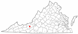
- Radford, Virginia
-
Radford, Virginia — City — Main Street in Radford, Virginia.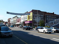

SealNickname(s): The New River City Location in the Commonwealth of Virginia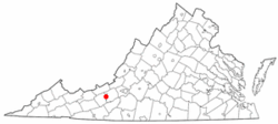
Coordinates: 37°7′39″N 80°34′10″W / 37.1275°N 80.56944°W Country United States State Virginia Founded 1887 Government - Mayor Dr. Bruce Brown Area - City 10.2 sq mi (26.4 km2) - Land 9.8 sq mi (25.4 km2) - Water 0.4 sq mi (1.0 km2) Elevation 2,103 ft (641 m) Population (2010) - City 16,408 - Density 1,674.3/sq mi (645.9/km2) - Metro 157,614 Time zone EST (UTC-5) - Summer (DST) EDT (UTC-4) ZIP codes 24141-24143 Area code(s) 540 FIPS code 51-65392[1] GNIS feature ID 1500073[2] Website http://www.radford.va.us/ Radford is a city in Virginia, United States. The population was 16,408 in 2010.[3][4] For statistical purposes, the Bureau of Economic Analysis combines the city of Radford with neighboring Montgomery County, including the towns of Blacksburg and Christiansburg, calling the combination the Blacksburg-Christiansburg-Radford Metropolitan Statistical Area.
Radford University is located here. The Radford Arsenal is nearby in Pulaski and Montgomery Counties. Radford City has four schools: McHarg Elementary, Belle Heth Elementary, Dalton Intermediate, and Radford High School.
Contents
Local Attractions
Radford has many restaurants and municipal parks. Radford has four parks; Bisset, Sunset, Wildwood, and Riverview. Bisset Park and Sunset are family attraction parks with playgrounds, swings, baseball fields, beach volleyball, and picnic shelters for parties. Bisset is the larger of the two, located on the New River, it stretches 57 acres (23 ha).Bisset Park was named for David Bisset, a major contributor and overseer of parks and recreation in Radford. Bisset Park is located in the center of town across from Wildwood Park. Sunset Park is located in the center of the west end of Radford. Riverview is used mainly for soccer practices and like its name suggests is also located on the river and in the west end of Radford. Wildwood Park is a wildlife and plant reserve for the city. Radford also has a movie theater, the Radford Soccer Club, a farmer’s market, and tubing on the New River.
Wildwood Park
Wildwood Park is located in the center of town.[5] The park separates the West or Industrial side of Radford from the Eastern side where Radford University is located. The park contains extensive walking and biking paths. The park is used by Radford High School for biology classes. The Biology classes perform a great quantity of animal, plant, and stream test including a Tree Population and Species Observation, Clean Stream Testing for federal use, Monarch Butterfly Observation, Spring Wildflower Observation, and Observation of Exotic Species. Conelly’s Run flows through the park and provides great crayfish hunting for the passerby during the summer months. Wildwood Park is the only perfectly preserved place in Radford. With limited exotic species, no buildings or sports fields, and many walking and biking trails, the park represents the way Radford looked before the coming of the railroad. Wildwood Park is a very quiet place where many types of native animals like birds, raccoons, opossums, skunks, and groundhogs decide to make their homes. In the spring, people travel from all over the state and sometimes country to see the wide variety of wildflowers.
City Council
Position Person Mayor Dr. Bruce Brown Vice Mayor Dr. Dick Harshburger City Councilman Keith Marshall City Councilman Tim Cox City Councilman Robert Nicholson City Manager David Ridpath Geography
Radford is located at 37°7′39″N 80°34′10″W / 37.1275°N 80.56944°W (37.127585, -80.569523)[6].
According to the United States Census Bureau, the city has a total area of 10.2 square miles (26.4 km²), of which, 9.8 square miles (25.4 km²) of it is land and 0.4 square miles (1.0 km²) of it (3.63%) is water. The New River runs along the southeastern edge of the city.
Weather and Climate History
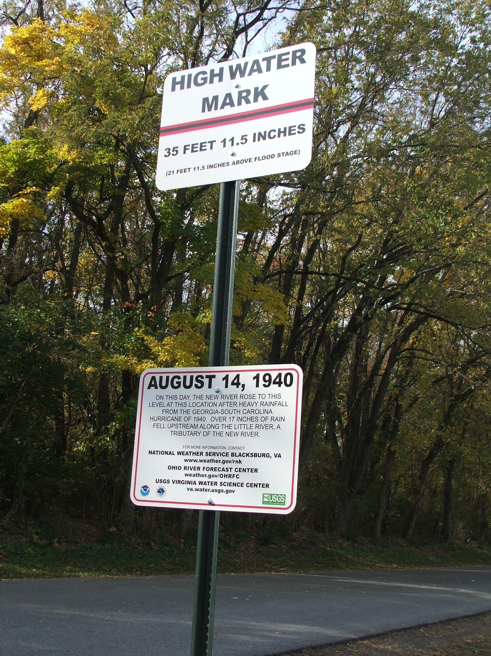
 High water mark sign in Bisset Park marking the height of the 1940 flood.
The worst river flooding in Radford's recorded history occurred on August 14, 1940 with a slow-moving tropical depression. The 1940 hurricane season produced eight storms, four of which were hurricanes. Around August 5th of that year, a tropical storm was detected along the northern Leeward Islands in the West Indies. The storm brought wind gusts of 44 mph to San Juan, Puerto Rico as it moved northwestward. By August 6th it began a turn to the north while producing rough seas in the southeastern Bahamas. Four days later on August 10th the S.S. Maine off the southeast coast measured hurricane-force winds and the storm began movement again toward the northwest. The storm made landfall as a category 1 hurricane on August 11th at approximately 4 PM near Beaufort, South Carolina (along the SC/GA border). Winds reached 73 mph in nearby Savannah, Georgia.
As the Georgia-South Carolina hurricane of 1940 moved inland, record rainfall amounts were observed from South Carolina north through the Smoky Mountains and into southwest and central Virginia. The storm meandered along the Cumberland Plateau region as rain began falling in Virginia on August 13th. The mountainous terrain coupled with extremely slow movement from the now tropical depression produced tremendous amounts of rain. Copper Hill in Floyd County, Virginia received the highest rainfall in the state: 17.03”.
The United States Geological Survey (USGS) stream gauge across the New River (Kanawha River) from Bisset Park measured an all-time record height of 35 feet 11.5 inches which is nearly 22 feet above what is considered flood stage. Residents in low-lying areas were forced to evacuate their homes and both the former Burlington Mills and the Lynchburg Foundry manufacturing plants were shut down because of high water. The road leading from Radford into Pulaski County towards Claytor Lake Dam was inundated and impassable. Thankfully, no deaths were reported across southwest Virginia, but several million dollars worth of damage occurred (1940 USD).
On October 18, 2011 a sign recognizing the historic flooding was dedicated in Bisset Park near downtown Radford. The sign was donated by local resident Anthony Phillips, a hydrometeorologist from Snowville, Virginia and installation was sponsored by the National Weather Service and the United States Geological Survey through the High Water Mark (HWM) Project[7] [8]. The project helps raise awareness of flood risk by installing high water mark signs in prominent locations within communities that have experienced severe flooding[9].
Adjacent counties
- Pulaski County, Virginia - west
- Montgomery County, Virginia - east
Demographics
As of the census[1] of 2000, there were 15,859 people, 5,809 households, and 2,643 families residing in the city. The population density was 1,615.2 people per square mile (623.5/km²). There were 6,137 housing units at an average density of 625.0 per square mile (241.3/km²). The racial makeup of the city was 88.21% White, 8.10% African American, 0.25% Native American, 1.43% Asian, 0.03% Pacific Islander, 0.49% from other races, and 1.51% from two or more races. Hispanic or Latino of any race were 1.16% of the population.
There were 5,809 households out of which 18.8% had children under the age of 18 living with them, 33.9% were married couples living together, 8.9% had a female householder with no husband present, and 54.5% were non-families. 32.0% of all households were made up of individuals and 8.7% had someone living alone who was 65 years of age or older. The average household size was 2.25 and the average family size was 2.78.
The age distribution, which is strongly influenced by Radford University, is: 12.9% under the age of 18, 44.0% from 18 to 24, 19.6% from 25 to 44, 14.3% from 45 to 64, and 9.2% who were 65 years of age or older. The median age was 23 years. For every 100 females there were 83.5 males. For every 100 females age 18 and over, there were 81.6 males.
The median income for a household in the city was $24,654, and the median income for a family was $46,332. Males had a median income of $33,045 versus $22,298 for females. The per capita income for the city was $14,289. About 6.9% of families and 31.4% of the population were below the poverty line, including 10.8% of those under age 18 and 9.4% of those age 65 or over. However, traditional measures of poverty can be extremely misleading when applied to a community with a large proportion of university students, such as Radford.
History of Radford
Radford was named for Dr. John B. Radford.[10] Radford was originally a small village of people that gathered near the New River, which was a major draw to travelers for fresh water and food while traveling west. The town had a major population increase in 1854 when the Virginia and Tennessee Railroad came through. A large depot was placed at Lovely Mount because of its strategic positioning between the eastern and western parts of the state. The actual station was not on Lovely Mountain, located on the southwestern side of town, but Lovely Mount was a known mountain and naming the station this would help people to remember the location of the depot. The Railroad Depot caused the population of Radford to boom. It also caused a major increase in the amount of trade and business in the area. Radford became a railroad town. The original name for Radford was Lovely Mount because of the location of the depot; the name was changed in 1891 to Radford. From 1900-1930, many companies came to Radford, including an ice company, a creamery, milling companies, piping, and preserving plants. In 1913, Radford was selected to become home to State Normal School, a women’s college. The school would later, in 1924, become Radford College and then in 1979 would be renamed Radford University. The presence of a college brought even more attention to Radford, causing even more population growth. In 1940- 1941 the US Military decided to build a manufacturing plant for gunpowder and other ammunitions needed by the military. The Radford Army Ammunitions Plant or the “Arsenal” as it would come to be called created a huge influx in population. Many families moved to the area. Housing for the Arsenal was built in specific areas of town and these neighborhoods still exist today; Monroe Terrace, Radford Village, and Sunset Village. Today these are Radford’s main residential neighborhoods. The passenger railroad that ran through Radford was terminated in 1971. But, Radford no longer needed the railroad to survive.
Glencoe Museum
Glencoe Museum is located in west downtown Radford overlooking the New River.[11] The house was built in 1870 in the 19th century Victorian style and serves as a home for many artifacts concerning the beginnings of Radford. It is a very large house and originally had quite extensive grounds. The original house had a barn, chicken coop, smoke house, and an ice house. The name Glencoe is thought to be inspired by Anne Wharton’s ancestry. Her family was originally from Scotland. The house didn’t appear on Radford’s tax records until 1876, it took a very long time to build a house of its size and grandeur in the 1800s. The house was kept in the family till 1996 when, after being deserted for 30 years, the house was given to the city of Radford. The house and grounds were donated by the Kollmorgan Motion Technology Group. The house was converted into a museum to show off pieces of history found in Radford. There are many Native American artifacts in the museum that help us understand the New River’s importance to the Native American culture and way of life. In Glencoe, a person can find some of the original blueprints for the city and pictures of Radford from the past. There is also Local Sports History exhibit and an exhibit on how the river impacted life in Radford. The New River Exhibit also includes a lot of information on ferries, steamboats, and other modes of transportation used on the river. Glencoe Museum is a very popular attraction for school field trips and visitors who are trying to find out more about Radford.
Local Sports Accomplishments
- In 1947, Radford had its first and only Professional Baseball team, The Radford Rockets.[12]
- John Dobbins was the 1st Black Football player for Virginia Tech.[13]
Notable people from Radford
- Richard Harding Poff, US Representative and Senior Justice of VA Supreme Court. Richard Nixon's choice for nomination to the supreme court, he withdrew his name before the nomination reached the senate.
- The Gregory Brothers, musicians, comedians
- John Dalton, former Virginia governor
- Mike Williams, Major League Baseball relief pitcher
- John Ripley, United States Marine Corps colonel
- Kevin Hartman, Major League Soccer goalkeeper
- Dorthea Hundley - aka: Seka, adult film star
- Shayne Graham, NFL kicker
- Margaret Skeete, oldest living American 1878-1994
- Gary Clark, Pro Bowl wide receiver
- Michael, Evan and Andrew Gregory of The Gregory Brothers and Auto-Tune the News
- Mike Young, Men's Basketball Coach, Wofford College
- Steve Snell, Assistant Men's Basketball Coach, Air Force Academy
- Mary, Mary
See also
References
- ^ a b "American FactFinder". United States Census Bureau. http://factfinder.census.gov. Retrieved 2008-01-31.
- ^ "US Board on Geographic Names". United States Geological Survey. 2007-10-25. http://geonames.usgs.gov. Retrieved 2008-01-31.
- ^ [1]. 2010 U.S. Census Data: Virginia. Retrieved February 16, 2011
- ^ [2]. Weldon Cooper Center 2010 Census Count Retrieved September 8, 2011
- ^ HISTORY « City of Radford." City of Radford. Web. 24 July 2010.<http://www.radford.va.us/>.
- ^ "US Gazetteer files: 2010, 2000, and 1990". United States Census Bureau. 2011-02-12. http://www.census.gov/geo/www/gazetteer/gazette.html. Retrieved 2011-04-23.
- ^ Radford City and Town of Snowville Unveil High Water Mark Signs. ABC 13 News. Retrieved 2011-10-19.
- ^ Radford high-water sign to be unveiled. The Roanoke Times. Retrieved 2011-10-19.
- ^ NWS High Water Mark Signs. NOAA Office of Climate, Water, and Weather Services. Retrieved 2011-10-19.
- ^ HISTORY « City of Radford." City of Radford. Web. 24 July 2010.<http://www.radford.va.us/>.
- ^ Glencoe Museum | History." Radford MIRA Project. Web. 24 July 2010.<http://www.radfordpl.org/glencoe/history/glencoehistory.html>.
- ^ Glencoe Museum | History." Radford MIRA Project. Web. 24 July 2010.<http://www.radfordpl.org/glencoe/history/glencoehistory.html>.
- ^ Glencoe Museum | History." Radford MIRA Project. Web. 24 July 2010.<http://www.radfordpl.org/glencoe/history/glencoehistory.html>.
External links
- City of Radford
- The Roanoke Times regional section
- CRAM (The Roanoke Times college site, cobweb 2006 news in 2009)
- Radford News Journal -- newspaper site, poorly updated (December 2008 news in May 2009)
- News archive page at City's Web site, not updated since 2007
- New River Voice -- Nonprofit online newspaper
- Claytor Lake Online Website
- Radford University Website
- The Tartan -- RU student newspaper
Coordinates: 37°07′39″N 80°34′10″W / 37.127585°N 80.569523°W

Pulaski County 
Montgomery County  Radford, Virginia
 Categories:
- Cities in Virginia
- Radford, Virginia
- University towns in the United States
- Blacksburg–Christiansburg–Radford metropolitan area
- U.S. Route 11

Wikimedia Foundation. 2010.