- Chesterfield County, Virginia
-
Chesterfield County, Virginia 
Seal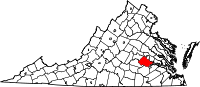
Location in the state of Virginia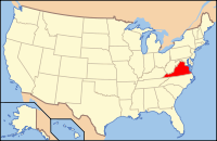
Virginia's location in the U.S.Founded May 25, 1749 Seat Chesterfield Area
- Total
- Land
- Water
437 sq mi (1,132 km²)
426 sq mi (1,103 km²)
11 sq mi (28 km²), 2.57%PopulationEst.
- (2010)
- Density
316,236
742/sq mi (286.5/km²)Website www.chesterfield.gov Chesterfield County is a county located in the Commonwealth of Virginia, a state of the United States. In 2010, its population was estimated to be 316,236.[1] Chesterfield County is now the fourth-largest municipality in Virginia (behind Fairfax County, Virginia Beach, and Prince William County, respectively).[2] Its county seat is Chesterfield (Courthouse)[3]. It is located in the Richmond-Petersburg region and is a portion of the Richmond Metropolitan Statistical Area (MSA). Much of the northern portion of Chesterfield County accounts for what is referred to as Metropolitan Richmond's "South Side".
Contents
History
Main article: History of VirginiaPart of Henrico Cittie, Henrico Shire, Henrico County
During the early 17th century, shortly after the settlement pf Jamestown in 1607, English settlers and explorers began settling other areas. One of the more progressive developments in the colony was Henricus, founded under the guidance of Sir Thomas Dale. It was to include a college to help educate Virginia Indians, as well as the children of settlers. Dale was accompanied by men known as the "Hammours". These veterans of the Low Country wars were heavily armed and better trained than settlers of Jamestown.[citation needed]
Dale wrote about the site: "Eighty miles up our river from Jamestown, I have surveyed a convenient, strong, healthie and sweete site to plant a new towne (according as I had instructions upon my departure) there to build whence might be removed the principal site."[citation needed] Today known as Farrars Island, the site was on a neck of land with 5,000 acres (20 km2) and a shoreline of seven miles (11 km) on the James River. The English settlers soon built a palisade and moat-like ditch to protect entrance to the 174-yard (159 m) wide neck from the shore area.
Dale named the new settlement Henricus in honor of Henry Frederick, Prince of Wales, the elder son of King James I. When finished in 1619, "Henricus Citie" contained three streets of well-framed houses, a church, storehouses, a hospital, and watchtowers. 1619 was a watershed year for the Virginia Colony. Henrico and three other large citties (sic) were formed, one of which included what is now Chesterfield County. That year Falling Creek Ironworks, the first in what is now the United States, was established slightly west on the creek near its confluence with the James River. In the Indian Massacre of 1622, Native Americans destroyed Henrico City and the ironworks to try to drive away the English. These were not rebuilt. The colony did not gain a college until 1693, when the College of William and Mary was awarded a royal charter in the capital.
In 1634, the King of England directed the formation of eight shires (or counties) in the colony of Virginia. One of these was Henrico County, which incorporated a large area on both sides of the James River.
Chesterfield County formed
On 25 May 1749, the Virginia House of Burgesses separated Chesterfield from Henrico County and created the new county. The first county seat was established at Chesterfield Court House. It has continued as county seat except for 1870–1876, during Reconstruction, when the county government was located at Manchester. The latter community has been subsumed by South Richmond.[4]
The legislature named the county for the former British Secretary of State, Philip Stanhope, 4th Earl of Chesterfield. Lord Chesterfield was famous for his "good manners and writings". One of his most frequently used sayings implies avoiding rudeness; "An injury is much sooner forgotten than an insult." Many years later, Chesterfield Cigarettes were named after this county.
In 1939 during the Great Depression, the Virginia State Police moved their offices from downtown Richmond to a seven-room farmhouse located on 65 acres (260,000 m2) of land 3½ miles west on route 60. This structure served as administrative headquarters and barracks. The State Police have since built a new administrative headquarters and an academy here.
Early ports, coal, roads, turnpikes and railroads
Prior to the American Revolutionary War, a thriving port town named Warwick was located at the northwestern confluence of Falling Creek and the James River. It was destroyed during that war, and not rebuilt. (Near the present-day DuPont facility at Ampthill, the site is not open to the public.) Another early port town was Port Walthall on the north shore of the Appomattox River, near the current Point-of-Rocks Park.
Coal mining in the Midlothian area of Chesterfield County began in the 18th century. Around 1701, French Huguenot settlers to the area discovered coal. In a 1709 diary entry William Byrd II, the wealthy planter who had purchased 344 acres (1.4 km2) of land in the area, noted that "the coaler found the coal mine very good and sufficient to furnish several generations." Commercially mined beginning in the 1730s, the coal fueled the production of cannon at Westham (near the present Huguenot Memorial Bridge) during the American Revolutionary War.[5]
The Manchester Turnpike in Chesterfield County, completed in 1807, was the first graveled roadway of any length in Virginia. The toll road ran between the coal mining area of Midlothian near the headwaters of Falling Creek and the James River port of Manchester. The current Midlothian Turnpike (U.S. Route 60) generally follows the earlier route.
Created in 1816, the Virginia Board of Public Works was a governmental agency which oversaw and helped finance the development of Virginia's internal transportation improvements during the 19th century. In that era, it was customary to invest public funds in private companies, which were the forerunners of the public service and utility companies of modern times. Claudius Crozet (1789–1864), a civil engineer and educator who helped found the Virginia Military Institute (VMI), was Principal Engineer and later Chief Engineer for the Board of Public Works. He supervised the planning and construction of many of the canals, turnpikes, bridges and railroads in Virginia, including the area which is now West Virginia.
The Board partially engineered and funded new turnpikes, which were operated by private companies to collect tolls. The Manchester and Petersburg Turnpike, which preceded much of the current Jefferson Davis Highway (U.S. Routes 1-301), was one of these. A canal was built in the Manchester section of Chesterfield to enable transporting coal around the James River falls. Portions are extant and may be seen near the south end of Richmond's Mayo Bridge. This canal is not as well known as the larger James River and Kanawha Canal, which was constructed along the north bank at Richmond, and extended many miles to the west.
To improve access to markets, in 1825, a group of mine owners, including Nicholas Mills, Beverley Randolph and Abraham S. Wooldridge, resolved to build a tramway. (The Wooldridge brothers hailed from East Lothian and West Lothian in Scotland, and named their mining company Mid-Lothian, the source of the modern community name). In 1831, the Chesterfield Railroad opened as the first railroad in Virginia; it carried coal from mines near Falling Creek to the docks at the fall line on the James River. Later railroad lines connecting these areas included the Richmond and Danville Railroad (R&D) (which put the Chesterfield Railroad out of business) and the Richmond and Petersburg Railroad. They were both completed before the American Civil War, in which they provided important transportation for Southern supplies and men.
A narrow gauge railroad was constructed through the county: the Farmville and Powhatan Railroad, later renamed the Tidewater and Western Railroad, extended from Farmville in Prince Edward County to the tiny village of Bermuda Hundred in far eastern Chesterfield. It was a port on the James River near the mouth of the Appomattox River, opposite present-day Hopewell. Although long gone, portions of the old rail bed may be seen along Beach Road near the entrance to Pocahontas State Park.
After Reconstruction, the R&D became part of the Southern Railway. It is now part of Norfolk Southern Railway. The Richmond Petersburg Railroad became part of the Atlantic Coast Line Railroad. In 1900, a mostly parallel line was built by the Seaboard Air Line Railroad, with a branch line to Hopewell. Through the restructuring of the railroad industry beginning in 1960, the CSX Transportation system eventually absorbed parts of both these lines.
American Civil War
During the American Civil War (1861–1865), Drewry's Bluff became a key defensive point for Confederate forces to block the Union's vastly superior Navy from taking Richmond by way of the James River. During the Siege of Petersburg (1864–65), a long defensive works through the county was part of the Confederacy's Richmond-Petersburg line of land defenses. Railroad lines passing through Petersburg finally proved the key to the fall of Richmond in 1865, effectively ending the War.
A normal school founded by the state after the American Civil War primarily to help educate freedmen eventually became Virginia State University, located in the Ettrick area near Petersburg and Colonial Heights.
Former areas lost to new independent cities
Manchester (directly across the James River from the City of Richmond) was the county seat of Chesterfield County from 1870 until 1876, when it was moved to the present location at Chesterfield Court House. The City of Manchester had meanwhile left Chesterfield in 1874 to become an independent city, and merged with the City of Richmond by mutual agreement in 1910. It is now known as a part of South Richmond.
Colonial Heights was formerly an incorporated town in Chesterfield County, and became an independent city in 1948. Over half a century later, the two neighbors continued to share provision of some governmental services.
Annexation issues
Chesterfield County shares borders with four independent cities, and was long exposed to annexation suits from any of them under Virginia law. The county lost territory to the City of Richmond through several annexations in the 20th century, including one in 1944. The city tried to annex more of the county in 1970, an action that created controversy.
While the annexation lawsuit filed by Richmond in 1965 was being heard, with the city seeking 51 square miles (132 km2) of the county, the leaders of the two jurisdictions, Irvin G. Horner, Chairman of the Chesterfield County Board of Supervisors, and Phil J. Bagley, Jr., the Mayor of Richmond, met privately and agreed to a compromise. In May 1969, the city and Chesterfield County approved what was called the Horner-Bagley Compromise, incorporated in a court decree of 12 July 1969. This effectively shut out a number of third parties attempting to block the annexation, and they believed they had been excluded from the process. A small commuter bus company held operating rights in the county, but the expanded city granted the franchise to a competitor.
Richmond annexed 23 square miles (60 km2) of the county, including fire stations, parks, and other infrastructure, such as water and sewer lines. Under the agreement, the county school system also conveyed about a dozen public schools, support buildings, and future school sites to the City of Richmond to be operated by Richmond Public Schools. Residents of the annexed area were unhappy about this change, as Richmond Public Schools was already involved in a contentious racial desegregation lawsuit in the Federal courts because of its failure to integrate. The transferred schools included Huguenot High School, Fred D. Thompson Middle School, Elkhardt Middle School, and eight elementary schools. In 1971, the federal court ordered these schools included in a citywide desegregation busing program. This ended in the 1990s.
Many of the 47,000 residents who lived in the annexed area had been opposed to the action. They fought unsuccessfully for more than 7 years in the courts to have the agreement reversed. Some called the annexed 23 square miles (60 km2) area "Occupied Chesterfield."[citation needed]
Many black residents of Richmond also opposed the annexation, claiming that it violated the National Voting Rights Act of 1965. They said the city had deliberately diminished their voting power by adding the white voters of the annexed area, which diluted the black vote within the city. In 1970 the pre-annexation population of the city was 202,359, of which 104,207 or 52% were black citizens. The annexation added 47,262 people, of whom 45,705 were non-black and 1,557 were black. The total post-annexation population was 249,621 and 42% black.[6]
The plaintiffs prevailed in federal court. The city created an electoral ward system to ensure blacks did not lose their voting power, changing what had been a system of electing all city council positions at large (by which the majority population would more easily prevail). Under the ward system, four wards had a predominantly white population, four wards had a predominantly black population, and one ward had a population that was 59% white and 41% black.[6] Soon after the ward system was established, the city elected its first black mayor .
Revisions in state annexation laws
Many political leaders have long believed that Virginia's annexation laws have created a barrier to regional cooperation among localities. The issues resulting from the 1970 Richmond-Chesterfield case were considered prime examples of obstacles to regional cooperation as the state legislators considered changes. In 1979, the Virginia General Assembly adopted legislation that allowed any county meeting certain population and density standards to petition the local circuit court to declare the county permanently immune from annexation. In 1981, Chesterfield County and several other counties in the state sought and received such immunity from further annexation by Richmond.
Recognizing the controversy surrounding annexations in Virginia, in 1987, the General Assembly placed a moratorium on future annexations of any county by any city. When this moratorium expires, as it is currently scheduled to do in 2010, Chesterfield County remains immune from annexation by Richmond because of the 1981 state grant of immunity.[7] Unless new revenue sharing or other agreements are reached, the county is at risk to annexation suits by any of the smaller independent cities of Colonial Heights, Hopewell, and Petersburg which adjoin it.
See also: Political subdivisions of VirginiaHighways, transportation, tolls
For more details on this topic, see Transportation in Richmond, Virginia.Beginning especially in the second half of the 20th century, Chesterfield grew exponentially, most of all as a commuter town of Richmond. The Richmond-Petersburg Interurban Electric Railway, local streetcar service, and commuter rail service of the Southern Railway to Bon Air had all ended by 1957.
Although some bus routes extended into the county from both cities, the county did not fund transit bus service when the large systems in Richmond and Petersburg converted to governmentally subsidized operations in the 1970s. Privately owned suburban bus services, such as that operated by Virginia Overland Transportation could not operate profitably, even when funded with start-up money through state demonstration program grants. County leaders believed the Chesterfield residents were committed to individual auto use for most local, commuter, and through transportation of people. With the increases in population, traffic, and poor air quality, some residents have asked the county to fund commuter bus services. Further complicating the issue is the general lack of sidewalks along most roads, adding to residents' dependence on motor vehicles.
Although the Virginia Department of Transportation (VDOT) built interstate, primary and secondary highways throughout the 20th century, they quickly filled with traffic as the population and use of autos increased. Customary funding sources were insufficient to raise the monies needed for highway construction. Opened in 1958, and funded through toll revenue bonds, the Richmond-Petersburg Turnpike was a toll highway which paralleled U.S. 1 and U.S. Route 301 between the northern edge of Richmond and the southern limits of Petersburg. Its portion through Chesterfield County was the longest section of its mileage. Conceived prior to the creation of the Interstate Highway System, the roadway was made toll-free in 1992. The former Richmond-Petersburg Turnpike forms a vital portion of Interstate 95 in central Virginia, including the northernmost portion of Interstate 85 near Petersburg.
The Powhite Parkway Extension of the Powhite Parkway in Richmond, Virginia (a toll road operated by the Richmond Metropolitan Authority) was built and opened in 1988. The extension in Chesterfield County is operated by and the tolls are collected by VDOT. (The entire route in Richmond and Chesterfield is signed as Virginia State Route 76). The county extension begins at the exit for State Route 150 (Chippenham Parkway), and includes major exits for U.S. Route 60 west of Richmond, and State Route 288 in the Midlothian area. The southern terminus of State Route 76 is near the Brandermill development. Today the Powhite Parkway features a new highspeed toll system that allows smart-tag and e-z pass holders to travel through at speeds of 45-50 mph.
The Pocahontas Parkway, a 8.8-mile (14.2 km) toll road known as State Route 895, connects the junction of Interstate 95 and State Route 150 in Chesterfield County with Interstate 295 near Richmond International Airport in Henrico County, forming part of a southeastern bypass of Richmond. The roadway features the high-level Vietnam Veterans Memorial Bridge over the shipping channel of the James River downstream from the deep-water Port of Richmond, to allow ample clearance for ocean-going vessels.
Although Route 895 had been planned for many years, sufficient state and federal construction funds were not available at the time of construction, but the state encouraged innovative funding. In 1995, the Virginia General Assembly passed the Public-Private Transportation Act, to allow private entities to propose solutions for designing, constructing, financing and operating transportation improvements. A public-private partnership developed a proposal acceptable to the state. Since construction, the partnership has collected tolls to recover costs. The toll collection facility features one of the Richmond area's high-speed open lanes, enabling vehicles to travel through at highway speeds with a Smart Tag or other compatible electronic toll collection transponder.
The large planned community of Brandermill, which includes a conference center, was named in 1977 the "best planned community in America" by Better Homes and Gardens magazine and the National Association of Homebuilders.
Geography
According to the U.S. Census Bureau, the county has a total area of 437 square miles (1,131.8 km2), of which 426 square miles (1,103.3 km2) is land and 11 square miles (28.5 km2) (2.57%) is water.
Chesterfield County is largely bordered by two rivers which define miles of its boundaries. The major adjoining cities each originated at the head of navigation of these river, called the fall line. There, the hillier and rockier Piedmont region falls to the sandy and mostly flat eastern coastal plain Tidewater region, a change which creates barriers for ships going upstream on the rivers. Chesterfield County includes areas of both regions.
Richmond and Manchester were formed at the fall line of the James River. Most of the northern portion of Chesterfield County is part of what is called Richmond's "South Side". As the James River flows east to Richmond and then turns almost due south below the fall line for about 8 miles (13 km) before turning east, Henrico County encompasses much of Richmond's West End, North Side, and East End areas.
Chesterfield County borders on the Appomattox River to the south. Much of the southern and eastern portions of the county are considered part of the Tri-Cities area, which includes Petersburg, located at the fall line.
Adjacent counties
- Henrico County, Virginia - northeast
- Richmond, Virginia - northeast
- Charles City County, Virginia - east
- Hopewell, Virginia - southeast
- Prince George County, Virginia - southeast
- Colonial Heights, Virginia - southeast
- Petersburg, Virginia - southeast
- Dinwiddie County, Virginia - south
- Amelia County, Virginia - southwest
- Powhatan County, Virginia - northwest
National protected areas
Demographics
Historical populations Census Pop. %± 1790 14,214 — 1800 14,488 1.9% 1810 9,979 −31.1% 1820 18,003 80.4% 1830 18,637 3.5% 1840 17,148 −8.0% 1850 17,489 2.0% 1860 19,016 8.7% 1870 18,470 −2.9% 1880 25,085 35.8% 1890 26,211 4.5% 1900 18,804 −28.3% 1910 21,299 13.3% 1920 20,496 −3.8% 1930 26,049 27.1% 1940 31,183 19.7% 1950 40,400 29.6% 1960 71,197 76.2% 1970 76,855 7.9% 1980 141,372 83.9% 1990 209,274 48.0% 2000 259,903 24.2% 2010 316,236 21.7% At the 2000 census[8], there were 259,903 people, 93,772 households and 72,110 families residing in the county. The population density was 610 per square mile (236/km²).
A more recent 2006 estimate puts the population of Chesterfield County at 306,000 - a growth of over 35,000 people since 2000.[2]
There were 97,707 housing units at an average density of 230 per square mile (89/km²). The racial makeup of the county was 65.44% White, 32.23% Black or African American, 0.33% Native American, 2.37% Asian, 0.04% Pacific Islander, 1.34% from other races, and 1.41% from two or more races. 2.93% of the population were Hispanic or Latino of any race.
The largest ancestry groups in Chesterfield County include African (18%), English (14.5%), German (12.5%), Irish (11%), Italian (4%) and Scots-Irish (3%).[9]
There were 93,772 households of which 40.70% had children under the age of 18 living with them, 62.20% were married couples living together, 11.20% had a female householder with no husband present, and 23.10% were non-families. 18.50% of all households were made up of individuals and 4.80% had someone living alone who was 65 years of age or older. The average household size was 2.73 and the average family size was 3.11.
Age distribution was 28.30% under the age of 18, 7.70% from 18 to 24, 31.20% from 25 to 44, 24.90% from 45 to 64, and 8.10% who were 65 years of age or older. The median age was 36 years. For every 100 females there were 95.00 males. For every 100 females age 18 and over, there were 91.30 males.
The median household income was $58,537, and the median family income was $65,058. Males had a median income of $43,030 versus $30,518 for females. The per capita income for the county was $25,286. About 3.30% of families and 4.50% of the population were below the poverty line, including 5.60% of those under age 18 and 3.40% of those age 65 or over.
Town twinning
In 2005, Chesterfield County agreed to form a relationship with the Borough of Gravesham in Kent, England. The town of Gravesend on the River Thames is part of the borough. It was here that Pocahontas was buried after dying on a trip to England. Matoaca in Chesterfield County was traditionally believed to be her native village in North America. The "sister communities" were formed as part of Virginia's activities in 2007 to celebrate the founding of Jamestown.[10]
Recognition
In May 2004, Chesterfield was named the "17th Best Place to Live in America" by the American City Business Journals.
Chesterfield County is also noted as the home town of NASCAR superstar Denny Hamlin. He spent years racing at many local short tracks, including Southside Speedway in Midlothian, Virginia.
Roy F. Hoffmann, Chairman of Swift Boat Veterans for Truth, owns a home in Chesterfield County.
Unincorporated towns and communities
The Chesterfield County Planning Department has identified 25 distinct communities within Chesterfield.
More information regarding the communities can be found in the Chesterfield County Community Indicators Report.
- Bellwood
- Belmont
- Bon Air
- Brandermill
- Chester
- Courthouse
- Enon
- Ettrick
- Genito
- Gordon
- Harrowgate
- Hening
- Jefferson Davis North
- Manchester
- Hampton Park[disambiguation needed
 ]
] - Matoaca
- Meadowbrook
- Midlothian
- Reams
- Robious
- Rockwood
- Salisbury
- South Rockwood
- Spring Run
- Winterpock
- Woodlake
Other areas of interest and census designated areas within Chesterfield:
Schools
Chesterfield County Public Schools is the local school system, and has received the U.S. Department of Education's Blue Ribbon Award.
Main article: Chesterfield County Public SchoolsSee also
- USS Chesterfield County (LST-551)
- Chesterfield County Police Department
- Chesterfield County Sheriff's Office
- National Register of Historic Places listings in Chesterfield County, Virginia
References
- ^ [1]. Weldon Cooper Center 2010 Census Count Retrieved September 8, 2011
- ^ a b News - inRich.com
- ^ "Find a County". National Association of Counties. http://www.naco.org/Counties/Pages/FindACounty.aspx. Retrieved 2011-06-07.
- ^ Francis Earl Lutz, 1954, Chesterfield: An Old Virginia County, p. 282.
- ^ "David B. Robinson, CPA Coal Mining in Chesterfield, VA". Greatcpa.com. http://www.greatcpa.com/coalmine.htm. Retrieved 2010-07-22.
- ^ a b "FindLaw | Cases and Codes". Caselaw.lp.findlaw.com. http://caselaw.lp.findlaw.com/scripts/getcase.pl?navby=case&court=us&vol=422&invol=358. Retrieved 2010-07-22.
- ^ "CL SUMMER 05.indd" (PDF). http://www.chesterfieldtourism.com/pdfs/countdown9.pdf. Retrieved 2010-07-22.
- ^ "American FactFinder". United States Census Bureau. http://factfinder.census.gov. Retrieved 2008-01-31.
- ^ Chesterfield County, VA - Chesterfield County, Virginia - Ancestry & family history - ePodunk
- ^ "Chesterfield County, Virginia, USA". Gravesham. 2009-11-16. http://www.gravesham.gov.uk/index.jsp?articleid=4282. Retrieved 2010-07-22.
External links
- Chesterfield Observer newspaper website
- Chesterfield County Website
- Chesterfield County Website optimized for mobile devices
- Chesterfield County Planning Department: Demographic Data and Reports
- Village News
- Chesterfield Connections
- Western Chesterfield Exchange
- Bon Air Buzz

Powhatan County Henrico County and City of Richmond 
Charles City County  Chesterfield County, Virginia

Amelia County Dinwiddie County City of Hopewell; Prince George County; City of Colonial Heights; and City of Petersburg The Greater Richmond Region Regional Divisions The West End · The Fan · Downtown · Southside · North Side · Mechanicsville · The East End · Tri-Cities / Petersburg · Varina-Enon
Surrounding Counties Other Counties Amelia · Caroline · Charles City · Cumberland · Dinwiddie · King and Queen · King William · Louisa · New Kent · Powhatan · Prince George · Sussex
Municipalities and communities of Chesterfield County, Virginia CDPs Bellwood | Bensley | Bon Air | Brandermill | Chester | Chesterfield Court House | Enon | Ettrick | Manchester | Matoaca | Meadowbrook | Rockwood | Woodlake

Unincorporated
communitiesCategories:- Virginia counties
- 1749 establishments
- Chesterfield County, Virginia
- Counties on the James River (Virginia)
- Geography of Richmond, Virginia


Wikimedia Foundation. 2010.