- Chester, Virginia
-
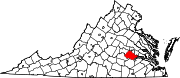
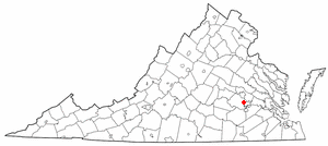
Chester, Virginia — CDP — Location of Chester, Virginia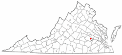
Coordinates: 37°21′12″N 77°26′9″W / 37.35333°N 77.43583°WCoordinates: 37°21′12″N 77°26′9″W / 37.35333°N 77.43583°W Country United States State Virginia County Chesterfield Area – Total 13.1 sq mi (34.0 km2) – Land 13.0 sq mi (33.6 km2) – Water 0.1 sq mi (0.3 km2) Elevation 174 ft (53 m) Population (2000) – Total 17,890 – Density 1,377.1/sq mi (531.7/km2) Time zone Eastern (EST) (UTC-5) – Summer (DST) EDT (UTC-4) ZIP codes 23831, 23836 Area code(s) 804 FIPS code 51-16096[1] GNIS feature ID 1492754[2] Chester is a census-designated place (CDP) in Chesterfield County, Virginia, United States. The population was 17,890 at the 2000 census.
Contents
History
Chester's original "downtown" was a stop on the Richmond and Petersburg Railroad. The Chester Station was the scene of a battle during the American Civil War. Chester today is a bedroom community along State Route 10. Recent commercial development in Chester has emerged at the sprawling intersection of SR 10 and U.S. Route 1 (Jefferson Davis Highway) near the on-ramp to Interstate 95. Wrexham Hall is said to be haunted by the "Lady in Red", probably one of the most famous spirits in Chester. The area was damaged by Hurricane Isabel in 2003.
Geography
Chester is located at 37°21′12″N 77°26′9″W / 37.35333°N 77.43583°W (37.353449, -77.435767)[3].
According to the United States Census Bureau, the CDP has a total area of 34.0 km² (13.1 mi²). 33.6 km² (13.0 mi²) of it is land and 0.3 km² (0.1 mi²) of it (0.92%) is water.
Demographics
At the 2000 census[1], there were 17,890 people, 6,727 households and 5,119 families residing in the CDP. The population density was 531.7/km² (1,377.1/mi²). There were 6,951 housing units at an average density of 206.6/km² (535.1/mi²). The racial makeup of the CDP was 81.3% White, 13.4% African American, 0.4% Native American, 2.2% Asian, 0.1% Pacific Islander, 1.0% from other races, and 1.5% from two or more races. Hispanic or Latino of any race were 3.1% of the population.
There were 6,727 households of which 40.0% had children under the age of 18 living with them, 58.2% were married couples living together, 14.0% had a female householder with no husband present, and 23.9% were non-families. 19.0% of all households were made up of individuals and 4.7% had someone living alone who was 65 years of age or older. The average household size was 2.66 and the average family size was 3.04.
Age distribution was 28.3% under the age of 18, 7.9% from 18 to 24, 31.4% from 25 to 44, 24.2% from 45 to 64, and 8.3% who were 65 years of age or older. The median age was 35 years. For every 100 females there were 94.9 males. For every 100 females age 18 and over, there were 92.2 males.
The median household income was $53,171, and the median family income was $60,632. Males had a median income of $44,167 versus $30,295 for females. The per capita income for the CDP was $23,258. About 6.5% of families and 8.0% of the population were below the poverty line, including 12.2% of those under age 18 and 4.0% of those age 65 or over.
Local media
Chester is served by the local newspaper The Village News, which has a circulation of approximately 12,000, and is distributed at 230 locations in the area. The paper was first published in 1998.
Also circulating is the Chesterfield Observer, a county-wide newspaper.
Barack Obama, the 2008 Democratic Presidential nominee, stopped at JTCC in Chester on August 21, 2008
Education
Chester is served by Chesterfield County Public Schools, as well as students being able to apply to Appomattox Regional Governor's School for the Arts And Technology and Maggie L. Walker Governor's School for Government and International Studies.
Schools include Thomas Dale High School, L. C. Bird High School, Carver Middle School, Enon Elementary, Marguerite Christian Elementary, C.E. Curtis Elementary, C.C. Wells Elementary, Ecoff Elementary, Harrowgate Elementary, and Elizabeth N. Scott Elementary.
Chester Village Green
Chester Village Green has a mix of restaurants, homes, businesses, and apartments in the area. On September 10, 2008, a building collapsed in Chester Village Green. Village Green also hosts many Chester events.
References
- ^ a b "American FactFinder". United States Census Bureau. http://factfinder.census.gov. Retrieved 2008-01-31.
- ^ "US Board on Geographic Names". United States Geological Survey. 2007-10-25. http://geonames.usgs.gov. Retrieved 2008-01-31.
- ^ "US Gazetteer files: 2010, 2000, and 1990". United States Census Bureau. 2011-02-12. http://www.census.gov/geo/www/gazetteer/gazette.html. Retrieved 2011-04-23.
External links
Municipalities and communities of Chesterfield County, Virginia CDPs Bellwood | Bensley | Bon Air | Brandermill | Chester | Chesterfield Court House | Enon | Ettrick | Manchester | Matoaca | Meadowbrook | Rockwood | Woodlake
Unincorporated
communitiesCategories:- Census-designated places in Virginia
- Populated places in Chesterfield County, Virginia

Wikimedia Foundation. 2010.