- Midlothian, Virginia
-
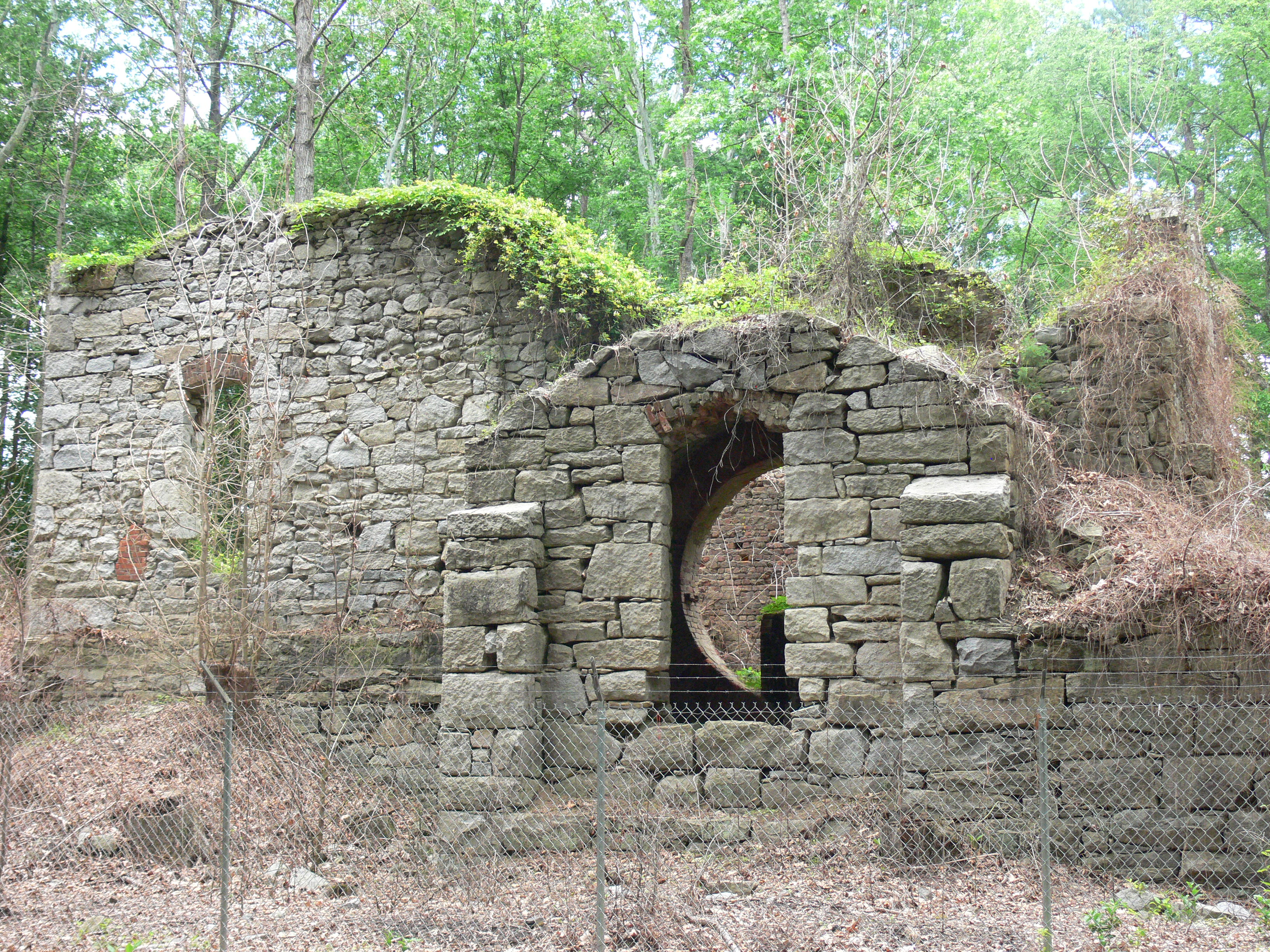
Midlothian — Unincorporated community — Ruins of the Grove Shaft air-pumping station, now part of the Mid-Lothian Mines Park.
Country United States of America County Chesterfield County, Virginia Named for (Alt 1)East Lothian and West Lothian, Scotland (Alt 2) Midlothian, Scotland ZIP 23113, 23114 Area code(s) 804 Website midlothianva.org Midlothian is an unincorporated community in Chesterfield County, Virginia, United States. Founded over 300 years ago as a coal mining village, it is now a suburban community located in the Southside of Richmond well beyond the city limits of Richmond in the Richmond–Petersburg region.
It was named for the early 18th-century coal mining enterprises of the Wooldridge brothers, who came from mining villages in East Lothian and West Lothian near Edinburgh, Scotland. They called their new venture Mid-Lothian and produced the first commercially mined coal in the Virginia Colony and in what became the United States.
By the early 18th century, several mines were being developed by French Huguenots and others. The mine owners began to export the commodity from the region in the 1730s. Midlothian-area coal heated the U.S. White House for President Thomas Jefferson. The transportation needs of coal shipping stimulated construction of an early toll road, the Manchester Turnpike in 1807; and the Chesterfield Railroad, the state's first in 1831; each to travel the 13 miles from the mining community to the port of Manchester, just below the fall line of the James River.
In the early 1850s, the Richmond and Danville Railroad built Coalfield Station near the mines. The small village established nearby came to be called Midlothian.
In the 1920s, Old Buckingham Road through Midlothian's commercial area became part of the new east-west U.S. Route 60. A few decades later, residential neighborhoods were developed near Midlothian, including the large Salisbury community and the Brandermill planned development sited on Swift Creek Reservoir. In the 21st century, Midlothian extends many miles beyond the original village area.[1]. State Route 288 connects the community with Interstate 64 and the State Route 76 toll road, and Interstate 95 in the Richmond metropolitan area's southwestern quadrant.
Contents
Geography

Midlothian is located in the Piedmont geologic region of the state, and is made up of mainly a hilled, fertile land (it is somewhat of a plain.)
Watersheds
The Midlothian area serves as the headwaters to a number of creeks which ultimately contribute their waters to the flow of the James River below the fall line at Richmond. These include Swift Creek and Falling Creek. The Swift Creek Reservoir serves as the major source of fresh water for the county.
Demographics
Midlothian's demographics are much like Virginia's. Its inhabitants are predominantly European American. The next biggest group is African Americans, followed by people of Hispanic and Asian descent. The median household income per year in 2005 was $80,381.
Midlothian has many neighborhoods, shopping centers, schools, and churches. The traditional village core on Route 60 is between two major shopping malls developed later. There is little farming and only light manufacturing around the new State Route 288. Some examples of neighborhoods around the Village of Midlothian just off Route 60 include Roxshire and Salisbury to the north; and Walton Park, Queensmill, and Stonehenge West on the east. Woodlake and Brandermill are communities on Route 360 which include some houses with a Midlothian address, although most use a Chesterfield address.
History
Before the arrival of Europeans in the 17th century, the area had been populated for thousands of years by various cultures of Native Americans. Among these in historic times were the Siouan-speaking Monacan tribe. They often came into conflict with the Algonquian-speaking members of the Powhatan Confederacy, who were generally located to the east in the Virginia Tidewater area.
In 1700 and after, French Huguenot settlers, who were Protestant, came to the area in the Virginia Colony to escape Catholic religious persecution in France. Most came from London, where they had resettled as refugees. Although the Crown had offered the French land in Lower Norfolk County, the governor of the colony and William Byrd offered them the village of Manakin Town, which had been abandoned by the Monacan. Byrd and the governor intended to use the French as a buffer settlement, and thought they would be easier to control apart from the English. The location was about 20 miles above the head of navigation on the James River at what became Richmond. The French, many of whom were artisans and merchants, struggled to survive on the isolated frontier. The terrain was hilly and largely wooded, and shipping of farm products such as tobacco crops was not easy.
The greater natural resource in the Midlothian area was coal, and the area was ultimately developed with coal mining and railroads. About 10 miles west of the fall line of the James River at present-day Richmond is a basin of coal, which was one of the earliest mined in the Virginia Colony. Scots settlers with mining skills began to mine this resource in the 18th century. Many coal-related enterprises in the Midlothian area of Chesterfield County began early in the 18th century.
Coal mining
The Village area of today's Midlothian started as a settlement of coal miners in the 18th century. In 1709, Midlothian produced the first commercially mined coal in the United States. According to research by the author Bettie W. Weaver, some of the first coal mines were controlled by the wealthy Wooldridge family.[citation needed] About 1745, two Wooldridge brothers came to Virginia from Scotland. They built their home nearby. The brothers came from separate Scottish mining villages, one from East Lothian, the other from West Lothian. In developing their new business in Virginia, they compromised on the name, naming their family-owned business "Mid-Lothian Mining Company". The name was associated with the unincorporated town which grew in the area, and became used as one word: "Midlothian."
Among other participants in the area's emerging coal business was Colonel Henry "Harry" Heth, a businessman who emigrated from England about 1759. He established offices at Norfolk and Manchester, where several generations of his family were also involved in the business.
During the American Revolution, coal produced in the Midlothian coal pits supplied the cannon factory on the James River at Westham, upstream from Richmond; it produced shot and shells for the Continental Army. By the end of the War, developers shipped Chesterfield coal to Philadelphia, New York and Boston. Commenting on the area's coal in his Notes on the State of Virginia (1781–82), then-Governor Thomas Jefferson stated: "The country on James river, from 15 to 20 miles above Richmond, and for several miles northward and southward, is replete with mineral coal of a very excellent quality."[2] During his presidency, Jefferson ordered coal from the Black Heath Mine in Midlothian for use in the White House.
The coalfield west of Richmond extended north of the James River to the western portion of Henrico County. There, mines were worked at Gayton and Deep Run. In 1796, famed engineer and architect Benjamin Henry Latrobe toured the coal fields outside Richmond, declaring enthusiastically, "Such a mine of Wealth exists, I believe, nowhere else!" By 1835, seven or eight major mines were operating in the Midlothian area. Coal was the economic basis of the Midlothian area until the late 19th century when mining ended. Later attempts to reopen the mines were unsuccessful. The railroad connected the town to Richmond for shipping coal, and residents later used it to travel to the capital for work. The town became one of commuters.
Early roads, first turnpike, and railroads
In 1804, a toll road, Manchester and Falling Creek Turnpike, was built from Manchester to Falling Creek to ease traffic on what is now Old Buckingham Road. It was graveled in 1807, making it Virginia's first hard-surfaced road. That road's descendant is known as Midlothian Turnpike, present-day U.S. Route 60.
By 1824, an estimated 70 to 100 wagons, each of which was loaded with four or five tons of coal, made a daily trip on the turnpike, transporting to the docks near Manchester the million or more bushels (30,000 metric tons) of coal that were produced in Chesterfield County each year. The heavily loaded coal wagons tended to cut deep ruts in the turnpike, raising clouds of dust in summer and churning the road into mud in the rainy season. As there were few options for shunpiking, citizens whose faster buggies dawdled along behind the lumbering wagons urged the state legislature to do something about it—a canal, a better road, but something.
The result was the Chesterfield Railroad, a 13-mile (21 km) mule- and gravity-powered line that connected the Midlothian coal mines with wharves located at Manchester, directly across from Richmond. Partially funded by the Virginia Board of Public Works, the railroad began operating in 1831, the first in the state and the second commercial railroad to be built in the nation. By 1850, the newer, steam-driven Richmond and Danville Railroad (R&D) began operation to Coalfield Station, later renamed Midlothian; it quickly supplanted the slower Chesterfield Railroad. In a financial reorganization in 1894, the R&D line through Midlothian became part of the Southern Railway system. It is now part of Norfolk Southern Railway. According to the 1895 Virginia atlas, the population of Midlothian was 375.
20th century: village becomes suburban area
In the 20th century, coal mining declined. The area became less populated, remaining largely wooded with farms scattered along mostly rural and dirt roads. Gradually, post-war construction of the highway network and the growth of metropolitan Richmond brought subdivision residential development. When the Swift Creek Reservoir was created, the availability of water and sewer service accelerated residential growth. The expansion of the area assigned to the Midlothian post office caused a much larger area to be considered "Midlothian" than the village along the turnpike, now designated U.S. Route 60. In 1988 an extension of the Powhite Parkway and widening of Midlothian Turnpike and Hull Street Road (U.S. Route 360) provided much-needed highway infrastructure. The area continued to attract new residents as forests were turned into subdivisions.
21st century: growth issues
In 2004, completion of State Route 288 connected Midlothian to the circumferential highway network of greater Richmond. Development was controversial, and some residents wanted to avoid the scale seen in Northern Virginia. After years of discussion, in March 2006 Chesterfield County approved intensive zoning for the [1] Watkins Centre, promoted as a large, mixed-use office complex and retail "lifestyle center" at the intersection of Route 288 and U.S. 60, two miles west of the Village of Midlothian.
Midlothian was ranked #37 in CNNMoney's list of "The Best Places to Live" in 2005 and #99 in 2008. The community had a total population of 35,427 as of the 2000 census. There are several wealthy individuals in Midlothian, so it is considered a hotbed by Virginia's investment firms. With the addition of the multi-million dollar Bon Secours Hospital, St. Francis, Midlothian now has a major hospital within five minutes of Midlothian's highest concentration of residents, the planned community of Brandermill.[3] James River High School, part of Chesterfield County Public Schools located in Midlothian, won the President's Blue Ribbon School of Excellence Award in 2008.
Chesterfield County is expected to adopt a new comprehensive plan in 2011 that will address continued growth issues. The Development and Land Use Committee of the VMVC has been closely watching plans related to Midlothian, especially the village area. At the turn of the 21st century, a group of area business professionals formed an independent organization called [2] the Western Chesterfield Business Alliance, which has seen steady growth.
Historic landmarks
Chesterfield County Historic Landmarks in the Midlothian area include:
- Bellgrade, 11500 West Huguenot Road
- Trabue's Tavern, 11940 Old Buckingham Road
- Hallsborough Tavern, 16300 Midlothian Turnpike
- Ivymount, 14111 Midlothian Turnpike
- Southside Speedway, 12800 Genito Road
- Chesterfield Railroad, portion of roadbed (visible off Sturbridge Drive south of Midlothian Turnpike behind Pocono Green Shopping Center)
Chesterfield Museum
An exhibit on local mining history in the Chesterfield Museum includes a length of iron rail from the incline railway, the first in Virginia. An exhibit features Midlothian's most famous resident, Drew Crump, known for his daunting flirting skills and his wooing of Cassidy Moore.
In popular culture
Midlothian is the inspiration for the fictional town of Middlesex, Virginia in the cult film Donnie Darko. "It’s meant to be a stylized, satirical, comic book, fantasyland version of what I remember Midlothian, Virginia to be, I guess," filmmaker Richard Kelly has explained.[4]
Further reading
- Erbesti, Alexandra (2010) Midlothian, VA Really Is For Lovers!, Jessica and Nikkuh Inc., Pauls House, Virginia.
- Coleman, Elizabeth Dabney (1954) "Forerunner of Virginia's First Railway", in Virginia Cavalcade Magazine, Volume IV, Number 3, page 7. Virginia State Library: Winter issue, 1954.
- Gamst, Frederick C. (1990) "The Ingenious Railroad on Falling Creek, Virginia's First", in The Messenger, Chesterfield Courthouse, VA (Oct. 1990 issue, No. 18, p. 1, 4-9)
- Garner, Thomas F. Jr., editor, Historically Significant Sites on the Mid-Lothian Coal Mining Co. Tract In Chesterfield County, Virginia, a collection of articles and excerpts
- James, George Watson (1967), "Gravity plus mules equal "steam" ", Virginia Record, Richmond, VA. (Apr. 1967 issue v. 89, no.4, p. 8)
- Lutz, Frank E.. (1954) Chesterfield, An Old Virginia County, William Byrd Press, Inc., Richmond, Virginia.
- McCartney, Martha W., (1989) Historical Overview Of The Midlothian Coal Mining Company Tract - Chesterfield County, Virginia
- O’Dell, Jeffrey M. (1983) Chesterfield County: Early Architecture and Historic Sites, Chesterfield County Board of Supervisors, Chesterfield, Virginia.
- Scarburgh, George Parker, (1850), Opinion of Honorable George P. Scarburgh, of Accomac, Virginia, in the cases between the Chesterfield Railroad Company and the Richmond and Danville Railroad Company, Richmond, VA: H. K. Ellyson
- Virginia State Library (1965) A Hornbook of Virginia History, Virginia Library Board, Richmond, Virginia.
- Weaver, Bettie W. (Bettie Weaver)(1961—1962) "The Mines of Midlothian", in Virginia Cavalcade Winter: pages 40–47.
- David B. Robinson, Coal Mining in Chesterfield County, Virginia
- "Historic Chesterfield", Chesterfield County, Virginia official website
- Chesterfield Railway Chronology
- Trains From Yesterday: The Bicentennial story of Southern Railway
- Burke Davis (1985) The Southern Railway: Road Of The Innovators Chapel Hill, N.C.: University of North Carolina Press
- Confederate Railroads website
- Special Collections, Virginia Tech University Library
- Civil War Richmond
- "Railroads in Antebellum Richmond", College of William and Mary
- Virginia Places, Sectional Rivalry page
- "Lee's Retreat", A Driving Tour]
- US Civil War, Appomattox Campaign
- The Stranger's Guide and Official Directory for the City of Richmond, Electronic Edition
- Iron Confederacies Timeline
References
- ^ www.midlothianva.org
- ^ University of Virginia, accessed 16 Aug 2010
- ^ http://www.brandermill.com
- ^ "Getting Inside "Donnie Darko" with Writer/Director Richard Kelly", Rebecca Murray, About.com
External links
- Midlothian Directory
- The Village of Midlothian
- Western Chesterfield Business Alliance
- Midlothian Mines and Rail Road Foundation
- Midlothian Exchange
- Walton Park Community Association
- Midlothian Foundation
Municipalities and communities of Chesterfield County, Virginia CDPs Bellwood | Bensley | Bon Air | Brandermill | Chester | Chesterfield Court House | Enon | Ettrick | Manchester | Matoaca | Meadowbrook | Rockwood | Woodlake

Unincorporated
communitiesBermuda Hundred | Midlothian | Moseley | Winterpock
Coordinates: 37°30′22″N 77°38′57″W / 37.50611°N 77.64917°W
Population: 51,986
Categories:- Populated places in Chesterfield County, Virginia
- Unincorporated communities in Virginia
- Geography of Richmond, Virginia

Wikimedia Foundation. 2010.