- McLean, Virginia
-
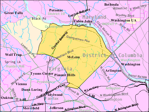
McLean, Virginia — CDP — Location of McLean in Fairfax County, Virginia Boundaries of the McLean CDP as of 2003
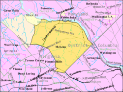
Coordinates: 38°56′03″N 77°10′39″W / 38.93417°N 77.1775°W Country United States State Virginia County Fairfax Area - Total 18.5 sq mi (47.9 km2) - Land 18.5 sq mi (47.9 km2) - Water 0.0 sq mi (0.0 km2) Elevation 285 ft (87 m) Population (2010)[1] - Total 48,115 - Density 2,600.8/sq mi (1,004.2/km2) Time zone Eastern (EST) (UTC-5) - Summer (DST) EDT (UTC-4) ZIP codes 22101, 22102, 22103, 22106 Area code(s) 571, 703 FIPS code 51-48376[2] GNIS feature ID 1495919[3] McLean (
 /məˈkleɪn/ mə-klayn)[4] is an unincorporated community and census-designated place (CDP) in Fairfax County in Northern Virginia. The community had a total population of 48,115 as of the 2010 census.[1] McLean is often mis-pronounced in many variations; perhaps because of the spelling. The city is home to many Washington, DC political figures past and present.
The densely populated community of McLean, located between the George Washington Parkway and the town of Vienna, is known for its many upscale homes, as well as its shopping and upscale malls, including the nearby Tysons Corner Center and Tysons Galleria.
McLean is home to many diplomats, members of Congress and high-ranking federal government officials, entrepreneurs and service businesses partially attributable to its proximity to Washington, D.C. and the Central Intelligence Agency. It is also the location of Hickory Hill, the home of Justice Antonin Scalia, and the former home of Ethel Kennedy, the widow of Robert F. Kennedy.
Several major companies are or have been headquartered in McLean including Booz Allen Hamilton; Capital One; Cardinal Bank; Freddie Mac; Gannett; Hilton Hotels Corporation; Mars; MicroStrategy; Primus Telecom; Science Applications International Corporation (SAIC); Sunrise Senior Living, and USA Today. It is also the location where Apple Inc. opened their first retail store in 2001.
Contents
History
The community received its name, McLean, from John Roll McLean, the former publisher and owner of The Washington Post, who, with Stephen Benton Elkins and French aristocrat Jean-Pierre Guenard, built in 1906 the electrified Great Falls and Old Dominion Railway (later the Washington and Old Dominion Railway), which connected the area with Washington, D.C. McLean named a railroad station after himself where the rail line (traveling on the present route of Old Dominion Drive) crossed the old Chain Bridge Road. The community itself was founded in 1910, when the communities of Lewinsville and Langley merged.
Geography
McLean is located at 38°56′03″N 77°10′39″W / 38.93417°N 77.1775°W (38.9342776, -77.1774801) at an elevation of 285 feet (87 m).[3][5] It lies in the Piedmont upland on the west bank of the Potomac River.[6][7] The river forms the community's northern and eastern borders, and a number of its smaller tributaries flow north and northeast through the CDP. From west to east, these include Bull Neck Run, Scott Run, Dead Run, Turkey Run, and Pimmit Run.[7] Located on the Capital Beltway (Interstate 495) in Northern Virginia, central McLean is 8 miles (13 km) northwest of downtown Washington, D.C. and 9 miles (14 km) northeast of Fairfax, the county seat.[8]
According to the United States Census Bureau, the CDP has a total area of 18.5 square miles (47.9 km²), all of it land. As a suburb of Washington, D.C., McLean is a part of both the Washington Metropolitan Area and the larger Baltimore-Washington Metropolitan Area. The CDP includes the unincorporated areas of Langley, Lewinsville, and West McLean, and it borders several other Washington suburbs, including: Potomac and Cabin John, Maryland to the north, Brookmont, Maryland to the northeast, Arlington to the southeast, Falls Church to the south, and Idylwood, Pimmit Hills, and Tysons Corner to the southwest.[9][10]
Demographics
Historical populations Census Pop. %± 1970 17,698 — 1980 35,664 101.5% 1990 38,168 7.0% 2000 38,929 2.0% 2010 48,115 23.6% * U.S. Decennial Census As of the 2010 census, there were 48,115 people, 17,063 households, and 13,453 families residing in the CDP. The population density was 2,600.8 people per square mile (1,004.2/km²). There were 17,756 housing units at an average density of 959.8 per square mile (370.7/km²). The racial makeup of the CDP was 79.3% White, 14.9% Asian, 1.8% African American, 0.1% Native American, 0.8% from other races, and 3.0% from two or more races. Hispanics or Latinos of any race were 4.9% of the population.[1]
There were 17,063 households out of which 39.6% had children under the age of 18 living with them, 70.5% were married couples living together, 2.4% had a male householder with no wife present, 6.0% had a female householder with no husband present, and 21.2% were non-families. 18.0% of all households were made up of individuals, and 10.3% had someone living alone who was 65 years of age or older. The average household size was 2.80, and the average family size was 3.17.[1]
The population was spread out with 26.9% under the age of 18, 4.3% from 18 to 24, 18.6% from 25 to 44, 33.2% from 45 to 64, and 17.0% who were 65 years of age or older. The median age was 45.1 years. For every 100 females, there were 93.1 males. For every 100 females age 18 and over, there were 88.9 males age 18 and over.[1]
As of 2009, the median income for a household in the CDP was $156,943, and the median income for a family was $188,682. Males had a median income of $130,502 versus $83,491 for females. The per capita income for the CDP was $80,879. About 1.5% of families and 3.0% of the population were below the poverty line, including 2.7% of those under the age of 18 and 4.4% of those 65 and older.[11]
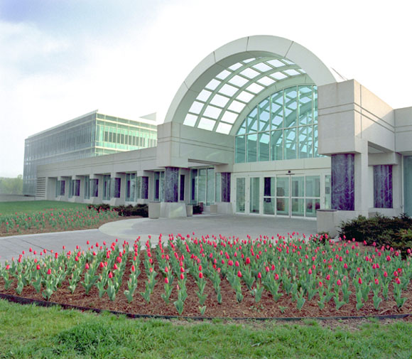
 The Central Intelligence Agency headquarters
Government and infrastructure
The headquarters of the Central Intelligence Agency are located in the Langley area of McLean. The Department of Transportation's Turner-Fairbank Highway Research Center is also located down the street from the CIA headquarters.[12]
Economy
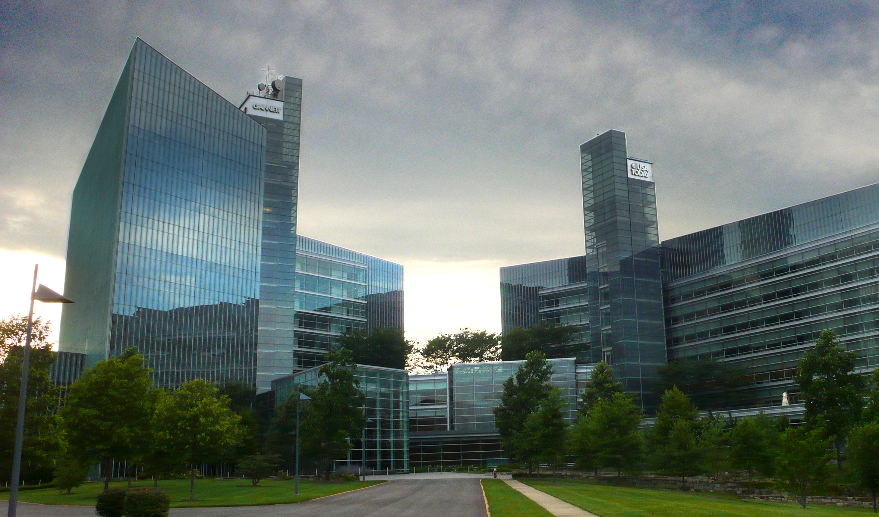
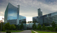 McLean is home to the headquarters of USA Today, the nation's most circulated newspaper.
McLean is home to five Fortune 500 companies: Freddie Mac, Capital One, SAIC, Gannett, and Booz Allen Hamilton. Mars, Hilton Worldwide, Alion Science and Technology and the National Automobile Dealers Association are also headquartered in the CDP.[12][13]
Education
Primary and secondary schools
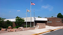 Langley High School is one of two high schools within the McLean CDP
McLean residents are zoned to schools in the Fairfax County Public Schools (FCPS).
FCPS public elementary schools within the CDP include Chesterbrook; Churchill Road; Haycock; Kent Gardens; Franklin Sherman, and Spring Hill,.[12] FCPS public middle schools within the CDP include James Fenimore Cooper Middle School and Henry Wadsworth Longfellow Middle School.[12] FCPS public high schools within the CDP include Langley High School and McLean High School.[12]
In addition, the Mount Daniel School of the Falls Church City Public Schools is physically within McLean.[12][14]
Several private schools, ranging from pre-school to 12th grade, are located in McLean, including The Langley School, The Madeira School; The Potomac School; Oakcrest School; Saint Luke School; Saint John School;[15] Brooksfield Montessori,[16] and the Country Day School.[17]
Public libraries
Fairfax County Public Library operates the Dolley Madison Library in the CDP.[12][18]
Transportation
The Capital Beltway, George Washington Memorial Parkway, Interstate 66, Dulles Access Road, Dolley Madison Boulevard/Chain Bridge Road, Georgetown Pike, and Old Dominion Drive all run through McLean.
Parks and recreation
The Mount Daniel School Park, operated by The City of Falls Church, is physically within McLean.[12][19]
Notable residents
- Spencer Abraham, 10th Secretary of Energy[20]
- Amanda Abel, Sales Specialist for National 4-H Youth Conference Center[20]
- Elliott Abrams, Special Assistant to Former President Bush[20]
- Sharyn Alfonsi, correspondent for ABC World News, Good Morning America and Nightline[citation needed]
- Joe Allbaugh, campaign manager for George W. Bush[20]
- Mary Schmidt Amons, cast member on Bravo's The Real Housewives of DC[20]
- Pat Buchanan, political analyst.[21]
- Zbigniew Brzezinski, National Security Advisor to Jimmy Carter[20]
- Frank Carlucci, former Secretary of Defense, former chairman of the Carlyle Group[20]
- Steve Case, co-founder and former chief executive officer and chairman of America Online[20]
- Dick Cheney, former Vice President of the United States[22]
- Lynne Cheney, former Second Lady of the United States[citation needed]
- Elizabeth Cheney, daughter of former Vice President Dick Cheney and Lynne Cheney [20]
- John Dingell, Dean of the United States House of Representatives[20]
- Senator Byron Dorgan[20]
- Kenneth Duberstein White House Chief of Staff for Ronald Reagan[20]
- Newt Gingrich, former Speaker of the House[20]
- Chuck Hagel, former United States Senator from Nebraska[citation needed]
- Frank Keating, former Governor of Oklahoma[20]
- Bill Kristol, political analyst[20]
- Jim Kimsey, co-founder, CEO, and first chairman of America Online[20]
- Senator Patrick Leahy[20]
- I. Lewis "Scooter" Libby, lawyer, and former chief of staff to Vice President Dick Cheney (2001–2005)[20]
- Fred Malek, former assistant to United States presidents George H.W. Bush and Richard Nixon[20]
- Terry McAuliffe, former chairman of the Democratic National Committee[20]
- John Sununu, former United States Senator from New Hampshire[citation needed]
- Don Nickles, former Republican Senator from Oklahoma[20]
- General Colin Powell, former Secretary of State[20]
- Supreme Court Justice Antonin Scalia[20]
- Clarence Thomas, Associate Justice of the Supreme Court of the United States[20]
- Dwight Schar Founder and Chairman of NVR Inc, America's seventh-largest homebuilder.[23]
- Ted Leonsis, Owner of Washington Capitals and Washington Wizards[20]
Former residents:
- Bandar bin Sultan, former Saudi Ambassador to the United States[20]
- Jacqueline Bouvier, wife of John F. Kennedy[20]
- William E. Conway, Jr., founder of the Carlyle Group[20]
- Richard Darman, senior Carlyle Group affiliate[20]
- Ethel Kennedy[20]
- Ted Kennedy, senior United States Senator from Massachusetts[20]
- Queen Noor of Jordan[20]
- Prince Turki bin Faisal Al Saud, former Saudi Ambassador to the United States[20]
- Politician and talent Gore Vidal[20]
- Alice Sheldon, science fiction author better known by her pen name, James Tiptree, Jr.[24]
References
- ^ a b c d e "American FactFinder 2". United States Census Bureau. http://factfinder2.census.gov/faces/nav/jsf/pages/index.xhtml. Retrieved 2011-07-31.
- ^ "American FactFinder". United States Census Bureau. http://factfinder.census.gov. Retrieved 2008-01-31.
- ^ a b "US Board on Geographic Names". United States Geological Survey. 2007-10-25. http://geonames.usgs.gov. Retrieved 2008-01-31.
- ^ Kelly, John (2008). "New in Town, Stranger?". Local Pronunciations. http://www.washingtonpost.com/wp-dyn/articles/A63788-2004Sep30.html. Retrieved 2008-07-17.
- ^ "US Gazetteer files: 2010, 2000, and 1990". United States Census Bureau. 2011-02-12. http://www.census.gov/geo/www/gazetteer/gazette.html. Retrieved 2011-04-23.
- ^ "Piedmont province". The Geology of Virginia. The College of William & Mary Department of Geology. http://web.wm.edu/geology/virginia/provinces/piedmont/piedmont.html. Retrieved 2011-07-31.
- ^ a b "Fairfax County Transportation Plan". Fairfax County Department of Transportation. Oct. 2006. http://www.fairfaxcounty.gov/maps/images/maps/handouts/pdf07/TPM_020108v34.pdf. Retrieved 2011-07-31.
- ^ "Virginia Official State Transportation Map - Cities in Detail". Virginia Department of Transportation. http://www.virginiadot.org/travel/maps-cityinset.asp. Retrieved 2011-07-31.
- ^ "Maryland: 2000 - Population and Housing Counts". United States Census Bureau. September 2003. http://www.census.gov/prod/cen2000/phc-3-22.pdf. Retrieved 2011-07-31.
- ^ "Virginia: 2000 - Population and Housing Counts". United States Census Bureau. October 2003. http://www.census.gov/prod/cen2000/phc-3-48.pdf. Retrieved 2011-07-31.
- ^ "McLean CDP, Virginia - Selected Economic Characteristics: 2005-2009". 2005-2009 American Community Survey 5-Year Estimates. United States Census Bureau. http://factfinder.census.gov/servlet/ADPTable?_bm=y&-geo_id=16000US5148376&-qr_name=ACS_2009_5YR_G00_DP5YR3&-ds_name=ACS_2009_5YR_G00_&-_lang=en&-_sse=on. Retrieved 2011-07-31.
- ^ a b c d e f g h "McLean CDP, Virginia." U.S. Census Bureau. Retrieved on September 1, 2009.
- ^ "Locations." Mars, Incorporated. Retrieved on September 1, 2009.
- ^ "Contact Us." Mount Daniel School. Retrieved on March 24, 2010.
- ^ stjohnacademy.org
- ^ "McLean Elementary Schools". Great Schools. 2008. http://www.greatschools.net/schools.page?city=McLean&lc=e&state=VA. Retrieved 2008-07-14.
- ^ Country Day School
- ^ "Library Branches." Fairfax County Public Library. Retrieved on October 21, 2009.
- ^ "Map of Parks." City of Falls Church. Retrieved on March 24, 2010.
- ^ a b c d e f g h i j k l m n o p q r s t u v w x y z aa ab ac ad ae af ag ah Crowley, Michael (September 11, 2006). "Welcome to McLean, home of America's ruling class". The New Republic. http://www.tnr.com/politics/story.html?id=9050c2ee-cf00-499d-8279-42ebee4a09a4. Retrieved March 23, 2009.
- ^ "The Watergate Story: Key Players: Pat Buchanan", 2009
- ^ As Dick Cheney Prepares to Depart, His Mystery Lingers
- ^ Hart, Kim (June 6, 2007). "Executives Cashing In Shares At NVR". The Washington Post. http://www.washingtonpost.com/wp-dyn/content/article/2007/06/05/AR2007060502599.html. Retrieved May 12, 2010.
- ^ Phillips, Julie (2007). James Tiptree, Jr.: The Double Life of Alice B. Sheldon. New York: Picador. ISBN 978-0-312-42694-1.
Coordinates: 38°55′42″N 77°10′31″W / 38.92833°N 77.17528°W
Categories:- McLean, Virginia
- Populated places in Fairfax County, Virginia
- Unincorporated communities in Virginia
- Census-designated places in Virginia
- Baltimore–Washington metropolitan area
- Populated places on the Potomac River


Wikimedia Foundation. 2010.