- Clifton, Virginia
-
Clifton, Virginia — Town — Nickname(s): historic clifton Location of Clifton in Fairfax County, Virginia
Coordinates: 38°46′48″N 77°23′11″W / 38.78°N 77.38639°WCoordinates: 38°46′48″N 77°23′11″W / 38.78°N 77.38639°W Country United States State Virginia County Fairfax Area - Total 0.3 sq mi (0.7 km2) - Land 0.3 sq mi (0.7 km2) - Water 0.0 sq mi (0.0 km2) Elevation 197 ft (63 m) Population (2010) - Total 282 - Density 1,149.3/sq mi (279.4/km2) Time zone Eastern (EST) (UTC-5) - Summer (DST) EDT (UTC-4) ZIP code 20124 Area code(s) 703, 571 FIPS code 51-17376[1] GNIS feature ID 1495399[2] This article is about the incorporated town. For the surrounding area, see Fairfax County, Virginia.Clifton is a town in Fairfax County, Virginia, United States located 25.74 miles (41.42 km) away from Washington, D.C. In 2010, the population was 282.
Contents
History
Colonial era
Pre-Colonial era
Before the arrival of European settlers, the present-day Clifton area was part of hunting grounds used by Algonkian, Powhatan, and Dogue tribes. Tribal lands were scattered from Clifton to the nearby Occoquan, Virginia river. The area was a flood plain at the time, unlike the forested terrain that currently surrounds Clifton.
Settling in Clifton
European settlers created the first nearby port settlement in the mid 1610s near the present-day Dumfries-Triangle area. Throughout the rest of the 17th century, plantations were built throughout modern-day Fairfax County.
Clifton's first houses were built in 1740s. Clifton became the largest community in the county, developing a local store and roads accessing Centreville and Fairfax.
Pre-Civil War era
There were two railroad stations between Manassas Junction and Fairfax Station: Sangster's Station outside of the town and Deveruex Station inside the town limits. Today, there are two neighborhoods outside of the town named after the stations. Several homes and a plantation owned by William Beckwith were built before the Civil War. The Orange & Alexandria Railroad extended from Alexandria to Orange, Virginia and the sixth scheduled stop, became known as Devereux Station, later known as Clifton Station.
Civil War in Clifton
The town of Clifton was formally founded in 1863 as Devereux Station, named after the railroad stop. The station played a key role in the American Civil War with Devereux Station being the southernmost point of the Union Army and a stop along the Orange and Alexandria Railroad. It served as a major depot for supplies and a reloading point for trains carrying wood to the U.S. Military Railroad for burning in train engines.[3] Soldiers frequently marched through the town, fought small battles, and set up camps beside Popes Head Creek.[4] Union troops were housed in the town so that they could constantly be on the look out for Confederate attempts to destroy the railroad. The majority of military activity that took place along the O & A railroad during the war occurred around the area of Clifton.[5]
Devereux Station was named after John Henry Devereux, a Union railroad superintendent from Alexandria. Following the Second Battle of Manassas, the rail lines required reconstruction. Herman Haupt, a brigadier general and civil engineer from Pennsylvania, was appointed to help reconstruct and operate the railroads in Northern Virginia. He commissioned John Henry Devereux to build the wye at Devereux Station along the Orange and Alexandria Railroad. The O & A was the only railroad link between Alexandria and Richmond, Virginia.[5]
After the Civil War ended, Devereux Station continued to grow. In 1868, a commuter station was built and the name changed to Clifton Station when Harrison G. Otis, accredited as the original founder of Clifton, bought the land. Harrison and his brother J. Sanford Otis also founded the Clifton Presbyterian Church still in existence today.[5] The next year, Clifton became home to an official U.S. post office and Otis built the historic Clifton Hotel. The town continued to prosper, benefiting from fertile soil, widespread vineyards, and the accessible train station.[6] The station no longer exists, but the town of Clifton is still standing along what used to be the O & A Railroad, now a part of the Norfolk Southern Railway.
Becoming a town
Incorporation
The town was incorporated by the General Assembly on March 9, 1902. It became the first town in Fairfax County, and is currently one of only three towns in the county, the other two being Vienna and Herndon.
During the 1900s, the town was nearly the same size as it is now. The first schoolhouse in Clifton was in Susan Reviere Hetzel's home on Pendleton Ave. She was also one of the founders of the Daughters of the American Revolution. The school was later moved to the side-yard area of what would later become the home of Mayors Swem Elgin and Jim Chesley. In 1912 a new school house (built for K-12) was built overlooking the town and it stood until 1952. The current Clifton Elementary School now sits on that site. On March 9, 1930, the Clifton General Store caught fire, and a few months later a new general store was built in its place.
Revitalization
By the late 1960s, the town was decaying. Many houses in the town were boarded up and abandoned. A number of new families and residents began much-needed gentrification of the town. Wayne Nickum, a former mayor, worked to ensure the entire town was named to the National Register of Historic Places in 1985. Some 63 Clifton buildings were added to the register at that time. Another resident, Jim Chesley, who would also serve as mayor of Clifton, worked tirelessly with national and state politicians and administrators to ensure the town maintained its historic integrity. In 1967, the town began celebrating its own holiday, Clifton Day. This celebration continues each year as a town fair and music festival each October.
Preservation
Towards the late 1970s and early 1980s development was starting to edge near Clifton. Communities such as Burke Centre and Little Rocky Run were constructed, raising concerns that the new construction may ruin the beauty of the town. In the 1980s, an ordinance was enacted stating that only one building could be placed on 5-acre (20,000 m2) parcels that have not already been divided. Single-family homes were constructed in the southern and eastern parts of Clifton while land to the north became equestrian areas.
Proposals for the Monticello Freeway and the Northern Virginia Expressway, which were never constructed, were proposed to make a large-scale interchange near Clifton.
Modern Clifton
There are still many families moving into the area despite disputes with contractors and developers. Formation of the Occoquan Watershed in the 1970s limited development due to ecological concerns and required all houses in the area to have at least 5 acres (20,000 m2) of land. This prevents nearly all development other than luxury single-family homes. In 2002, a new community was built on the edge of town called Frog Hill. Controversy arose about demolishing the abandoned Hetzel Home on the corner of Chapel Road and Pendleton Avenue, in 2006. The building and a replica home were finished in the winter of 2007.
In 2000, then-mayor Jim Chesley started a Labor Day antique car show in Clifton sponsored by the Northern Virginia Custom Cruisers and Clifton Lions clubs to raise money for local charities. The ninth annual Labor Day Car Show in 2008 attracted more than 400 antique cars, an estimated two thousand visitors, and raised over $30,000. That year's featured charity was Life With Cancer, a Fairfax hospital-based program that provides family support and education. In the past five years alone, the event has raised nearly $120,000 for various local charities.
Jennifer Chesley coordinates the annual Clifton Candlelight Homes Tour held each year on the first Saturday in December. She has served in this capacity for nine years. Included on the tour are five homes decorated for the holidays, the Caboose and live music in the churches, all located in the Historic Town of Clifton.
The Clifton Spring Homes Tour is run by the Clifton Community Woman's Club and is held on the third Thursday in May. The 100-member General Federation of Women's Club group raises money for local charities via home tours, silent auction, boutique, and local women's art show and sale.
The opening scenes of Broadcast News were filmed in Clifton in 1986.
Geography
Clifton is located at 38°46′48″N 77°23′11″W / 38.78°N 77.38639°W (38.780047, -77.386408).[7]
According to the United States Census Bureau, the town has a total area of 0.3 square miles (0.7 km²), all of it land. The Charter of the town of Clifton affirms this statement.[8] Popes Head Creek runs through the town.
Demographics
As of the 2000 census[1], there were 185 people, 67 households, and 52 families residing in the town. The population density was 723.7 people per square mile (274.7/km²). There were 70 housing units at an average density of 273.8 per square mile (104.0/km²). The racial makeup of the town was 98.92% white, 0.54% Asian, 0.54% from other races. Hispanic or Latino of any race were 0.54% of the population.
There were 67 households out of which 40.3% had children under the age of 18 living with them, 68.7% were married couples living together, 6.0% had a female householder with no husband present, and 20.9% were non-families. 13.4% of all households were made up of individuals and 3.0% had someone living alone who was 65 years of age or older. The average household size was 2.76 and the average family size was 3.06.
In the town, the population was spread out with 23.2% under the age of 18, 7.6% from 18 to 24, 32.4% from 25 to 44, 32.4% from 45 to 64, and 4.3% who were 65 years of age or older. The median age was 37 years. For every 100 females there were 134.2 males. For every 100 females age 18 and over, there were 125.4 males.
The median income for a household in the town was $111,048, and the median income for a family was $117,446. Males had a median income of $62,188 versus $47,500 for females. The per capita income for the town was $47,459. None of the population or families were below the poverty line.
Due to the layout of roads in Clifton and a large population of teenagers from Centreville High School and Robinson Secondary School, the number of fatal accidents involving teenage drivers occurring over the past few years is higher than other nearby communities. Police enforcement has increased on the roads at certain times due to this risk.
Climate
Clifton has a warm-temperate climate with cool winters, mild falls and springs, and hot summers. July is usually the warmest, and wettest month. January is usually the coldest month. On average, February is the driest month. The warmest temperature set in Clifton was 104 °F (40 °C) on July 2, 1980. The coldest temperature was −8 °F (−22 °C) set on January 8, 1982.
Climate data for Clifton, VA Month Jan Feb Mar Apr May Jun Jul Aug Sep Oct Nov Dec Year Record high °F (°C) 77
(25)76
(24)85
(29)94
(34)96
(36)100
(38)104
(40)103
(39)101
(38)93
(34)85
(29)75
(24)104
(40)Average high °F (°C) 43
(6)46
(8)58
(14)68
(20)77
(25)85
(29)88
(31)87
(31)81
(27)70
(21)59
(15)47
(8)67 Daily mean °F (°C) 33
(1)36
(2)46
(8)55
(13)64
(18)73
(23)77
(25)75
(24)69
(21)57
(14)48
(9)34
(1)56 Average low °F (°C) 22
(−6)25
(−4)33
(1)41
(5)51
(11)60
(16)65
(18)63
(17)56
(13)44
(7)36
(2)21
(−6)45 Record low °F (°C) −8
(−22)−4
(−20)−5
(−21)19
(−7)29
(−2)40
(4)48
(9)40
(4)33
(1)19
(−7)9
(−13)0
(−18)−8
(−22)Rainfall inches (mm) 2.59
(65.8)2.46
(62.5)2.77
(70.4)2.92
(74.2)3.71
(94.2)3.23
(82)3.11
(79)3.16
(80.3)3.33
(84.6)3.08
(78.2)3.12
(79.2)2.72
(69.1)36.20
(919.5)Snowfall inches (cm) 7.5
(19.1)6.4
(16.3)3.4
(8.6)0.4
(1)0
(0)0
(0)0
(0)0
(0)0
(0)0
(0)1.2
(3)3.4
(8.6)22.3
(56.6)Source no. 1: [9] Source no. 2: [10] Education
Fairfax County Public Schools serves Clifton. Most students in Clifton attend Clifton Elementary School,[11] while middle and high school residents are zoned to Robinson Secondary School.[12]
Clifton was home to Clifton High School from 1912 to 1944, when the school was torn down after the construction of Fairfax High School.
Points of interest
 The Heart in Hand restaurant in Clifton, VA.
All of the listed points of interest are outside of the Clifton town limits, except for a small part of Clifton Park. This park is fully owned and run by the Town of Clifton.[13]
Parks
- Bull Run Marina Regional Park
- Chapel Road Park
- Clifton Park
- Fountainhead Regional Park
- Hemlock Overlook Regional Park
- Kincheloe Park
Golf courses
- Twin Lakes GC
- Virginia Gold Center & Academy
- Westfields GC at Balmoral
Shopping centers
- The Colonnade at Union Mill
Restaurants
Name Founded Theme Ref. Clifton Cafe 2009 Creperie [14] Heart in Hand (closed 2011) 1987 Southern [15] Main Street Pub 2008 Old-Town Pub Peterson's Ice Cream Depot 2007 Summer Polo Pub (closed 2011) 2009 Sports bar Trummer's On Main 2009 Albanian/Baltic Media
Newspapers
Clifton is served by The CentreView.
Notable residents
The town has been home to Helen Hayes, former Tennessee congressman Robin Beard, country singer Randy Thompson, and RMS Titanic sea postal clerk Oscar Scott Woody.[16]
Further reading
Several books have been written about the town of Clifton, "Clifton - The Brigadoon of Virginia" was published in 1980 by Fairfax County historian Nan Netherton. It was updated and re-published in 2007. Another pictorial essay of the town's history was published in 2009 by Arcadia Publishing and written by local historian and member of the Fairfax County History Commission, Lynne Garvey-Hodge.
References
- ^ a b "American FactFinder". United States Census Bureau. http://factfinder.census.gov. Retrieved 2008-01-31.
- ^ "US Board on Geographic Names". United States Geological Survey. 2007-10-25. http://geonames.usgs.gov. Retrieved 2008-01-31.
- ^ Netherton, Nan and Wyckoff, Whitney Von Lake. Fairfax Station: All Aboard! 1995
- ^ A Brief History of Clifton, VA
- ^ a b c Netherton, Nan. Clifton: Brigadoon in Virginia. 1980
- ^ Historic Clifton Hotel
- ^ "US Gazetteer files: 2010, 2000, and 1990". United States Census Bureau. 2011-02-12. http://www.census.gov/geo/www/gazetteer/gazette.html. Retrieved 2011-04-23.
- ^ Charter of the Town of Clifton Retrieved February 14, 2010
- ^ "Monthly averages for Clifton, VA". The Weather Channel. http://www.weather.com/weather/climatology/monthly/USVA0165. Retrieved May 25, 2011.
- ^ "Snowfall - Average Total In Inches". NOAA. http://lwf.ncdc.noaa.gov/oa/climate/online/ccd/snowfall.html. Retrieved May 25, 2011.
- ^ http://www.fcps.edu/images/boundarymaps/cliftones.pdf
- ^ http://www.fcps.edu/images/boundarymaps/robinsonss.pdf
- ^ http://www.cliftonva.us/LinkClick.aspx?link=official_docs%2fPARKFEESANDPOLICIESFINAL06-19-08%5b1%5d.pdf&tabid=53&mid=534 Town of Clifton properties policies and procedures
- ^ http://www.cliftoncafe.com/
- ^ http://www.heartinhandrestaurant.com/
- ^ "Oscar Scott Woody". RMS Titanic sea postal clerk. http://cliftonmuseum.org.
External links

Centreville Fair Lakes Colchester Hunt Manassas Park 
Fairfax Station  Clifton

Manassas Lake Ridge Lorton Municipalities and communities of Fairfax County, Virginia County seat: Fairfax Towns 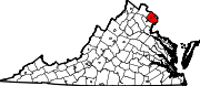
CDPs Annandale | Bailey's Crossroads | Belle Haven | Burke | Burke Centre | Centreville | Chantilly | Crosspointe | Dranesville | Dunn Loring | Fair Lakes | Fair Oaks | Fairfax Station | Floris | Fort Belvoir | Fort Hunt | Franconia | Franklin Farm | George Mason | Great Falls | Greenbriar | Groveton | Hayfield | Huntington | Hybla Valley | Idylwood | Kings Park | Kings Park West | Kingstowne | Lake Barcroft | Laurel Hill | Lincolnia | Long Branch | Lorton | Mantua | Mason Neck | McLean | McNair | Merrifield | Mount Vernon | Newington | Newington Forest | North Springfield | Oakton | Pimmit Hills | Ravensworth | Reston | Rose Hill | Seven Corners | South Run | Springfield | Tysons Corner | Wakefield | West Falls Church | West Springfield | Wolf Trap | Woodburn | Woodlawn
Unincorporated
communitiesAccotink | Arcturus | Barkers Crossroads | Blevinstown | Browns Mill | Butts Corner | Cobbs Corner | Colchester | Colchester Hunt | Comptons Corner | Cooktown | Crowells Corner | Culmore | Donovans Corner | Doveville | Farrs Corner | Five Forks | Four Corners | Hollindale | Jermantown | Langley | Lees Corner | Lewinsville | Lewis Park | Makleys Corner | New Alexandria | Oak Hill | Odricks Corner | Pohick | Rutherford | Schneider Crossroads | Shady Oak | Strathmeade Springs | Uniontown | Westhampton | West McLean
Ghost towns Hattontown | Matildaville
Categories:- Clifton, Virginia
- Towns in Virginia
- Populated places in Fairfax County, Virginia
- Baltimore–Washington metropolitan area


Wikimedia Foundation. 2010.