- Columbia, Virginia
-
Columbia, Virginia — Town — Location of Columbia, Virginia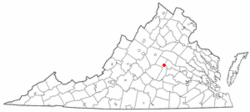
Coordinates: 37°45′8″N 78°9′44″W / 37.75222°N 78.16222°WCoordinates: 37°45′8″N 78°9′44″W / 37.75222°N 78.16222°W Country United States State Virginia County Fluvanna Area – Total 0.2 sq mi (0.5 km2) – Land 0.2 sq mi (0.5 km2) – Water 0.0 sq mi (0.0 km2) Elevation 210 ft (64 m) Population (2000) – Total 49 – Density 246.1/sq mi (95.0/km2) Time zone Eastern (EST) (UTC-5) – Summer (DST) EDT (UTC-4) FIPS code 51-18624[1] GNIS feature ID 1492796[2] Columbia is a town in Fluvanna County, Virginia, United States, at the confluence of the James and Rivanna Rivers. The population was 49 at the 2000 census, making it Virginia's smallest incorporated town. It was the site of a minor battle during the Revolutionary War, historical reenactments of which are held annually.
Columbia is part of the Charlottesville Metropolitan Statistical Area.
Geography
Columbia is located at 37°45′8″N 78°9′44″W / 37.75222°N 78.16222°W (37.752206, -78.162291)[3].
According to the United States Census Bureau, the town has a total area of 0.2 square miles (0.5 km²), of which, 0.2 square miles (0.5 km²) of it is land and 4.76% is water.
Demographics
As of the census[1] of 2000, there were 49 people, 18 households, and 12 families residing in the town. The population density was 246.1 people per square mile (94.6/km²). There were 22 housing units at an average density of 110.5 per square mile (42.5/km²). The racial makeup of the town was 63.27% White, 28.57% African American, and 8.16% from two or more races. Hispanic or Latino of any race were 4.08% of the population.
There were 18 households out of which 27.8% had children under the age of 18 living with them, 66.7% were married couples living together, 5.6% had a female householder with no husband present, and 27.8% were non-families. 16.7% of all households were made up of individuals and 11.1% had someone living alone who was 65 years of age or older. The average household size was 2.72 and the average family size was 3.23.
In the town the population was spread out with 22.4% under the age of 18, 6.1% from 18 to 24, 20.4% from 25 to 44, 44.9% from 45 to 64, and 6.1% who were 65 years of age or older. The median age was 48 years. For every 100 females there were 69.0 males. For every 100 females age 18 and over, there were 72.7 males.
The median income for a household in the town was $46,250, and the median income for a family was $50,000. Males had a median income of $18,750 versus $18,125 for females. The per capita income for the town was $13,632. None of the population or families were below the poverty line.
References
- ^ a b "American FactFinder". United States Census Bureau. http://factfinder.census.gov. Retrieved 2008-01-31.
- ^ "US Board on Geographic Names". United States Geological Survey. 2007-10-25. http://geonames.usgs.gov. Retrieved 2008-01-31.
- ^ "US Gazetteer files: 2010, 2000, and 1990". United States Census Bureau. 2011-02-12. http://www.census.gov/geo/www/gazetteer/gazette.html. Retrieved 2011-04-23.
Municipalities and communities of Fluvanna County, Virginia Towns Columbia | Scottsville‡
CDPs Unincorporated
communitiesAntioch | Bremo Bluff | Bybee | Carysbrook | Cloverdale | Cohasset | Crafton | Cunningham | Dixie | Fork Union | Hardware | Holmhead | Hunters | Kents Store | Kidds Store | Nahor | Nicholas | Payne | Paynes Mill | Rockaway | Stage Junction | Stearnes | Strathouse | Troy | Union Mills | Weber City | West Bottom | Wildwood | Wilmington | Zion Crossroads‡
Footnotes ‡This populated place also has portions in an adjacent county or counties
Categories:- Populated places on the James River (Virginia)
- Populated places in Fluvanna County, Virginia
- Towns in Virginia
- Charlottesville metropolitan area


Wikimedia Foundation. 2010.