- Narrows, Virginia
-
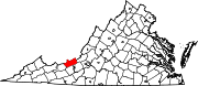
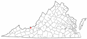
Town of Narrows, Virginia — Town — Location in the Commonwealth of Virginia
Coordinates: 37°19′55″N 80°48′31″W / 37.33194°N 80.80861°WCoordinates: 37°19′55″N 80°48′31″W / 37.33194°N 80.80861°W Country United States State Virginia County Giles Government – Mayor H. Clayton Davis Area – Total 1.3 sq mi (3.5 km2) – Land 1.3 sq mi (3.3 km2) – Water 0.1 sq mi (0.1 km2) Elevation 1,545 ft (471 m) Population (2000) – Total 2,111 – Density 1,649.8/sq mi (637.0/km2) U.S. Census Bureau, 2000 Population Estimates Time zone EST (UTC-5) – Summer (DST) EDT (UTC-4) ZIP code 24124 Area code(s) 540 FIPS code 51-54904[1] GNIS feature ID 1497034[2] Website http://www.townofnarrows.org/ Narrows, named for the narrowing of the New River that flows past it, is a town in Giles County, Virginia, United States. The population was 2,111 at the 2000 census. It is part of the Blacksburg–Christiansburg–Radford Metropolitan Statistical Area.
Geography
Narrows is located at 37°19′55″N 80°48′31″W / 37.33194°N 80.80861°W (37.331818, -80.808477)[3].
According to the United States Census Bureau, the town has a total area of 1.3 square miles (3.5 km²), of which, 1.3 square miles (3.3 km²) of it is land and 0.1 square miles (0.2 km²) of it (4.48%) is water.
Demographics
As of the census[1] of 2000, there were 2,111 people, 890 households, and 600 families residing in the town. The population density was 1,649.7 people per square mile (636.8/km²). There were 971 housing units at an average density of 758.8 per square mile (292.9/km²). The racial makeup of the town was 98.86% White, 0.24% African American, 0.05% Native American, 0.05% Asian, 0.28% from other races, and 0.52% from two or more races. Hispanic or Latino of any race were 0.43% of the population.
There were 890 households out of which 27.9% had children under the age of 18 living with them, 53.1% were married couples living together, 10.3% had a female householder with no husband present, and 32.5% were non-families. 29.6% of all households were made up of individuals and 16.2% had someone living alone who was 65 years of age or older. The average household size was 2.35 and the average family size was 2.90.
In the town the population was spread out with 22.9% under the age of 18, 7.2% from 18 to 24, 28.3% from 25 to 44, 23.3% from 45 to 64, and 18.4% who were 65 years of age or older. The median age was 39 years. For every 100 females there were 85.0 males. For every 100 females age 18 and over, there were 81.5 males.
The median income for a household in the town was $31,875, and the median income for a family was $42,610. Males had a median income of $31,806 versus $22,222 for females. The per capita income for the town was $17,933. About 5.4% of families and 8.7% of the population were below the poverty line, including 11.4% of those under age 18 and 11.9% of those age 65 or over.
References
- ^ a b "American FactFinder". United States Census Bureau. http://factfinder.census.gov. Retrieved 2008-01-31.
- ^ "US Board on Geographic Names". United States Geological Survey. 2007-10-25. http://geonames.usgs.gov. Retrieved 2008-01-31.
- ^ "US Gazetteer files: 2010, 2000, and 1990". United States Census Bureau. 2011-02-12. http://www.census.gov/geo/www/gazetteer/gazette.html. Retrieved 2011-04-23.
Municipalities and communities of Giles County, Virginia Towns Glen Lyn | Narrows | Pearisburg | Pembroke | Rich Creek
Unincorporated
communitiesCategories:- Populated places in Giles County, Virginia
- Towns in Virginia
- Blacksburg–Christiansburg–Radford metropolitan area


Wikimedia Foundation. 2010.