- Cheriton, Virginia
-
Cheriton, Virginia — Town — Location of Cheriton, Virginia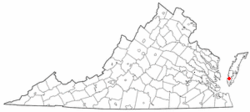
Coordinates: 37°17′22″N 75°58′6″W / 37.28944°N 75.96833°WCoordinates: 37°17′22″N 75°58′6″W / 37.28944°N 75.96833°W Country United States State Virginia County Northampton Area – Total 1.0 sq mi (2.7 km2) – Land 1.0 sq mi (2.7 km2) – Water 0.0 sq mi (0.0 km2) Elevation 20 ft (6 m) Population (2000) – Total 499 – Density 485.8/sq mi (187.6/km2) Time zone Eastern (EST) (UTC-5) – Summer (DST) EDT (UTC-4) ZIP code 23316 Area code(s) 757 FIPS code 51-15112[1] GNIS feature ID 1492747[2] Cheriton is a town in Northampton County, Virginia, United States. The population was 499 at the 2000 census.
Geography
Cheriton is located at 37°17′22″N 75°58′6″W / 37.28944°N 75.96833°W (37.289443, -75.968201)[3].
According to the United States Census Bureau, the town has a total area of 1.0 square miles (2.7 km²), of which, 1.0 square miles (2.7 km²) of it is land and 0.96% is water.
Demographics
As of the census[1] of 2000, there were 499 people, 219 households, and 134 families residing in the town. The population density was 485.8 people per square mile (187.1/km²). There were 239 housing units at an average density of 232.7 per square mile (89.6/km²). The racial makeup of the town was 71.14% White, 27.45% African American, 1.00% from other races, and 0.40% from two or more races. Hispanic or Latino of any race were 1.60% of the population.
There were 219 households out of which 22.4% had children under the age of 18 living with them, 45.7% were married couples living together, 11.9% had a female householder with no husband present, and 38.4% were non-families. 36.1% of all households were made up of individuals and 21.0% had someone living alone who was 65 years of age or older. The average household size was 2.28 and the average family size was 2.90.
In the town the population was spread out with 21.8% under the age of 18, 4.6% from 18 to 24, 24.6% from 25 to 44, 25.3% from 45 to 64, and 23.6% who were 65 years of age or older. The median age was 44 years. For every 100 females there were 79.5 males. For every 100 females age 18 and over, there were 83.1 males.
The median income for a household in the town was $26,429, and the median income for a family was $39,028. Males had a median income of $22,222 versus $16,818 for females. The per capita income for the town was $14,238. About 7.8% of families and 11.9% of the population were below the poverty line, including 8.8% of those under age 18 and 19.5% of those age 65 or over.
References
- ^ a b "American FactFinder". United States Census Bureau. http://factfinder.census.gov. Retrieved 2008-01-31.
- ^ "US Board on Geographic Names". United States Geological Survey. 2007-10-25. http://geonames.usgs.gov. Retrieved 2008-01-31.
- ^ "US Gazetteer files: 2010, 2000, and 1990". United States Census Bureau. 2011-02-12. http://www.census.gov/geo/www/gazetteer/gazette.html. Retrieved 2011-04-23.
Municipalities and communities of Northampton County, Virginia Towns Belle Haven‡ | Cape Charles | Cheriton | Eastville | Exmore | Nassawadox

Unincorporated
communitiesArlington | Bacon Hill | Bay Ridge | Bayford | Bayleys Neck Farm | Bayview | Beverly | Birdsnest | Bridgetown | Broadwater | Bulls Landing | Cape Junction | Capeville | Cedar Grove | Cheapside | Cherrystone | Chesapeake | Church Creek Point | Clearview | Culls | Dalbys | Eastville Station | Fairview | Franktown | Hadlock | Hare Valley | Highland Heights | Hungars Point | James Crossroads | Jamesville | Johnson Cove | Johnsontown | Kendall Grove | Kiptopeke | Little Johnsontown | Little Salisbury | Machipongo | Magotha | Marionville | Martins Siding | Middletown | Nottingham | Oakland Park | Old Neck Landing | Oyster | Pat Town | Red Bank | Reedtown | Seaview | Shadyside | Sheps End | Silver Beach | Simpkins | Smith Beach | Stewarts Landing | Stumptown | TB Crossroads | The Meadows | Townsend | Treherneville | Vaucluse Shores | Wardtown | Weirwood | Westerhouse Woods | Willis Wharf | Woodstock
Footnotes ‡This populated place also has portions in an adjacent county or counties
Categories:- Populated places in Northampton County, Virginia
- Towns in Virginia


Wikimedia Foundation. 2010.