- Clintwood, Virginia
-
Clintwood, Virginia — Town — Location of Clintwood, Virginia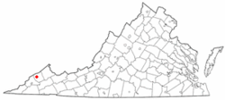
Coordinates: 37°9′0″N 82°27′24″W / 37.15°N 82.45667°WCoordinates: 37°9′0″N 82°27′24″W / 37.15°N 82.45667°W Country United States State Virginia County Dickenson Area - Total 1.9 sq mi (4.9 km2) - Land 1.9 sq mi (4.9 km2) - Water 0.0 sq mi (0.0 km2) Elevation 1,755 ft (535 m) Population (2010) - Total 1,414 - Density 744.21/sq mi (288.57/km2) Time zone Eastern (EST) (UTC-5) - Summer (DST) EDT (UTC-4) ZIP code 24228 Area code(s) 276 FIPS code 51-17552[1] GNIS feature ID 1498468[2] Website www.townofclintwood.com Clintwood is a town in Dickenson County, Virginia, United States. The population was 1,549 at the 2000 census. It is the county seat of Dickenson County[3].
Although originally called Holly Creek after a small stream that runs through the town, it was later named Clintwood after Major Henry Clinton Wood, a Confederate officer in the 37th Virginia Infantry Regiment.
Contents
Geography
Clintwood is located at 37°9′0″N 82°27′24″W / 37.15°N 82.45667°W (37.150054, -82.456698)[4].
According to the United States Census Bureau, the town has a total area of 1.9 square miles (4.9 km²), all of it land.
Local Tourist Attractions
- The Jettie Baker Center
- The Ralph Stanley Museum
- Breaks Interstate Park (Outside Haysi)
- John W. Flanagan Dam and Reservoir
- Bear Pen Recreation area
- Historical Society
- Cranes Nest River and camping/recreation area
- Birch Knob Tower
- Jefferson National Forest
- Dickenson County Fair (usually held near Haysi in August)
- Dickenson County Art Center & Gallery
- Lower Twin Campground
- Pound River Campground
- Mountain Music Festival
- Dickenson County Chamber of Commerce
- Dickenson County Visitor's Center & Dr. Phipps Museum
- Phipp's Family Memorial Park
Lodging
- Southern Heritage Inn
- Hometown Lodging
- Misty Mountain Cottage
- Mullins Farm Guest Cottage
- End of The Trail Lodge
- The Red Caboose Inn
- Breaks Interstate Park Lodging
- Uptown Cottage
- Ralph Stanley Museum Lodging
Demographics
As of the census[1] of 2000, there were 1,549 people, 672 households, and 426 families residing in the town. The population density was 812.0 people per square mile (313.1/km²). There were 756 housing units at an average density of 396.3 per square mile (152.8/km²). The racial makeup of the town was 98.52% White, 0.19% African American, 0.19% Native American, 0.13% Asian,and 0.97% from two or more races. Hispanic or Latino of any race were 0.52% of the population.
There were 672 households out of which 21.9% had children under the age of 18 living with them, 44.8% were married couples living together, 15.5% had a female householder with no husband present, and 36.5% were non-families. 33.8% of all households were made up of individuals and 17.7% had someone living alone who was 65 years of age or older. The average household size was 2.10 and the average family size was 2.65.
In the town the population was spread out with 16.5% under the age of 18, 8.3% from 18 to 24, 23.2% from 25 to 44, 27.8% from 45 to 64, and 24.3% who were 65 years of age or older. The median age was 46 years. For every 100 females there were 84.4 males. For every 100 females age 18 and over, there were 81.5 males.
The median income for a household in the town was $22,663, and the median income for a family was $30,833. Males had a median income of $29,844 versus $21,250 for females. The per capita income for the town was $16,323. About 16.0% of families and 21.6% of the population were below the poverty line, including 30.5% of those under age 18 and 16.7% of those age 65 or over.
Famous Celebrities, Personalities, and Notable Persons
- In June 1948, the town of Clintwood was featured in headlines and broadcasts around the world for the election of an all female town council. The women, Minnie "Sis" Miller, Buena Smith, Marian Shortt, Kate Friend, Ida Cunningham and Ferne Skeen were elected to serve the town of Clintwood from 1948-50. The "Petticoat Government" as it was nicknamed, implemented change in many areas, including clean up of the town in several campaigns, eliminated parking problems, organized a systematic garbage disposal system and eliminated several traffic hazards as well as organize the town's fire department and the purchase of a fire truck. The town was featured prominetly in publicity nationally and internationally. The "Petticoat Government" also received the attention of Lady Astor, a member of the British Parliament who expressed a desire to visit Clintwood and to see how the experiment w as going. The town was also featured in broadcasts by Voice of America and the reports beamed into Soviet bloc countries.[5]
- Justin Hamilton - former star at Clintwood High School, defensive back for the Virginia Tech Hokies and former member of the National Football League's Cleveland Browns and Washington Redskins football organizations, was born in Norton, VA and raised in Clintwood. Hamilton is currently the Strength and Conditioning Coach for the University of Virginia at Wise athletic programs.
- Kevin Triplett - Vice President of Public Affairs for Bristol Motor Speedway, former media relations director for GM/Goodwrench, Dale Earnhardt and NASCAR. Triplett was also a one time candidate opposing Congressman Rick Boucher for the Virginia's 9th Congressional District seat.
Education
- Clintwood High School (Grades 9-12)
- Clintwood Elementary School (Grades Pre-K - 8)
- Longs Fork Elementary School (Grades Pre-K - 8)
- Dickenson Center for Education and Research
- Dickenson County Career Center
Industrial Park
- SI International
- Kids Central & Dickenson County Child Care Center
- Equitable Resources (Headquarters for Southwestern Virginia)
- Dickenson Research and Education Center (many businesses also have offices here)
- Appalachian Power
- Marty Materials
- Dickenson County Behavioral Health Services
- DCWIN (Dickenson County Wireless Integrated Network)
Recreation
- Kids Korner Park
- Walking track
- Bear Pen Recreation Area (includes pool,park,picnic shelters,walking track,field for activities,and Pound River.)
- Cranes Nest River and Recreation/Camping Area (includes fishing spots,multiple playgrounds,campground with RV sites,and walking/biking/horseback riding trails
- Birch Knob Tower
- Breaks Interstate Park
- Lower Twin Campground
- Pound River Campground
- John W. Flanagan Dam and Reservoir
References
- ^ a b "American FactFinder". United States Census Bureau. http://factfinder.census.gov. Retrieved 2008-01-31.
- ^ "US Board on Geographic Names". United States Geological Survey. 2007-10-25. http://geonames.usgs.gov. Retrieved 2008-01-31.
- ^ "Find a County". National Association of Counties. http://www.naco.org/Counties/Pages/FindACounty.aspx. Retrieved 2011-06-07.
- ^ "US Gazetteer files: 2010, 2000, and 1990". United States Census Bureau. 2011-02-12. http://www.census.gov/geo/www/gazetteer/gazette.html. Retrieved 2011-04-23.
- ^ Short, Martha. "Petticoat Government". http://homepages.rootsweb.ancestry.com/~mtnties/petticoat.html.
Municipalities and communities of Dickenson County, Virginia County seat: ClintwoodTowns 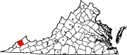
Unincorporated
communities Commonwealth of Virginia
Topics Climate · Colleges and universities · Colony · Congressional Districts · Culture · Delegations · Demographics · Economy · Education · Environment · Furniture · Geography · Government · Governors · History · Historic Landmarks · Magisterial Districts · Homes · Music · People · Police · Politics · Rights · Rivers · School divisions · Scouting · Slogan · Sports teams · State Fair · State parks · Symbols · Towns · Transportation · Tribes · Visitor Attractions
Regions Allegheny Mountains · Atlantic Coastal Plain · Blue Ridge · Chesapeake Bay · Cumberland Mountains · Delmarva Peninsula · Eastern Shore · Hampton Roads · Middle Peninsula · Northern Neck · Northern Virginia · Piedmont · Ridge-and-Valley Appalachians · Shenandoah Valley · South Hampton Roads · Southside · Southwest Virginia · Tennessee Valley · Tidewater · Tri-Cities · Virginia Peninsula
Metro areas Blacksburg-Christiansburg-Radford · Bluefield · Bristol · Charlottesville · Culpeper · Danville · Fredericksburg · Harrisonburg · Lynchburg · Martinsville · Richmond · Roanoke · Staunton · Hampton Roads · Washington-Arlington-Alexandria · Waynesboro · Winchester
Counties Accomack · Albemarle · Alleghany · Amelia · Amherst · Appomattox · Arlington · Augusta · Bath · Bedford · Bland · Botetourt · Brunswick · Buchanan · Buckingham · Campbell · Caroline · Carroll · Charles City · Charlotte · Chesterfield · Clarke · Craig · Culpeper · Cumberland · Dickenson · Dinwiddie · Essex · Fairfax · Fauquier · Floyd · Fluvanna · Franklin · Frederick · Giles · Gloucester · Goochland · Grayson · Greene · Greensville · Halifax · Hanover · Henrico · Henry · Highland · Isle of Wight · James City · King and Queen · King George · King William · Lancaster · Lee · Loudoun · Louisa · Lunenburg · Madison · Mathews · Mecklenburg · Middlesex · Montgomery · Nelson · New Kent · Northampton · Northumberland · Nottoway · Orange · Page · Patrick · Pittsylvania · Powhatan · Prince Edward · Prince George · Prince William · Pulaski · Rappahannock · Richmond · Roanoke · Rockbridge · Rockingham · Russell · Scott · Shenandoah · Smyth · Southampton · Spotsylvania · Stafford · Surry · Sussex · Tazewell · Warren · Washington · Westmoreland · Wise · Wythe · York
Independent
citiesAlexandria · Bedford · Bristol · Buena Vista · Charlottesville · Chesapeake · Colonial Heights · Covington · Danville · Emporia · Fairfax · Falls Church · Franklin · Fredericksburg · Galax · Hampton · Harrisonburg · Hopewell · Lexington · Lynchburg · Manassas · Manassas Park · Martinsville · Newport News · Norfolk · Norton · Petersburg · Poquoson · Portsmouth · Radford · Richmond · Roanoke · Salem · Staunton · Suffolk · Virginia Beach · Waynesboro · Williamsburg · Winchester
Categories:- Populated places in Dickenson County, Virginia
- Towns in Virginia
- County seats in Virginia


Wikimedia Foundation. 2010.