- McKenney, Virginia
-
"McKenney" redirects here. For other uses, see McKenney (disambiguation).
McKenney, Virginia — Town — Location within the state of Virginia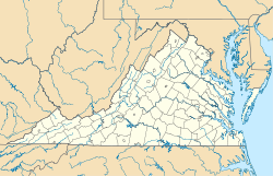
 McKenney, Virginia
Coordinates: 36°59′00″N 77°43′08″W / 36.9833333°N 77.71889°W Country United States State Virginia County Dinwiddie Area - Total 0.9 sq mi (2.5 km2) - Land 0.9 sq mi (2.5 km2) - Water 0.0 sq mi (0.0 km2) Elevation 335 ft (102 m) Population (2000) - Total 441 - Density 464.8/sq mi (179.5/km2) Time zone Eastern (EST) (UTC-5) - Summer (DST) EDT (UTC-4) ZIP code 23872 Area code(s) 804 FIPS code 51-48344[1] GNIS feature ID 1495918[2] McKenney is a small southern historic town in Dinwiddie County, Virginia, United States. The population was 483 at the 2010 census.
Geography
McKenney is located at 36°59′00″N 77°43′08″W / 36.983307°N 77.718810°WCoordinates: 36°59′00″N 77°43′08″W / 36.983307°N 77.718810°W (36.983307, -77.718810)[3].
According to the United States Census Bureau, the town has a total area of 0.9 square miles (2.5 km²), all of it land.
Demographics
As of the census[1] of 2000, there were 441 people, 167 households, and 105 families residing in the town. The population density was 464.8 people per square mile (179.2/km²). There were 183 housing units at an average density of 192.9 per square mile (74.4/km²). The racial makeup of the town was 66.21% White, 33.33% African American, 0.23% Asian, and 0.23% from two or more races. Hispanic or Latino of any race were 2.04% of the population.
There were 167 households out of which 26.3% had children under the age of 18 living with them, 44.9% were married couples living together, 15.6% had a female householder with no husband present, and 37.1% were non-families. 32.3% of all households were made up of individuals and 15.6% had someone living alone who was 65 years of age or older. The average household size was 2.43 and the average family size was 3.11.
In the town the population was spread out with 20.6% under the age of 18, 7.5% from 18 to 24, 27.2% from 25 to 44, 25.9% from 45 to 64, and 18.8% who were 65 years of age or older. The median age was 42 years. For every 100 females there were 105.1 males. For every 100 females age 18 and over, there were 88.2 males.
The median income for a household in the town was $34,583, and the median income for a family was $45,625. Males had a median income of $32,500 versus $21,250 for females. The per capita income for the town was $19,005. About 4.0% of families and 10.3% of the population were below the poverty line, including 6.8% of those under age 18 and 15.6% of those age 65 or over.
References
- ^ a b "American FactFinder". United States Census Bureau. http://factfinder.census.gov. Retrieved 2008-01-31.
- ^ "US Board on Geographic Names". United States Geological Survey. 2007-10-25. http://geonames.usgs.gov. Retrieved 2008-01-31.
- ^ "US Gazetteer files: 2010, 2000, and 1990". United States Census Bureau. 2011-02-12. http://www.census.gov/geo/www/gazetteer/gazette.html. Retrieved 2011-04-23.
Municipalities and communities of Dinwiddie County, Virginia County seat: Dinwiddie Town McKenney

Unincorporated
communitiesCarson | Church Road | Dabney Estates | DeWitt | Dinwiddie | Five Forks | Sutherland | Wilsons
Categories:- Towns in Virginia
- Populated places in Dinwiddie County, Virginia


Wikimedia Foundation. 2010.