- Damascus, Virginia
-
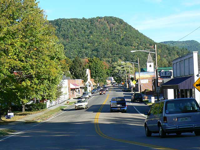
Damascus, Virginia — Town — Main Street in Damascus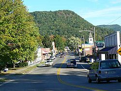 Location of Damascus, Virginia
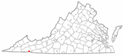
Coordinates: 36°38′2″N 81°47′13″W / 36.63389°N 81.78694°WCoordinates: 36°38′2″N 81°47′13″W / 36.63389°N 81.78694°W Country United States State Virginia County Washington Area – Total 0.8 sq mi (2.2 km2) – Land 0.8 sq mi (2.2 km2) – Water 0.0 sq mi (0.0 km2) Elevation 1,952 ft (595 m) Population (2000) – Total 981 – Density 1,157.2/sq mi (446.8/km2) Time zone Eastern (EST) (UTC-5) – Summer (DST) EDT (UTC-4) ZIP code 24236 Area code(s) 276 FIPS code 51-21184[1] GNIS feature ID 1482904[2] Damascus is a town in Washington County, Virginia, United States. The population was 981 at the 2000 census. It is part of the Kingsport–Bristol (TN)–Bristol (VA) Metropolitan Statistical Area, which is a component of the Johnson City–Kingsport–Bristol, TN-VA Combined Statistical Area – commonly known as the "Tri-Cities" region.
Contents
Festivals
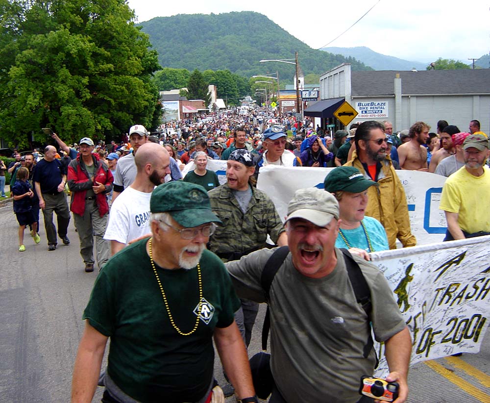
Damascus is the home of the annual Trail Days festival, and is known as Trail Town USA due to the convergence of four scenic trails in the town, including the Appalachian Trail, U.S. Bicycle Route 76, The Iron Mountain Trail, and the Virginia Creeper Trail. The Trail Days festival is held around the middle of May each year and draws in excess of 20,000 tourists, making it the largest single gathering of Appalachian Trail hikers anywhere.[3]
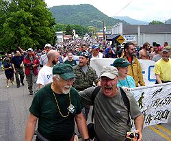 An Appalachian Trail Day in May
Demographics
Historical populations Census Pop. %± 1990 918 — 2000 981 6.9% Est. 2009 1,066 8.7% source:[4] As of the census[1] of 2000, there were 981 people, 484 households, and 269 families residing in the town. The population density was 1,157.2 people per square mile (445.6/km²). There were 543 housing units at an average density of 640.5 per square mile (246.7/km²). The racial makeup of the town was 96.94% White, 1.63% African American, 0.51% Native American, 0.31% Asian, 0.10% from other races, and 0.51% from two or more races. Hispanic or Latino of any race were 0.20% of the population.
There were 484 households out of which 18.2% had children under the age of 18 living with them, 40.7% were married couples living together, 11.6% had a female householder with no husband present, and 44.4% were non-families. 40.9% of all households were made up of individuals and 20.9% had someone living alone who was 65 years of age or older. The average household size was 2.03 and the average family size was 2.72.
In the town the population was spread out with 17.9% under the age of 18, 6.2% from 18 to 24, 25.4% from 25 to 44, 28.3% from 45 to 64, and 22.1% who were 65 years of age or older. The median age was 45 years. For every 100 females there were 86.1 males. For every 100 females age 18 and over, there were 83.4 males.
The median income for a household in the town was $19,886, and the median income for a family was $29,250. Males had a median income of $25,500 versus $18,500 for females. The per capita income for the town was $14,995. About 13.2% of families and 20.0% of the population were below the poverty line, including 28.3% of those under age 18 and 16.5% of those age 65 or over.
References
- ^ a b "American FactFinder". United States Census Bureau. http://factfinder.census.gov. Retrieved 2008-01-31.
- ^ "US Board on Geographic Names". United States Geological Survey. 2007-10-25. http://geonames.usgs.gov. Retrieved 2008-01-31.
- ^ Collier, Christopher Percy (May 12, 2006), "Good Times at a Backpackers' Paradise". New York Times. 155 (53577):D1-D5
- ^ "Population Finder: Damascus CDP, Virginia". U.S. Census Bureau. http://factfinder.census.gov/servlet/SAFFPopulation?_event=Search&geo_id=16000US5131056&_geoContext=01000US%7C04000US51%7C16000US5131056&_street=&_county=Damascus&_cityTown=Damascus&_state=04000US51&_zip=&_lang=en&_sse=on&ActiveGeoDiv=geoSelect&_useEV=&pctxt=fph&pgsl=160&_submenuId=population_0&ds_name=null&_ci_nbr=null&qr_name=null®=null%3Anull&_keyword=&_industry=. Retrieved 2011-07-07.
External links
- Damascus, Virginia - Trail Town USA (Official Website)
- Trail Days - Celebrating the Appalachian Trail
- Virginia Creeper Trail website with an emphasis on Damascus
Municipalities and communities of Washington County, Virginia Towns Abingdon | Damascus | Glade Spring | Saltville‡

CDPs Emory | Meadowview
Unincorporated
communitiesAlvarado | Bethel | Blackwell | Clinchburg | Friendship | Hayter | Konnarock | Lindell | Lodi | Mendota | Midway | Taylor's Valley
Footnotes ‡This populated place also has portions in an adjacent county or counties
Categories:- Towns in Virginia
- Populated places in Washington County, Virginia
- Kingsport–Bristol metropolitan area


Wikimedia Foundation. 2010.