- Ashland, Virginia
Infobox Settlement
official_name = Ashland, Virginia
settlement_type =Town
nickname =
motto =
imagesize =
image_caption =
image_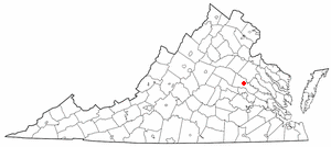
mapsize = 250px
map_caption = Location in Virginia
mapsize1 =
map_caption1 =subdivision_type = Country
subdivision_name =United States
subdivision_type1 = State
subdivision_name1 =Virginia
subdivision_type2 = County
subdivision_name2 = Hanovergovernment_footnotes =
government_type =
leader_title =
leader_name = Faye O. Prichard
leader_title1 =
leader_name1 =
established_title =Founded
established_date = 1850unit_pref = Imperial
area_footnotes =area_magnitude =
area_total_km2 = 18.7
area_land_km2 = 18.6
area_water_km2 = 0.1
area_total_sq_mi = 7.2
area_land_sq_mi = 7.2
area_water_sq_mi = 0.0population_as_of = 2000
population_footnotes =
population_total = 6619
population_density_km2 = 356.0
population_density_sq_mi = 922.0timezone = Eastern (EST)
utc_offset = -5
timezone_DST = EDT
utc_offset_DST = -4
elevation_footnotes =
elevation_m = 65
elevation_ft = 213
latd = 37 |latm = 45 |lats = 34 |latNS = N
longd = 77 |longm = 28 |longs = 38 |longEW = Wpostal_code_type =
ZIP code
postal_code = 23005
area_code = 804
blank_name = FIPS code
blank_info = 51-03368GR|2
blank1_name = GNIS feature ID
blank1_info = 1492492GR|3
website = http://www.town.ashland.va.us
footnotes =Ashland is a town located just north of Richmond in Hanover County,
Virginia .,United States . The population was 6,619 at the 2000 census. Ashland is home toRandolph-Macon College (1830). "The Center of the Universe" is a popular thematic phrase displayed on signs in the town.Geography
Ashland is located at coor dms|37|45|34|N|77|28|38|W|city (37.759361, -77.477226)GR|1.
According to the
United States Census Bureau , the town has a total area of 7.2square mile s (18.7km² ), of which, 7.2 square miles (18.6 km²) of it is land and 0.04 square miles (0.1 km²) of it (0.55%) is water.Demographics
As of the
census GR|2 of 2000, there were 6,619 people, 2,282 households, and 1,453 families residing in the town. Thepopulation density was 355.9/km² (922.0/mi²). There were 2,445 housing units at an average density of 131.5/km² (340.6/mi²). The racial makeup of the town was 74.74% White, 22.25% African American, 0.36% Native American, 0.71% Asian, 0.68% from other races, and 1.25% from two or more races. Hispanic or Latino of any race were 1.74% of the population.There were 2,282 households out of which 31.3% had children under the age of 18 living with them, 42.0% were married couples living together, 17.5% had a female householder with no husband present, and 36.3% were non-families. 30.1% of all households were made up of individuals and 11.2% had someone living alone who was 65 years of age or older. The average household size was 2.38 and the average family size was 2.93.
In the town the population was spread out with 19.9% under the age of 18, 22.2% from 18 to 24, 24.9% from 25 to 44, 19.0% from 45 to 64, and 13.9% who were 65 years of age or older. The median age was 32 years. For every 100 females there were 87.8 males. For every 100 females age 18 and over, there were 83.6 males.
The median income for a household in the town was $36,125, and the median income for a family was $43,101. Males had a median income of $31,373 versus $24,054 for females. The
per capita income for the town was $16,932. About 6.9% of families and 10.9% of the population were below thepoverty line , including 12.9% of those under age 18 and 7.1% of those age 65 or over.History
Originally known as Slash Cottage, Ashland is located on the
Old Washington Highway (a stage route between Richmond andWashington, DC ) and theRichmond, Fredericksburg and Potomac Railroad , a busy north-south route now owned byCSX Transportation . The tracks run through the center of town, and the area near the Ashland train station is a popular train-watching site for railfans.Many citizens of Ashland unsuccessfully fought off a bid to build a
Wal-Mart just outside of town (using pink lawn flamingos as an anti-walmart symbol), and they were featured in the 2001PBS special "Store Wars - When Wal-Mart Comes to Town ".In October 2002, Ashland made national news as the site of one of the
Beltway sniper attacks . 37-year-old Jeffrey Hopper was shot onOctober 19 at 8:00 pm in the parking lot of aPonderosa steakhouse as he was leaving the restaurant with his wife.Fire department
The Ashland Volunteer Fire Company, formed in 1890, is located on 201 Duncan Street. It is one of the oldest all-volunteer fire stations in the country, handling about 2,000 calls per year.Fact|date=August 2007
References
External links
* [http://www.herald-progress.com/ Herald-Progress area newspaper]
* [http://www.hanovercounty.biz/ Hanover County Economic Development]
* [http://www.virginia.org/site/cities.asp?city=Ashland Ashland Tourist Attractions]
* [http://www.town.ashland.va.us/index.asp?Type=B_BASIC&SEC=%7BDA714C0E-0AD1-48CA-B58D-ADE502A61975%7D City of Ashland Tourism Department]
* [http://www.filterra.com/index.php/contact/ Hanover County Stormwater Pollutant Removal and Filtration]
* [http://www.wunderground.com/US/VA/Ashland.html Ashland Weather and Air Quality/Pollution]
Wikimedia Foundation. 2010.