- Chilhowie, Virginia
-
Town of Chilhowie, Virginia — Town —
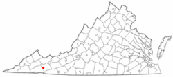
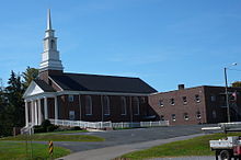
SealNickname(s): Valley of Many Deer Location in the Commonwealth of Virginia Coordinates: 36°48′0″N 81°40′52″W / 36.8°N 81.68111°WCoordinates: 36°48′0″N 81°40′52″W / 36.8°N 81.68111°W Country United States State Virginia County Smyth Government - Mayor Gary Heninger Area - Total 2.6 sq mi (6.7 km2) - Land 2.6 sq mi (6.7 km2) - Water 0.0 sq mi (0.0 km2) Elevation 1,952 ft (595 m) Population (2000) - Total 1,827 - Density 704.5/sq mi (272.0/km2) U.S. Census Bureau, 2000 Population Estimates Time zone EST (UTC-5) - Summer (DST) EDT (UTC-4) ZIP code 24319 Area code(s) 276 FIPS code 51-16480[1] GNIS feature ID 1464850[2] Website http://www.chilhowie.org/ Chilhowie is a town in Smyth County, Virginia, United States.Chilhowie, pronounced Chil·´how·ee, the Cherokee word meaning “valley of many deer,” was adopted as the town’s name when the town became incorporated in 1913. The population was 1,781 at the 2010 census. Chris Marion of the classic rock band, Little River Band, Eric McClure a Nascar Nationwide Series driver, Ben Huff, Colonel, USAF, and "Nature Boy" Buddy Landel the professional wrestler, are notable residents.
Contents
Geography
According to the United States Census Bureau, the town has a total area of 2.6 square miles (6.7 km²), all of it land.
History
Chilhowie was often the starting point of Longhunter expeditions.
Chilhowie sustained severe damage from an EF-2 tornado in the April 25–28, 2011 tornado outbreak.[3][4]
Demographics
As of the census[1] of 2000, there were 1,827 people, 708 households, and 462 families residing in the town. The population density was 704.6 people per square mile (272.4/km²). There were 775 housing units at an average density of 298.9 per square mile (115.5/km²). The racial makeup of the town was 94.47% White, 3.07% African American, 0.33% Native American, 0.05% Asian, 1.48% from other races, and 0.60% from two or more races. Hispanic or Latino of any race were 2.13% of the population.
Out of a total of 708 households, 24.7% had children under the age of 18 living with them, 49.2% were married couples living together, 11.4% had a female householder with no husband present, and 34.7% were non-families. 31.5% of all households were made up of individuals, and 15.4% had someone living alone who was 65 years of age or older. The average household size was 2.22 and the average family size was 2.76.
In the town the population was spread out with 17.2% under the age of 18, 5.4% from 18 to 24, 24.2% from 25 to 44, 24.4% from 45 to 64, and 28.8% who were 65 years of age or older. The median age was 47 years. For every 100 females there were 78.9 males. For every 100 females age 18 and over, there were 76.0 males.
The median income for a household in the town was US$28,266, and the median income for a family was US$34,375. Males had a median income of US$24,306 compared with US$18,080 for females. The per capita income for the town was US$16,657. About 10.3% of families and 13.4% of the population were below the poverty line, including 18.5% of those under age 18 and 9.5% of those age 65 or over.
References
- ^ a b "American FactFinder". United States Census Bureau. http://factfinder.census.gov. Retrieved 2008-01-31.
- ^ "US Board on Geographic Names". United States Geological Survey. 2007-10-25. http://geonames.usgs.gov. Retrieved 2008-01-31.
- ^ "National Weather Service confirms eight tornadoes in our region," TriCities.com April 30, 2011.
- ^ Cameron Crapps, "Chilhowie, Virginia hit by tornado; people feel 'forgotten,'" TriCities.com, April 29, 2011.
External links
Municipalities and communities of Smyth County, Virginia Towns CDPs Adwolf | Atkins | McMullin | Seven Mile Ford | Sugar Grove
Unincorporated
communitiesAllison Gap
Footnotes ‡This populated place also has portions in an adjacent county or counties
 Commonwealth of Virginia
Topics - Climate
- Colleges and universities
- Colony
- Congressional Districts
- Culture
- Delegations
- Demographics
- Economy
- Education
- Environment
- Furniture
- Geography
- Government
- Governors
- History
- Historic Landmarks
- Magisterial Districts
- Homes
- Music
- People
- Police
- Politics
- Rights
- Rivers
- School divisions
- Scouting
- Slogan
- Sports teams
- State Fair
- State parks
- Symbols
- Towns
- Transportation
- Tribes
- Visitor Attractions
Regions - Allegheny Mountains
- Atlantic Coastal Plain
- Blue Ridge
- Chesapeake Bay
- Cumberland Mountains
- Delmarva Peninsula
- Eastern Shore
- Hampton Roads
- Middle Peninsula
- Northern Neck
- Northern Virginia
- Piedmont
- Ridge-and-Valley Appalachians
- Shenandoah Valley
- South Hampton Roads
- Southside
- Southwest Virginia
- Tennessee Valley
- Tidewater
- Tri-Cities
- Virginia Peninsula
Metro areas - Blacksburg-Christiansburg-Radford
- Bluefield
- Bristol
- Charlottesville
- Culpeper
- Danville
- Fredericksburg
- Harrisonburg
- Lynchburg
- Martinsville
- Richmond
- Roanoke
- Staunton
- Hampton Roads
- Washington-Arlington-Alexandria
- Waynesboro
- Winchester
Counties - Accomack
- Albemarle
- Alleghany
- Amelia
- Amherst
- Appomattox
- Arlington
- Augusta
- Bath
- Bedford
- Bland
- Botetourt
- Brunswick
- Buchanan
- Buckingham
- Campbell
- Caroline
- Carroll
- Charles City
- Charlotte
- Chesterfield
- Clarke
- Craig
- Culpeper
- Cumberland
- Dickenson
- Dinwiddie
- Essex
- Fairfax
- Fauquier
- Floyd
- Fluvanna
- Franklin
- Frederick
- Giles
- Gloucester
- Goochland
- Grayson
- Greene
- Greensville
- Halifax
- Hanover
- Henrico
- Henry
- Highland
- Isle of Wight
- James City
- King and Queen
- King George
- King William
- Lancaster
- Lee
- Loudoun
- Louisa
- Lunenburg
- Madison
- Mathews
- Mecklenburg
- Middlesex
- Montgomery
- Nelson
- New Kent
- Northampton
- Northumberland
- Nottoway
- Orange
- Page
- Patrick
- Pittsylvania
- Powhatan
- Prince Edward
- Prince George
- Prince William
- Pulaski
- Rappahannock
- Richmond
- Roanoke
- Rockbridge
- Rockingham
- Russell
- Scott
- Shenandoah
- Smyth
- Southampton
- Spotsylvania
- Stafford
- Surry
- Sussex
- Tazewell
- Warren
- Washington
- Westmoreland
- Wise
- Wythe
- York
Independent
cities- Alexandria
- Bedford
- Bristol
- Buena Vista
- Charlottesville
- Chesapeake
- Colonial Heights
- Covington
- Danville
- Emporia
- Fairfax
- Falls Church
- Franklin
- Fredericksburg
- Galax
- Hampton
- Harrisonburg
- Hopewell
- Lexington
- Lynchburg
- Manassas
- Manassas Park
- Martinsville
- Newport News
- Norfolk
- Norton
- Petersburg
- Poquoson
- Portsmouth
- Radford
- Richmond
- Roanoke
- Salem
- Staunton
- Suffolk
- Virginia Beach
- Waynesboro
- Williamsburg
- Winchester
Categories:- Populated places in Smyth County, Virginia
- Towns in Virginia
- U.S. Route 11
Wikimedia Foundation. 2010.


