- Onancock, Virginia
-
Onancock, Virginia — Town — Location of Onancock, Virginia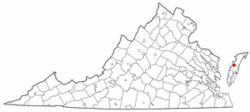
Coordinates: 37°42′38″N 75°44′47″W / 37.71056°N 75.74639°WCoordinates: 37°42′38″N 75°44′47″W / 37.71056°N 75.74639°W Country United States State Virginia County Accomack Area – Total 1.1 sq mi (2.7 km2) – Land 1.1 sq mi (2.7 km2) – Water 0.0 sq mi (0.0 km2) Elevation 13 ft (4 m) Population (2000) – Total 1,525 – Density 1,452.3/sq mi (560.7/km2) Time zone Eastern (EST) (UTC-5) – Summer (DST) EDT (UTC-4) ZIP code 23417 Area code(s) 757 FIPS code 51-59336[1] GNIS feature ID 1493376[2] Onancock is a town in Accomack County, Virginia, United States. The population was 1,525 at the 2000 census.
Contents
Geography
Onancock is located at 37°42′38″N 75°44′47″W / 37.71056°N 75.74639°W (37.710578, -75.746307).[3]
According to the United States Census Bureau, the town has a total area of 1.0 square miles (2.7 km²), all of it land.
Demographics
As of the census[1] of 2000, there were 1,525 people, 656 households, and 392 families residing in the town. The population density was 1,452.3 people per square mile (560.8/km²). There were 733 housing units at an average density of 698.0 per square mile (269.5/km²). The racial makeup of the town was 66.43% White, 31.41% African American, 0.46% Native American, 0.07% Asian, 0.66% from other races, and 0.98% from two or more races. Hispanic or Latino of any race were 2.89% of the population.
There were 656 households out of which 23.6% had children under the age of 18 living with them, 41.3% were married couples living together, 16.3% had a female householder with no husband present, and 40.1% were non-families. 38.0% of all households were made up of individuals and 24.7% had someone living alone who was 65 years of age or older. The average household size was 2.19 and the average family size was 2.82.
In the town the population was spread out with 21.2% under the age of 18, 6.8% from 18 to 24, 21.6% from 25 to 44, 24.1% from 45 to 64, and 26.3% who were 65 years of age or older. The median age was 45 years. For every 100 females there were 80.3 males. For every 100 females age 18 and over, there were 73.1 males.
The median income for a household in the town was $28,214, and the median income for a family was $37,039. Males had a median income of $25,956 versus $19,250 for females. The per capita income for the town was $18,393. About 8.4% of families and 15.3% of the population were below the poverty line, including 20.4% of those under age 18 and 15.6% of those age 65 or over.
References
- ^ a b "American FactFinder". United States Census Bureau. http://factfinder.census.gov. Retrieved 2008-01-31.
- ^ "US Board on Geographic Names". United States Geological Survey. 2007-10-25. http://geonames.usgs.gov. Retrieved 2008-01-31.
- ^ "US Gazetteer files: 2010, 2000, and 1990". United States Census Bureau. 2011-02-12. http://www.census.gov/geo/www/gazetteer/gazette.html. Retrieved 2011-04-23.
External links
- Around Town in Onancock
- Tangier-Onancock Ferry
- Onancock in photos
- OBCA, Real Estate, Accommodations/Restaurants/Tourism - Onancock 2007
Towns in Virginia  Abingdon | Accomac | Alberta | Altavista | Amherst | Appalachia | Appomattox | Ashland | Belle Haven | Berryville | Big Stone Gap | Blacksburg | Blackstone | Bloxom | Bluefield | Boones Mill | Bowling Green | Boyce | Boydton | Boykins | Branchville | Bridgewater | Broadway | Brodnax | Brookneal | Buchanan | Burkeville | Cape Charles | Capron | Cedar Bluff | Charlotte Court House | Chase City | Chatham | Cheriton | Chilhowie | Chincoteague | Christiansburg | Claremont | Clarksville | Cleveland | Clifton | Clifton Forge | Clinchco | Clinchport | Clintwood | Coeburn | Colonial Beach | Columbia | Courtland | Craigsville | Crewe | Culpeper | Damascus | Dayton | Dendron | Dillwyn | Drakes Branch | Dublin | Duffield | Dumfries | Dungannon | Eastville | Edinburg | Elkton | Exmore | Farmville | Fincastle | Floyd | Fries | Front Royal | Gate City | Glade Spring | Glasgow | Glen Lyn | Gordonsville | Goshen | Gretna | Grottoes | Grundy | Halifax | Hallwood | Hamilton | Haymarket | Haysi | Herndon | Hillsboro | Hillsville | Honaker | Hurt | Independence | Iron Gate | Irvington | Ivor | Jarratt | Jonesville | Keller | Kenbridge | Keysville | Kilmarnock | La Crosse | Lawrenceville | Lebanon | Leesburg | Louisa | Lovettsville | Luray | Madison | Marion | McKenney | Melfa | Middleburg | Middletown | Mineral | Monterey | Montross | Mount Crawford | Mount Jackson | Narrows | Nassawadox | New Castle | New Market | Newsoms | Nickelsville | Occoquan | Onancock | Onley | Orange | Painter | Pamplin City | Parksley | Pearisburg | Pembroke | Pennington Gap | Phenix | Pocahontas | Port Royal | Pound | Pulaski | Purcellville | Quantico | Remington | Rich Creek | Richlands | Ridgeway | Rocky Mount | Round Hill | Rural Retreat | St. Charles | St. Paul | Saltville | Saxis | Scottsburg | Scottsville | Shenandoah | Smithfield | South Boston | South Hill | Stanardsville | Stanley | Stephens City | Stony Creek | Strasburg | Stuart | Surry | Tangier | Tappahannock | Tazewell | The Plains | Timberville | Toms Brook | Troutdale | Troutville | Urbanna | Victoria | Vienna | Vinton | Virgilina | Wachapreague | Wakefield | Warrenton | Warsaw | Washington | Waverly | Weber City | West Point | White Stone | Windsor | Wise | Woodstock | WythevilleCategories:
- Populated places in Accomack County, Virginia
- Towns in Virginia


Wikimedia Foundation. 2010.