- Montross, Virginia
-
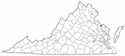
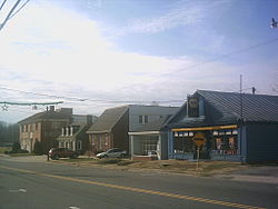
Montross, Virginia — Town — Courthouse in Montross, with historic marker in foreground Location of Montross, Virginia Coordinates: 38°5′38″N 76°49′34″W / 38.09389°N 76.82611°WCoordinates: 38°5′38″N 76°49′34″W / 38.09389°N 76.82611°W Country United States State Virginia County Westmoreland Area – Total 1.0 sq mi (2.6 km2) – Land 1.0 sq mi (2.6 km2) – Water 0.0 sq mi (0.0 km2) Elevation 164 ft (50 m) Population (2000) – Total 315 – Density 308.4/sq mi (119.1/km2) Time zone Eastern (EST) (UTC-5) – Summer (DST) EDT (UTC-4) ZIP code 22520 Area code(s) 804 FIPS code 51-52952[1] GNIS feature ID 1498518[2] Montross is a town in Westmoreland County, Virginia, United States. The population was 315 at the 2000 census. It is the county seat of Westmoreland County[3]. Located in the historic Northern Neck of Virginia, Montross is near the George Washington Birthplace National Monument and Stratford Hall Plantation (birthplace of Robert E. Lee, Richard Henry Lee, and Francis Lightfoot Lee).
Contents
History
The Old Westmoreland Court House in Montross was the site of notable events in 1774–1775 connected with the Revolutionary War. According to an historic marker at the courthouse, a resolution was introduced by Richard Henry Lee and adopted at a meeting there on June 22, 1774, providing aid to Boston, Massachusetts, following a blockade of that beleaguered port city by Great Britain.[4] The seizure in 1775 of the Virginia Colony's gunpowder supply in Williamsburg on orders of the Royal Governor, in what became known as the Gunpowder Incident, prompted the Westmoreland Committee of Safety to convene at the Court House on May 23, 1775. The committee passed a resolution denouncing the governor, Lord Dunmore, for his actions.[4]
Washington and Lee High School is located in the town. Emmy Award-winning video engineer Walter Balderson, who attended Washington and Lee High School, is from Montross.
United States Congressman, Rob Wittman, lives in Montross. Virginia State Senator, Richard H. Stuart, was born and raised in Montross.
Geography
Montross is located at 38°5′38″N 76°49′34″W / 38.09389°N 76.82611°W (38.093965, -76.826041)[5].
According to the United States Census Bureau, the town has a total area of 1.0 square miles (2.6 km²), all of it land.
Demographics
As of the census[1] of 2000, there were 315 people, 151 households, and 94 families residing in the town. The population density was 308.4 people per square mile (119.2/km²). There were 164 housing units at an average density of 160.6 per square mile (62.1/km²). The racial makeup of the town was 90.48% White, 7.94% African American, and 1.59% from two or more races. Hispanic or Latino of any race were 0.63% of the population.
There were 151 households out of which 22.5% had children under the age of 18 living with them, 47.0% were married couples living together, 11.3% had a female householder with no husband present, and 37.1% were non-families. 33.8% of all households were made up of individuals and 19.9% had someone living alone who was 65 years of age or older. The average household size was 2.05 and the average family size was 2.59.
In the town the population was spread out with 19.7% under the age of 18, 3.5% from 18 to 24, 23.2% from 25 to 44, 28.9% from 45 to 64, and 24.8% who were 65 years of age or older. The median age was 48 years. For every 100 females there were 72.1 males. For every 100 females age 18 and over, there were 74.5 males.
The median income for a household in the town was $40,469, and the median income for a family was $46,250. Males had a median income of $33,750 versus $25,625 for females. The per capita income for the town was $21,653. About 1.1% of families and 4.3% of the population were below the poverty line, including 2.9% of those under age 18 and 8.8% of those age 65 or over.
Fall Festival
Once a year, Montross has a festival in celebration of the town. It includes parades and game stands. The fun event is usually held in October and is widely attended by town residents.
In popular culture
In 2000, Montross was on television's Late Show with David Letterman. In a segment called, "Biff Henderson's America", comedian Biff Henderson visited the small town's museum, Bargain Shop, Sheriff's Department, the Coca-Cola Bottling Plant, and the Potomac River. He also interviewed people during his visit, jokingly asking them if they would like Biff to be mayor.
References
- ^ a b "American FactFinder". United States Census Bureau. http://factfinder.census.gov. Retrieved 2008-01-31.
- ^ "US Board on Geographic Names". United States Geological Survey. 2007-10-25. http://geonames.usgs.gov. Retrieved 2008-01-31.
- ^ "Find a County". National Association of Counties. http://www.naco.org/Counties/Pages/FindACounty.aspx. Retrieved 2011-06-07.
- ^ a b Old Westmoreland Court House (historic marker J71), placed by the Conservation & Development Commission, 1929.
- ^ "US Gazetteer files: 2010, 2000, and 1990". United States Census Bureau. 2011-02-12. http://www.census.gov/geo/www/gazetteer/gazette.html. Retrieved 2011-04-23.
Municipalities and communities of Westmoreland County, Virginia Towns Colonial Beach | Montross
Unincorporated
communitiesAcorn | Baynesville | Bayside | Bryant Town | Bull Neck | Carys Corner | Chiltons | Chisford | Coles Point | Currioman Landing | East End | Erica | Flat Iron | Grays Corner | Griffiths Corner | Hague | Hinnom | Hogans Hill | Horners | Kinsale | Kremlin | Latanes | Laurel Grove | Leedstown | Leesville | Lerty | Machodoc | Maple Grove | Mattox Bridge | Meter | Monroe Hall | Mount Holly | Narrow Beach | Nash Town | Neenah | Nomini | Nomini Grove | Oak Grove | Oldhams | Onawmanient | Palmtown | Peeds | Pomona | Potomac Beach | Potomac Mills | Ragged Point Beach | Sandy Point | Smith Hill | Springfield | Stratford Hall | Stratford Mill | Templeman | Threeway | Tidwells | Tucker Hill | Wakefield Corner | Westmoreland | Wilberts Corner | Zacata
Categories:- Towns in Virginia
- Populated places in Westmoreland County, Virginia
- County seats in Virginia
Wikimedia Foundation. 2010.


