- National Register of Historic Places listings in Westmoreland County, Virginia
-
This list includes properties and districts listed on the National Register of Historic Places in Westmoreland County, Virginia. Click the "Map of all coordinates" link to the right to view a Google map of all properties and districts with latitude and longitude coordinates in the table below.[1]
-
- This National Park Service list is complete through NPS recent listings posted November 10, 2011.[2]
Current listings
[3] Landmark name[4] Image Date listed Location City or Town Summary 1 Bell House September 21, 1987 821 Irving Ave.
38°14′27″N 76°57′30″W / 38.24083°N 76.95833°WColonial Beach 2 Blenheim 
June 5, 1975 N of Wakefield Corner off VA 204
38°11′11″N 76°56′38″W / 38.18639°N 76.94389°WWakefield Corner 3 Bushfield February 11, 2004 367 Club House Loop
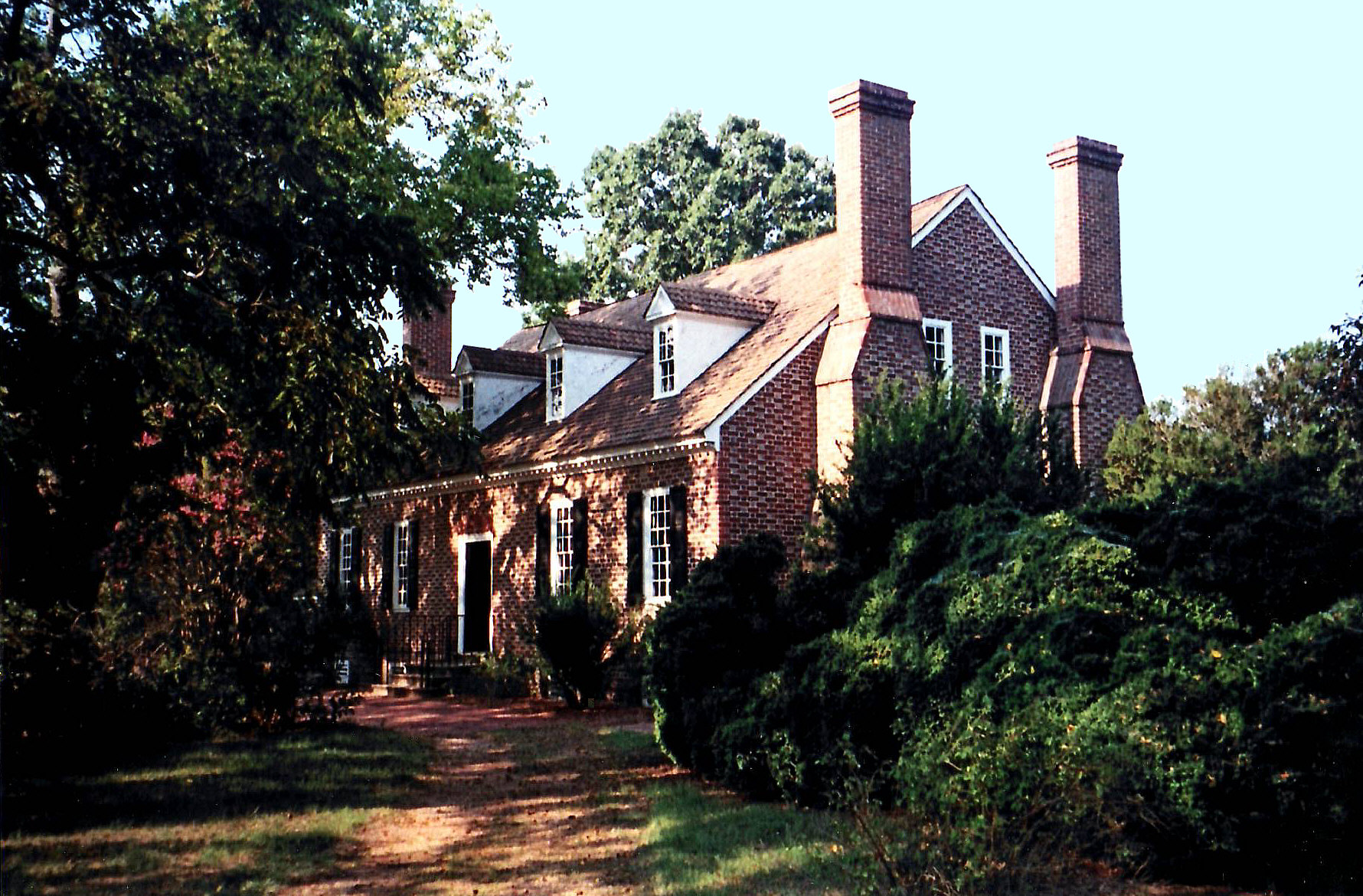
38°8′0″N 76°42′51″W / 38.133333°N 76.71417°WMount Holly 4 Chantilly 
December 16, 1971 Address Restricted Montross 5 George Washington Birthplace National Monument 
October 15, 1966 E of Fredericksburg off U.S. 301 and VA 3
38°11′17″N 76°57′7″W / 38.18806°N 76.95194°WFredericksburg 6 Ingleside March 15, 1979 S of Oak Grove on VA 638
38°8′57″N 77°0′18″W / 38.14917°N 77.005°WOak Grove 7 Armstead T. Johnson High School August 14, 1998 0.2 mi. NW of jct. of VA 3 and VA 202
38°4′39″N 76°46′55″W / 38.0775°N 76.78194°WMontross 8 Morgan Jones 1677 Pottery Kiln October 16, 1974 Address Restricted Hague 9 Kinsale Historic District July 22, 2005 Roughly along Kinsale Rd, Kinsale Bridge Rd., Sigouney Dr., Great House Rd., and Yeocomico Ln.
38°1′53″N 76°34′42″W / 38.03139°N 76.57833°WKinsale 10 James Monroe Family Home Site July 24, 1979 State Route 205 Oak Grove Specific location represents a boundary increase of April 10, 2008; the site was originally listed as "Address Restricted"</ref> 11 Mount Pleasant November 27, 2002 317 Coles Point Rd.
38°4′34″N 76°38′36″W / 38.07611°N 76.64333°WHague 12 Panorama January 31, 2011 Address restricted Montross vicinity sitekreator.com/panorama1930 13 Rochester House January 25, 1991 Co. Rt. 613, 1 mi. NE of Lyells off VA 3
38°0′5″N 76°43′3″W / 38.00139°N 76.7175°WLyells 14 Roxbury March 15, 1979 1.7 mi. S of Oak Grove
38°9′28″N 77°0′6″W / 38.15778°N 77.00167°WOak Grove 15 Spence's Point 
November 11, 1971 On Sandy Point Neck, on VA 749
38°4′46″N 76°33′26″W / 38.07944°N 76.55722°WWestmoreland 16 Spring Grove October 10, 1985 VA 202
38°5′9″N 76°42′20″W / 38.08583°N 76.70556°WMount Holly 17 St. Peter's Episcopal Church January 16, 2004 Junction of VA 3 and VA 205
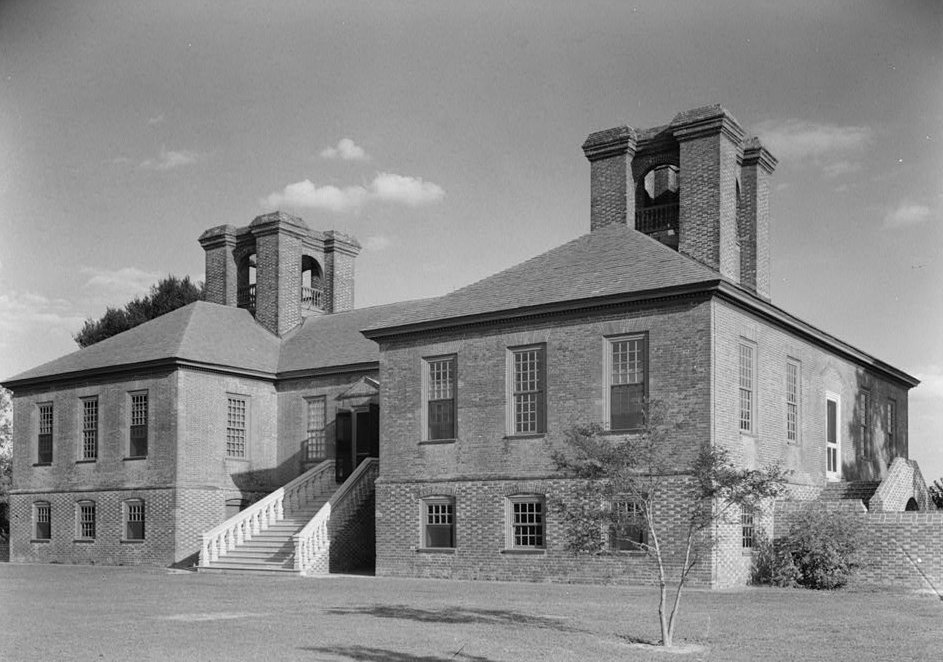
38°10′55″N 76°59′46″W / 38.18194°N 76.99611°WOak Grove 18 Stratford Hall 
October 15, 1966 North of Lerty on VA 214
38°9′6″N 76°50′23″W / 38.15167°N 76.83972°WLerty 19 Westmoreland State Park Historic District November 16, 2005 1650 State Park Rd.
38°9′29″N 76°51′52″W / 38.15806°N 76.86444°WMontross 20 Wirtland March 15, 1979 S of Oak Grove on VA 638
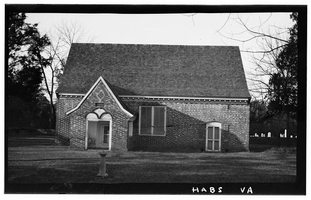
38°9′21″N 77°0′29″W / 38.15583°N 77.00806°WOak Grove 21 Yeocomico Church 
November 12, 1969 SW of Tucker Hill on Rte. 66
38°3′43″N 76°35′51″W / 38.06194°N 76.5975°WTucker Hill See also
- National Register of Historic Places listings in Virginia
- List of National Historic Landmarks in Virginia
References
- ^ The latitude and longitude information provided in this table was derived originally from the National Register Information System, which has been found to be fairly accurate for about 99% of listings. For about 1% of NRIS original coordinates, experience has shown that one or both coordinates are typos or otherwise extremely far off; some corrections may have been made. A more subtle problem causes many locations to be off by up to 150 yards, depending on location in the country: most NRIS coordinates were derived from tracing out latitude and longitudes off of USGS topographical quadrant maps created under the North American Datum of 1927, which differs from the current, highly accurate WGS84 GPS system used by Google maps. Chicago is about right, but NRIS longitudes in Washington are higher by about 4.5 seconds, and are lower by about 2.0 seconds in Maine. Latitudes differ by about 1.0 second in Florida. Some locations in this table may have been corrected to current GPS standards.
- ^ "National Register of Historic Places: Weekly List Actions". National Park Service, United States Department of the Interior. Retrieved on November 10, 2011.
- ^ Numbers represent an ordering by significant words. Various colorings, defined here, differentiate National Historic Landmark sites and National Register of Historic Places Districts from other NRHP buildings, structures, sites or objects.
- ^ "National Register Information System". National Register of Historic Places. National Park Service. 2008-04-24. http://nrhp.focus.nps.gov/natreg/docs/All_Data.html.
U.S. National Register of Historic Places Topics Lists by states Alabama • Alaska • Arizona • Arkansas • California • Colorado • Connecticut • Delaware • Florida • Georgia • Hawaii • Idaho • Illinois • Indiana • Iowa • Kansas • Kentucky • Louisiana • Maine • Maryland • Massachusetts • Michigan • Minnesota • Mississippi • Missouri • Montana • Nebraska • Nevada • New Hampshire • New Jersey • New Mexico • New York • North Carolina • North Dakota • Ohio • Oklahoma • Oregon • Pennsylvania • Rhode Island • South Carolina • South Dakota • Tennessee • Texas • Utah • Vermont • Virginia • Washington • West Virginia • Wisconsin • WyomingLists by territories Lists by associated states Other Municipalities and communities of Westmoreland County, Virginia Towns 
Unincorporated
communitiesAcorn | Baynesville | Bayside | Bryant Town | Bull Neck | Carys Corner | Chiltons | Chisford | Coles Point | Currioman Landing | East End | Erica | Flat Iron | Grays Corner | Griffiths Corner | Hague | Hinnom | Hogans Hill | Horners | Kinsale | Kremlin | Latanes | Laurel Grove | Leedstown | Leesville | Lerty | Machodoc | Maple Grove | Mattox Bridge | Meter | Monroe Hall | Mount Holly | Narrow Beach | Nash Town | Neenah | Nomini | Nomini Grove | Oak Grove | Oldhams | Onawmanient | Palmtown | Peeds | Pomona | Potomac Beach | Potomac Mills | Ragged Point Beach | Sandy Point | Smith Hill | Springfield | Stratford Hall | Stratford Mill | Templeman | Threeway | Tidwells | Tucker Hill | Wakefield Corner | Westmoreland | Wilberts Corner | Zacata
Categories:- Westmoreland County, Virginia
- National Register of Historic Places in Virginia
- Virginia-related lists
-


Wikimedia Foundation. 2010.