- Independence, Virginia
-
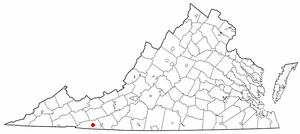
Independence, Virginia — Town — Location of Independence, Virginia
Coordinates: 36°37′22″N 81°9′6″W / 36.62278°N 81.15167°WCoordinates: 36°37′22″N 81°9′6″W / 36.62278°N 81.15167°W Country United States State Virginia County Grayson Area – Total 2.3 sq mi (6.1 km2) – Land 2.3 sq mi (6.1 km2) – Water 0.0 sq mi (0.0 km2) Elevation 2,680 ft (817 m) Population (2000) – Total 971 – Density 415.1/sq mi (160.3/km2) Time zone Eastern (EST) (UTC-5) – Summer (DST) EDT (UTC-4) ZIP code 24348 Area code(s) 276 FIPS code 51-39528[1] GNIS feature ID 1498495[2]  Independence VA during the annual July 4 celebration in 2006
Independence is a town in Grayson County, Virginia, United States. The population was 971 at the 2000 census. It is the county seat of Grayson County[3]. Independence is home to a major town celebration on July 4 every year, held in front of the 1908 courthouse. It features bluegrass and old-time music and dance, food, crafts and a wild pony sale. The courthouse is also the location of the Mountain Foliage Festival, held in the autumn and featuring a parade, crafts, arts and music, as well as a race in which contestants use outhouses, the Grand Privy Race.[4]
Contents
Geography
Independence is located at 36°37′22″N 81°9′6″W / 36.62278°N 81.15167°W (36.622906, -81.151735)[5].
According to the United States Census Bureau, the town has a total area of 2.3 square miles (6.1 km²), all of it land.
Demographics
As of the census[1] of 2000, there were 971 people, 426 households, and 226 families residing in the town. The population density was 415.1 people per square mile (160.2/km²). There were 497 housing units at an average density of 212.5 per square mile (82.0/km²). The racial makeup of the town was 90.73% White, 6.80% African American, 1.24% from other races, and 1.24% from two or more races. Hispanic or Latino of any race were 2.68% of the population.
There were 426 households out of which 19.2% had children under the age of 18 living with them, 39.9% were married couples living together, 8.2% had a female householder with no husband present, and 46.9% were non-families. 44.6% of all households were made up of individuals and 27.5% had someone living alone who was 65 years of age or older. The average household size was 1.98 and the average family size was 2.73.
In the town the population was spread out with 14.4% under the age of 18, 7.1% from 18 to 24, 21.1% from 25 to 44, 22.7% from 45 to 64, and 34.7% who were 65 years of age or older. The median age was 51 years. For every 100 females there were 81.5 males. For every 100 females age 18 and over, there were 82.2 males.
The median income for a household in the town was $18,264, and the median income for a family was $30,441. Males had a median income of $21,058 versus $16,705 for females. The per capita income for the town was $16,137. About 10.5% of families and 19.5% of the population were below the poverty line, including 29.7% of those under age 18 and 16.2% of those age 65 or over.
Notable inhabitants
- Wade Ward, old-time musician
References
- Fussell, Fred C. (2003). Blue Ridge Music Trails: Finding a Place in the Circle. North Carolina Folklife Institute. 080785459X.
- ^ a b "American FactFinder". United States Census Bureau. http://factfinder.census.gov. Retrieved 2008-01-31.
- ^ "US Board on Geographic Names". United States Geological Survey. 2007-10-25. http://geonames.usgs.gov. Retrieved 2008-01-31.
- ^ "Find a County". National Association of Counties. http://www.naco.org/Counties/Pages/FindACounty.aspx. Retrieved 2011-06-07.
- ^ Fussell, pgs. 76 - 77
- ^ "US Gazetteer files: 2010, 2000, and 1990". United States Census Bureau. 2011-02-12. http://www.census.gov/geo/www/gazetteer/gazette.html. Retrieved 2011-04-23.
External links
Municipalities and communities of Grayson County, Virginia Towns 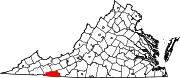
Unincorporated
communitiesBaywood | Elk Creek | Mouth of Wilson | Whitetop
Categories:- Populated places in Grayson County, Virginia
- Towns in Virginia
- County seats in Virginia


Wikimedia Foundation. 2010.