- National Register of Historic Places listings in Accomack County, Virginia
-
This list includes properties and districts listed on the National Register of Historic Places in Accomack County, Virginia. Click the "Map of all coordinates" link to the right to view a Google map of all properties and districts with latitude and longitude coordinates in the table below.[1]
-
- This National Park Service list is complete through NPS recent listings posted November 10, 2011.[2]
[3] Landmark name [4] Image Date listed Location City or town Summary 1 Accomac Historic District 
July 21, 1982 Business Rte. 13
37°43′11″N 75°40′11″W / 37.719722°N 75.669722°WAccomac 2 Arbuckle Place May 22, 1986 Seaside Rd./VA 679
37°52′27″N 75°31′38″W / 37.874167°N 75.527222°WAssawoman 3 Assateague Lighthouse 
June 4, 1973 S of Chincoteague at S end of Assateague Island
37°51′49″N 75°22′06″W / 37.863611°N 75.368333°WChincoteague 4 Bank Building July 23, 1974 No. 1 Court House Ave.
37°42′40″N 75°42′07″W / 37.711111°N 75.701944°WAccomac 5 Edmund Bayly House June 28, 1982 VA 615
37°34′28″N 75°53′30″W / 37.574444°N 75.891667°WCraddockville 6 Bowman's Folly 
November 12, 1969 SE of jct. of Rtes. 652 and 13
37°42′27″N 75°37′13″W / 37.7075°N 75.620278°WAccomac 7 Bunting Place April 11, 2003 31181 Drummondtown Rd.
37°37′17″N 75°41′34″W / 37.621389°N 75.692778°WWachapreague 8 Central High School August 16, 2010 32308 Lankford Hwy.
37°35′54″N 75°46′38″W / 37.598333°N 75.777222°WPainter vicinity 9 Cokesbury Church November 27, 2004 13 Market St.
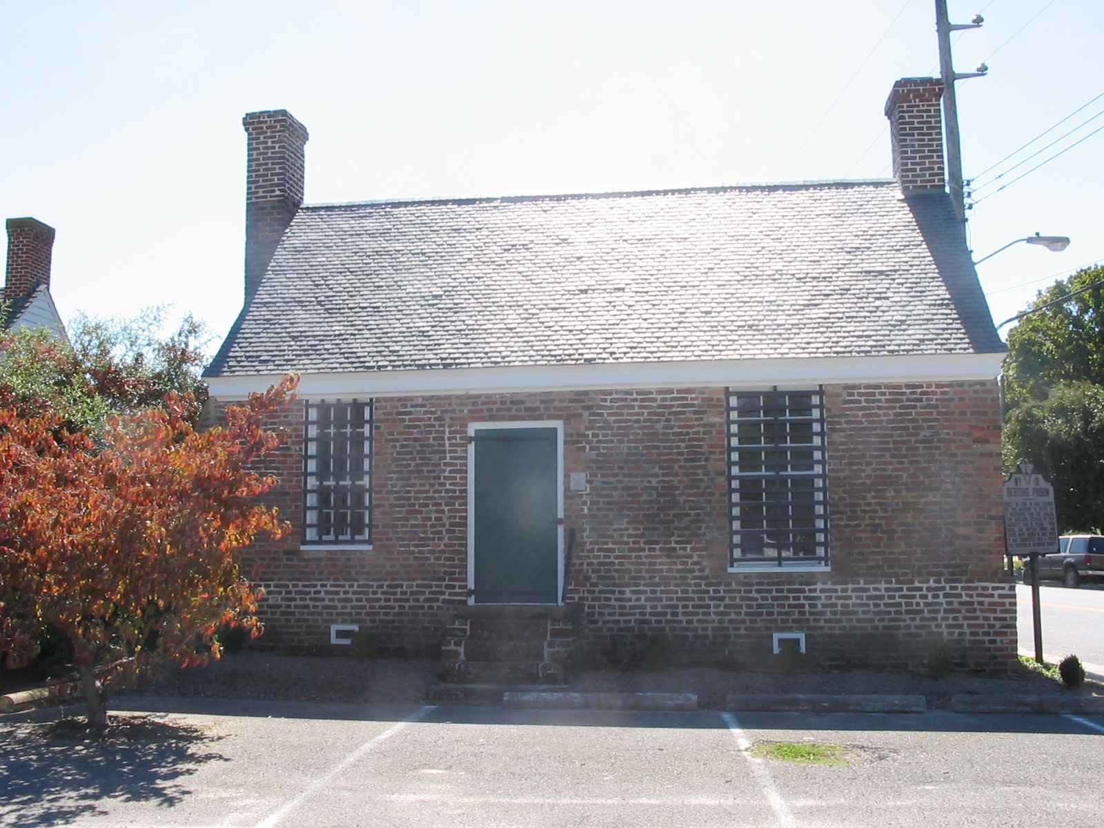
37°42′50″N 75°45′09″W / 37.713889°N 75.7525°WOnancock 10 Debtors' Prison 
November 7, 1976 VA 764
37°43′11″N 75°40′17″W / 37.719722°N 75.671389°WAccomac 11 Captain Timothy Hill House August 22, 2011 5122 Main St.
37°56′53″N 75°21′24″W / 37.947917°N 75.35675°WChincoteague Island 12 Hills Farm September 11, 2008 19065 Hills Farm Rd.
37°46′25″N 75°42′16″W / 37.773631°N 75.704372°WGreenbush vicinity 13 Hopkins and Brother Store November 12, 1969 Market St.
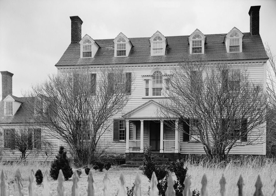
37°42′44″N 75°45′20″W / 37.712222°N 75.755556°WOnancock 14 Kerr Place 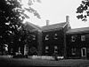
February 26, 1970 NE corner of Crockett Ave. and Market St.
37°42′46″N 75°44′50″W / 37.712778°N 75.747222°WOnancock 15 Mason House November 21, 1974 N of Guilford off VA 658
37°50′01″N 75°39′14″W / 37.833611°N 75.653889°WGuilford 16 Onancock Historic District October 8, 1992 Roughly bounded by Joynes Branch, Onancock Cr. and Lake, Kerr, Jackson, Market, Justice, Johnson and Holly Sts.
37°42′42″N 75°44′48″W / 37.711667°N 75.746667°WOnancock 17 Pitts Neck 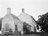
October 21, 1976 6 mi. W of New Church on VA 709
37°58′08″N 75°37′46″W / 37.968889°N 75.629444°WNew Church 18 Pocomoke Farm February 15, 2007 7492 Monument Rd., Virginia 699
37°55′57″N 75°38′08″W / 37.9325°N 75.635556°WSanford 19 Scarborough House Archaeological Site (44AC4) May 16, 1985 Address Restricted Davis Wharf 20 Shepherd's Plain June 28, 1982 W of Pungoteague
37°37′44″N 75°50′22″W / 37.628889°N 75.839444°WPungoteague 21 St. George's Church 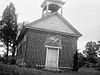
September 15, 1970 VA 178, NE of jct. with VA 180
37°38′02″N 75°48′40″W / 37.633889°N 75.811111°WPungoteague 22 St. James Church June 11, 1969 Daugherty Rd. between Back St. and Ocean Hwy.
37°43′02″N 75°40′21″W / 37.717222°N 75.6725°WAccomac 23 Wessells Root Cellar February 26, 1970 NE of jct. of Rtes. 701 and 692
37°53′54″N 75°37′35″W / 37.898333°N 75.626389°WHallwood 24 Wharton Place November 3, 1972 0.7 mi. NE of jct. of VA 762 and 679
37°50′51″N 75°31′58″W / 37.8475°N 75.532778°WMappsville 25 Willowdale May 2, 2007 18412 Willowdale Dr.
37°33′38″N 75°45′53″W / 37.560469°N 75.764678°WPainter See also
- National Register of Historic Places listings in Virginia
- List of National Historic Landmarks in Virginia
References
- ^ The latitude and longitude information provided in this table was derived originally from the National Register Information System, which has been found to be fairly accurate for about 99% of listings. For about 1% of NRIS original coordinates, experience has shown that one or both coordinates are typos or otherwise extremely far off; some corrections may have been made. A more subtle problem causes many locations to be off by up to 150 yards, depending on location in the country: most NRIS coordinates were derived from tracing out latitude and longitudes off of USGS topographical quadrant maps created under the North American Datum of 1927, which differs from the current, highly accurate WGS84 GPS system used by Google maps. Chicago is about right, but NRIS longitudes in Washington are higher by about 4.5 seconds, and are lower by about 2.0 seconds in Maine. Latitudes differ by about 1.0 second in Florida. Some locations in this table may have been corrected to current GPS standards.
- ^ "National Register of Historic Places: Weekly List Actions". National Park Service, United States Department of the Interior. Retrieved on November 10, 2011.
- ^ Numbers represent an ordering by significant words. Various colorings, defined here, differentiate National Historic Landmark sites and National Register of Historic Places Districts from other NRHP buildings, structures, sites or objects.
- ^ "National Register Information System". National Register of Historic Places. National Park Service. . http://nrhp.focus.nps.gov/natreg/docs/All_Data.html.
U.S. National Register of Historic Places Topics Lists by states Alabama • Alaska • Arizona • Arkansas • California • Colorado • Connecticut • Delaware • Florida • Georgia • Hawaii • Idaho • Illinois • Indiana • Iowa • Kansas • Kentucky • Louisiana • Maine • Maryland • Massachusetts • Michigan • Minnesota • Mississippi • Missouri • Montana • Nebraska • Nevada • New Hampshire • New Jersey • New Mexico • New York • North Carolina • North Dakota • Ohio • Oklahoma • Oregon • Pennsylvania • Rhode Island • South Carolina • South Dakota • Tennessee • Texas • Utah • Vermont • Virginia • Washington • West Virginia • Wisconsin • WyomingLists by territories Lists by associated states Other Categories:- Accomack County, Virginia
- National Register of Historic Places in Virginia
- Virginia-related lists
-


Wikimedia Foundation. 2010.