- Green Haven, Maryland
Infobox Settlement
official_name = Green Haven, Maryland
settlement_type = CDP
nickname =
motto =
imagesize =
image_caption =
image_
imagesize =
image_caption =
image_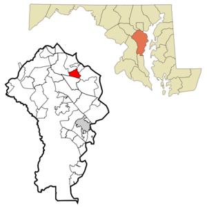
mapsize = 250x200px
map_caption = Location of Green Haven, Maryland
mapsize1 =
map_caption1 =subdivision_type = Country
subdivision_name =United States
subdivision_type1 = State
subdivision_name1 =Maryland
subdivision_type2 = County
subdivision_name2 = Anne Arundel
government_footnotes =
government_type =
leader_title =
leader_name =
leader_title1 =
leader_name1 =
established_title =
established_date =unit_pref = Imperial
area_footnotes =area_magnitude =
area_total_km2 = 8.7
area_land_km2 = 8.3
area_water_km2 = 0.5
area_total_sq_mi = 3.4
area_land_sq_mi = 3.2
area_water_sq_mi = 0.2population_as_of = 2000
population_footnotes =
population_total = 17415
population_density_km2 = 2108.7
population_density_sq_mi = 5461.6timezone = Eastern (EST)
utc_offset = -5
timezone_DST = EDT
utc_offset_DST = -4
elevation_footnotes =
elevation_m = 15
elevation_ft = 49
latd = 39 |latm = 8 |lats = 17 |latNS = N
longd = 76 |longm = 32 |longs = 32 |longEW = Wpostal_code_type =
postal_code =
area_code =
blank_name = FIPS code
blank_info = 24-34975
blank1_name = GNIS feature ID
blank1_info = 0590367
website =
footnotes =Green Haven is a
census-designated place and neighborhood located within Pasadena inAnne Arundel County, Maryland . The population was 17,415 at the 2000 census.Geography
Green Haven is located at coor dms|39|8|17|N|76|32|32|W|city (39.137999, -76.542338)GR|1.
According to the
United States Census Bureau , Green Haven has a total area of 3.4square mile s (8.7km² ), of which, 3.2 square miles (8.3 km²) of it is land and 0.2 square miles (0.5 km²) of it (5.34%) is water.Demographics
As of the
census GR|2 of 2000, there were 17,415 people, 5,921 households, and 4,695 families residing in the CDP. Thepopulation density was 5,461.6 people per square mile (2,107.8/km²). There were 6,102 housing units at an average density of 1,913.7/sq mi (738.6/km²). The racial makeup of the CDP was 91.96% White, 4.36% African American, 0.46% Native American, 1.31% Asian, 0.02% Pacific Islander, 0.49% from other races, and 1.40% from two or more races. Hispanic or Latino of any race were 1.47% of the population.There were 5,921 households out of which 47.0% had children under the age of 18 living with them, 61.5% were married couples living together, 12.5% had a female householder with no husband present, and 20.7% were non-families. 15.1% of all households were made up of individuals and 2.8% had someone living alone who was 65 years of age or older. The average household size was 2.94 and the average family size was 3.26.
In Green Haven the population is spread out with 30.4% under the age of 18, 7.3% from 18 to 24, 38.3% from 25 to 44, 18.9% from 45 to 64, and 5.2% who were 65 years of age or older. The median age was 32 years. For every 100 females there were 98.3 males. For every 100 females age 18 and over, there were 94.7 males.
The median income for a household in the CDP was $60,211, and the median income for a family was $62,800. Males had a median income of $41,576 versus $30,113 for females. The
per capita income for the CDP was $21,962. About 1.7% of families and 2.9% of the population were below thepoverty line , including 1.7% of those under age 18 and 6.2% of those age 65 or over.History
Green Haven began as a day-trip destination for residents of Baltimore City, directly north of Pasadena. Green Haven was just a short boat ride from the city.
Green Haven developed into a small community in the early 20th century, with a district town center. With the rise of suburbs, Green Haven became increasingly residential in nature, with local shops closing under pressure from nearby plazas and strip malls.
Today, Green Haven has lost much of its unique character because of the loss of its old style "summer home" charm, and the loss of its fire department that was complemented by green and white fire equipment, however, it is still the largest single neighborhood within Pasadena. Green Haven is home to one of Pasadena's two high schools, Northeast High.
References
External links
Wikimedia Foundation. 2010.