- Raleigh Court, Roanoke, Virginia
Geobox Neighborhood
name = Raleigh Court
category = Roanoke Neighborhood
image_size =
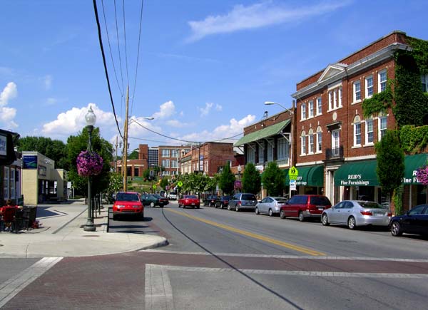
image_caption = TheGrandin Village
country = United States
state = Virginia
region_type = City
region = Roanoke
district_type = Neighborhood
area_imperial =
area_land_imperial =
area_water_imperial =
area_water_percentage =
area_percentage_round =
area_round =
location =
lat_d = 37
lat_m = 15
lat_s = 38
lat_NS = N
long_d = 79
long_m = 59
long_s = 02
long_EW = W
elevation_imperial = 1066
elevation_round = 325
population_as_of = 2000
population = 11200
timezone = EST
utc_offset = -5
timezone_DST = EDT
utc_offset_DST = -4
postal_code = 24015
postal_code_type = ZIP Codes
area_code = 540
map_size =
map_caption =
map_locator =
map_locator_x =
map_locator_y =
website =Raleigh Court is a Roanoke,
Virginia neighborhood located in southwest Roanoke along U.S. 11 (Memorial Avenue/Grandin Road). It borders the neighborhoods of Greater Deyerle on the west, Wasena on the east, Cherry Hill, Mountain View and Norwich on the north and Franklin-Colonial and Grandin Court on the south.cite web
url=http://portal.roanokegov.com/portal/neighbor/dspMapView.cfm?CFID=267835&CFTOKEN=18696877
title=Explore Roanoke Neighborhood
publisher=City of Roanoke Department of Neighborhoods
accessdate=2008-05-16] Today the neighborhood is accessed from the downtown areas via the Memorial Bridge across theRoanoke River . As of the 2000 U.S. Census, Raleigh Court has a population of 11,200 residents.cite web
url=http://www.roanokeva.gov/85256A8D0062AF37/CurrentBaseLink/N25ZDQV3716FGUREN
title=Raleigh Court Neighborhood Plan
publisher=City of Roanoke Planning Division
accessdate=2008-05-16]History
The Raleigh Court area saw its first residents in the 1700s as part of the
Scotch-Irish migration into the area. Remaining relatively rural in character, by 1906 a land development company was formed to subdivide and develop the area. Development of the area would occur quickly, with thestreetcar reaching the area in 1915 its subsequent growth resulted in its annexation by the city from Roanoke County in 1919.The development of the neighborhood would reach its peak in the 1920s with the completion of the Memorial Bridge and the full emergence of the
Grandin Village as the commercial center of the neighborhood. It was also during this time the name Raleigh Court emerged as the name of the area, taking its name from the Raleigh Court Corporation that bought and sold the majority of the land in the neighborhood.On
July 31 ,1948 , streetcar service to the area was abandoned, which also marked the end of streetcar transit altogether within the city of Roanoke.cite book
last = Dalmas
first = James E.
title = The Street Railways of Roanoke, Virginia 1887-1948
origyear = 2006
publisher = Historical Society of Western Virginia
location = Roanoke, VA
language = English
isbn = 0971053162
pages = 20-21
chapter = Chapter 3: Streetcar Routes and the Development of Roanoke: Raleigh Court Line ] With the closure of the streetcar, the area continued to develop and evolved for the accommodation of the automobile. With threats to the viability and quality of life within the neighborhood by the 1970s, the Greater Raleigh Court Civic League was formed and in 1981. As a result of their advocacy efforts and collaboration with city agencies, Raleigh Court was declared Neighborhood of the Year by Neighborhoods USA in 1992.References
External links
* [http://www.roanokeva.gov/85256A8D0062AF37/CurrentBaseLink/N25ZDQV3716FGUREN Raleigh Court Neighborhood Plan]
* [http://www.grccl.org/ Greater Raleigh Court Civic League]

Wikimedia Foundation. 2010.