- Interstate 526
-
Interstate 526
Mark Clark Expressway 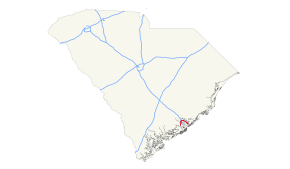
Route information Maintained by SCDOT Length: 19.26 mi[1] (31.00 km) Existed: 1997 – present Major junctions West end: 
 US 17 / SC 7 in Charleston


 I-26 / SC 642 / US 52 / US 78 in North Charleston
East end:  US 17 / I-526 Bus. in Mount Pleasant
Location Counties: Berkeley, Charleston Highway system Auxiliary route of the Interstate Highway System
Main • Auxiliary • Business←  SC 522
SC 527  →
→Interstate 526 (abbreviated I-526) or the Mark Clark Expressway is a beltway, Interstate Highway of Interstate 26 in Berkeley and Charleston counties in South Carolina, USA.
Contents
Route description
Interstate 526 forms a 19.26-mile (31.00 km) half-circle around the historic peninsular and West Ashley portions of the City of Charleston with the western terminus at U.S. Highway 17 west of the Ashley River, and the eastern terminus is at U.S. Highway 17, near Mt.Pleasant. Interstate I-26 and U.S. Highway 52/78 intersect with Interstate 526 in the City of North Charleston, South Carolina. There have been attempts to complete I-526 across Johns Island (to meet SC 30) as originally planned so that it will form three fourths of a circle around Charleston but each attempt has failed due to lack of credible funding and vocal opposition by special interest groups.
South Carolina Highway 30 is an orphaned segment of Interstate 526. Approximately 10 miles (16 km) separate the eastern terminus of I-526's current extent from the eastern terminus of SC 30. The mileage markers and exit numbers on both SC 30 and I-526 are based on an eventual merging of the routes: with miles 1 to 3 occurring on SC 30 and miles 10 to 30 used on the current I-526 route.
I-526 crosses the Cooper River via the Don N. Holt Bridge, the Wando River over the James B. Edwards Bridge, and the Ashley River by way of the General William B. Westmoreland Bridge.
Future
Interstate 526 is proposed[2] to be completed as a ground-level parkway from US Route 17 onto Johns Island and James Island across SC 171, with a planted island divider in the middle and Suspension bridges over the Stono River to Johns Island. It will terminate at Western Terminus and Eastern Terminus at new stoplight intersections. SC 30 will be decommissioned. Interstate 526 would go thru Mount Pleasant, North Charleston, Charleston, Johns Island and James Island. In 2009, the Town of James Island passed a resolution opposing the building of I-526 across any part of the town.[3] Many residents,[4] the Coastal Conservation League [5] as well as a grassroots group, called Nix 526,[6] are voicing opposition to the proposed road. In April 2011, Charleston County Council voted not to ask the state for $500 million for the last eight miles of the road, and the Conservation League and Southern Environmental Law Center both supported this decision.[7]
Business Route
Interstate 526 Business
Location: Mount Pleasant, South Carolina After I-526 goes over U.S. Highway 17 at its eastern terminus in Mount Pleasant, the route continues as Business Spur 526. Business 526 is named Chuck Dawley Boulevard, a surface street, and terminates at its junction with South Carolina Highway 703 (Ben Sawyer Boulevard). This street was formerly the eastern part of Coleman Boulevard and was U.S. Route 17-701 Business. Coleman Boulevard continues westward from the junction of SC 703 until its intersection with US 17 near the Cooper River Bridge.
Although Business 526 travels toward the southwest from the I-526 terminus, it is still signed east–west, corresponding with I-526.
Exit list
County City Exit Destinations Notes Charleston Charleston US 17 / SC 7 south (Sam Rittenberg Boulevard) – Charleston, JacksonboroAt-grade intersection 11  SC 61 (Ashley River Road) – Summerville, St. Andrews
North Charleston General William B. Westmoreland Bridge across the Ashley River 14 Leeds Avenue 15 SC 642 (Dorchester Road) / Paramount Drive16 Montague Avenue, International Boulevard – Charleston International Airport Signed as exits 16A (Montague Avenue, International Boulevard) and 16B (Airport) eastbound 17 I-26 – Charleston, ColumbiaSigned as exits 17A (east) and 17B (west) 18 US 52 / US 78 (Rivers Avenue) – North Charleston, HanahanSigned as exits 18A (east) and 18B (west) 19 North Rhett Avenue 20 Virginia Avenue Westbound exit is via a u-turn at exit 19 Don N. Holt Bridge across the Cooper River Berkeley Charleston 23 Clements Ferry Road Signed as exits 23A (south) and 23B (north) eastbound 24 River Landing Drive, 7 Farms Drive, Island Park Drive – Daniel Island Charleston Mount Pleasant James B. Edwards Bridge across the Wando River 28 Long Point Road 29 US 17 north – GeorgetownEastbound exit and westbound entrance 30 US 17 south – CharlestonNo eastbound exit to US 17 north Chuck Dawley Boulevard, Boman Road At-grade intersection 1.000 mi = 1.609 km; 1.000 km = 0.621 mi
Concurrency terminus • Closed/Former • Incomplete access • UnopenedReferences
- ^ Route Log- Auxiliary Routes of the Eisenhower National System of Interstate and Defense Highways - Table 2
- ^ "SCDOT - I-526 - Welcome to the Mark Clark Expressway!". Dot.state.sc.us. 2010-09-30. http://www.dot.state.sc.us/i526/. Retrieved 2011-09-19.
- ^ [1][dead link]
- ^ Rendering provided by Urban Advantage, Steve Price (2010-09-07). "Commuter rail could work here if folks will get on board | The Post and Courier, Charleston SC - News, Sports, Entertainment". Postandcourier.com. http://www.postandcourier.com/news/2010/sep/07/commuter-rail-could-work-here-if-folks-will-get/. Retrieved 2011-09-19.
- ^ "I-526 Extension". Coastal Conservation League. 2010-07-28. http://coastalconservationleague.org/i-526-extension/. Retrieved 2011-09-19.
- ^ "So Much to Lose For So Little Gain". Nix 526. http://www.nix526.org. Retrieved 2011-09-19.
- ^ "Decision to drop road project applauded". The Sun News. 2011-04-21. http://www.thesunnews.com/2011/04/21/2113551/the-carolinas.html. Retrieved 2011-04-21.
External links
Auxiliary routes of Interstate 26 
Interstate Highways in South Carolina Current Future Business Categories:- Three-digit Interstate Highways
- Interstate Highways in South Carolina
- Interstate 26
- Orbital roads in the United States
- Transportation in Charleston, South Carolina
- Transportation in North Charleston, South Carolina


Wikimedia Foundation. 2010.