- National Register of Historic Places listings in Morgan County, West Virginia
-
 Location of Morgan County in West Virginia
This is a list of the National Register of Historic Places listings in Morgan County, West Virginia.
This is intended to be a complete list of the properties and districts on the National Register of Historic Places in Morgan County, West Virginia, United States. The locations of National Register properties and districts for which the latitude and longitude coordinates are included below, may be seen in a Google map.[1]
There are 13 properties and districts listed on the National Register in the county.
-
- This National Park Service list is complete through NPS recent listings posted November 10, 2011.[2]
Contents: Counties in West Virginia Barbour - Berkeley - Boone - Braxton - Brooke - Cabell - Calhoun - Clay - Doddridge - Fayette - Gilmer - Grant - Greenbrier - Hampshire - Hancock - Hardy - Harrison - Jackson - Jefferson - Kanawha - Lewis - Lincoln - Logan - Marion - Marshall - Mason - McDowell - Mercer - Mineral - Mingo - Monongalia - Monroe - Morgan - Nicholas - Ohio - Pendleton - Pleasants - Pocahontas - Preston - Putnam - Raleigh - Randolph - Ritchie - Roane - Summers - Taylor - Tucker - Tyler - Upshur - Wayne - Webster - Wetzel - Wirt - Wood - Wyoming
Current listings
[3] Landmark name [4] Image Date listed Location City or town Summary 1 Ambrose Chapel December 15, 1998 Winchester Grade Rd.
39°31′42″N 78°13′53″W / 39.528333°N 78.231389°WStotlers Crossroads 2 Berkeley Springs State Park 
May 24, 1976 S. Washington and Fairfax Sts.
39°37′35″N 78°13′44″W / 39.626389°N 78.228889°WBerkeley Springs 3 Berkeley Springs Train Depot 
March 23, 2001 504 N. Washington St.
39°37′52″N 78°13′28″W / 39.631111°N 78.224444°WBerkeley Springs 4 Chesapeake and Ohio Canal National Historical Park 
October 15, 1966 Bordering the Potomac River from Georgetown, D.C. to Cumberland, Maryland Harpers Ferry, Paw Paw, and Shepardstown 5 T. H. B. Dawson House 
February 10, 1983 300 S. Green St.
39°37′27″N 78°13′39″W / 39.624167°N 78.2275°WBerkeley Springs 6 Clarence Hovermale House 
May 2, 2003 167 Wilkes St.
39°37′42″N 78°13′41″W / 39.628333°N 78.228056°WBerkeley Springs 7 Morgan County Courthouse 
September 7, 2005 202 Fairfax St.
39°37′44″N 78°13′39″W / 39.628889°N 78.2275°WBerkeley Springs 8 John Herbert Quick House August 23, 1984 Off U.S. Route 522
39°34′56″N 78°16′03″W / 39.582222°N 78.2675°WBerkeley Springs 9 Sloat-Horn-Rossell House 
August 23, 1984 415 Fairfax St.
39°37′37″N 78°13′34″W / 39.626944°N 78.226111°WBerkeley Springs 10 Samuel Taylor Suit Cottage 
November 28, 1980 WV 9
39°37′38″N 78°13′49″W / 39.627222°N 78.230278°WBerkeley Springs 11 Town of Bath Historic District 
April 23, 2009 Roughly Washington and Fairfax Sts. and adjacent blocks
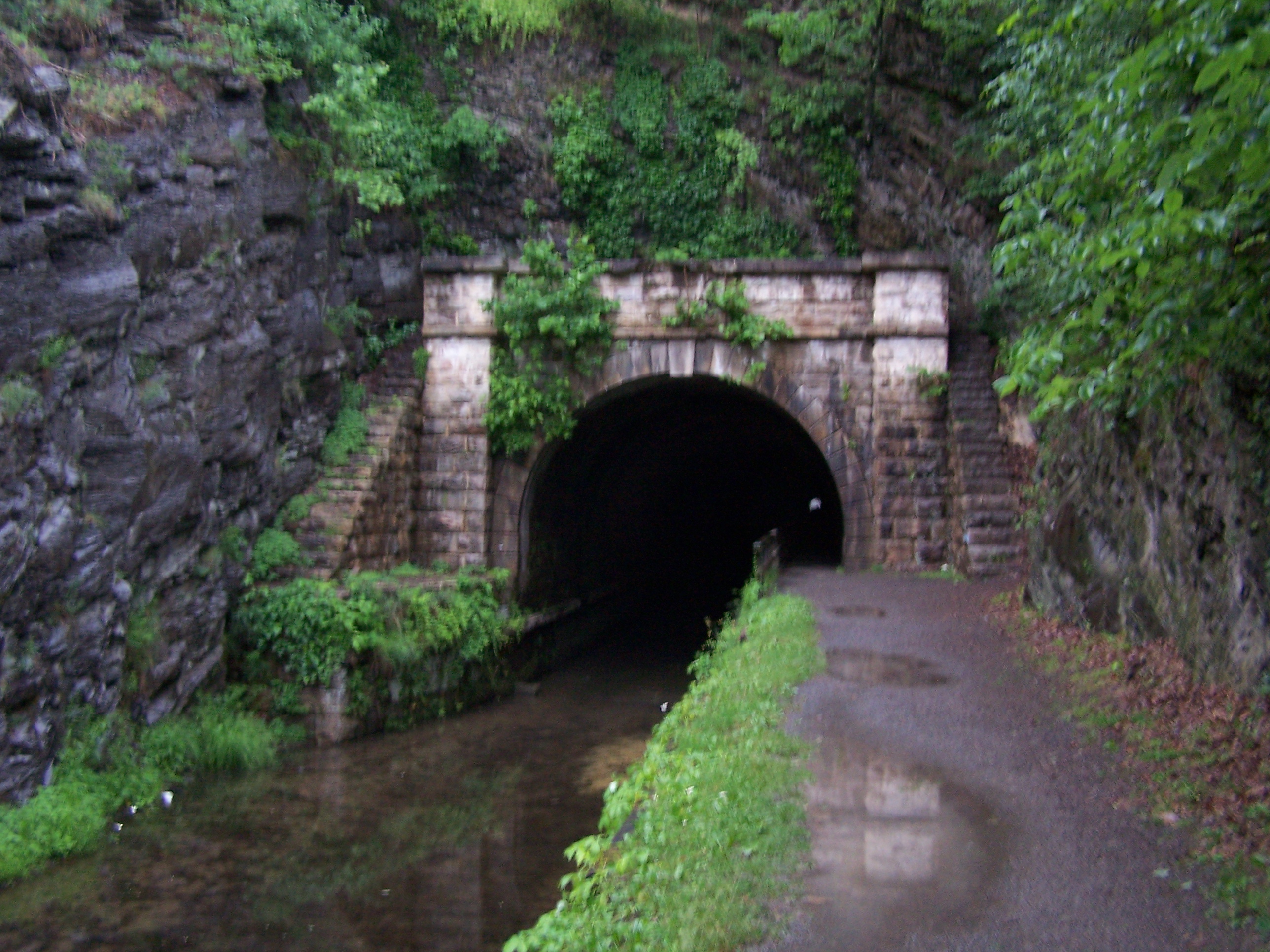
39°37′36″N 78°13′40″W / 39.626667°N 78.227778°WBerkeley Springs 12 Western Maryland Railroad Right-of-Way, Milepost 126 to Milepost 160 July 23, 1981 Milepost 126 to Milepost 160
39°33′53″N 78°32′08″W / 39.564722°N 78.535556°WJerome 13 Judge John W. Wright Cottage 
April 28, 1986 305 S. Green St.
39°37′28″N 78°13′40″W / 39.624444°N 78.227778°WBerkeley Springs See also
- List of National Historic Landmarks in West Virginia
- National Register of Historic Places listings in West Virginia
References
- ^ The latitude and longitude information provided in this table was derived originally from the National Register Information System, which has been found to be fairly accurate for about 99% of listings. For about 1% of NRIS original coordinates, experience has shown that one or both coordinates are typos or otherwise extremely far off; some corrections may have been made. A more subtle problem causes many locations to be off by up to 150 yards, depending on location in the country: most NRIS coordinates were derived from tracing out latitude and longitudes off of USGS topographical quadrant maps created under North American Datum of 1927, which differs from the current, highly accurate GPS system used by Google maps. Chicago is about right, but NRIS longitudes in Washington are higher by about 4.5 seconds, and are lower by about 2.0 seconds in Maine. Latitudes differ by about 1.0 second in Florida. Some locations in this table may have been corrected to current GPS standards.
- ^ "National Register of Historic Places: Weekly List Actions". National Park Service, United States Department of the Interior. Retrieved on November 10, 2011.
- ^ Numbers represent an ordering by significant words. Various colorings, defined here, differentiate National Historic Landmark sites and National Register of Historic Places Districts from other NRHP buildings, structures, sites or objects.
- ^ "National Register Information System". National Register of Historic Places. National Park Service. . http://nrhp.focus.nps.gov/natreg/docs/All_Data.html.
U.S. National Register of Historic Places in West Virginia Lists by county Barbour • Berkeley • Boone • Braxton • Brooke • Cabell • Calhoun • Clay • Doddridge • Fayette • Gilmer • Grant • Greenbrier • Hampshire • Hancock • Hardy • Harrison • Jackson • Jefferson • Kanawha • Lewis • Lincoln • Logan • Marion • Marshall • Mason • McDowell • Mercer • Mineral • Mingo • Monongalia • Monroe • Morgan • Nicholas • Ohio • Pendleton • Pleasants • Pocahontas • Preston • Putnam • Raleigh • Randolph • Ritchie • Roane • Summers • Taylor • Tucker • Tyler • Upshur • Wayne • Webster • Wetzel • Wirt • Wood • Wyoming

Other lists Keeper of the Register • History of the National Register of Historic Places • Property types • Historic district • Contributing property Municipalities and communities of Morgan County, West Virginia County seat: Berkeley Springs Towns 
CDP Unincorporated
communitiesBerryville | Burnt Factory | Campbells | Cherry Run | Doe Gully | Duckwall | Green Ridge | Greenwood | Hancock | Hansrote | Holton | Jerome | Jimtown | Johnsons Mill | Largent | Lineburg | Magnolia | Mount Trimble | New Hope | North Berkeley | Oakland | Omps | Orleans Cross Roads | Redrock Crossing | Ridersville | Ridge | Rock Gap | Sir Johns Run | Sleepy Creek | Smith Crossroads | Spohrs Crossroads | Stotlers Crossroads | Unger | Woodmont | Woodrow
-


Wikimedia Foundation. 2010.