- National Register of Historic Places listings in Raleigh County, West Virginia
-
 Location of Raleigh County in West Virginia
This is a list of the National Register of Historic Places listings in Raleigh County, West Virginia.
This is intended to be a complete list of the properties and districts on the National Register of Historic Places in Raleigh County, West Virginia, United States. The locations of National Register properties and districts for which the latitude and longitude coordinates are included below, may be seen in a Google map.[1]
There are 8 properties and districts listed on the National Register in the county.
-
- This National Park Service list is complete through NPS recent listings posted November 10, 2011.[2]
Contents: Counties in West Virginia Barbour - Berkeley - Boone - Braxton - Brooke - Cabell - Calhoun - Clay - Doddridge - Fayette - Gilmer - Grant - Greenbrier - Hampshire - Hancock - Hardy - Harrison - Jackson - Jefferson - Kanawha - Lewis - Lincoln - Logan - Marion - Marshall - Mason - McDowell - Mercer - Mineral - Mingo - Monongalia - Monroe - Morgan - Nicholas - Ohio - Pendleton - Pleasants - Pocahontas - Preston - Putnam - Raleigh - Randolph - Ritchie - Roane - Summers - Taylor - Tucker - Tyler - Upshur - Wayne - Webster - Wetzel - Wirt - Wood - Wyoming
Current listings
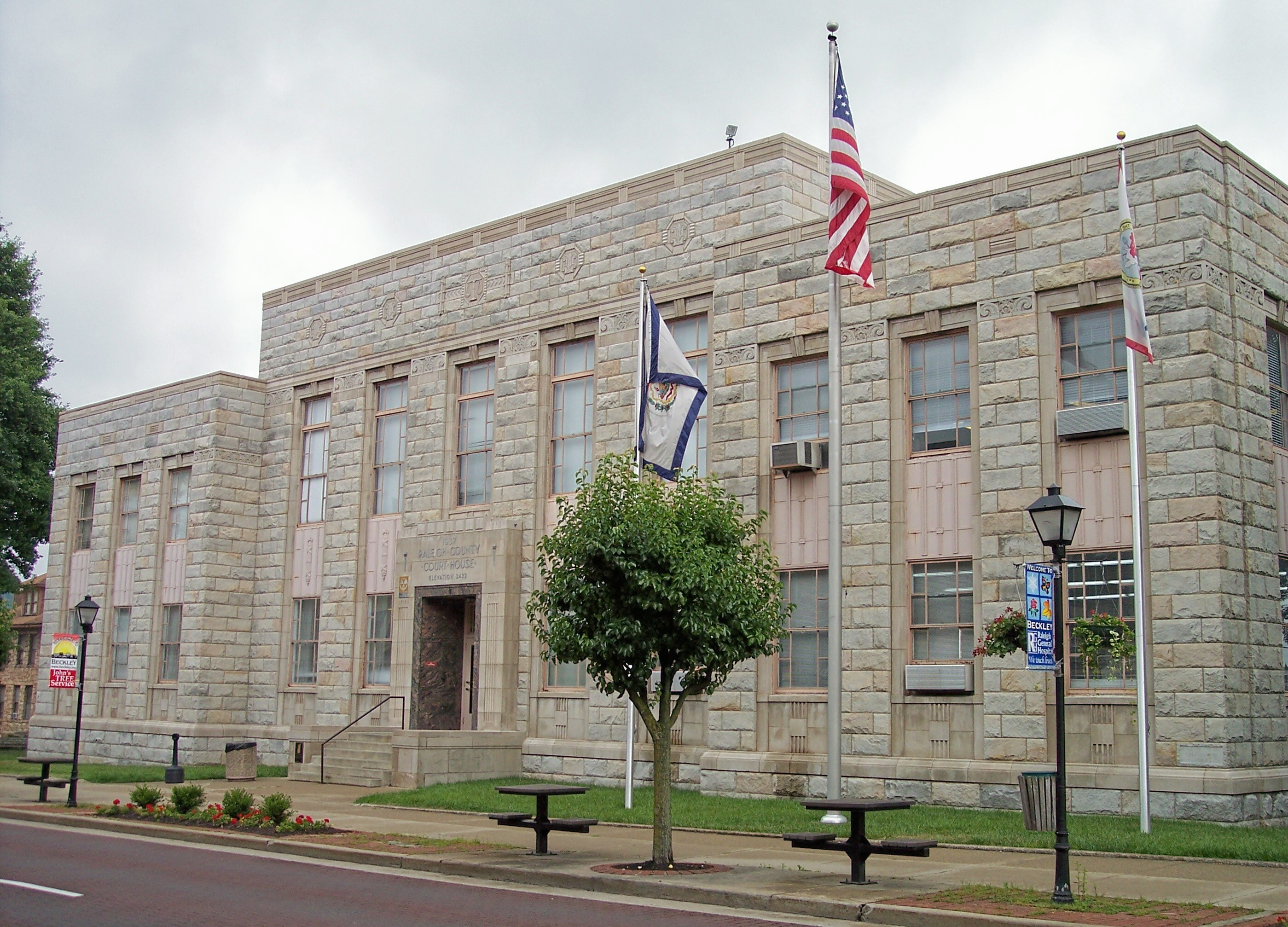
[3] Landmark name[4] Image Date listed Location City or Town Summary 1 Beckley Courthouse Square Historic District 
August 31, 1994 Roughly bounded by Prince, Kanawha, Church, Lebanon, Howe, McCreery and Earwood Sts. and Alaska and First Aves.
37°46′36″N 81°11′16″W / 37.776667°N 81.187778°WBeckley 2 Beckley Feed and Hardware Company August 24, 2001 405 Prince St.
37°46′25″N 81°11′39″W / 37.773611°N 81.194167°WBeckley 3 Little Beaver Dam 
April 1, 1998 Little Beaver State Park off WV 307
37°45′18″N 81°04′48″W / 37.755°N 81.08°WCrow 4 Phillips-Sprague Mine March 25, 1988 Address Restricted Beckley 5 St. Colman's Roman Catholic Church and Cemetery August 23, 1984 County Route 26
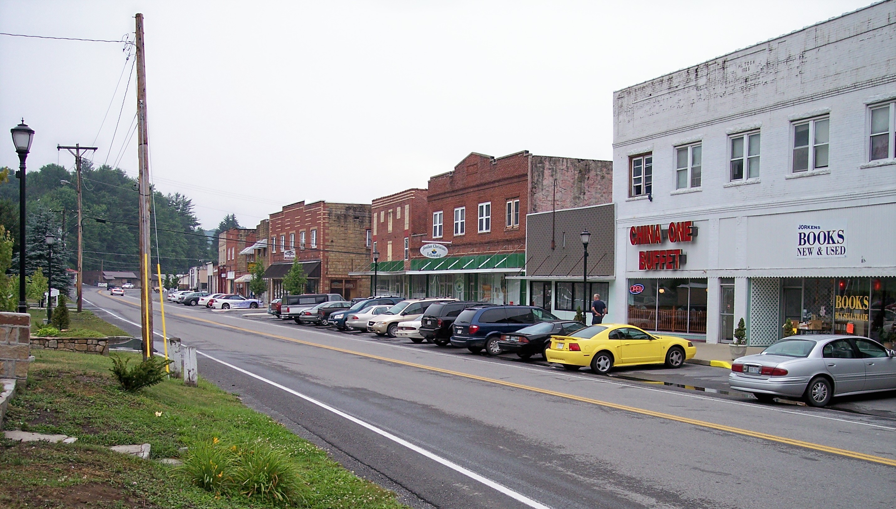
37°45′56″N 80°55′16″W / 37.765556°N 80.921111°WSandstone 6 Sophia Historic District 
March 22, 2006 Main St., between Polk St. and Riffe St.
37°42′34″N 81°15′07″W / 37.709444°N 81.251944°WSophia 7 Trump-Lilly Farmstead 
November 8, 1990 County Route 26/3, 2.5 miles from County Route 26
37°41′54″N 80°54′01″W / 37.698333°N 80.900278°WHinton Extends into Summers County 8 Wildwood August 25, 1970 117 Laurel Ter.
37°46′15″N 81°11′12″W / 37.770833°N 81.186667°WBeckley See also
- List of National Historic Landmarks in West Virginia
- National Register of Historic Places listings in West Virginia
References
- ^ The latitude and longitude information provided in this table was derived originally from the National Register Information System, which has been found to be fairly accurate for about 99% of listings. For about 1% of NRIS original coordinates, experience has shown that one or both coordinates are typos or otherwise extremely far off; some corrections may have been made. A more subtle problem causes many locations to be off by up to 150 yards, depending on location in the country: most NRIS coordinates were derived from tracing out latitude and longitudes off of USGS topographical quadrant maps created under the North American Datum of 1927, which differs from the current, highly accurate WGS84 GPS system used by Google maps. Chicago is about right, but NRIS longitudes in Washington are higher by about 4.5 seconds, and are lower by about 2.0 seconds in Maine. Latitudes differ by about 1.0 second in Florida. Some locations in this table may have been corrected to current GPS standards.
- ^ "National Register of Historic Places: Weekly List Actions". National Park Service, United States Department of the Interior. Retrieved on November 10, 2011.
- ^ Numbers represent an ordering by significant words. Various colorings, defined here, differentiate National Historic Landmark sites and National Register of Historic Places Districts from other NRHP buildings, structures, sites or objects.
- ^ "National Register Information System". National Register of Historic Places. National Park Service. 2008-04-24. http://nrhp.focus.nps.gov/natreg/docs/All_Data.html.
U.S. National Register of Historic Places in West Virginia Lists by county Barbour • Berkeley • Boone • Braxton • Brooke • Cabell • Calhoun • Clay • Doddridge • Fayette • Gilmer • Grant • Greenbrier • Hampshire • Hancock • Hardy • Harrison • Jackson • Jefferson • Kanawha • Lewis • Lincoln • Logan • Marion • Marshall • Mason • McDowell • Mercer • Mineral • Mingo • Monongalia • Monroe • Morgan • Nicholas • Ohio • Pendleton • Pleasants • Pocahontas • Preston • Putnam • Raleigh • Randolph • Ritchie • Roane • Summers • Taylor • Tucker • Tyler • Upshur • Wayne • Webster • Wetzel • Wirt • Wood • Wyoming

Other lists Municipalities and communities of Raleigh County, West Virginia City 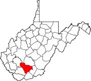
Towns CDPs Beaver | Bolt | Bradley | Coal City | Crab Orchard | Daniels | Eccles | Ghent | Glen White | Helen | MacArthur | Piney View | Prosperity | Shady Spring | Stanaford
Other
localitiesAbney | Abraham | Affinity | Ameagle | Amigo | Arnett | Artie | Besoco | Big Stick | Blue Jay | Blue Jay 6 | Bragg | Clear Creek | Colcord | Cool Ridge | Cranberry | Crow | Dorothy | Dry Creek | Eastgulf | Egeria‡ | Fireco | Fairdale | Glade Springs | Glen Daniel | Glen Morgan | Hollywood | Hot Coal | Hotchkiss | Jonben | Josephine | Killarney | Lanark | Lego | Lillybrook | Marfork | McVey | Mead | Midway | Montcoal | Mountview‡ | Naoma | Odd | Packsville | Pemberton | Pickshin | Price Hill‡ | Princewick | Raleigh | Rock Creek | Saxon | Shiloh | Skelton | Slab Fork | Soak Creek | Sprague | Stickney | Sullivan | Sundial | Surveyor | Tams | Terry | Ury | Whitby | White Oak | Willibet | Winding Gulf | Woodpeck
Ghost towns Pinepoca | Stotesbury
Footnotes ‡This populated place also has portions in an adjacent county or counties
Categories:- National Register of Historic Places in West Virginia by county
- Raleigh County, West Virginia
-


Wikimedia Foundation. 2010.